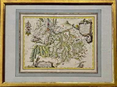
LARGE ANTIQUE MAP FRANCE CENTRAL REGION
LARGE ANTIQUE MAP FRANCE CENTRAL REGIONMar 10, 2024CENTRAL EAST AFRICA French Belgian Congo British German Kenya Tanzania 1909 mapFeb 28, 2024SOUTH CENTRAL AFRICA. Shows Zambesi river as circular! WELLER 1863 old mapFeb 28, 2024Afrique. Côte Déserte #48. Skeleton Coast. Namibia. VANDERMAELEN 1827 old mapFeb 28, 2024Afrique Pays… sud du Lac Tchad 30 Central African Republic VANDERMAELEN 1827 mapFeb 28, 2024AFRICA. European Possessions in Central; map of Zanzibar 1907 old antiqueFeb 28, 2024Central Africa. Congo Free State Rhodesia German East Africa. STANFORD 1896 mapFeb 28, 2024NIGERIA explorers' routes. Lander Clapperton Oudney Denham Allen. SDUK 1874 mapFeb 28, 2024WEST AFRICA II. NIGERIA. Bight of Benin-Lake Chad. Yariba Houssa. SDUK 1851 mapFeb 28, 2024CENTRAL AFRICA. Kongo. British & German East Africa. Kenya Tanzania 1907 mapFeb 28, 2024CENTRAL AFRICA. French Congo German east British Angola Tanzania. BACON 1893 mapFeb 28, 2024Colonial Central Africa. Belgian Congo. French Equatorial Africa. TIMES 1922 mapFeb 28, 2024CENTRAL AFRICA. Tanzania, Kenya, Angola, Zambia, Congo, Mozambique 1903 mapFeb 28, 2024NIGERIA early explorers' routes. Lake Chad. Yariba Houssa Borgou SDUK 1844 mapFeb 28, 2024CENTRAL AFRICA. International African Association (Congo) Gabon Angola 1889 mapFeb 28, 2024NIGERIA w/ early explorers' routes. Lake Chad Yariba Houssa Borgou.SDUK 1844 mapFeb 28, 2024MAP, South America, AaMar 12, 2024MAP, Europe, Cities, SchenkMar 12, 2024MAP, France, JodeMar 12, 2024MAP, France, HomannMar 12, 2024MAP, Spain, ValckMar 12, 2024MAP, Germany, BlaeuMar 12, 2024MAP, Italy, PeetersMar 12, 2024MAP, Asia, WitMar 12, 2024