ATLAS of ANTIENT GEOGRAPHY by SAMUEL BUTLER 1843John McInnis Auctioneers,LLC4.6(504)See Sold PriceFeb 25, 2024
18TH C. ANTIQUE MAP: FRENCH & INDIAN WAR, FRAMEDThomaston Place Auction Galleries4.4(389)See Sold PriceFeb 24, 2024
Rand McNally Railroad Map Cabinet w/ 21 Railroad MapsRail & Road Auctions4.6(165)See Sold PriceMar 08, 2024
Keith Haring - Ink on New York Map, Best Buddies, Inscribed, Signed, and DatedSapphire Auction Gallery4.1(67)See Sold PriceMar 02, 2024
LATE 17TH C. FRENCH MAP OF THE NEW WORLD BY ALEXIS-HUBERT JAILLOT (1632-1712)Thomaston Place Auction Galleries4.4(389)See Sold PriceFeb 24, 2024
Central Railroad of New Jersey Map of Sandy Hook Route-ca. 1903JM Hobby Supply and Railroad Artifact Auctions4.4(126)See Sold PriceFeb 24, 2024
Lot of Six Mixed Atlas Box Cars-HO Scale-New in BoxJM Hobby Supply and Railroad Artifact Auctions4.4(126)See Sold PriceFeb 25, 2024
Rand McNally/Santa Fe Railroad Map of Iowa-1912JM Hobby Supply and Railroad Artifact Auctions4.4(126)See Sold PriceFeb 24, 2024
NICOLAES VISSCHER (NETHERLANDS, 1618-1709) MAP OF THE NEW WORLDThomaston Place Auction Galleries4.4(389)See Sold PriceFeb 24, 2024
17TH C. WORLD MAP BY NICOLAES VISSCHER (NETHERLANDS, 1618-1709)Thomaston Place Auction Galleries4.4(389)See Sold PriceFeb 24, 2024
Lot of Six Mixed Atlas Cabooses-HO Scale-New in BoxJM Hobby Supply and Railroad Artifact Auctions4.4(126)See Sold PriceFeb 25, 2024
1859 Canada and Alaska (Russian ). By ColtonTitle: 1859 Canada and Alaska (Russian ). By Colton Date/Period: 1859 Materials: Hand colored steering engraved Size: 17 1/2 x 14 1/2” What would be Canada, then British possessions with its theSee Sold Price
SoldColton: Antique Map Canada, Russian Alaska & GreenlandTitle/Content of Map: Canada, Russian Alaska & Greenland Date Printed: 1859 Cartographer: H.J. Colton Material/Medium: Paper Size: 17 1/2" x 15" Hand colored, engraved Map. Published in New York in CoSee Sold Price
Colton: Map of North America, 1860Map: North America Date: 1860 Size: 11.5 x 13.5 inches From Colton's "School Atlas". Alaska as "Russian Possessions" and Canada as "British Possessions". Please note that this lot has a confidential rSee Sold Price
Sold1855 Colton Map of Canada, Alaska and Greenland --Title/Content of Map: 1855 Colton Map of Canada, Alaska and Greenland -- Northern America - British, Russian and Danish Possessions in North America Date: 1855, New York Cartographer: J Colton Size: 1See Sold Price
Map of North America - 1850'sMap of North America Showing Alaska as Russian Possessions and Canada as British Possessions. Hand Colored. Cartographer: George Woolworth Colton Dated: C 1850'sSee Sold Price
1859. Canada east. By ColtonTitle: 1859. Canada east. By Colton Date/Period: 1859 Materials: Hand colored steering engraved Size: 17 1/2 x 14 1/2” Canada east, or lower Canada. Insert of Montreal. 1859. By J. H. Colton & GSee Sold Price
Sold1850 Tallis Map of Canada -- British AmericaReserve Reduced! Title/Content of Map: 1850 Tallis Map of Canada -- British America Date: 1850, London Cartographer: J Tallis Size: 10 x 13 in. A very nice map of Canada plus Alaska, aka Russian AmeriSee Sold Price
1859 Canada West or Upper Canada. By ColtonTitle: 1859 Canada West or Upper Canada. By Colton Date/Period: 1859 Materials: Hand colored steering engraved Size: 17 1/2 x 14 1/2” Canada West or Upper Canada with Niagara area insert. 1859.See Sold Price
SoldColton: Antique Map of Upper Canada, 1859Title/Content of Map: Upper Canada by Colton Date Printed: 1859 Cartographer: H.J. Colton Material/Medium: Paper Size: 17 1/2" x 15" Hand colored, engraved Map. Published in New York in Colton's 'GeneSee Sold Price
SoldColton: Antique Map of Lower Canada, 1859Title/Content of Map: Lower Canada by Colton Date Printed: 1859 Cartographer: H.J. Colton Material/Medium: Paper Size: 17 1/2" x 15" Hand colored, engraved Map. Published in New York in Colton's 'GeneSee Sold Price
SoldColton's map of the Territory of Alaska (RussianColton's map of the Territory of Alaska (Russian America) ceded by Russia to the United States, col. NY: 1867Dimensions: 14 1/2" X 23 3/4"Note: Plate nos. 17-18; includes isothermal lines by Lorin BloSee Sold Price
SoldHolbrook Apparatus Mfg Co Teaching GlobeCirca 1840, Hartford, CT; paper gores over wood, Canada is referred to as British America, Alaska as Russian America and Texas is identified as a separate Republic; on a wood base, globe is approximatSee Sold Price
Sold1849 map of North AmericaInteresting map of North America during a time of great change for the continent. Alaska is still Russian property. Canada is “British America.” The only state to be called out by name is Texas, pSee Sold Price
SoldFolding map of New York 1859Title: Colton's Railroad & Township Map of the State of New York, with Parts of Adjoining States and Canada Author:Colton, J.H. Description:Lithographed map, hand-colored. 53x64 cm. (20¾x25¼"), foldSee Sold Price
Sold[COLTON'S MAP OF THE WORLD]102. [COLTON'S MAP OF THE WORLD] Attractive map from the first Colton's Atlas of the World depicting what is now Alaska as Russian America with an undefined Antarctic and continents outlined in variouSee Sold Price
Sold6 Books incl TRAVEL... TERRITORY OF ALASKA, 1871[Alaska/Canada/Travel/ Am. Imprint]. 6 Titles. ++ Frederick Whymper. TRAVEL AND ADVENTURE IN THE TERRITORY OF ALASKA, Formerly Russian America- Now Ceded to the United States- And in Various other ParSee Sold Price
SoldCOLTON'S MAP OF THE WORLD - MERCATOR'S PROJECTION173. [COLTON'S MAP OF THE WORLD] Attractive map from the first Colton's Atlas of the World depicting what is now Alaska as Russian America with an undefined Antarctic and continents outlined in variouSee Sold Price
Sold1861 JOHNSON AND BROWNING TWIN HEMISPHERE WORLD MAPSuccessors of the Colton Map Co. Alaska is still Russian on this map, Antarctic and parts of Africa are still terra incognita. 16 x 26.5 inch sight size. Professionally matted in archival material.See Sold Price
WESTERN HEMISPHERE. Shows Russian America, GranTITLE/CONTENT OF MAP: 'Western Hemisphere' Alaska is indicated as "Russian America" as it was prior to its sale to the United States in 1867. The border between British North America (now Canada) andSee Sold Price
WESTERN HEMISPHERE. Shows Russian America, GranTITLE/CONTENT OF MAP: 'Western Hemisphere' Alaska is indicated as "Russian America" as it was prior to its sale to the United States in 1867. The border between British North America (now Canada) andSee Sold Price
SoldWESTERN HEMISPHERE. Shows Russian America, GranTITLE/CONTENT OF MAP: 'Western Hemisphere' Alaska is indicated as "Russian America" as it was prior to its sale to the United States in 1867. The border between British North America (now Canada) andSee Sold Price
Russia by ColtonRussia by Colton 1859 H.J. Colton 17 1/2" x15" Hand colored and engraved. Published in New York in Colton's 'General Atlas'. Please note that this lot has a confidential reserve. When you leave a bidSee Sold Price
SoldColton: Antique Map of Russia, 1859Title/Content of Map: Russia by Colton Date Printed: 1859 Cartographer: H.J. Colton Material/Medium: Paper Size: 17 1/2" x 15" Hand colored,engraved. Published in New York in 'Colton's General Atlas.'See Sold Price
Prussia by ColtonPrussia by Colton 1859 H.J. Colton 17 1/2" x 15" Hand colored and engraved. Published in New York in Colton's 'General Atlas'. Please note that this lot has a confidential reserve. When you leave a biSee Sold Price
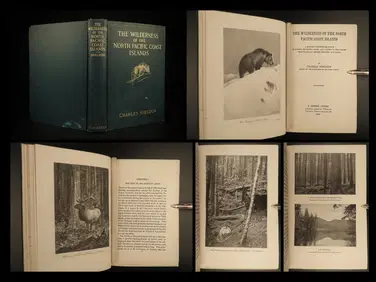
1912 HUNTING Alaska Vancouver Sheldon Wilderness of North Pacific Canada BearSchilb Antiquarian Rare Books4.8(422)See Sold PriceMar 31, 2024
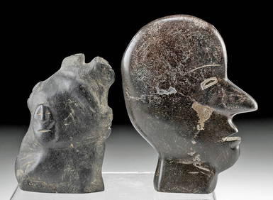
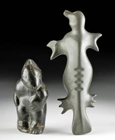
Alaskan / Canadian Inuit Stone Bird + Reclining SealArtemis Fine Arts4.8(1.4k)See Sold PriceFeb 27, 2024
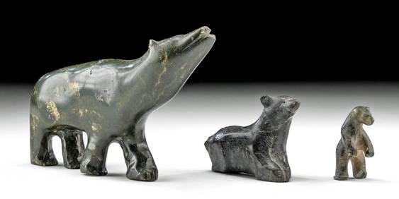
Inuit Soapstone Carvings Face Profile + Abstract FacesArtemis Fine Arts4.8(1.4k)See Sold PriceFeb 27, 2024
Inuit Soapstone Sculpture - Conjoined Male & FemaleArtemis Fine Arts4.8(1.4k)See Sold PriceFeb 27, 2024
Inuit Soapstone Carving - Shamanic TransformationArtemis Fine Arts4.8(1.4k)See Sold PriceFeb 27, 2024
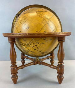
Antique Josiah Loring Terrestrial 1850s GlobeMatthew Bullock Auctioneers4.7(1.8k)See Sold PriceMar 02, 2024


![[COLTON'S MAP OF THE WORLD] (1 of 1)](https://p1.liveauctioneers.com/135/995/445679_1_x.jpg?height=282&quality=70)