ATLAS of ANTIENT GEOGRAPHY by SAMUEL BUTLER 1843John McInnis Auctioneers,LLC4.6(502)See Sold PriceFeb 24, 2024
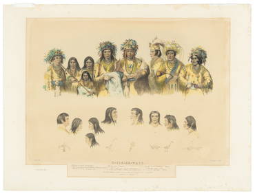
18TH C. ANTIQUE MAP: FRENCH & INDIAN WAR, FRAMEDThomaston Place Auction Galleries4.4(386)See Sold PriceFeb 24, 2024
Rand McNally Railroad Map Cabinet w/ 21 Railroad MapsRail & Road Auctions4.6(165)See Sold PriceMar 08, 2024
Keith Haring - Ink on New York Map, Best Buddies, Inscribed, Signed, and DatedSapphire Auction Gallery4(67)See Sold PriceMar 02, 2024
LATE 17TH C. FRENCH MAP OF THE NEW WORLD BY ALEXIS-HUBERT JAILLOT (1632-1712)Thomaston Place Auction Galleries4.4(386)See Sold PriceFeb 24, 2024
Central Railroad of New Jersey Map of Sandy Hook Route-ca. 1903JM Hobby Supply and Railroad Artifact Auctions4.4(126)See Sold PriceFeb 24, 2024
Lot of Six Mixed Atlas Box Cars-HO Scale-New in BoxJM Hobby Supply and Railroad Artifact Auctions4.4(126)See Sold PriceFeb 25, 2024
Rand McNally/Santa Fe Railroad Map of Iowa-1912JM Hobby Supply and Railroad Artifact Auctions4.4(126)See Sold PriceFeb 24, 2024
NICOLAES VISSCHER (NETHERLANDS, 1618-1709) MAP OF THE NEW WORLDThomaston Place Auction Galleries4.4(386)See Sold PriceFeb 24, 2024
17TH C. WORLD MAP BY NICOLAES VISSCHER (NETHERLANDS, 1618-1709)Thomaston Place Auction Galleries4.4(386)See Sold PriceFeb 24, 2024
Lot of Six Mixed Atlas Cabooses-HO Scale-New in BoxJM Hobby Supply and Railroad Artifact Auctions4.4(126)See Sold PriceFeb 25, 2024
Map of Central States - Northern DivisionMap of Central States - Northern Division Color Map. Publisher Harper Brothers Dated: 1888 Dimensions: 12 x 9" Condition Report Text on versoSee Sold Price
Map of Central States - Northern DivisionMap of Central States - Northern Division Color Map. Publisher Harper Brothers Dated: 1888 Dimensions: 12 x 9" Condition Report Text on vSee Sold Price
Map of West Central and Plains StatesMap of West Central and Plains States - Northern Divison Color Map. Publisher Harper Brothers Dated: 1888 Dimensions: 12 x 9" Condition Report <See Sold Price
Map of West Central and Plains StatesMap of West Central and Plains States - Northern Divison Color Map. Publisher Harper Brothers Dated: 1888 Dimensions: 12 x 9" Condition RepoSee Sold Price
SoldA MAP, CENTRAL AMERICA, INCLUDING TEXAS, CALIFORNIA ANDA MAP, CENTRAL AMERICA, INCLUDING TEXAS, CALIFORNIA AND THE NORTHERN STATES OF MEXICO BY SDUK, LONDON, 1842. Detailed map of Texas (shown as a Republic), upper California, the Rocky Mountains, and conSee Sold Price
[MAP]. Central America II.... London, 1842.646. [MAP]. SOCIETY FOR THE DIFFUSION OF USEFUL KNOWLEDGE. Central America II. Including Texas, California and the Northern States of Mexico...Published under the SuperintendenSee Sold Price
Central States Western DivisionTitle: Central States Western Division Date: 1881 Publisher: IVISON, BLAKEMAN, TAYLOR AND CO. Description: School map taken from a geography by William Swinton. Includes Dakota, Minnesota, Iowa, NebraSee Sold Price
SoldSOUTH WESTERN USA.Showing Republic of Texas & MexicanReserve Reduced! TITLE/CONTENT OF MAP: 'CENTRAL AMERICA, SHEET II., INCLUDING TEXAS, CALIFORNIA AND THE NORTHERN STATES OF MEXICO' The map shows the Republic of Texas as an independent state as it exiSee Sold Price
SoldFRAMED MID 19TH CENTURY MAP OF ''Central America, iFRAMED MID 19TH CENTURY MAP OF ''Central America, including Texas, California and the Northern States of Mexico'', published under the supervision of the Society for the Diffusion of Useful Knowledge,See Sold Price
SoldLewis (Samuel) A Map of Scotland Divided into CounLewis (Samuel) A Map of Scotland Divided into Counties,large map on a scale of 5 miles to the inch, in 3 sections, Northern Division, Central Division and Southern Division, the last with largSee Sold Price
SoldMap of Texas Republic, California, 1842, sight: 12.5 xMap of Central America II. Including Texas, California and the Northern States of Mexico. London: Chapman & Hall, 1842. Engraved by J. & C. Walker, sight: 12.5 x 15.25", frame: 18.25 x 20.75" with hanSee Sold Price
SoldMAP, C. 1842, CENTRAL AMERICA, TEXAS, CALIFORNIAFramed map c. 1842, "Central America including Texas, California and the Northern States of Mexico", "Published under the Superintendence of the Society for Diffusion of Useful Knowledge", J&C Walker,See Sold Price
Arrowsmith map of West Indies 1805Title: West Indies Author: Arrowsmith, Aaron Description: Copper-engraved map. 25x40 cm. (9¾x15¾").The Caribbean and its islands, with Mexico and Central America, southern United States, northern SoSee Sold Price
Il Circolo di Franconia…. Central Germany. Northern Bavaria. ZATTA 1783 mapTITLE/CONTENT OF MAP: 'Il Circolo di Franconia diviso ne suoi stati di nuova projezione' "The Circle of Franconia divided in its states". Central Germany; northern Bavaria DATE PRINTED: Published in 1See Sold Price
Il Circolo di Franconia. Central Germany. NorthernTITLE/CONTENT OF MAP: 'Il Circolo di Franconia diviso ne suoi stati di nuova projezione' "The Circle of Franconia divided in its states". Central Germany; northern Bavaria DATE PRINTED: Published in 1See Sold Price
MAP - Northern Asia. CluverNorthern Asia. Philipp Cluver, Scythia et Tartaria Asiatica, 1711 (published). Hand Color. This attractive map of northern and central Asia shows ancient divisions and place names. The northeastern coSee Sold Price
SoldMap of Texas and Indian TerritoryMap of Texas and Indian Territory West Central States and States of the Plains - Southern Division. Color Map. Publisher Harper Brothers Dated: 1888 DimenSee Sold Price
Map of Texas and Indian TerritoryMap of Texas and Indian Territory West Central States and States of the Plains - Southern Division. Color Map. Publisher Harper Brothers Dated: 1888 DSee Sold Price
SoldSDUK: Antique Map of Southwestern USA, 1846CENTRAL AMERICA, SHEET II., INCLUDING TEXAS, CALIFORNIA AND THE NORTHERN STATES OF MEXICO' The map, published in 1846, shows the Republic of Texas as an independent state as it existed between 1836 anSee Sold Price
SoldSDUK, Central AmericaSDUK Central America including Texas, California and the Northern States of Mexico Hand colored map, 1842 Plate: 12 x 15.50 inches/ 30.5 x 39.3 centimeters Frame: 20.75 x 23 inches/ 52.7 x 58.4 centimSee Sold Price
SoldSDUK Central America with independent Texas 1842Title: Central America II. Including Texas, California and the Northern States of Mexico Author: Society for the Diffusion of Useful Knowledge Description: Steel-engraved map, hand-colored in outline.See Sold Price
SoldBartholomew, John 1922 Lot of 8 Large Maps of EuropeIncl Belgium/Holland, Spain/Portugal - East & West, Northern Italy/Austria, Southern Italy, Central European States, Germany - South & West. Large Lithograph Maps Published 1922 by The Times, London fSee Sold Price
Bartholomew, John 1922 Lot of 8 Large Maps of EuropeIncl Belgium/Holland, Spain/Portugal - East & West, Northern Italy/Austria, Southern Italy, Central European States, Germany - South & West. Large Lithograph Maps Published 1922 by The Times, London fSee Sold Price
Sold[United States]. 4 Maps.[United States]. 4 Maps. ++ Lake Superior And The Northern Part Of Michigan. J. H. Colton: 1855. 11 1/2 x 13 3/4, hand-colored. Corners torn, minor edgewear, map unaffected. ++ Map Of The Central StatSee Sold Price
Michigan Southern and Northern Indiana RR 14th Annual Report-February 28, 1869JM Hobby Supply and Railroad Artifact Auctions4.4(126)See Sold PriceFeb 24, 2024
American Express/New York Central Railroad Map of the United States-1934JM Hobby Supply and Railroad Artifact Auctions4.4(126)See Sold PriceFeb 24, 2024
Northern Pacific RR Washington and Northern Idaho Map Folder-1941JM Hobby Supply and Railroad Artifact Auctions4.4(126)See Sold PriceFeb 24, 2024
New York Central and Hudson River RR Public Timetable-November 3, 1901JM Hobby Supply and Railroad Artifact Auctions4.4(126)See Sold PriceFeb 24, 2024
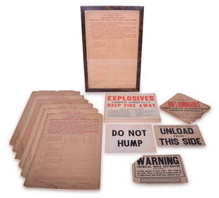
32 Railroad Loading Charts and Explosive Placards - Monon, Illinois Central, Northern Pacific, etc.Rail & Road Auctions4.6(165)See Sold PriceMar 08, 2024
Afrique. Côte Déserte #48. Skeleton Coast. Namibia. VANDERMAELEN 1827 old mapJasper524.5(9.8k)See Sold PriceFeb 28, 2024
Afrique Pays… sud du Lac Tchad 30 Central African Republic VANDERMAELEN 1827 mapJasper524.5(9.8k)See Sold PriceFeb 28, 2024
Central Africa. Congo Free State Rhodesia German East Africa. STANFORD 1896 mapJasper524.5(9.8k)See Sold PriceFeb 28, 2024
Afrique. Pays des Hottentots #51. Botswana South Africa. VANDERMAELEN 1827 mapJasper524.5(9.8k)See Sold PriceFeb 28, 2024
CENTRAL AFRICA. Tanzania, Kenya, Angola, Zambia, Congo, Mozambique 1903 mapJasper524.5(9.8k)See Sold PriceFeb 28, 2024
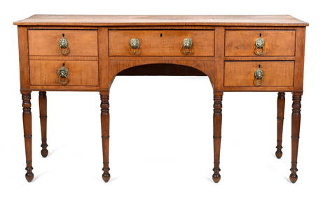
FEDERAL HUDSON VALLEY NY FIGURED MAPLE SIDEBOARD.William Smith Auctions4.6(146)See Sold PriceMar 06, 2024


![[MAP]. Central America II.... London, 1842. (1 of 1)](https://p1.liveauctioneers.com/514/20078/6912998_1_x.jpg?height=282&quality=70)


![[United States]. 4 Maps. (1 of 1)](https://p1.liveauctioneers.com/179/1435/617538_1_x.jpg?height=282&quality=70)