RARE 1638 HONDIUS MAP OF BERMUDA, FRAMEDThomaston Place Auction Galleries4.4(393)See Sold PriceFeb 24, 2024
SEUTTER, Georg Matthaus (1678-1757) - Atlas novus siveSEUTTER, Georg Matthaus (1678-1757) - Atlas novus sive geographicae totius orbis faciem. Habsburg: Matthaus Seutter, [ca. 1735]. A copy in fine contemporary colouring of Seutter's celebrated atlas whiSee Sold Price
SEUTTER, Georg Matthaus (1678-1757) - Atlas novus siveSEUTTER, Georg Matthaus (1678-1757) - Atlas novus sive tabulae geographicae totius orbis faciem. Habsburg: Matthaus Seutter, [ca. 1730-50]. A copy in fine contemporary colouring of Seutter's celebrateSee Sold Price
Seutter World MapSEUTTER, Georg Matthaus (1678-1757). [World Map] Diversi Globi terr-Aquei statione variante et visu interxedente. Engraved map with hand color. Augsburg: c. 1730. 21 1/4" x 25" sheet. The double-hemisSee Sold Price
SoldSeutter rare gore pairingSeutter, Georg Matthaus. 1678-1757. Globus Terrestris; Globus Celestis. Augsburg: [c.1710]. Seutter, Georg Matthaus. 1678-1757. Globus Terrestris; Globus Celestis. Augsburg: [c.1710]. 6 hand-colored eSee Sold Price
SoldAtlas Novus sive Tabulae GeographicaeGeorg Matthaus Seutter (1678-1757). Augsburg: Matthaus Seutter, ca 1740]See Sold Price
SoldSeutter, Hand Colored Map, Asia Minor, 18th C.German, circa 1770. "Natoliae olim Asiae Minoris Tabula per Matth. Seutterum"-circa 1770, hand colored copperplate cartographic engraving by Georg Matthäus Seutter (German, 1678-1757) published in AuSee Sold Price
SoldGEORG M. SEUTTER, MAP OF NORTHEAST AMERICA, LATERGeorg Matthaus Seutter (German, 1678-1757), second state, later impression. "Recens Edita totius Novi Belgii, in America Septentrionali siti, delineatio cura et sumtibus Matthaei Seutteri, Sac. Caes.See Sold Price
SoldGeorg Matthaus Seutter (German, 1678-1757) 17C MapGeorg Matthaus Seutter (German, 1678-1757) 17th century map. Nova Belgii America Septentrionali hand colored engraved map. In good condition, not glued down, tape hinge at top, there is a quarter inchSee Sold Price
Sold(3) ANTIQUE MAPS, SPAIN, PORTUGAL, SAXONY, 18TH C.(lot of 3) Antique maps, including: (1) "Saxonie Inferioris Circulus...," c.1730, Georg Matthaus Seutter (German, 1678-1757), hand colored, approx 20.5"h, 23.75"w; (1) "La Catalogna Li Regni Di AragonSee Sold Price
Seutter Georg MatthäusSeutter Georg Matthäus, Atlas minor præcipua orbis terrarum imperia, regna et provincias... [Augsburg: Seutter, 1744]. In-folio oblungo (mm 216x295). Carte [18], 67 mappe. Bella coloritura d'epoca.See Sold Price
SoldSEUTTER, Georg Matthaus (1678-1757). Atlas Minorpraecipua Orbis terrarium Imperia, Regna et Provincias Germania. Augsburg: Seutter, [ca. 1750]. Atlas with contemporary colouring and provenance attesting to the didactic use of such geographical publSee Sold Price
Prächtiger Sammel-Atlas mit caPrächtiger Sammel-Atlas mit ca. 102 Karten und Ansichten, Johann Baptist Homann(1664-1724) und Matthäus Seutter (1678-1757) , "Atlas novus terrarum orbis imperia regna et status exactis tabulis geogSee Sold Price
SEUTTER, Matthias (editore; 1678-1757) - Atlas MinorSEUTTER, Matthias (editore; 1678-1757) - Atlas Minor praecipua Orbis terrarium Imperia, Regna et Provincias Germania. Habsburg: [c. 1750]. Copy complete of all the plates handcoloured in a contemporarSee Sold Price
SEUTTER, GEORG MATTHÄUSSEUTTER, GEORG MATTHÄUS 1678 Augsburg - ebenda 1757 Landkarte 'Imperii Moscovitici' Kupferstich auf Papier, handcoloriert, 50 cm x 59 cm, Mittelfalte, bezeichnet '[...] à Matth. Seutter s August VinSee Sold Price
SoldGeorg Matthaus Seutter, EuropaColored engraving. Georg Matthaus Seutter (1678-1757). Approx. 20" H x 24" W sight, 25 1/2" H x 29" W framed. From the estate of Arthur Adlman, New York, NY and Cascais, Portugal. (5229) Wear and foxiSee Sold Price
SoldGeorg Matthäus SEUTTER (1678 - 1757). "FRANCOFURTI".483 mm x 585 mm sheet size. Copper Engraving on paper. Old colored. German Description: Georg Matthäus SEUTTER (1678 - 1757). "FRANCOFURTI". Frankfurt am Main. 483 mm x 585 mm Blattgröße. KupferstiSee Sold Price
SoldCanton of Glarus, SwitzerlandPagus Helvetiae Glaronensis cum Satrapia Werdenberg (Canton of Glarus, Switzerland). Matthäus Seutter (1678-1757). 1750, Atlas Novas Indicibus Instructus. 24 1/4 x 21 1/4See Sold Price
SoldSeutter, Hand Colored Map, Central Asia, 18th C.German, circa 1770. "Imperi Magni Mogolis sive Indici Padschach"-circa 1740, hand colored copperplate cartographic engraving by Georg Matthäus Seutter (German, 1678-1757) published in Ausburg. A GermSee Sold Price
GEORG MATTHÄUS SEUTTER 1678 Augsburg - 1757 ibidemGEORG MATTHÄUS SEUTTER 1678 Augsburg - 1757 ibidem POSTARUM SEN CURSORUM PUBLICORUM (...) GERMANIAM (...) Engraving, coloured, on paper with centre fold. Visible size 50 x 57,5 cm (f. 81 x 89 cm)See Sold Price
ÜBERSICHTSKARTE DER ENTFERNUNGEN DEUTSCHER UNDGEORG MATTHÄUS SEUTTER 1678 Augsburg - 1757 ebenda Übersichtskarte der Entfernungen deutscher und europäischer Städte Kupferstich auf Papier, koloriert. BM 49,5 x 57 cm. Mitte rechts bez. '[...] eSee Sold Price
"Neapolis Regnum quo continentur Aprutium Ulterius etNeapolis Regnum quo continentur Aprutium Ulterius et citer Avgsburg,1730, Sporse Matthaus Seutter "il Vecchio" (1678-1756), from Atlas Minor. Cm 21x27,2, copper etching with beautiful cartouche and acSee Sold Price
Neapolis Regnum quo continentur Aprutium Ulterius etNeapolis Regnum quo continentur Aprutium Ulterius et citer Avgsburg,1730, Sporse Matthaus Seutter "il Vecchio" (1678-1756), from Atlas Minor. Cm 21x27,2, copper etching with beautiful cartouche and acSee Sold Price
'Neapolis Regnum quo continentur Aprutium Ulterius et'Neapolis Regnum quo continentur Aprutium Ulterius et citer Avgsburg,1730, Sporse Matthaus Seutter 'il Vecchio' (1678-1756), from Atlas Minor. Cm 21x27,2, copper etching with beautiful cartouche and aSee Sold Price
SoldSeutter Map of EuropeSeutter, Matthaus (1678-1757). Europa Religionis Christianae Morum et Pacis ac Belli Artium Cultu Omnium Terrarum Orbis Partium Praestantiss.... Engraved map with original hand color in part. Ausburg,See Sold Price
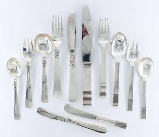
12 pc Jensen & Andersen Sterling FlatwareSchmidt's Antiques Inc. Since 19114.8(431)See Sold PriceMar 02, 2024
ATLAS WINDSHIELD WASHER TIN SERVICE STATION SIGN W/ CAN GRAPHIC.Dan Morphy Auctions4.2(1.3k)See Sold PriceFeb 25, 2024
LATE 16TH C. MAP OF SCOTLAND BY MERCATOR, FRAMEDThomaston Place Auction Galleries4.4(393)See Sold PriceFeb 24, 2024
VINTAGE GEORG JENSEN STERLING SILVER GOLD CUFFLINKS A22Modern Jewelry4.5(186)See Sold PriceFeb 25, 2024
VINTAGE GEORG JENSEN STERLING SILVER OPEN BOOK CUFFLINKS 109Modern Jewelry4.5(186)See Sold PriceFeb 25, 2024
18th Century Hess Germany Hand colored Engraved MapGlobal Auctions Company4.3(36)See Sold PriceMar 03, 2024
1678 BIBLE COMMENTARY by MATHEO POLO antique PIGSKIN BOUND MASSIVE FOLIO v. IVJasper524.5(9.9k)See Sold PriceFeb 27, 2024
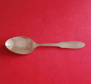
Mermaid by Georg Jensen Silverplate Pastry Fork 3-Tine 5 7/8"Mynt Auctions4.6(697)See Sold PriceMar 02, 2024
Blackie (Pub) 1882 Folio Print. Georgian, Circassian & Armenian RacesAlbion Auctions4.7(341)See Sold PriceMar 07, 2024
Tiffany & Co 18K Pink Gold Atlas X Closed 4.5 US Ring B0360Pacific Global Auction3.9(280)See Sold PriceFeb 24, 2024
Northern & Southern Africa. Maghreb. Orange River Sovereignty. HALL 1854 mapJasper524.5(9.9k)See Sold PriceFeb 28, 2024
COLONIAL AFRICA Afrique. League of Nations Mandates. Ethnicity 1929 old mapJasper524.5(9.9k)See Sold PriceFeb 28, 2024
Africa. Congo Free Trade Area. British South Africa Company. STANFORD 1896 mapJasper524.5(9.9k)See Sold PriceFeb 28, 2024
Early colonial Africa. Inset Madeira & Aden. SIDNEY HALL 1854 old antique mapJasper524.5(9.9k)See Sold PriceFeb 28, 2024
Stanford, Edward 1901 Large Map. Geological Map of the British IslesAlbion Auctions4.7(341)See Sold PriceMar 01, 2024