ATLAS of ANTIENT GEOGRAPHY by SAMUEL BUTLER 1843John McInnis Auctioneers,LLC4.6(502)See Sold PriceFeb 24, 2024
18TH C. ANTIQUE MAP: FRENCH & INDIAN WAR, FRAMEDThomaston Place Auction Galleries4.4(386)See Sold PriceFeb 24, 2024
Rand McNally Railroad Map Cabinet w/ 21 Railroad MapsRail & Road Auctions4.6(165)See Sold PriceMar 08, 2024
Keith Haring - Ink on New York Map, Best Buddies, Inscribed, Signed, and DatedSapphire Auction Gallery4(67)See Sold PriceMar 02, 2024
LATE 17TH C. FRENCH MAP OF THE NEW WORLD BY ALEXIS-HUBERT JAILLOT (1632-1712)Thomaston Place Auction Galleries4.4(386)See Sold PriceFeb 24, 2024
Central Railroad of New Jersey Map of Sandy Hook Route-ca. 1903JM Hobby Supply and Railroad Artifact Auctions4.4(126)See Sold PriceFeb 24, 2024
Lot of Six Mixed Atlas Box Cars-HO Scale-New in BoxJM Hobby Supply and Railroad Artifact Auctions4.4(126)See Sold PriceFeb 25, 2024
Rand McNally/Santa Fe Railroad Map of Iowa-1912JM Hobby Supply and Railroad Artifact Auctions4.4(126)See Sold PriceFeb 24, 2024
NICOLAES VISSCHER (NETHERLANDS, 1618-1709) MAP OF THE NEW WORLDThomaston Place Auction Galleries4.4(386)See Sold PriceFeb 24, 2024
17TH C. WORLD MAP BY NICOLAES VISSCHER (NETHERLANDS, 1618-1709)Thomaston Place Auction Galleries4.4(386)See Sold PriceFeb 24, 2024
Lot of Six Mixed Atlas Cabooses-HO Scale-New in BoxJM Hobby Supply and Railroad Artifact Auctions4.4(126)See Sold PriceFeb 25, 2024
Exact Chart of the River St. Lawrence,Title: Exact Chart of the River St. Lawrence, Publicaiton Date: 1775-05-25 Cartographer: JEFFERYS, THOMAS Publisher: ROBT. SAYER Size: 23.3Height - 37.1Width Additional Information: from Fort FrontenaSee Sold Price
Exact Chart of the River St. Lawrence,Publication Date: 1775-05-25 Title: Exact Chart of the River St. Lawrence, Cartographer: JEFFERYS, THOMAS Publisher: ROBT. SAYER Height: 23.3 Width: 37.1 "from Fort Frontenac to the island of AnticostSee Sold Price
Exact Chart of the River St. Lawrence,Publication Date: 1775-05-25 Title: Exact Chart of the River St. Lawrence, Cartographer: JEFFERYS, THOMAS Publisher: ROBT. SAYER Height: 23.3 Width: 37.1 "from Fort Frontenac to the island of AnticostSee Sold Price
Exact Chart of the River St. Lawrence,Publication Date: 1775-05-25 Title: Exact Chart of the River St. Lawrence, Cartographer: JEFFERYS, THOMAS Publisher: ROBT. SAYER Height: 23.3 Width: 37.1 "from Fort Frontenac to the island of AnticostSee Sold Price
Exact Chart of the River St. Lawrence,Publication Date: 1775-05-25 Title: Exact Chart of the River St. Lawrence, Cartographer: JEFFERYS, THOMAS Publisher: ROBT. SAYER Height: 23.3 Width: 37.1 "from Fort Frontenac to the island of AnticostSee Sold Price
SoldJeffreys. Chart of River St. Lawrence, 1775.[Map/River St. Lawrence]. Thomas Jeffreys. An Exact Chart Of The River St. Lawrence, From Fort Frontenac To The Island Of Anticosti...and all necessary Instructions for navigating that River to QuebecSee Sold Price
SoldJeffreys, Chart of River St. Lawrence, 1775[Chart/River St. Lawrence]. Thomas Jeffreys. An Exact Chart Of The River St. Lawrence, From Fort Frontenac To The Island Of Anticosti...and all necessary Instructions for navigating that River to QuebSee Sold Price
Jeffery's Map of the St. Lawrence River, CanadaJefferys, Thomas (1719-1771). Exact Chart of the River St. Lawrence... Engraved map. Robert Sayer, 1775. 23 ¼" x 37 ⅛" sheet. "...from Fort Frontenac to the island of Anticosti shewing the sSee Sold Price
SoldJefferys EXACT CHART OF THE RIVER ST LAURENCE 1775Details: JEFFERYS, Thomas (1719-71). An Exact Chart of the River St. Laurence, from Fort Frontenac to the Island of Anticosti shewing the soundings, rocks, shoals &c with views of the lands and all nSee Sold Price
THOMAS JEFFERYS - AN EXACT CHART OF THE RIVER ST.Thomas Jefferys - An Exact Chart Of The River St. Laurence, 1775 - 44 X 28 3/8 In. - This Giclée Print Is Gallery Stretched And Ready To Hang Or Lean Against A Wall, Or Display On An Easel. - A Gicl�See Sold Price
THOMAS JEFFERYS - AN EXACT CHART OF THE RIVER ST.Thomas Jefferys - An Exact Chart Of The River St. Laurence, 1775 - 36 X 23 1/4 In. - This Giclée Print Is Gallery Stretched And Ready To Hang Or Lean Against A Wall, Or Display On An Easel. - A Gicl�See Sold Price
THOMAS JEFFERYS - AN EXACT CHART OF THE RIVER ST.Thomas Jefferys - An Exact Chart Of The River St. Laurence, 1775 - 40 X 25 3/4 In. - This Giclée Print Is Gallery Stretched And Ready To Hang Or Lean Against A Wall, Or Display On An Easel. - A Gicl�See Sold Price
AN EXACT CHART OF THE RIVER ST. LAURENCE, 1775…THOMASThomas Jefferys - An Exact Chart Of The River St. Laurence, 1775 - 40 X 25 3/4 In. - This Giclée On Canvas Is Gallery Stretched And Ready To HangSee Sold Price
THOMAS JEFFERYS - AN EXACT CHART OF THE RIVER ST.Thomas Jefferys - An Exact Chart Of The River St. Laurence, 1775 - 40 X 25 3/4 In. - This Giclée Print Is Gallery Stretched And Ready To Hang Or Lean Against A Wall, Or Display On An Easel. - A Gicl�See Sold Price
THOMAS JEFFERYS -AN EXACT CHART OF THE RIVER ST.Thomas Jefferys -an Exact Chart Of The River St. Laurence, 1775 - Giclée On Canvas -40 X 25 3/4 In. - A Giclée Print Is The Highest Quality Print Available Today. Because There Is No Visible Dot ScrSee Sold Price
THOMAS JEFFERYS - AN EXACT CHART OF THE RIVER ST.Thomas Jefferys - An Exact Chart Of The River St. Laurence, 1775 - Giclée On Canvas - 44 X 28 3/8 In. A Giclée Print Is The Highest Quality Print Available Today. Because There Is No Visible Dot ScrSee Sold Price
AN EXACT CHART OF THE RIVER ST. LAURENCE, 1775…THOMASThomas Jefferys - An Exact Chart Of The River St. Laurence, 1775 - 40 X 25 3/4 In. - This Giclée Print Is Gallery Stretched And Ready To HangSee Sold Price
THOMAS JEFFERYS - AN EXACT CHART OF THE RIVER ST.Thomas Jefferys - An Exact Chart Of The River St. Laurence, 1775 - 36 X 23 1/4 In. - Gallery Stretched The Piece Of Art Is Ready To Hang Or Lean Against A Wall, Or Display On An Easel. - A Giclée PriSee Sold Price
Thomas Jefferys - An Exact Chart Of The River St.Thomas Jefferys - An Exact Chart Of The River St. Laurence, 1775 Size: 36 X 23 1/4 In. - This Is A Gallery Stretched Giclee Print On Canvas. The Piece Was Printed On High Quality Artist Grade 350 Gsm,See Sold Price
AN EXACT CHART OF THE RIVER ST. LAURENCE, 1775…THOMASThomas Jefferys - An Exact Chart Of The River St. Laurence, 1775 - 40 X 25 3/4 In. - This Gicle On Canvas Is Gallery Stretched And Ready To HangSee Sold Price
THOMAS JEFFERYS - AN EXACT CHART OF THE RIVER ST.Thomas Jefferys - An Exact Chart Of The River St. Laurence, 1775 - 40 X 25 3/4 In. - This Giclée Print Is Gallery Stretched And Ready To Hang Or Lean Against A Wall, Or Display On An Easel. - A Gicl�See Sold Price
THOMAS JEFFERYS - AN EXACT CHART OF THE RIVER ST.Thomas Jefferys - An Exact Chart Of The River St. Laurence, 1775 - 40 X 25 3/4 In. - Giclée Is On Canvas - Gallery Stretched And Ready To HangSee Sold Price
THOMAS JEFFERYS - AN EXACT CHART OF THE RIVER ST.Thomas Jefferys - An Exact Chart Of The River St. Laurence, 1775 - 40 X 25 3/4 In. - This Giclée Print Is Gallery Stretched And Ready To Hang Or Lean Against A Wall, Or Display On An Easel. - A Gicl�See Sold Price
THOMAS JEFFERYS - AN EXACT CHART OF THE RIVER ST.Thomas Jefferys - An Exact Chart Of The River St. Laurence, 1775 - 36 X 23 1/4 In. - Gallery Stretched The Piece Of Art Is Ready To Hang Or Lean Against A Wall, Or Display On An Easel. - A Giclée PriSee Sold Price
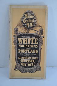
Maine Central RR Through the White Mtns-Portland to the St Lawrence River Book-1901JM Hobby Supply and Railroad Artifact Auctions4.4(126)See Sold PriceFeb 24, 2024
LATE 18TH C. VERY LARGE CHART OF NORTHEAST CANADA BY DES BARRES (1721-1824), 1780, FRAMEDThomaston Place Auction Galleries4.4(386)See Sold PriceFeb 24, 2024
1883 Mark Twain 1ed Life on the Mississippi St. Louis Missouri Steamboat CLASSICSchilb Antiquarian Rare Books4.8(421)See Sold PriceMar 31, 2024
THE COLLECTED WORKS OF BERNARD SHAW, LIMITED EDITION SET – 1930 – 36 VOLUMESThe Rug Life4.3(12)See Sold PriceMar 07, 2024
1764 Bellin Map of Lesser Antilles Northern Portion -- Petites Antilles ou Isles du Vent 3e. Partie.Jasper524.5(9.8k)See Sold PriceFeb 27, 2024
WEST AFRICA Explorers' routes Senegal Ashanti. Mountains of Kong. SDUK 1857 mapJasper524.5(9.8k)See Sold PriceFeb 28, 2024
WEST AFRICA explorers' routes. Beaufort Gray Park Dochard Caillie. SDUK 1874 mapJasper524.5(9.8k)See Sold PriceFeb 28, 2024
Partie de la Coste d'Afrique'. Southern Mauritania BELLIN/SCHLEY 1747 old mapJasper524.5(9.8k)See Sold PriceFeb 28, 2024
WEST AFRICA I Explorers' routes Senegal Ashanti Ivory Gold Coast. SDUK 1851 mapJasper524.5(9.8k)See Sold PriceFeb 28, 2024
South Namibia coast. Walvis Bay-Orange River ADMIRALTY sea chart 1881 (1954) mapJasper524.5(9.8k)See Sold PriceFeb 28, 2024
WEST AFRICA showing early explorers' routes & Mountains of Kong. SDUK 1844 mapJasper524.5(9.8k)See Sold PriceFeb 28, 2024
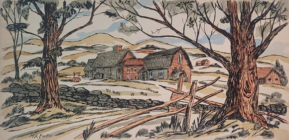
Marc Aurele Fortin (Attributed) Mixed Media on Board 8" x 16"Carstens Galleries4.5(128)See Sold PriceMar 01, 2024