ATLAS of ANTIENT GEOGRAPHY by SAMUEL BUTLER 1843John McInnis Auctioneers,LLC4.5(505)See Sold PriceFeb 24, 2024
18TH C. ANTIQUE MAP: FRENCH & INDIAN WAR, FRAMEDThomaston Place Auction Galleries4.4(393)See Sold PriceFeb 24, 2024
Rand McNally Railroad Map Cabinet w/ 21 Railroad MapsRail & Road Auctions4.6(165)See Sold PriceMar 08, 2024
Keith Haring - Ink on New York Map, Best Buddies, Inscribed, Signed, and DatedSapphire Auction Gallery4(67)See Sold PriceMar 02, 2024
LATE 17TH C. FRENCH MAP OF THE NEW WORLD BY ALEXIS-HUBERT JAILLOT (1632-1712)Thomaston Place Auction Galleries4.4(393)See Sold PriceFeb 24, 2024
Central Railroad of New Jersey Map of Sandy Hook Route-ca. 1903JM Hobby Supply and Railroad Artifact Auctions4.4(127)See Sold PriceFeb 24, 2024
Lot of Six Mixed Atlas Box Cars-HO Scale-New in BoxJM Hobby Supply and Railroad Artifact Auctions4.4(127)See Sold PriceFeb 25, 2024
Rand McNally/Santa Fe Railroad Map of Iowa-1912JM Hobby Supply and Railroad Artifact Auctions4.4(127)See Sold PriceFeb 24, 2024
NICOLAES VISSCHER (NETHERLANDS, 1618-1709) MAP OF THE NEW WORLDThomaston Place Auction Galleries4.4(393)See Sold PriceFeb 24, 2024
17TH C. WORLD MAP BY NICOLAES VISSCHER (NETHERLANDS, 1618-1709)Thomaston Place Auction Galleries4.4(393)See Sold PriceFeb 24, 2024
Lot of Six Mixed Atlas Cabooses-HO Scale-New in BoxJM Hobby Supply and Railroad Artifact Auctions4.4(127)See Sold PriceFeb 25, 2024
Scarce and impressive large RR map of Maine from elusive Cram’s atlasStunning and scarce large format railroad map of Maine, perhaps the finest railroad map of the state during that time period. Extremely impressive map painstakingly delineates enormous number of islanSee Sold Price
Extremely scarce RR map of Utah from 1910 Cram Std. Amer. Railway atlasImpossibly scarce, large format railroad map of Utah, showing counties, railroad lines, towns, mines, rivers, township surveys, Indian reservations, lakes, mountains, creeks, waterfalls, and a host ofSee Sold Price
Scarce 1910 Railroad map of Oklahoma from elusive Cram atlasIncredibly detailed, large format railroad map of Oklahoma showing every railroad line operating in the territory during this time period. Shows both steam and electric lines and displays them in a coSee Sold Price
Scarce and large RR system map of Eastern Texas, 1898Highly informative, scarce large format map of Eastern Texas showing the extensive rail system in the state toward the end of the 19th century. From George F. Cram’s 1898 Bankers and Brokers RaiSee Sold Price
Large and scarce 19th century RR map of Western TexasHighly detailed railroad map of the western half of Texas from the extremely scarce 1898 Cram’s Bankers and Brokers Railroad Atlas. All railroads and routes operating during that time period areSee Sold Price
SoldScarce RR map of Colorado - 1897Scarce and large 2-page map from the very scarce Cram’s 1897 Standard American Railway System Atlas of the World. Cram was unique in producing a special group of atlases for just a few years that hiSee Sold Price
Most impressive RR map of Georgia from scarce atlasGray’s New Map of Georgia by Frank A. Gray with a copyright date of 1877 by O. W. Gray. This very impressive and scarce map is from Gray’s very scarce 1884 National Atlas. It is a large foSee Sold Price
Scarce map of Maine, Anthony Finley 1833Striking and extremely scarce map of Maine from the elusive 1833 New General Atlas by Anthony Finley. Issued when the state had just ten counties. Original hand coloring by county, showing towns, roadSee Sold Price
Scarce large 1903 RR map of TexasTitle: Scarce large 1903 RR map of Texas Description: Beautiful and clean large format railroad map with complete view of all railroads operating in the state at the time. Rand McNally & Co’s RailroSee Sold Price
Scarce early Cram RR map of the Deep SouthFrom a very scarce Cram atlas comes this map of the Deep South showing the areas railway system in place in 1882. ”New Railroad and County Map of Arkansas, Louisiana & Mississippi.” The 18See Sold Price
Scarce early Cram RR map of Missouri“New Railroad and County Map of Missouri” from an exceedingly scarce 1882 edition of Cram’s Unrivaled Family Atlas of the World.” Collections of vintage maps of Missouri will nSee Sold Price
Fine RR map of Colorado from extremely scarce Cram RR atlasHighly detailed map of Colorado, from Cram's 1910 Standard American Railway System Atlas. Shows counties, railroads, railway stations, township surveys, mountains, rivers, lakes, and a host of other eSee Sold Price
SoldScarce 1882 RR map of New JerseyScarce map of New Jersey from the first mass-produced world atlas by George F. Cram. He published at least two versions of his 1883 Universal Family Atlas, an early edition and a later edition. The eaSee Sold Price
North and South CarolinaTitle: North and South Carolina Publication Date: 1901 Cartographer: CRAM, GEORGE F. Publisher: GEO. F. CRAM Size: 22.5X32.75 Scarce Cram Large Pocket Map of the Carolinas. Included with Cram's indexeSee Sold Price
SoldScarce 19th cent. RR map of TexasHighly detailed railroad map of Texas from the extremely scarce 1898 Cram’s Bankers and Brokers Railroad Atlas published by George F. Cram. All railroads and routes operating during that time periodSee Sold Price
Scarce 19th cent. RR map of Texas in fine conditionReserve Reduced! Highly detailed railroad map of Texas from the extremely scarce 1898 Cram’s Bankers and Brokers Railroad Atlas published by George F. Cram. All railroads and routes operating duringSee Sold Price
Scarce 19th cent. RR map of Texas in fine conditionReserve Reduced! Highly detailed railroad map of Texas from the extremely scarce 1898 Cram’s Bankers and Brokers Railroad Atlas published by George F. Cram. All railroads and routes operating duringSee Sold Price
Extremely scarce 1910 RR map of Montana from little-known atlasAn exceptionally scarce railroad map of Montana from the very last railroad atlas published by the George F. Cram map firm. There are literally only a handful of 1910 Cram Standard American Railway atSee Sold Price
Scarce RR map of early Midwest, H. H. Lloyd 1872Elusive map showing the network of rail lines across a fourteen-state section of the Midwest from the Great Lakes to the Atlantic coast. Published just a few years after the end of the Civil War. IntrSee Sold Price
Ext. scarce 1910 map of BostonFrom the extremely scarce 1910 Cram’s Standard American Railway Atlas comes this large format map of Boston with huge margins. This was the last railway atlas Cram produced and is so scarce, most deSee Sold Price
SoldScarce and huge RR map of California – 1898Toward the end of the 19th century, the better atlas makers had pushed the size and quality of their maps to the limit. George F. Cram was one of these publishers, but he also put out a special groupSee Sold Price
Johnson’s Iowa and Nebraska Civil War era RR map (1864)Large and impressive map of this Plains era as it existed during the closing years of the Civil War. All working railroad lines shown as well as the proposed route of the Dubuque & Pacific Railroad. ISee Sold Price
SoldScarce Cram map of MontanaThis large, 2-page map of Montana, with the yellow and carmine color scheme, is much scarcer than the green and rose versions in later 1883 and 1884 Cram atlases. Created at a time when the West was sSee Sold Price
1901 - Maine - XTRA Large Map1901 - Maine - XTRA Large Map **|**|** This is a beautiful, 114 year old map of Maine - published in the USA by George F. Cram. The map is much larger than most atlas maps of the same era. The detailsSee Sold Price
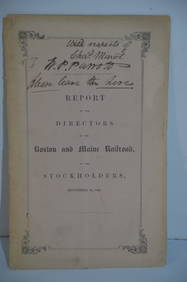
Boston and Maine RR Annual Report-September 12, 1849JM Hobby Supply and Railroad Artifact Auctions4.4(127)See Sold PriceFeb 24, 2024
Crams Colored Railway Map and Shippers Guide of South Dakota 1908-1909JM Hobby Supply and Railroad Artifact Auctions4.4(127)See Sold PriceFeb 24, 2024
Crams Map of North Dakota-Complete Railroad System and County Map-1907JM Hobby Supply and Railroad Artifact Auctions4.4(127)See Sold PriceFeb 24, 2024
Crams Railroad Map of New York-1881JM Hobby Supply and Railroad Artifact Auctions4.4(127)See Sold PriceFeb 24, 2024
Crams Township and Railroad Map of New York-1890JM Hobby Supply and Railroad Artifact Auctions4.4(127)See Sold PriceFeb 24, 2024
Crams Township and Railroad Map of Pennsylvania-1898JM Hobby Supply and Railroad Artifact Auctions4.4(127)See Sold PriceFeb 24, 2024
Union Pacific RR Map of the United States-1926JM Hobby Supply and Railroad Artifact Auctions4.4(127)See Sold PriceFeb 24, 2024
LARGE LATE 17TH C. DUTCH CHART OF CANADA, GREAT LAKES, NEW FRANCE, LABRADOR, HUDSON BAY, BY PIERREThomaston Place Auction Galleries4.4(393)See Sold PriceFeb 24, 2024
CHARLES ROLLIN c1828 Ceasar Hand Colored Africa Military MapLuis Porretta Fine Arts4.3(10)See Sold PriceMar 02, 2024
1849 Mitchell School ATLAS 24 MAPS America Holy Land France Africa Egypt AsiaSchilb Antiquarian Rare Books4.8(428)See Sold PriceMar 31, 2024
Rand McNally & Co's New Ideal State and County Survey and Atlas 1911North American Artifact Auctions4.7(198)See Sold PriceApr 20, 2024
Cram's Global War Atlas 1939 Maps WWIINorth American Artifact Auctions4.7(198)See Sold PriceApr 20, 2024
De Jode, Rare, pub. 1593 - Map of the Czech Republic or Kingdom of Bohemia (Chorographia insignisTrillium Antique Prints & Rare Books4.5(32)See Sold PriceFeb 24, 2024
De Jode, Rare, pub. 1593 - Map of the Middle East, Eastern Asia (Primae Partis Asiae accurataTrillium Antique Prints & Rare Books4.5(32)See Sold PriceFeb 24, 2024
Raphael - Religious Fresco or Decorative Pilaster. 7Trillium Antique Prints & Rare Books4.5(32)See Sold PriceFeb 24, 2024
1736 LARGE MAP OF SILESIA POLAND OPPAVIENSIS antique 25 by 34 3/4"Jasper524.5(9.9k)See Sold PriceFeb 27, 2024
1816 MAP NORTHERN PART OF RUSSIA or MUSCOVY in EUROPE copper engraving ANTIQUEJasper524.5(9.9k)See Sold PriceFeb 27, 2024
Stanford, Edward 1901 Large Map. Geological Map of the British IslesAlbion Auctions4.6(341)See Sold PriceMar 01, 2024