ATLAS of ANTIENT GEOGRAPHY by SAMUEL BUTLER 1843John McInnis Auctioneers,LLC4.6(502)See Sold PriceFeb 24, 2024
18TH C. ANTIQUE MAP: FRENCH & INDIAN WAR, FRAMEDThomaston Place Auction Galleries4.4(386)See Sold PriceFeb 24, 2024
Rand McNally Railroad Map Cabinet w/ 21 Railroad MapsRail & Road Auctions4.6(165)See Sold PriceMar 08, 2024
Keith Haring - Ink on New York Map, Best Buddies, Inscribed, Signed, and DatedSapphire Auction Gallery4(67)See Sold PriceMar 02, 2024
LATE 17TH C. FRENCH MAP OF THE NEW WORLD BY ALEXIS-HUBERT JAILLOT (1632-1712)Thomaston Place Auction Galleries4.4(386)See Sold PriceFeb 24, 2024
Central Railroad of New Jersey Map of Sandy Hook Route-ca. 1903JM Hobby Supply and Railroad Artifact Auctions4.4(126)See Sold PriceFeb 24, 2024
Lot of Six Mixed Atlas Box Cars-HO Scale-New in BoxJM Hobby Supply and Railroad Artifact Auctions4.4(126)See Sold PriceFeb 25, 2024
Rand McNally/Santa Fe Railroad Map of Iowa-1912JM Hobby Supply and Railroad Artifact Auctions4.4(126)See Sold PriceFeb 24, 2024
NICOLAES VISSCHER (NETHERLANDS, 1618-1709) MAP OF THE NEW WORLDThomaston Place Auction Galleries4.4(386)See Sold PriceFeb 24, 2024
17TH C. WORLD MAP BY NICOLAES VISSCHER (NETHERLANDS, 1618-1709)Thomaston Place Auction Galleries4.4(386)See Sold PriceFeb 24, 2024
Lot of Six Mixed Atlas Cabooses-HO Scale-New in BoxJM Hobby Supply and Railroad Artifact Auctions4.4(126)See Sold PriceFeb 25, 2024
Antique map of United Kingdom. Robert de Vaugondy (1794)Antique map of United Kingdom (Les Isles Britanniques). Robert de Vaugondy (1794). An interesting map created by Robert de Vaugondy for the 'Atlas Universel' in 1757 and corrected by his successor LamSee Sold Price
SoldDecorative Art: Antique Map by Robert De Vaugondy (18thMAPPEMONDE OU DESCRIPTION DU GLOBE TERRESTRE, Paris 1752, world map in two hemispheres, color etching on chain-laid paper with hand-coloring, image 18 x 27 ”, with center fold as issued, framed withSee Sold Price
Antique Arabian Map Robert De Vaugondy 1753Antique Arabian peninsula and Turkey printed by Robert de Vaugondy. Ornamental title on the lower left corner of two figures. Title: Etats Due Grand-Seigneur En Asie, Empire De Perse, Pays Des Usbecs,See Sold Price
SoldFramed Antique Map Orbis Vetus, Robert De VaugondyItem/Description: Old print. Map of the world by Robert de Vaugondy from 1752. Orbis vetus in utraque continente : In both the old continent / world map / Vaugondy 1752. Material: Print framed under gSee Sold Price
Antique map of Europe. Robert de Vaugondy (1804)Antique map of Europe. Robert de Vaugondy (1804). An interesting map created by Robert de Vaugondy for the 'Atlas Universel' in 1757 and corrected by his successor Lamarche. The Atlas Universel is oneSee Sold Price
SoldAntique map, Northeast US, by Robert De VaugondyAntique map, Northeast US, by Robert De Vaugondy "Partie De L'Amerique Septentrionale Qui Comprend Le Cours De L'Ohio, La Nlle Angleterre, La Nlle York, Le New Jersey, La Pensyvanie, Le Maryland La ViSee Sold Price
Antique Asia Minor Map by Robert De Vaugondy 1756Title: Asia Minor In Suas Partes, Seu Provincias Divisa 1756. Map Maker: Didier Robert De Vaugondy. Measures: 33"W x 28"H. Paris / 1756See Sold Price
SoldFRAMED ANTIQUE MAP OF THE WORLDFRAMED ANTIQUE MAP OF THE WORLD, ROBERT DE VAUGONDY, ORBIS VET US, 1752, GEOGRAPHO REGIS ORDINARIO. PAPER IS ACID BURNED AND FOLDED IN THE CENTER. Height: 27 & 19 1/2 in. by Width: 36 1/2 & 29 in.See Sold Price
SoldRobert de Vaugondy: Antique Map of Asia, 1778Map: 1778 Robert de Vaugondy Map of Asia -- l'Asie par le S. Robert de Vaugoundy Geog ord. du Roi... Cartographer: Robert de Vaugoundy Year / Place: 1778, Paris Dimensions: 9.4 x 10.8 in. Condition: VSee Sold Price
Antique 1778 Switzerland Engraved Map by Robert de VaugondyRobert de Vaugondy and E. Dussy antique 1778 Switzerland engraved map - Its Subjects, Its Allies and The Neighboring Grisons. Hand colored. Date of 1778 is in the cartouche/legend. PROVENANCE: This itSee Sold Price
Sold1750 Amerique Septentrionale dressee, sur les RelationsThis is an authentic antique map of North America by Robert De Vaugondy. The map is dated 1750, but was published in Vaugondy’s “Atlas Universal” out of Paris in 1757. This exceptioSee Sold Price
Antique 1757 Vaugondy Map of Russian EmpireAntique 1757 Vaugondy Map of Russian Empire. 1757 Robert De Vaugondy Large Antique Map of the Russian Empire - Poland to Asia. Antique hand colored engraving. Professionally framed and matted. MeasureSee Sold Price
SoldAntique 1757 Vaugondy Map of Russian EmpireAntique 1757 Vaugondy Map of Russian Empire. 1757 Robert De Vaugondy Large Antique Map of the Russian Empire - Poland to Asia. Antique hand colored engraving. Professionally framed and matted. MeasureSee Sold Price
SoldAntique Robert De Vaugondy Map of Ancient ItalyAntique Robert De Vaugondy Map of Ancient Italy. Profesionally matted and framed. 28.75 inches x 31.5 inches.See Sold Price
SoldAntique Robert De Vaugondy Map of Ancient ItalyAntique Robert De Vaugondy Map of Ancient Italy. Professionally matted and framed. 28.75 inches x 31.5 inches.See Sold Price
Amérique Méridionale. South America. ROBERT DE VAUGONDY 1750 old antique mapTITLE OF MAP (NOT PRINTED ON THE PAGE):'Amérique Méridionale, dressée, sur les Mémoires les plus récents et assujétie aux observations astronomique. Par le Sr. Robert deSee Sold Price
SoldAntique 1806 Robert de Vaugondy Map of FranceAntique 1806 Robert de Vaugondy Map of France. Antique early 19th century hand colored engraving. Framed and matted. Measures 14.5 x 17 inches.See Sold Price
Soldde Vaugondy: Antique Map of Judea / Holy Land, 1795Title/Content of Map: Judée ou Terre Sainte Cartographer: Robert de Vaugondy/Lamarche Place & Date: Paris / 1795 Size: 8 1/2" x 9 5/8" Condition: outline color; overall age toning, spotting and someSee Sold Price
de Vaugondy: Antique Map of Land of the Hebrews, 1778Map: Carte de la Terre des Hebreux ou Israelites partagee selon l'ordre de Dieu aux douze tribus descendantes des douze fils de Jacob Cartographer: Robert de Vaugondy / Fortin Place & Date: Paris / 17See Sold Price
SoldAntique Map of Europe(1) 23" x 22". Title: Turquie Europeene Par Robert De Vaugondy. Subject: Europe.See Sold Price
SoldVaugondy: Antique Map of Europe, 1750Map: L'europe Publication Date: 1750 Authors: ROBERT DE VAUGONDY, DIDIER Size: Miniature – 5.75 H x 5.80 W Inches Par le Sr. Robert de Vaugondy avec privilege du roi 1750. Page 55 of a series used iSee Sold Price
Vaugondy / Porte: Antique Map of St. Domingue, 1806Map: L'Isle St. Domingue Cartographer: Didier Robert de Vaugondy/L’Abbé de la Porte Place & Date: Paris / 1806 Size: 8 1/2" x 6 1/4" Condition: outline color; light overall age toning; very light oSee Sold Price
SoldAntique Map Print - America - Mexico - Brazil - California - Vaugondy - 1806Title: Antique Map Print - America - Mexico - Brazil - California - Vaugondy - 1806 Description: Original 1806 copper-engraved map by Robert de Vaugondy on the Mercator projection. Derived from "NouveSee Sold Price
Vaugoundy: Antique Map of European Turkey, 1750Map: Turquie Europeenne Publication Date: 1750 ca. Authors: ROBERT DE VAUGONDY, DIDIER Size: Miniature – 5.90 H x 6.30 W Inches Par le Sr Robert de Vaugondy. Avec privilege du Roy.No.13 of a seriesSee Sold Price
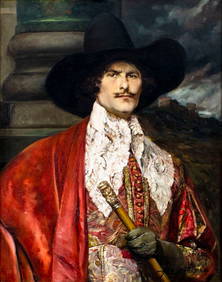
Alfred De Breanski Sr (UK,1852-1928) oil painting antiqueBroward Auction Gallery4.8(277)See Sold PriceMar 17, 2024
Alex De Andreis (France,Belgium,UK,1880-1929) oil painting antiqueBroward Auction Gallery4.8(277)See Sold PriceApr 14, 2024
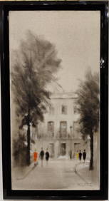
Tony Klitz O/C European Modernist Architectural LandscapeHeritage Gallery Auctions4.4(56)See Sold PriceMar 10, 2024
Royaumes, Etats et Pays de la Haute Guinée. Gulf of Guinea. BONNE 1788 old mapJasper524.5(9.8k)See Sold PriceFeb 28, 2024
Robert Benard (1734 - 1777) - Set of 9 Copperplate Engravings - Greek and Roman architecture - ViewProverde Auctions4.3(3)See Sold PriceFeb 28, 2024
Robert Benard (1734 - 1777) - Set of 9 Copperplate Engravings - Architecture, Masonry, Quarry withProverde Auctions4.3(3)See Sold PriceFeb 28, 2024
Robert Benard (1734 - 1777) - Set of 9 Chemical Engravings - Alchemical symbols - Utensils forProverde Auctions4.3(3)See Sold PriceFeb 28, 2024
Joseph Williamson Ludlow (1840 - 1916) - Set of 2 Bird Prints - Aylesbury Ducks - Toulouse GeeseProverde Auctions4.3(3)See Sold PriceFeb 28, 2024
Joseph Williamson Ludlow (1840 - 1916) - Set of 2 Bird Prints - White-faced black Spanish - WhiteProverde Auctions4.3(3)See Sold PriceFeb 28, 2024
Robert de Vaugondy - Map of Canada - Mer de l' Ouest or Sea of the West and a Northwest PassageProverde Auctions4.3(3)See Sold PriceFeb 28, 2024
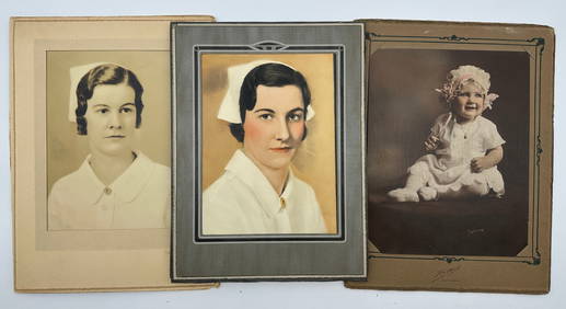
Photography - Lot of 10 Photo - United Kingdom - Portrait of Woman and ChildrenProverde Auctions4.3(3)See Sold PriceFeb 28, 2024
Photography - Lot of 9 Photo - United Kingdom - Portraits of man and childrenProverde Auctions4.3(3)See Sold PriceFeb 28, 2024
Photography - Lot of 3 Photo - Portrait of woman and children - United KingdomProverde Auctions4.3(3)See Sold PriceFeb 28, 2024