ATLAS of ANTIENT GEOGRAPHY by SAMUEL BUTLER 1843John McInnis Auctioneers,LLC4.6(502)See Sold PriceFeb 24, 2024
18TH C. ANTIQUE MAP: FRENCH & INDIAN WAR, FRAMEDThomaston Place Auction Galleries4.4(386)See Sold PriceFeb 24, 2024
Rand McNally Railroad Map Cabinet w/ 21 Railroad MapsRail & Road Auctions4.6(165)See Sold PriceMar 08, 2024
Keith Haring - Ink on New York Map, Best Buddies, Inscribed, Signed, and DatedSapphire Auction Gallery4(67)See Sold PriceMar 02, 2024
LATE 17TH C. FRENCH MAP OF THE NEW WORLD BY ALEXIS-HUBERT JAILLOT (1632-1712)Thomaston Place Auction Galleries4.4(386)See Sold PriceFeb 24, 2024
Central Railroad of New Jersey Map of Sandy Hook Route-ca. 1903JM Hobby Supply and Railroad Artifact Auctions4.4(126)See Sold PriceFeb 24, 2024
Lot of Six Mixed Atlas Box Cars-HO Scale-New in BoxJM Hobby Supply and Railroad Artifact Auctions4.4(126)See Sold PriceFeb 25, 2024
Rand McNally/Santa Fe Railroad Map of Iowa-1912JM Hobby Supply and Railroad Artifact Auctions4.4(126)See Sold PriceFeb 24, 2024
NICOLAES VISSCHER (NETHERLANDS, 1618-1709) MAP OF THE NEW WORLDThomaston Place Auction Galleries4.4(386)See Sold PriceFeb 24, 2024
17TH C. WORLD MAP BY NICOLAES VISSCHER (NETHERLANDS, 1618-1709)Thomaston Place Auction Galleries4.4(386)See Sold PriceFeb 24, 2024
Lot of Six Mixed Atlas Cabooses-HO Scale-New in BoxJM Hobby Supply and Railroad Artifact Auctions4.4(126)See Sold PriceFeb 25, 2024
THRACE & DACIA. European Turkey Romania Bulgaria Danube. 'Dace'. MALLET 1683 mapTITLE/CONTENT OF MAP: 'Hungary with Turky in Europe' DATE PRINTED: 1782 IMAGE SIZE: Approx 18.5 x 22.5cm, 7.25 x 9 inches (Medium); Please note that this is a folding map. TYPE: Antique engraved coppeSee Sold Price
THRACE & DACIA. European Turkey Romania Bulgaria Danube. 'Dace'. MALLET 1683 mapTITLE OF THE MAP: 'Dace; Thrace' (De L'Europe) Thrace is a historical and geographic area in southeast Europe. Thrace designates a region bounded by the Balkan Mountains on the north, Rhodope MountainSee Sold Price
THRACE & DACIA. European Turkey Romania Bulgaria Danube. 'Dace'. MALLET 1683 mapTITLE OF THE MAP: 'Dace; Thrace' (De L'Europe) Thrace is a historical and geographic area in southeast Europe. Thrace designates a region bounded by the Balkan Mountains on the north, Rhodope MountainSee Sold Price
THRACE & DACIA. European Turkey Romania BulgariaTITLE OF THE MAP: 'Dace; Thrace' Thrace is a historical and geographic area in southeast Europe. Thrace designates a region bounded by the Balkan Mountains on the north, Rhodope Mountains and the AegeSee Sold Price
THRACE & DACIA. European Turkey Romania BulgariaTITLE OF THE MAP: 'Dace; Thrace' Thrace is a historical and geographic area in southeast Europe. Thrace designates a region bounded by the Balkan Mountains on the north, Rhodope Mountains and the AegeSee Sold Price
DANUBE Balkans Romania Hungary Serbia Bulgaria. European Turkey. MALLET 1683 mapTITLE OF THE MAP: 'Turquie Septentrionale en Europe 1682' (De L'Europe) DATE PRINTED: 1683 IMAGE SIZE: Approx Overall page size 13 x 21cm approximately (5 x 8 inches); image size 10.5 x 14.5cm approxiSee Sold Price
DANUBE Balkans Romania Hungary Serbia Bulgaria. European Turkey. MALLET 1683 mapTITLE OF THE MAP: 'Turquie Septentrionale en Europe 1682' (De L'Europe) DATE PRINTED: 1683 IMAGE SIZE: Approx Overall page size 13 x 21cm approximately (5 x 8 inches); image size 10.5 x 14.5cm approxiSee Sold Price
GREECE & BALKANS. Albania Bulgaria Serbia Croatia Bosnia Aegean. MALLET 1683 mapTITLE OF THE MAP: 'De la Turquie Meridionale en Europe' (De L'Europe) The map extends from Greece northwards to the Danube. Shows Romania. Serbia. etc. DATE PRINTED: 1683 IMAGE SIZE: Approx Overall paSee Sold Price
GREECE & BALKANS. Albania Bulgaria Serbia Croatia Bosnia Aegean. MALLET 1683 mapTITLE OF THE MAP: 'De la Turquie Meridionale en Europe' (De L'Europe) The map extends from Greece northwards to the Danube. Shows Romania. Serbia. etc. DATE PRINTED: 1683 IMAGE SIZE: Approx Overall paSee Sold Price
NORTH AEGEAN Tasso (Thasos). Macedonia Thrace coast. Montesanto. MALLET 1683 mapTITLE OF THE MAP: 'I(sles) de Tasso et Montesanto' (De L'Europe) The map depicts the Greek islands of Tasso (Thasos) and Montesanto.The map shows the coast of Macedonia & Thrace, with Romania in the dSee Sold Price
SoldAncient Balkans. Dacia (Romania), Thrace (Bulgaria),Title/Content of Map: Ancient Balkans. Dacia (Romania), Thrace (Bulgaria), Macedonia, Dalmatia ( Albania ) Date: 1598/99. Cartographer: Ruscelli Size: 11x9”. Provenance: Venice. Reserve: $130.00 JSee Sold Price
ROMANIA & MOLDOVA. Moldavia & Transylvania. Hungary. MALLET 1683 mapTITLE OF THE MAP: 'Moldavie Transilvanie' (De L'Europe) The maps runs northwards from the Danube. Includes parts of Hugary. Transyvania. Poland. etc. DATE PRINTED: 1683 IMAGE SIZE: Approx Overall pageSee Sold Price
TURKEY IN EUROPE. Greece & The Balkans. 'Turquie en Europe'. MALLET 1683 mapTITLE OF THE MAP: 'Turquie en Europe' (De L'Europe) The European part of the Turkish (Ottoman) Empire in the Balkans and modern day Greece DATE PRINTED: 1683 IMAGE SIZE: Approx Overall page size 13 xSee Sold Price
Mallet: Antique Map of Tasso & Montesanto, 1683TITLE OF THE MAP: 'I(sles) de Tasso et Montesanto' The map depicts the Greek islands of Tasso (Thasos) and Montesanto.The map shows the coast of Macedonia & Thrace, with Romania in the distance. AlsoSee Sold Price
Mallet: Map of North Aegean Tasso (Thasos), 1683Title of the Map: 'I(sles) de Tasso et Montesanto' The map depicts the Greek islands of Tasso (Thasos) and Montesanto.The map shows the coast of Macedonia & Thrace, with Romania in the distance. AlsoSee Sold Price
DANUBE Balkans Romania Hungary Serbia Bulgaria.TITLE OF THE MAP: 'Turquie Septentrionale en Europe 1682' DATE PRINTED: 1683 IMAGE SIZE: Approx Overall page size 13 x 21cm approximately (5 x 8 inches); image size 10.5 x 14.5cm approximately (4 x 5.See Sold Price
DANUBE Balkans Romania Hungary Serbia Bulgaria.TITLE OF THE MAP: 'Turquie Septentrionale en Europe 1682' DATE PRINTED: 1683 IMAGE SIZE: Approx Overall page size 13 x 21cm approximately (5 x 8 inches); image size 10.5 x 14.5cm approximately (4 x 5.See Sold Price
DANUBE Balkans Romania Hungary Serbia Bulgaria.TITLE OF THE MAP: 'Turquie Septentrionale en Europe 1682' DATE PRINTED: 1683 IMAGE SIZE: Approx Overall page size 13 x 21cm approximately (5 x 8 inches); image size 10.5 x 14.5cm approximately (4 x 5.See Sold Price
SoldSouth India Tamil Nadu Kerala. Mallet, 1683 MapCeylon/sri Lanka. 'isle De Ceylan'south India Tamil Nadu Kerala. Mallet 1683 Map. Size: Approx Overall page size 13 x 21cm approximately (5 x 8 inches); image size 10.5 x 14.5cm approximately (4 x 5.5See Sold Price
SoldBlaeu, W.: Walachia, Servia, Bulgaria, Romania Map 1635Map: Walachia, Servia, Bulgaria, Romania Publishing: Blaeu, W.: Amsterdam Date: 1635 Size: 15 x 20 inches Early edition of a very attractive map of the Balkans, shown during the occupation by the OttoSee Sold Price
SoldMallet, Alain 1683 Antique Map. Ancient Libya"Ancienne Libye Interievre" Copper Engraved Map Published 1683, Paris for "Description de l'Univers" First Edition by Alain Manesson Mallet. French text to verso. Paper Size: 8 x 5 inch (20 x 13cm) SoSee Sold Price
SoldMallet, Alain Manesson 1683 HCol Map of India & China"Ancienne Region des Sines" Hand Coloured Copper Engraved Map Published 1683, Paris for "Description de l'Univers" by Alain Manesson Mallet. French text to verso. Paper Size: 8 x 5 inch (20 x 13cm) GoSee Sold Price
SoldGrp: 4 Maps of Eastern Europe Romanian TransylvanGroup of four maps of Eastern Europe. One map by Gerard Valck and Peter Schenk depicting Serbia, Bulgaria, and Romania; one map by Gerard and Leonard Valck depicting Wallachia, Transylvania, and MoldoSee Sold Price
SoldGrp: 3 Maps Eastern Europe Ukraine Romania BlaeuGroup of three maps of Eastern Europe. Includes one map of Walachia, Serbia, Bulgaria, and Romania by Willem Janszoon Blaeu (1571-1638); one map of Slovenia, Croatia, and Bosnia by Blaeu after GerarduSee Sold Price
Vintage mid 20C European oil painting signedBroward Auction Gallery4.8(277)See Sold PriceMar 10, 2024
Detailed Antique European Old Master Antique Religious Original Oil Painting ATTR Louis De CaulleryCurated Gallery Auctions4.6(120)See Sold PriceFeb 25, 2024
Antique European Impressionist Young Woman Portrait Framed Signed Oil PaintingCurated Gallery Auctions4.6(120)See Sold PriceFeb 25, 2024
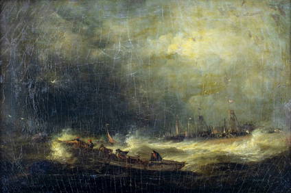
Antique Finely Painted 19th Century European Nocturnal Cityscape Ashcan School Original Oil PaintingCurated Gallery Auctions4.6(120)See Sold PriceFeb 25, 2024
Antique European Landscape Framed Impressionist Original Oil PaintingCurated Gallery Auctions4.6(120)See Sold PriceFeb 25, 2024
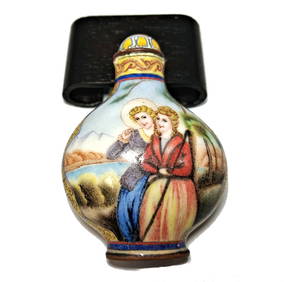
BEAUTIFUL CHINESE SNUFF BOTTLE EUROPEAN SUBJECT ENAMEL ON COPPERNoble House Collection Gallery4.5(114)See Sold PriceFeb 28, 2024
Willem Blaeu, Etc. 17th C. Antiquarian Maps, 2Auctions at Showplace4.5(726)See Sold PriceMar 17, 2024
WEST AFRICA Niger/Gambia rivers tribes towns. 'Pays des Negres'. MALLET 1683 mapJasper524.5(9.8k)See Sold PriceFeb 28, 2024
NORTH & WEST AFRICA. Sahara Niger river 'Zaara ou le Desert'. MALLET 1683 mapJasper524.5(9.8k)See Sold PriceFeb 28, 2024
WEST AFRICA. People of Guinea. 'Peuples de Guinée'. Costume. MALLET 1683 printJasper524.5(9.8k)See Sold PriceFeb 28, 2024
WEST AFRICA. Guinea. Nigeria Ghana Benin Togo Sierra Leone. MALLET 1683 mapJasper524.5(9.8k)See Sold PriceFeb 28, 2024
WEST CENTRAL AFRICA. Congo Angola Gabon Cameroon Sao Tome. MALLET 1683 old mapJasper524.5(9.8k)See Sold PriceFeb 28, 2024
NORTH AFRICA. 'Biledulgerid', a former North African country. MALLET 1683 mapJasper524.5(9.8k)See Sold PriceFeb 28, 2024
WEST AFRICA/MAGHREB Tribes Garamantes Getgulie 'Ancienne Libye'. MALLET 1683 mapJasper524.5(9.8k)See Sold PriceFeb 28, 2024
MALLET. Description de l'Univers. Africa. Volume 3 title page. MALLET 1683Jasper524.5(9.8k)See Sold PriceFeb 28, 2024
NORTH AFRICA. Barbary. Morocco Tunisia Libya Egypt. 'Barbarie'. MALLET 1683 mapJasper524.5(9.8k)See Sold PriceFeb 28, 2024
NORTH AFRICA. Morocco Tunisia Libya. 'Mauritanie'. Malta Melita. MALLET 1683 mapJasper524.5(9.8k)See Sold PriceFeb 28, 2024
NUBIA. 'Nubie'. Nile Valley. Sudan Ethiopia Egypt. MALLET 1683 old antique mapJasper524.5(9.8k)See Sold PriceFeb 28, 2024
SUB-SAHARAN AFRICA. 'Ancienne Ethiopie'. Ancient Ethiopia. MALLET 1683 old mapJasper524.5(9.8k)See Sold PriceFeb 28, 2024
SOUTHERN AFRICA Monomotapa (Mutapa Kingdom) Cafrerie (Kaffraria) MALLET 1683 mapJasper524.5(9.8k)See Sold PriceFeb 28, 2024
Ludwig Erminy - Topography in Bulgaria - Ruins of Orava - Danube Views: BulgariaProverde Auctions4.3(3)See Sold PriceFeb 28, 2024