ATLAS of ANTIENT GEOGRAPHY by SAMUEL BUTLER 1843John McInnis Auctioneers,LLC4.6(502)See Sold PriceFeb 24, 2024
18TH C. ANTIQUE MAP: FRENCH & INDIAN WAR, FRAMEDThomaston Place Auction Galleries4.4(386)See Sold PriceFeb 24, 2024
Rand McNally Railroad Map Cabinet w/ 21 Railroad MapsRail & Road Auctions4.6(165)See Sold PriceMar 08, 2024
Keith Haring - Ink on New York Map, Best Buddies, Inscribed, Signed, and DatedSapphire Auction Gallery4(67)See Sold PriceMar 02, 2024
LATE 17TH C. FRENCH MAP OF THE NEW WORLD BY ALEXIS-HUBERT JAILLOT (1632-1712)Thomaston Place Auction Galleries4.4(386)See Sold PriceFeb 24, 2024
Central Railroad of New Jersey Map of Sandy Hook Route-ca. 1903JM Hobby Supply and Railroad Artifact Auctions4.4(126)See Sold PriceFeb 24, 2024
Lot of Six Mixed Atlas Box Cars-HO Scale-New in BoxJM Hobby Supply and Railroad Artifact Auctions4.4(126)See Sold PriceFeb 25, 2024
Rand McNally/Santa Fe Railroad Map of Iowa-1912JM Hobby Supply and Railroad Artifact Auctions4.4(126)See Sold PriceFeb 24, 2024
NICOLAES VISSCHER (NETHERLANDS, 1618-1709) MAP OF THE NEW WORLDThomaston Place Auction Galleries4.4(386)See Sold PriceFeb 24, 2024
17TH C. WORLD MAP BY NICOLAES VISSCHER (NETHERLANDS, 1618-1709)Thomaston Place Auction Galleries4.4(386)See Sold PriceFeb 24, 2024
Lot of Six Mixed Atlas Cabooses-HO Scale-New in BoxJM Hobby Supply and Railroad Artifact Auctions4.4(126)See Sold PriceFeb 25, 2024
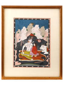
MOGHUL EMPIRE. India Afghanistan &c. Delhi Agra. Mughal Mogul. MALLET 1683 mapTITLE OF THE MAP: 'Partie de la Terre Ferme de l'Inde ou l'Empire du Mogul' (De L'Asie) Central India northwards to Cashmere, Himalayas, etc. DATE PRINTED: 1683 IMAGE SIZE: Approx Overall page size 13See Sold Price
INDIA. Moghul Mogul Mughal Empire. Goa Kochi Chaul &c. MALLET 1683 old mapTITLE OF THE MAP: 'Presqu-isle de l'Inde deca de Golfe de Bengala' (De L'Asie) Includes Ceylon. DATE PRINTED: 1683 IMAGE SIZE: Approx Overall page size 13 x 21cm approximately (5 x 8 inches); image siSee Sold Price
MUGHAL EMPEROR AURANGZEB. Mogul Moghul Empire. 'Grand Mogol'. India. MALLET 1683TITLE OF THE PRINT: 'Grand Mogol' (De L'Asie) DATE PRINTED: 1683 IMAGE SIZE: Approx Overall page size 13 x 21cm approximately (5 x 8 inches); image size 10.5 x 14.5cm approximately (4 x 5.5 inches) TYSee Sold Price
Sold17th C. India Moghul Bronze Betel Nut Cutter - Bird**Originally Listed At $150** Central Asia, India, Moghul Empire (also Mughal or Mogul), ca. 17th century CE. A cast bronze cutter with an iron blade in the form of a peacock, used for cutting open thSee Sold Price
SoldMoghul Badshah Emperor Portrait PaintingMoghul Badshah Emperor Portrait Painting on Paper - Size: Art Work: 8 3/4 x 6 1/4 inches. History & Origin. Before the rise of the Mughal Empire in India, the Delhi Sultanate ruled over most parts ofSee Sold Price
SoldMoghul Badshah Emperor Harem PaintingMoghul Badshah Emperor Harem Painting on Paper - Size: Art Work: 6 1/2 x 9 inches. History & Origin. Before the rise of the Mughal Empire in India, the Delhi Sultanate ruled over most parts of the IndSee Sold Price
SoldSouth India Tamil Nadu Kerala. Mallet, 1683 MapCeylon/sri Lanka. 'isle De Ceylan'south India Tamil Nadu Kerala. Mallet 1683 Map. Size: Approx Overall page size 13 x 21cm approximately (5 x 8 inches); image size 10.5 x 14.5cm approximately (4 x 5.5See Sold Price
SoldMallet, Alain Manesson 1683 HCol Map of India & China"Ancienne Region des Sines" Hand Coloured Copper Engraved Map Published 1683, Paris for "Description de l'Univers" by Alain Manesson Mallet. French text to verso. Paper Size: 8 x 5 inch (20 x 13cm) GoSee Sold Price
SoldAntique MUGHAL Steel HILTED SHISHPAR Mace WeaponAntique Shishpar Flanged Mace, of the rare hilted variety. Introduced by the Delhi Sultanate and was utilised by the Moghul Empire well after the Sultanate's fall in the First Battle of Panipat in 152See Sold Price
SoldMallet, Alain 1683 Map of Germany & Part of Poland"Allemagne en General" Copper Engraved Map Published 1683, Paris for "Description de l'Univers" by Alain Manesson Mallet. French text to verso. Paper Size: 8 x 5 inch (20 x 13cm) Good ConditionSee Sold Price
SoldMallet, Alain 1683 Antique Map. Ancient Libya"Ancienne Libye Interievre" Copper Engraved Map Published 1683, Paris for "Description de l'Univers" First Edition by Alain Manesson Mallet. French text to verso. Paper Size: 8 x 5 inch (20 x 13cm) SoSee Sold Price
SoldMughal Jaipur School Hindu Rajput Hunting Painting PairMughal Empire (Mogul Empire, Gurkani). Antique circa 17th to 18th Century fine Mughal paintings on linen. Two panels depicting a large hunting party procession with princes, nobles, officials, and ridSee Sold Price
SoldHondius: Antique Map of Mogul Empire, 1640Item: Mogul Empire Map Henricus Hondius Date: 1640 Double page Expertly reinforced on verso ( reverse). French text on verso. Excellent condition. Size: 16 x 20 inches Please note that this lot has aSee Sold Price
Sold1683 Map of Russia Moscovie Mallet HandcoloredA map of "Moscovie" from the work by Alain Manesson Mallet, c 1683. Handcolored, printed by Denys Thierry at Paris. Text on verso. Fine, measures 5,25 x 8". Reserve: $50.00 Shipping: Domestic: Flat-raSee Sold Price
SoldLarge Gandharan Schist Buddha HeadCentral Asia, Pakistan, India, and Afghanistan, Gandharan Empire, ca. 1st century CE. An absolutely stunning gray schist face with a tremendous turban-style headdress. The face is sensuously and realiSee Sold Price
Sold1780 VOYAGES Explorers India Shah Jahan Mughal Empire1780 VOYAGES Explorers India Shah Jahan Mughal Empire Illustrated Fakirs The best book of its kind! A rare book La Harpe’s ‘General History of Voyages’! This extensive work was begun by La HarpeSee Sold Price
Sold5 Piercing War ArrowsFive Mughal Empire 1526/1858 India Armor Piercing War Arrows, 1650See Sold Price
Sold1849 INDIA Illustrated Siam Mohammedan Maps Costumes1849 INDIA Illustrated Siam Mohammedan Maps Costumes Hinduism Delhi “‘Lectures on India,’ is valuable for its subject-matter, even beyond any other similar collection of the size within my knowlSee Sold Price
Sold18th/19th c. India ivory carved dagger handleAn important 18th/19th century India ivory carved dagger handle in horse motif "Moghul Empire", 5.5"H , NO INTERNATIONAL SHIPPING OF IVORYSee Sold Price
Sold45pc Ancient Roman Empire & India Coins. Includes (39)45pc Ancient Roman Empire & India Coins. Includes (39) cased and identified Roman copper coins from various empires. Also (6) Indian Sultan of Delhi ancient silver coins cased and identified. ConditioSee Sold Price
Mallet: Antique Map of Japan, 1683Title of the Map: 'Isles du Iapon' JAPAN. 'Isles du Iapon'. Yedo (Tokyo) Miyako (Kyoto) Date Printed: 1683 Image Size: Approx Overall page size 13 x 21cm approximately (5 x 8 inches); image size 10.5See Sold Price
SoldMallet: Antique Map of England, 1683Title of the Map: 'Royaume d'Angleterre' ENGLAND counties towns rivers. Date Printed: 1683 Image Size: Approx Overall page size 13 x 21cm approximately (5 x 8 inches); image size 10.5 x 14.5cm approxiSee Sold Price
SoldMallet: Antique Astronomy Map of Planets, 1683Title:'[Des Aspects des Planettes]' Astrony, Planets. Date Printed: 1683 Image Size: Approx Overall page size 13 x 21cm approximately (5 x 8 inches); image size 10.5 x 14.5cm approximately (4 x 5.5 inSee Sold Price
ARMOR MUSEUM LEVEL FEMALE WARRIOR CHEST PLATE BOTH SIDES FIGURES FLYING HORSEHISTORY Collections.4.2(15)See Sold PriceFeb 28, 2024
ARMOR MUSEUM LEVEL PERSIAN STYLE WARRIOR SHIELD ARABIC INSCRIPTION SURFACE FLOWER MOTIFHISTORY Collections.4.2(15)See Sold PriceFeb 28, 2024
Extremely early Ganesh from India, Afghanistan, or Pakistan.The Buddha Gallery4.4(29)See Sold PriceMar 13, 2024
A MUGHAL GILT AND 'GEM'-INLAID JADE STEM CUP, INDIA, 18TH CENTURYGalerie Zacke 4.4(50)See Sold PriceMar 01, 2024
Antique Miniature Japtripatti Jagannath PaintingThe Scanlan Collection4.4(22)See Sold PriceFeb 24, 2024
Willem Blaeu, Etc. 17th C. Antiquarian Maps, 2Auctions at Showplace4.5(726)See Sold PriceMar 17, 2024
Duval - Pair: Map of India & Map of MaldivesTrillium Antique Prints & Rare Books4.5(30)See Sold PriceFeb 24, 2024
1683 Sanson Map of the Caribbean -- Les Isles Antilles, &c Entre Lesquelles sont les Lucayes, et lesJasper524.5(9.8k)See Sold PriceFeb 27, 2024
New and Correct Map of North America With the West India Islands,Jasper524.5(9.8k)See Sold PriceFeb 27, 2024
1834 Malte-Brun Map of the Caribbean -- West India IslandsJasper524.5(9.8k)See Sold PriceFeb 27, 2024
WEST AFRICA Niger/Gambia rivers tribes towns. 'Pays des Negres'. MALLET 1683 mapJasper524.5(9.8k)See Sold PriceFeb 28, 2024
NORTH & WEST AFRICA. Sahara Niger river 'Zaara ou le Desert'. MALLET 1683 mapJasper524.5(9.8k)See Sold PriceFeb 28, 2024
WEST CENTRAL AFRICA. Congo Angola Gabon Cameroon Sao Tome. MALLET 1683 old mapJasper524.5(9.8k)See Sold PriceFeb 28, 2024
NORTH AFRICA. 'Biledulgerid', a former North African country. MALLET 1683 mapJasper524.5(9.8k)See Sold PriceFeb 28, 2024
MALLET. Description de l'Univers. Africa. Volume 3 title page. MALLET 1683Jasper524.5(9.8k)See Sold PriceFeb 28, 2024
SUB-SAHARAN AFRICA. 'Ancienne Ethiopie'. Ancient Ethiopia. MALLET 1683 old mapJasper524.5(9.8k)See Sold PriceFeb 28, 2024
SOUTHERN AFRICA Monomotapa (Mutapa Kingdom) Cafrerie (Kaffraria) MALLET 1683 mapJasper524.5(9.8k)See Sold PriceFeb 28, 2024
OLD ILLUSTRATED 1902 CROSS-COVERED LANDS JOURNEY TO CALCUTTA, INDIA, 2 VOLUMESNY Elizabeth 4.3(84)See Sold PriceMar 03, 2024
ANTIQUE ILLUSTRATED HANDBOOK OF GEOGRAPHY AND TRAVEL IN ASIA, VOLUME 2, 1896NY Elizabeth 4.3(84)See Sold PriceMar 03, 2024