Blaeu (Johan and Willem) 4 regional maps of ScotlaBlaeu (Johan and Willem) 4 regional maps of Scotland,The Westerne Iles of Scoltand; Some of the smaller Westerne Yles; Lidisdail, these after Timothy Pont, also with Southerland, engraved mapsSee Sold Price
Blaeu (Johan and Willem) 3 regional maps of ScotlaBlaeu (Johan and Willem) 3 regional maps of Scotland,The South Part of Carrick; Lorn Wt. the Yles and provinces bordering there-upon; Lidisdail, after Timothy Pont, engraved maps with hand-colSee Sold Price
Blaeu (Johan & Willem) 4 Welsh county mapsBlaeu (Johan & Willem) Ceretica, sive Cardiganensis Comitatus,with Comitatus Brechini', and Herefordia Comitatus, 3 Welsh county maps, each with decorative cartouches, coats-of-arms and otherSee Sold Price
Blaeu (J & W) 4 county mapsBlaeu (Johan & Willem) Glocestria Ducatus; Wiltonia sive Comitatus Wiltoniensis; Herefordia Comitatus; Monumethensis Comitatus,4 county maps of Gloucestershire, Wiltshire, Herefordshire and MoSee Sold Price
SoldGrp: 4 Regional Maps Blaeu OrteliusGroup of four hand colored regional maps. Includes three maps by Willem Janszoon Blaeu (1571-1638), "Prima pars Brabantiae cuius caput Lovanium," a map depicting Tienen and Leuven in Belgium, and "ComSee Sold Price
SoldBlaeu French Regional Map, 17th C.Les Souverainetez de Sedan et de Raucourt et la prevosté de Doncheri. Willem Janszoon Blaeu (1571-1638). Joan Blaeu (1596-1673). Amsterdam: Mid 17th Century. Hand-colored engraving19 3/4 x 24 inchesSee Sold Price
SoldMiddle East.- Blaeu (Johan and Willem) Arabia, [c.Middle East.- Blaeu (Johan and Willem) Arabia, map of the Arabian Peninsula, dividing it into the three regions coined by the Romans: Arabia Petraea, Arabia Deserta, and Arabia Felix, engraving with hSee Sold Price
Sold[Blaeu (Johan & Willem)] Cyprus Insula[Blaeu (Johan & Willem)] Cyprus Insula,map of the island of Cyprus from, and with the bound text of, the Asia et Sina vol. of the Theatrum Orbis Terrarum (incorporating the text, only, of theSee Sold Price
SoldScandinavia.- Blaeu (Johan & Willem) Tabula IslandScandinavia.- Blaeu (Johan & Willem) Tabula Islandiae,map of Iceland, with decorative title cartouche lower left, engraving after Joris Carolus, 380 x 495mm., central vertical fold minor surfaSee Sold Price
SoldMiddle East.- Blaeu (Johan and Willem) TurcicumMiddle East.- Blaeu (Johan and Willem) Turcicum Imperium, map covering north east Africa, Italy, Greece, Turkey, and Saudi Arabia, with decorative title cartouche lower left and dedication cartouche cSee Sold Price
Turkey.- Blaeu (Johan and Willem) Turcicum ImperiuTurkey.- Blaeu (Johan and Willem) Turcicum Imperium,map covering north east Africa, Italy, Greece, Turkey, and Saudi Arabia, with decorative title cartouche lower left, engraved map with outliSee Sold Price
SoldBlaeu (Johan & Willem) Bercheria Vernacule BarkshiBlaeu (Johan & Willem) Bercheria Vernacule Barkshire,county map with large decorative title cartouche upper centre, royal arms to either side, engraved map with original hand-colouring, 385 xSee Sold Price
SoldMediterranean.- Blaeu (Johan and Willem) Corsica IMediterranean.- Blaeu (Johan and Willem) Corsica Insula,engraved map, with decorative armorials and figures in each corner, 385 x 510mm., Latin text verso, central vertical fold, very light spSee Sold Price
Blaeu (Johan and Willem) Connachtia vulgo ConnaughBlaeu (Johan and Willem) Connachtia vulgo Connaughty,map showing the Irish province of Connaught, with coat-of-arms upper right, title cartouche lower right, engraving with hand-colouring, 410See Sold Price
SoldBlaeu (Willem) Perchensis Comitatus; Comitatus BleBlaeu (Willem) Perchensis Comitatus; Comitatus Blesensis,2 regional maps of France on 1 sheet, engraved maps with original hand-colouring, 390 x 510mm. overall, central vertical crease, slightSee Sold Price
SoldBSURR Blaeu (Johan and Willem) Surria vernacule SuBSURR Blaeu (Johan and Willem) Surria vernacule Surrey,county map with London and arms of the United Kingdom at upper right, decorative title cartouche supported by a stag and hound, upper lefSee Sold Price
SoldBlaeu (Johan & Willem) [Spain]Blaeu (Johan & Willem) [Spain and Portugal],collection of 13 maps of Spain and Portugal, including the Balearics and 10 regions, 13 engraved maps, with outline hand-colouring, cartouches, coatSee Sold Price
Spain.- Blaeu (Johan & Willem) Legionis Regnum etSpain.- Blaeu (Johan & Willem) Legionis Regnum et Asturiarum Principatus,engraved map with early hand-colouring in outline, the title cartouche heightened with gold, 385 x 500mm., Latin text vSee Sold Price
SoldSpain.- Blaeu (Johan & Willem) Legionis Regnum etSpain.- Blaeu (Johan & Willem) Legionis Regnum et Asturiarum Principatus,engraved map with early hand-colouring in outline, the title cartouche heightened with gold, 385 x 500mm., Latin text vSee Sold Price
Blaeu (J & W) 3 county mapsBlaeu (Johan & Willem) Wigorniensis; Comitatus Nottinghamiensis; Lincolnia Comitatus,3 county maps of Warwickshire, Nottinghamshire and Lincolnshire, all with decorative title cartouches and cSee Sold Price
Blaeu (Willem) - Normandia Ducatus; Britannia Ducatus,2 regional maps of Normandy and Britanny, each with title banderole supported by putti and mermen, respectively, both upper centre, compass roses and ships, engraved maps with hand-colouring, each c.See Sold Price
Blaeu (Johan & Willem) China veteribus sinarum regioBlaeu (Johan & Willem) China veteribus sinarum regio nunc incolis tame dicta, Eastern China, with Japan, Korea as an island, and the northern Philippines, a large decorative title cartouche supportedSee Sold Price
SoldBlaeu (Willem) - Normandia Ducatus; Britannia Ducatus,2 regional maps of Normandy and Britanny, each with title banderole supported by putti and mermen, respectively, both upper centre, compass roses and ships, engraved maps with hand-colouring, each c.See Sold Price
SoldBlaeu (Johan & Willem) Anglia Regnum, England and WalesBlaeu (Johan & Willem) Anglia Regnum, England and Wales with parts of Scotland and Ireland, largely derived from John Speed, from a rare Spanish text deluxe edition heightened with gold, title cartoucSee Sold Price
Illinois Central RR October 2, 1901 Public TimetableJM Hobby Supply and Railroad Artifact Auctions4.4(127)See Sold PriceFeb 24, 2024
Illinois Central RR July 24, 1906 Western Lines Public TimetableJM Hobby Supply and Railroad Artifact Auctions4.4(127)See Sold PriceFeb 24, 2024
Oregon Short Line RR April 1899 Public TimetableJM Hobby Supply and Railroad Artifact Auctions4.4(127)See Sold PriceFeb 24, 2024
Union Pacific RR December 14, 1897 Public TimetableJM Hobby Supply and Railroad Artifact Auctions4.4(127)See Sold PriceFeb 24, 2024
WILLEM JANSZOON BLAEU (NETHERLANDS, 1571-1638) MAP OF UMBRIAThomaston Place Auction Galleries4.4(394)See Sold PriceFeb 24, 2024
WILLEM JANSZOON BLAEU (NETHERLANDS, 1571-1638)Thomaston Place Auction Galleries4.4(394)See Sold PriceFeb 24, 2024
Willem Blaeu, Etc. 17th C. Antiquarian Maps, 2Auctions at Showplace4.6(744)See Sold PriceMar 17, 2024
1738 BIBLE in DUTCH ILLUSTRATED w/ MAPS MASSIVE FOLIO in DUTCH antique BIBLIAJasper524.5(9.9k)See Sold PriceFeb 27, 2024
1558 SCANDINAVIA SWEDEN ILLUSTRATED HISTORY Gothorum Sveonumque historia antiqueJasper524.5(9.9k)See Sold PriceFeb 27, 2024
LUNA LUNA - OFFICAL PROGRAM (HARING, BASQUIAT, LICHTENSTEIN, DALI)ArtMeetsStreet x Mercer Auctions4.4(44)See Sold PriceMar 02, 2024
THE ANTIQUE ILLUSTRATED BOOK "1856 ARCTIC EXPLORATIONS: SECOND GIRNEL EXPEDITION 2" BY E. KANENY Elizabeth 4.1(88)See Sold PriceMar 03, 2024
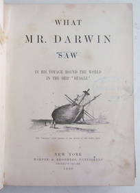
1880 WHAT MR. DARWIN SAW IN SHIP BEAGLE ANTIQUE DURING HIS WORLD TOURNY Elizabeth 4.1(88)See Sold PriceMar 03, 2024
Carl Johan Billmark - Set of 4 Prints depicting Rome, Italy - Church in Sweden - Views of EuropeProverde Auctions4.3(3)See Sold PriceFeb 28, 2024
Antique Pennsylvania Map Fragment incl Wellersburg and New CentervilleCordier Auctions & Appraisals4.4(1.5k)See Sold PriceMar 02, 2024


![[Blaeu (Johan & Willem)] Cyprus Insula (1 of 1)](https://p1.liveauctioneers.com/410/10165/2289091_1_x.jpg?height=282&quality=70)


![Blaeu (Johan & Willem) [Spain] (1 of 0)](https://p1.liveauctioneers.com/dist/images/placeholder.jpg?height=282&quality=70)