Blaeu (Johan and Willem) 3 regional maps of ScotlaBlaeu (Johan and Willem) 3 regional maps of Scotland,The South Part of Carrick; Lorn Wt. the Yles and provinces bordering there-upon; Lidisdail, after Timothy Pont, engraved maps with hand-colSee Sold Price
Blaeu (Johan and Willem) 4 regional maps of ScotlaBlaeu (Johan and Willem) 4 regional maps of Scotland,The Westerne Iles of Scoltand; Some of the smaller Westerne Yles; Lidisdail, these after Timothy Pont, also with Southerland, engraved mapsSee Sold Price
Blaeu (J & W) 3 county mapsBlaeu (Johan & Willem) Wigorniensis; Comitatus Nottinghamiensis; Lincolnia Comitatus,3 county maps of Warwickshire, Nottinghamshire and Lincolnshire, all with decorative title cartouches and cSee Sold Price
Blaeu (Johan & Willem) 4 Welsh county mapsBlaeu (Johan & Willem) Ceretica, sive Cardiganensis Comitatus,with Comitatus Brechini', and Herefordia Comitatus, 3 Welsh county maps, each with decorative cartouches, coats-of-arms and otherSee Sold Price
Wales.- Blaeu (Johan and Willem) - ComitatusVernacule Carnarvon-shire et Mona insula Vulgo Anglesey, title cartouche supported by harvest figures, lower right, 3 coats-of-arms and ships, engraved map with hand-coouring, 385 x 500mm., Dutch textSee Sold Price
SoldBlaeu (J & W) Persia sive Sophorum RegnumBlaeu (Johan & Willem) Persia sive Sophorum Regnum,Persia, present day Iran, decorative title cartouche with 3 robed persian figures, armorial dedication cartouche, engraved map with outline hSee Sold Price
SoldBlaeu French Regional Map, 17th C.Les Souverainetez de Sedan et de Raucourt et la prevosté de Doncheri. Willem Janszoon Blaeu (1571-1638). Joan Blaeu (1596-1673). Amsterdam: Mid 17th Century. Hand-colored engraving19 3/4 x 24 inchesSee Sold Price
SoldMiddle East.- Blaeu (Johan and Willem) Arabia, [c.Middle East.- Blaeu (Johan and Willem) Arabia, map of the Arabian Peninsula, dividing it into the three regions coined by the Romans: Arabia Petraea, Arabia Deserta, and Arabia Felix, engraving with hSee Sold Price
Sold[Blaeu (Johan & Willem)] Cyprus Insula[Blaeu (Johan & Willem)] Cyprus Insula,map of the island of Cyprus from, and with the bound text of, the Asia et Sina vol. of the Theatrum Orbis Terrarum (incorporating the text, only, of theSee Sold Price
SoldScandinavia.- Blaeu (Johan & Willem) Tabula IslandScandinavia.- Blaeu (Johan & Willem) Tabula Islandiae,map of Iceland, with decorative title cartouche lower left, engraving after Joris Carolus, 380 x 495mm., central vertical fold minor surfaSee Sold Price
SoldMiddle East.- Blaeu (Johan and Willem) TurcicumMiddle East.- Blaeu (Johan and Willem) Turcicum Imperium, map covering north east Africa, Italy, Greece, Turkey, and Saudi Arabia, with decorative title cartouche lower left and dedication cartouche cSee Sold Price
Turkey.- Blaeu (Johan and Willem) Turcicum ImperiuTurkey.- Blaeu (Johan and Willem) Turcicum Imperium,map covering north east Africa, Italy, Greece, Turkey, and Saudi Arabia, with decorative title cartouche lower left, engraved map with outliSee Sold Price
SoldBlaeu (Johan & Willem) Bercheria Vernacule BarkshiBlaeu (Johan & Willem) Bercheria Vernacule Barkshire,county map with large decorative title cartouche upper centre, royal arms to either side, engraved map with original hand-colouring, 385 xSee Sold Price
SoldMediterranean.- Blaeu (Johan and Willem) Corsica IMediterranean.- Blaeu (Johan and Willem) Corsica Insula,engraved map, with decorative armorials and figures in each corner, 385 x 510mm., Latin text verso, central vertical fold, very light spSee Sold Price
Blaeu (Johan and Willem) Connachtia vulgo ConnaughBlaeu (Johan and Willem) Connachtia vulgo Connaughty,map showing the Irish province of Connaught, with coat-of-arms upper right, title cartouche lower right, engraving with hand-colouring, 410See Sold Price
SoldBlaeu (Willem) Perchensis Comitatus; Comitatus BleBlaeu (Willem) Perchensis Comitatus; Comitatus Blesensis,2 regional maps of France on 1 sheet, engraved maps with original hand-colouring, 390 x 510mm. overall, central vertical crease, slightSee Sold Price
SoldBSURR Blaeu (Johan and Willem) Surria vernacule SuBSURR Blaeu (Johan and Willem) Surria vernacule Surrey,county map with London and arms of the United Kingdom at upper right, decorative title cartouche supported by a stag and hound, upper lefSee Sold Price
Sold3 17th century Maps of various parts of Europe.[Europe] 3 Engraved Maps. (1) Blaeu, Willem & Mortier, Pierre. “Calabre Ultra.” Amsterdam, c.1710. Engraved map. 19 3/8” x 15”. (2) [After Mercator] “Morea olim PeloponneSee Sold Price
SoldBlaeu (Johan & Willem) [Spain]Blaeu (Johan & Willem) [Spain and Portugal],collection of 13 maps of Spain and Portugal, including the Balearics and 10 regions, 13 engraved maps, with outline hand-colouring, cartouches, coatSee Sold Price
Spain.- Blaeu (Johan & Willem) Legionis Regnum etSpain.- Blaeu (Johan & Willem) Legionis Regnum et Asturiarum Principatus,engraved map with early hand-colouring in outline, the title cartouche heightened with gold, 385 x 500mm., Latin text vSee Sold Price
SoldSpain.- Blaeu (Johan & Willem) Legionis Regnum etSpain.- Blaeu (Johan & Willem) Legionis Regnum et Asturiarum Principatus,engraved map with early hand-colouring in outline, the title cartouche heightened with gold, 385 x 500mm., Latin text vSee Sold Price
Blaeu (J & W) 4 county mapsBlaeu (Johan & Willem) Glocestria Ducatus; Wiltonia sive Comitatus Wiltoniensis; Herefordia Comitatus; Monumethensis Comitatus,4 county maps of Gloucestershire, Wiltshire, Herefordshire and MoSee Sold Price
Blaeu (Willem) - Normandia Ducatus; Britannia Ducatus,2 regional maps of Normandy and Britanny, each with title banderole supported by putti and mermen, respectively, both upper centre, compass roses and ships, engraved maps with hand-colouring, each c.See Sold Price
Blaeu (Johan & Willem) China veteribus sinarum regioBlaeu (Johan & Willem) China veteribus sinarum regio nunc incolis tame dicta, Eastern China, with Japan, Korea as an island, and the northern Philippines, a large decorative title cartouche supportedSee Sold Price
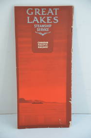
Canadian Pacific RY Great Lakes Steamship 1919 Brochure and TimetableJM Hobby Supply and Railroad Artifact Auctions4.4(127)See Sold PriceFeb 24, 2024
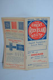
Chicago Rock Island and Pacific RY October 1896 Public TimetableJM Hobby Supply and Railroad Artifact Auctions4.4(127)See Sold PriceFeb 24, 2024
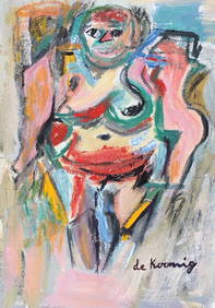
Oil on cardboard Willem de Kooning after Dutch Abstract painting woman portraitVintage Art Finder Gallery4.2(4)See Sold PriceApr 07, 2024
DAVID ROBERTS - Holy Land / Syria / Egypt etc. 3 x Folio Volumes 1849 Very RareLuis Porretta Fine Arts4.3(10)See Sold PriceMar 02, 2024
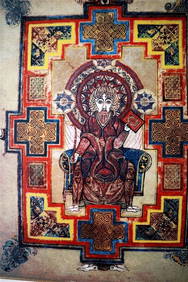
THE BOOK OF KELLS 3 x Limited Edition Serigraph Hand Made Prints Celtic ArtLuis Porretta Fine Arts4.3(10)See Sold PriceMar 02, 2024
WILLEM JANSZOON BLAEU (NETHERLANDS, 1571-1638) MAP OF UMBRIAThomaston Place Auction Galleries4.4(394)See Sold PriceFeb 24, 2024
WILLEM JANSZOON BLAEU (NETHERLANDS, 1571-1638)Thomaston Place Auction Galleries4.4(394)See Sold PriceFeb 24, 2024
DUNLEVIE c1856 Map Counties Of Gaspe & Bonaventure Quebec Canada SCARCE! #1Luis Porretta Fine Arts4.3(10)See Sold PriceMar 02, 2024
Willem Blaeu, Etc. 17th C. Antiquarian Maps, 2Auctions at Showplace4.6(744)See Sold PriceMar 17, 2024


![[Blaeu (Johan & Willem)] Cyprus Insula (1 of 1)](https://p1.liveauctioneers.com/410/10165/2289091_1_x.jpg?height=282&quality=70)