SoldTwo Japanese Printed Maps(lot of 2) Unframed Japanese printed maps, the first of Edo (old designation for Tokyo), original one printed in 1811, the second of old Japan with all the provinces, lords and famous temples, the oriSee Sold Price
Two printed maps after N.C. Wyeth, 15 1/2'' x 18''Two printed maps after N.C. Wyeth, 15 1/2'' x 18''.See Sold Price
SoldTWO PRINTED MAPS 2 piecesTWO PRINTED MAPS one of Scotland by Robert Morden; one ""The Old Course, St. Andrews"" marked ""Surveyed and Depicted by A. Mackenzie, Golf Course Architect, March 1924"" 2 pieces 17 1/2 x 14 1/2 inchSee Sold Price
SoldTwo Japanese Printed Hugh Laidman BooksTwo Japanese printed books by Hugh Laidman to include Figures / Faces, and The Complete Book of Drawing and Painting.See Sold Price
Two Japanese Printed and Painted Porcelain dishesOne lobed and scalloped bowl of both printed design and hand painted washes and borders in cobalt blue underglaze. Offered along with a imari dish with hand painted glaze of cobalt, green and iron redSee Sold Price
Sold[John Coffee "Jack" Hays]. Two Printed Maps of C[John Coffee "Jack" Hays]. Two Printed Maps of California by Texas Ranger Jack Hays, <See Sold Price
SoldUnframed Japanese Printed Map, Edo 1828Unframed Japanese woodblock printed map, dated Bunsei 11 (1828), depicting the castle town of Edo (modern day Tokyo), with all of the important houses and establishments in an oversize color renderingSee Sold Price
SoldCollection of Asian textiles20th century; including: two Indonesian Ikats, including one silk, silk - 20 x 45 in., and linen - 62 x 52 in.; two Japanese printed cotton panels, 27 x 30 in., and 33 x 26 in., one printed blue linenSee Sold Price
Sold(After) Henry Fletcher (British, 18th Century)(After) Henry Fletcher (British, 18th Century) 'December' Engraving Together with two printed maps and a print titled 'Good Cheer' Height: 19.00 inches, Width: 16.00 inches (largest) Category: DecoratSee Sold Price
Plats of 90 antique Japanese mapsHeading: (Japanese) Author: Title: [Portfolio & Appendix Volume to "Collection of Old Japanese Printed Maps" - in Japanese] Place Published: Japan Publisher: Date Published: c.1938 DesSee Sold Price
SoldTwp printed maps of SomersetTwo printed maps of Somerset, the first a printed 'Saxton's Map of Somerset, 1575, (British Museum. Maps C.7 C.1)', 24.5" x 19.5" (62.25 cm x 49.5 cm), framed under glass, along with a printed Speed MSee Sold Price
SoldLOT OF TWO EARLY PRINTED MAPSLOT OF TWO EARLY PRINTED MAPS circa 1657, 1659rnframed overall - 19 1/4" x 31 1/4"See Sold Price
SoldTwo Folded Japanese Maps, Larger 52 1/2 x 28 1/2 iTwo Folded Japanese Maps, 19th/20th century, one of the world with all the flags of the world on the borders. woodblock print Larger 52 1/2 x 28 1/2 inches.See Sold Price
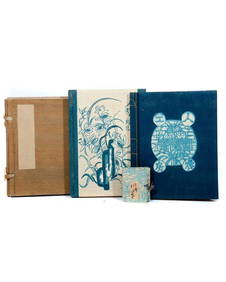
SoldTWO LENGTHS JAPANESE PRINTED YARDAGE, MID 20th C DTWO LENGTHS JAPANESE PRINTED YARDAGE, MID 20th C DDCF. Both 14 yards x 14 inches wide: One white and black swirls on teal damask ground. One with turquoise palm frond brushstroke design. Excellent.See Sold Price
SoldJapanese Woodblock Printed MapJapanese Woodblock Printed Map. Size: 6.5" x 3.5", 17 x 9 cm (closed); 14" x 28.5", 36 x 72 cm (open). Provenance: De Hoogh Gallery, Philadelphia.See Sold Price
SoldJapanese Woodblock Printed Map, Edo Period, KyotoUnframed Japanese woodblock color printed folding map, Meiji Period (1868-1911), entitled Kyoto fu-ku kumiwake saizu, a detailed map of the old capital and its environs, dated Meiji 18.7 (=1885 July),See Sold Price
SoldJapanese Woodblock Printed Map, Edo Period, NaraUnframed Japanese woodblock printed map, Edo Period (1615-1868), entitled Washu Nara no zu (Diagram of Nara, Wakayama [prefecture]), dated Tempo 15 (=1844.5), featuring the eight scenic spots, togetheSee Sold Price
SoldJapanese Woodblock Printed Map, Edo Period, RyukuUnframed Japanese woodblock printed map, Edo Period (1615-1868), depicting the Ryuku island group, each island labeled, the largest with notation of various important buildings (toned, backed, centerSee Sold Price
SoldJapanese Woodblock Printed Map, Edo Period, NikkoUnframed Japanese woodblock printed map, Edo Period (1615-1868), entitled Nikko gozan no ezu (Pictorial Illustration of the Nikko mountains), with the various places, temples and shrine labeled, publiSee Sold Price
SoldJapanese Woodblock Printed Map, Edo Period, KyotoUnframed Japanese woodblock printed map, Edo Period (1615-1868), depicting the capital (old designation for Kyoto), a reissue dated Tempo 14 (=1843.6), the city and surrounding famous places and templSee Sold Price
SoldThree 19th C. Maps & Two 19th C. Prints**Originally Listed At $100** Europe, Ireland and Germany, ca. 19th century CE. A collection of printed materials: two printed German maps, one print of an older engraved map, and two prints of engravSee Sold Price
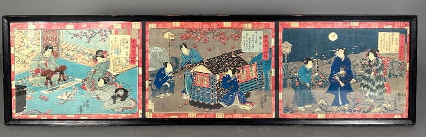
SoldJapanese printed books, Tosa, ShijoTwo Japanese monochrome printed books, including: the fourth volume in a series devoted to the works of the Tosa school, the 26 pages (13 folded sheets) featuring landscapes, figures, birds-and-flowerSee Sold Price
Three 19th C. Maps & Two 19th C. Prints**First Time At Auction** Europe, Ireland and Germany, ca. 19th century CE. A collection of printed materials: two printed German maps, one print of an older engraved map, and two prints of engravingsSee Sold Price
Medieval Printed Paper Bible Page by Johann GrüningerTimeLine Auctions Ltd.4.5(183)See Sold PriceMar 07, 2024
Jerusalem Map for British Soldiers in Palestine - WW2Levy Auction House4.3(11)See Sold PriceFeb 27, 2024
18 Booklets Collection - War Graves of Palestine - WWILevy Auction House4.3(11)See Sold PriceFeb 27, 2024
Rand McNally Railroad Map Cabinet w/ 21 Railroad MapsRail & Road Auctions4.6(165)See Sold PriceMar 08, 2024
[JAPANESE BASEBALL]. Group of Two Japanese Baseball Photo C...Potter & Potter Auctions4.6(539)See Sold PriceMar 07, 2024
Two Japanese Woodblock Print Illustrated Books.Turner Auctions + Appraisals4.3(311)See Sold PriceMar 09, 2024
THE MATRIX RELOADED (2003)/THE MATRIX REVOLUTIONS (2003) - VFX Freeway Diagram PortfolioPropstore4.2(6)See Sold PriceMar 14, 2024
NORTH AFRICA. Morocco Algeria Tunis Tunisia Egypt. Cairo. BARTHOLOMEW 1901 mapJasper524.5(9.8k)See Sold PriceFeb 28, 2024
Eizan (Japanese, 1787-1867) Woodblock Print, GeishasLion and Unicorn4.7(1.8k)See Sold PriceMar 14, 2024
Yayoi Kusama (JAPANESE, B. 1929) Printed Cast Resin Multiples 2013, "Red Pumpkin; Yellow Pumpkin",DuMouchelles4.6(825)See Sold PriceMar 15, 2024
Yoshitomo Nara (Japanese, B. 1959) Offset Lithographic Poster, "Slight Fever", H 47.4' W 43.5"DuMouchelles4.6(825)See Sold PriceMar 15, 2024


![[John Coffee "Jack" Hays]. Two Printed Maps of C (1 of 2)](https://p1.liveauctioneers.com/906/44965/20107064_1_x.jpg?height=282&quality=70&version=1378758745)


![[JAPANESE BASEBALL]. Group of Two Japanese Baseball Photo C... (1 of 6)](https://p1.liveauctioneers.com/928/318880/171361453_1_x.jpg?height=282&quality=70&version=1707501302)