ATLAS of ANTIENT GEOGRAPHY by SAMUEL BUTLER 1843John McInnis Auctioneers,LLC4.6(502)See Sold PriceFeb 24, 2024
18TH C. ANTIQUE MAP: FRENCH & INDIAN WAR, FRAMEDThomaston Place Auction Galleries4.4(386)See Sold PriceFeb 24, 2024
Rand McNally Railroad Map Cabinet w/ 21 Railroad MapsRail & Road Auctions4.6(165)See Sold PriceMar 08, 2024
Keith Haring - Ink on New York Map, Best Buddies, Inscribed, Signed, and DatedSapphire Auction Gallery4(67)See Sold PriceMar 02, 2024
LATE 17TH C. FRENCH MAP OF THE NEW WORLD BY ALEXIS-HUBERT JAILLOT (1632-1712)Thomaston Place Auction Galleries4.4(386)See Sold PriceFeb 24, 2024
Central Railroad of New Jersey Map of Sandy Hook Route-ca. 1903JM Hobby Supply and Railroad Artifact Auctions4.4(126)See Sold PriceFeb 24, 2024
Lot of Six Mixed Atlas Box Cars-HO Scale-New in BoxJM Hobby Supply and Railroad Artifact Auctions4.4(126)See Sold PriceFeb 25, 2024
Rand McNally/Santa Fe Railroad Map of Iowa-1912JM Hobby Supply and Railroad Artifact Auctions4.4(126)See Sold PriceFeb 24, 2024
NICOLAES VISSCHER (NETHERLANDS, 1618-1709) MAP OF THE NEW WORLDThomaston Place Auction Galleries4.4(386)See Sold PriceFeb 24, 2024
17TH C. WORLD MAP BY NICOLAES VISSCHER (NETHERLANDS, 1618-1709)Thomaston Place Auction Galleries4.4(386)See Sold PriceFeb 24, 2024
Lot of Six Mixed Atlas Cabooses-HO Scale-New in BoxJM Hobby Supply and Railroad Artifact Auctions4.4(126)See Sold PriceFeb 25, 2024
SoldThomas Bowen Map, South America"An Accurate Map of South America", hand colored engraving, Bankess, London. Toning, taped tear at the top left. Sight 13"h x 18.25"w, frame 17"h x 21.5"wSee Sold Price
SoldBowen, Thomas 1789 Map of South America"An Accurate Map of South America from the best Modern Maps and Charts" Copper Engraved Map Published 1789-91 by C. Cooke, London for "The New Royal Encyclopedia, Or, Complete Modern Universal DictionSee Sold Price
MAPS - Continents. BowenContinents. Thomas Bowen, [Lot of 5] A Map of North America [and] An Accurate Map of South America [and] A New and Accurate Map of Africa [and] A New & Accurate Map of Asia [and] A New & Accurate MapSee Sold Price
MAPS - Continents. BowenContinents. Thomas Bowen, [Lot of 5] A Map of North America [and] An Accurate Map of South America [and] A New and Accurate Map of Africa [and] A New & Accurate Map of Asia [and] A New & Accurate MapSee Sold Price
18TH CENTURY COPPERPLATE ENGRAVING OF THE WESTERN18TH CENTURY COPPERPLATE ENGRAVING OF THE WESTERN HEMISPHERE Engraved map of the Atlantic Ocean and North and South America, 11 1/2" x 10", executed by British engraver THOMAS BOWEN (d. 1790). The mapSee Sold Price
SoldMap, Amerique Meridionale, Thomas Bowen(Lot of 2) Framed maps, ''Amerique Meridionale,'' circa 1800, copper plate engraving with hand colored elements, Blondeau, Paris, depicting South America, Thomas Bowen (1749-1790), and ''An Accurate MSee Sold Price
SoldSouth America.- Bowen (Thomas) and others. - A mix3 maps of the continent by Bowen, Kitchen, and by Rapkin for the Tallis Atlas, with 4 other maps, a hand-coloured lithograph 'View of the City of Caracas from the Calvary', by Wood after Thomas, and aSee Sold Price
Sold1785 Bowen Map of South America -- An Accurate Map ofTitle/Content of Map: 1785 Bowen Map of South America -- An Accurate Map of South America from the best Modern Maps and Charts. By Thos. Bowen, Geogr. Date: 1785, London Cartographer: T Bowen Size: 12See Sold Price
1785 Bowen Map od South America -- An Accurate Map ofItem: 1785 Bowen Map od South America -- An Accurate Map of South America from the best Modern Maps and Charts. By Thos. Bowen, Geogr. Cartographer: T Bowen Year / Place: 1785, London Map Dimension (iSee Sold Price
SoldBowen: Map of Northern South America / West Indies 1747Map: A New and Accurate Map of Terra Firma and the Caribbe Islands drawn from the most approved Modern Maps & Charts Cartographer: Bowen Place & Date: London / 1747 Size: 16 3/4" x 14" Condition: outlSee Sold Price
SoldKitchen (Thomas) A Map of South AmericaKitchen (Thomas) A Map of South America containing Terra Firma, Guayana, New Granada, Amazonia, Brasil, Peru, Paraguay, Chaco, Tucuman, Chili and Patagonia, South America with inset map of thSee Sold Price
SoldThomas Kitchin Map of "South America"Thomas Kitchin (English, 1718-1784). "South America with its Several Divisions". A hand colored and engraved map with vertical central fold. 18" x 22" (sight), 26" x 29" (framed).See Sold Price
SoldThomas Bowen. Map of North America, circa 1770(British, d. 1790). "A New and Accurate Map of North America," hand colored engraving for Middleton's Complete System of Geography, 11 1/4 x 17 3/4 in., framedSee Sold Price
Bowen: Antique Map of South America & West Indies, 1747Map: A New and Accurate Map of Terra Firma and the Caribbe Islands drawn from the most approved Modern Maps & Charts Cartographer: Bowen Place & Date: London / 1747 Size: 16 3/4" x 14" Condition: outlSee Sold Price
Sold-. Robertson (William) The History of America-. Robertson (William) The History of America,3 vol., seventh edition, 4 folding maps by Thomas Kitchin, map of South America with closed tear strengthened to rear, lacks folding plate, contemSee Sold Price
SoldThomas Bowen, North America map(English 18th century). "New & Accurate Map of North America including Nootka Sound with the new discovered Islands on the North East coast of Asia" (sic) hand colored map, circa 1790, 11 x 17 in. , fSee Sold Price
SoldThomas Bowen Map of North and South PacificA New & Accurate Chart of the Discoveries made by the late Capt Jas Cook.....Exhibiting Botany Bay with the whole Coast of New South Wales in New Holland, also New Zealand, Norfolk and the various othSee Sold Price
SoldBowen: Map of Chili, Terra Magellanica, Terra del FuegoMap: A New and Accurate Map of Chili, Terra Magellanica. Terra del Fuego Cartographer: Bowen Place & Date: London / 1750 Size: 16 7/8" x 14" Bowen's wonderfully detailed map of southern South AmericaSee Sold Price
A New and Accurate Map of Chili, Bowen, 1750Bowen's wonderfully detailed map of southern South America from his A Complete System of Geography. Includes an inset map of Tierra del Fuego and a plan of Santiago, capital of Chile. Cartographer: BoSee Sold Price
Thomas, Cowperthwait & Co.: South America, 1851Title/Content of Map: Thomas, Cowperthwait & Co.: South America, 1851 Date Printed: 1851/Philadelphia Cartographer: Thomas, Cowperthwait & Co. Size: 13" x 15 3/4" The attractive, highly detailed map oSee Sold Price
Antique Map - Map of North America - Middleton's Complete System of Geography - 18thCentury"A New & Accurate Map of North America; Drawn from the most Authentic Modern Maps and Charts", Bowen, Thomas. Map of North America that is particularly interesting for its depiction of the Pacific NorSee Sold Price
SoldBowen, Thomas 1789 Map of North America. USA Canada"A New & Accurate Map of North America including Nootka Sound, with the new discovered Islands on the North East Coast of Asia" Copper Engraved Map Published 1789-91 by C. Cooke, London for "The New RSee Sold Price
MAP - Central South America. BowenCentral South America. Emanuel Bowen, An Accurate Map of Paraguay, Tucumania, Chaco, Rio de la Plata, &c. with Part of Brasil..., 1759 (circa). Hand Color. An interesting copper engraved map showing cSee Sold Price
MAP - Central South America. BowenCentral South America, Paraguay. Emanuel Bowen, An Accurate Map of Paraguay, Tucumania, Chaco, Rio de la Plata, &c. with Part of Brasil from 20 to 37 Degrees South Latitude..., 1759 (circa). Hand ColoSee Sold Price
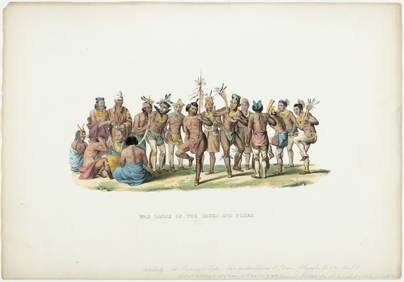
[UPRISING OF ENSLAVED PEOPLE]. American Eagle. No. 1. Salem, MA: Thomas C. Cushing, 5 January 1790.Freeman's | Hindman4.4(1.6k)See Sold PriceFeb 27, 2024
Carey, pub. 1796 - A Chart of the West IndiesTrillium Antique Prints & Rare Books4.5(30)See Sold PriceFeb 24, 2024
Carey, pub. 1796 - Map of the State of MarylandTrillium Antique Prints & Rare Books4.5(30)See Sold PriceFeb 24, 2024
Carey, pub. 1796 - Map of GeorgiaTrillium Antique Prints & Rare Books4.5(30)See Sold PriceFeb 24, 2024
Carey, pub. 1796 - Map of The State of South CarolinaTrillium Antique Prints & Rare Books4.5(30)See Sold PriceFeb 24, 2024
Carey, pub. 1796 - Map of KentuckyTrillium Antique Prints & Rare Books4.5(30)See Sold PriceFeb 24, 2024
Carey, pub. 1796 - Map of the Tennassee State formerly part of North Carolina (Tennessee)Trillium Antique Prints & Rare Books4.5(30)See Sold PriceFeb 24, 2024
Map: A 19thC engraved and hand coloured map of South America. Published by the Society for theClaydon Auctioneers Ltd4.3(125)See Sold PriceFeb 26, 2024
Map: An 18thC engraved and hand coloured map of North America and South America, titled DeClaydon Auctioneers Ltd4.3(125)See Sold PriceFeb 26, 2024
1822 MAP of SOUTH AMERICA GEOGRAPHICAL STATISTICAL HISTORICAL antique 17.5x 22"Jasper524.5(9.8k)See Sold PriceFeb 27, 2024
1822 MAP of NORTH & SOUTH AMERICA GEOGRAPHICAL STATISTICAL HISTORICAL antiqueJasper524.5(9.8k)See Sold PriceFeb 27, 2024


![[UPRISING OF ENSLAVED PEOPLE]. American Eagle. No. 1. Salem, MA: Thomas C. Cushing, 5 January 1790. (1 of 3)](https://p1.liveauctioneers.com/197/319238/171468013_1_x.jpg?height=282&quality=70&version=1707520367)