SoldHistorical Atlas of 1878 Marion CountyHistorical Atlas of 1878 Marion County – 128 pagesSee Sold Price
MAPS IN BOOK - Oregon. Edgar Williams & Co.Oregon. Edgar Williams & Co., Historical Atlas Map of Marion & Linn Counties Oregon..., 1878 (published). Hand Color. This attractive and informative atlas was produced by Edgar Williams & Co. in SanSee Sold Price
SoldAtlas of Marion & Linn Counties Oregon 1878Title: Historical Atlas Map of Marion and Linn Counties, Oregon. Compiled, Drawn and Published from Personal Examinations and Actual Surveys Author: Williams, Edgar Description: 104 pp. With 20 hand-cSee Sold Price
SoldAtlas of Marion & Linn Counties Oregon 1878Title: Historical Atlas Map of Marion and Linn Counties, Oregon. Compiled, Drawn and Published from Personal Examinations and Actual Surveys Author: Williams, Edgar Description: 104 pp. With 20 hand-cSee Sold Price
SoldAtlas of Marion & Linn Counties Oregon 1878Title: Historical Atlas Map of Marion and Linn Counties, Oregon. Compiled, Drawn and Published from Personal Examinations and Actual Surveys Author: Williams, Edgar Description: 104 pp. With 20 hand-cSee Sold Price
SoldHistorical Atlas of Alameda County, 1878Historical atlas of Alameda County, California, Thompson & West, 1878, Illustrated title page, impressive maps and views of Oakland, Alameda, Berkeley and other more obscure parts of the county, fullSee Sold Price
SoldAtlas, Maps of Alameda County, 1878Thompson & West, ''Official and Historical Atlas Map of Alameda County California, Compiled, Drawn and Published from Personal Examinations and Surveys,'' Oakland, 1878, incomplete, rebound in buckramSee Sold Price
SoldTWO HISTORICAL ATLASES OF MISSOURIIncludes Ralls county 1878, and Clark county 1915. Measure approximately 17.4 x 14.5 inches each. No condition report available, appear complete.See Sold Price
SoldTwo Historical AtlasesHastings & Prince Edward Counties 1878. Note, both in poor condition.See Sold Price
SoldThompson & West Atlas of Solano County Cal. 1878Heading: (California - Solano County) Author: Title: Historical Atlas Map of Solano County, California Place Published: San Francisco Publisher:Thompson & West Date Published: 1878 DesSee Sold Price
SoldThompson & West Atlas of Solano County Cal. 1878Title: Historical Atlas Map of Solano County, California Author: ** Description: 68 pp. Lithographed title-page; 13 hand-colored lithographed map sheets, 8 of them double-page; 17 lithographed plates,See Sold Price
Thompson & West Atlas of Solano County Cal. 1878Heading: (California - Solano County) Author: Title: Historical Atlas Map of Solano County, California Place Published: San Francisco Publisher:Thompson & West Date Published: 1878 DesSee Sold Price
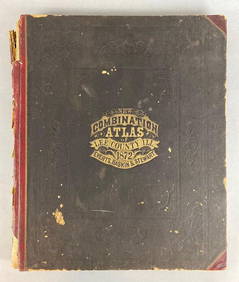
Sold1878 Caldwell's Historical Atlas Clearfield Co. PACaldwell's Illustrated Historical Combination Atlas of Clearfield County, Pennsylvania produced under the direction of J.H. Newton, C.E. Published by J.A. Caldwell, Condit, Ohio: 1878. Brown cloth boaSee Sold Price
SoldHistorical Atlas of Alameda CountyHistorical Atlas of Alameda County, California, Thompson & West, 1878, Illustrated title page, impressive maps and views of Oakland, Alameda, Berkeley and other more obscure parts of the county, fullSee Sold Price
Sold1 vol. (Pennsylvania County Atlas.) Caldwell, Jos1 vol. (Pennsylvania County Atlas.) Caldwell, Joseph A. Caldwell's Illustrated, Historical, Combination Atlas of Clearfield County, Pennsylvania. Condit, Oh., 1878. Folio, orig. morocco-backed cloth;See Sold Price
SoldHistorical Atlas of Alameda CountyHistorical Atlas of Alameda County, California, Thompson and West, 1878, illustrated title page, impressive maps and views of Oakland, Alameda, Berkeley and other more obscure parts of the county, fulSee Sold Price
SoldNEW HISTORICAL ATLAS OF ALAMEDA COUNTY CALIFORNIA1976 reprint of the 1878 original, unpaginated folio. Measures 12.25 x 9.25 inches. We are happy to offer in-house shipping for all but very large or very fragile items. Some international orders maySee Sold Price
Sold[ATLASES] Lot of 2 County Atlases[COUNTY ATLASES] Lot of 2 County Atlases, sold together. Including: Illustrated Historical Atlas of The Counties ofNorthumberland and Durham. Toronto: H. Belden & Co. 1878.** Illustrated Historical AtSee Sold Price
SoldILLUSTRATED HISTORICAL ATLASIllustrated Historical Atlas of Northumberland and Durham Counties Ontario, Illustrated by H. Belden & Co., Mika Silk Screening Limited, Belleville, Ontario 1972, copy of 1878, limited edition 29/500See Sold Price
SoldCALDWELL'S ILLUSTRATED HISTORICAL COMBINATION ATLACALDWELL'S ILLUSTRATED HISTORICAL COMBINATION ATLAS OF CLEARFIELD COUNTY PENNSYLVANIA under the direction of JH Newton. Clearfield County Historical Society, 1998 facsimile reprint of of the 1878 origSee Sold Price
SoldHistorical Atlas Washtenaw County 1874Historical Atlas Washtenaw County , Michigan 1874 illustrated. Everts & Stewart. 143 pp. lower corners dog-eared from pages 126-141, 142 - transfer pages chipped lower corners. Transfer pages are blanSee Sold Price
SoldHistorical Atlas Lenawee County 1874Historical Atlas Washtenaw Country, Michigan 1874 illustrated. Everts & Stewart. 124 pp. some maps separated or torn. Residence cut from page 59. Transfer pages blank. 17.25" x 14.25" x 1". ProvenanceSee Sold Price
SoldHISTORICAL ATLAS OF DUTCHESS COUNTY NEW YORKHISTORICAL ATLAS OF DUTCHESS COUNTY NEW YORK ILLUSTRATED - READING PUBLISHING HOUSE 1876. IN GOOD ESTATE CONDITION, FROM HOUSE IN STANFORDVILLE, N.Y. BEAUTIFUL MAPS AND ILLUSTRATIONS. HARD ATLAS TO FISee Sold Price
SoldNew Historical Atlas of Rockland County New YorkNew Historical Atlas of Rockland County New York Illustrated Centennial 1876". Atlas contains maps as well as engraving of various buildings and landscapes within Rockland County. Good condition withSee Sold Price
General Books - Nicolson - The Counties of Britain - A Tudor Atlas by John SpeedTimeLine Auctions Ltd.4.5(183)See Sold PriceMar 08, 2024
Rand McNally & Co's New Ideal State and County Survey and Atlas 1911North American Artifact Auctions4.7(175)See Sold PriceApr 20, 2024
HAMMOND'S READY REFERENCE HISTORICAL ATLAS 1920North American Artifact Auctions4.7(175)See Sold PriceApr 20, 2024
2 1/2" Miniature Head Pot. Alabama. Found in 1990.Tony Putty Artifacts4.7(397)See Sold PriceMar 09, 2024
[BLACK PANTHER PARTY]. Black is Beautiful poster. [With:] Photographic essays, incl. The VanguardFreeman's | Hindman4.4(1.6k)See Sold PriceFeb 27, 2024
1872 New Combination Atlas of Lee County Illinois BookMatthew Bullock Auctioneers4.7(1.8k)See Sold PriceFeb 24, 2024
1905 20th Century Atlas of Boone County IllinoisMatthew Bullock Auctioneers4.7(1.8k)See Sold PriceFeb 24, 2024
Book: A Concise Historical, Biographical & Genealogical Atlas of the Principal Events in theClaydon Auctioneers Ltd4.3(125)See Sold PriceFeb 26, 2024
1822 MAP of LEEWARD ISLANDS GEOGRAPHICAL STATISTICAL HISTORICAL antique 17.5x22"Jasper524.5(9.7k)See Sold PriceFeb 27, 2024
1822 MAP of SOUTH AMERICA GEOGRAPHICAL STATISTICAL HISTORICAL antique 17.5x 22"Jasper524.5(9.7k)See Sold PriceFeb 27, 2024
1822 MAP of NORTH & SOUTH AMERICA GEOGRAPHICAL STATISTICAL HISTORICAL antiqueJasper524.5(9.7k)See Sold PriceFeb 27, 2024
1822 MAP of CHILI GEOGRAPHICAL STATISTICAL HISTORICAL antique 17.5x 22" CHILEJasper524.5(9.7k)See Sold PriceFeb 27, 2024
Friedrich Arnold Brockhaus - Set of 4 Prints - Anthropologic Lithography - Sudan - Sennar - Africa -Proverde Auctions4.3(3)See Sold PriceFeb 28, 2024
Friedrich Arnold Brockhaus - Set of 4 Prints - Anthropologic Lithography - Ethnography - Africa -Proverde Auctions4.3(3)See Sold PriceFeb 28, 2024
Robert H Labberton - Map of The Territory of the Present United States - The territory of theProverde Auctions4.3(3)See Sold PriceFeb 28, 2024


![[ATLASES] Lot of 2 County Atlases (1 of 3)](https://p1.liveauctioneers.com/1124/187577/94368833_1_x.jpg?height=282&quality=70&version=1607095126)


![[BLACK PANTHER PARTY]. Black is Beautiful poster. [With:] Photographic essays, incl. The Vanguard (1 of 8)](https://p1.liveauctioneers.com/197/319238/171467899_1_x.jpg?height=282&quality=70&version=1707520367)