ATLAS of ANTIENT GEOGRAPHY by SAMUEL BUTLER 1843John McInnis Auctioneers,LLC4.6(502)See Sold PriceFeb 24, 2024
18TH C. ANTIQUE MAP: FRENCH & INDIAN WAR, FRAMEDThomaston Place Auction Galleries4.4(386)See Sold PriceFeb 24, 2024
Rand McNally Railroad Map Cabinet w/ 21 Railroad MapsRail & Road Auctions4.6(165)See Sold PriceMar 08, 2024
Keith Haring - Ink on New York Map, Best Buddies, Inscribed, Signed, and DatedSapphire Auction Gallery4(67)See Sold PriceMar 02, 2024
LATE 17TH C. FRENCH MAP OF THE NEW WORLD BY ALEXIS-HUBERT JAILLOT (1632-1712)Thomaston Place Auction Galleries4.4(386)See Sold PriceFeb 24, 2024
Central Railroad of New Jersey Map of Sandy Hook Route-ca. 1903JM Hobby Supply and Railroad Artifact Auctions4.4(126)See Sold PriceFeb 24, 2024
Lot of Six Mixed Atlas Box Cars-HO Scale-New in BoxJM Hobby Supply and Railroad Artifact Auctions4.4(126)See Sold PriceFeb 25, 2024
Rand McNally/Santa Fe Railroad Map of Iowa-1912JM Hobby Supply and Railroad Artifact Auctions4.4(126)See Sold PriceFeb 24, 2024
NICOLAES VISSCHER (NETHERLANDS, 1618-1709) MAP OF THE NEW WORLDThomaston Place Auction Galleries4.4(386)See Sold PriceFeb 24, 2024
17TH C. WORLD MAP BY NICOLAES VISSCHER (NETHERLANDS, 1618-1709)Thomaston Place Auction Galleries4.4(386)See Sold PriceFeb 24, 2024
Lot of Six Mixed Atlas Cabooses-HO Scale-New in BoxJM Hobby Supply and Railroad Artifact Auctions4.4(126)See Sold PriceFeb 25, 2024
Spain & Portugal by Bonne/ Raynal 1780Title: Spain & Portugal by Bonne/ Raynal 1780 Date/Period: 1780 Materials: Copperplate engraved Size: 13 1/2 x 9'' The map not only covers the cities, towns, mountains and rivers but in a very clear mSee Sold Price
Bonne: Antique Map of Spain Portugal, 1780TITLE/CONTENT OF MAP: 'Les Royaumes d'Espagne et de Portugal' A map of Iberia including Spain & Portugal DATE PRINTED: 1780 IMAGE SIZE: Approx 23.0 x 34.5cm, 9 x 13.5 inches (Large); Please note thatSee Sold Price
Royaumes d'Espagne et de Portugal.' by Rigobert Bonne.TITLE OF THE MAP: 'Royaumes d'Espagne et de Portugal' Kingdoms of Spain and Portugal - Iberia Date: 1780 IMAGE SIZE: Approx 24.5 x 36.0cm, 9.75 x 14 inches (Large); Please note that this is a foldingSee Sold Price
SoldSayer: Antique Map of Spain & Portugal, 1780Map: Kingdoms of Spain and Portugal, Divided Into Their Great Provinces Publication Date: 1780-03-02 Cartographer: SAYER, ROBERT Publisher: ROBERT SAYER Size: Folio – 18.50 H x 25.25 W Inches ShortSee Sold Price
Sayer: Map of Kingdoms of Spain & Portugal, 1780Map: The Kingdoms of Spain and Portugal, Divided Into Their Great Provinces Publication Date: 1780-03-02 Authors: ROBERT SAYER, SAYER, ROBERT Publisher: ROBERT SAYER Size: Folio – 18.50 H x 25.25 WSee Sold Price
Spice island (Indonesia, Malaysia) by Bonne/Raynal 1780Title: Spice island (Indonesia, Malaysia) by Bonne/Raynal 1780 Date/Period: 1780 Materials: Copperplate engraved Size: 13 1/2 x 9 3/4'' All of modern Indonesia, Malaysia, Brunei, Singapore are shown aSee Sold Price
Double Hemisphere world map by Bonne/ Raynal 1780Title: Double Hemisphere world map by Bonne/ Raynal 1780 Date/Period: 1780 Materials: Copperplate engraved Size: 17 1/2 x 9 3/4”. Maps shows the North American west empty, misshaped Alaska, the newSee Sold Price
Persia, Central Asia to Tibet by Bonne/Raynal 1780Title: Persia, Central Asia to Tibet by Bonne/Raynal 1780 Date/Period: 1780 Materials: Copperplate engraved Size: 13 1/2 x 9 3/4'' From eastern Black Sea to the Caspian Sea down to the Persian gulf arSee Sold Price
Asia By Bonne/Raynal 1780Title: Asia By Bonne/Raynal 1780 Date/Period: 1780 Materials: Copperplate engraved Size: 13 1/2 x 9 3/4'' 1780, cartographer Rigobert Bonne one of the most important and highly regarded map makers ofSee Sold Price
Africa By Bonne/Raynal 1780Title: Africa By Bonne/Raynal 1780 Date/Period: 1780 Materials: Copperplate engraved Size: 13 1/2 x 9 3/4'' Interesting features including a near empty interior. 1780, cartographer Rigobert Bonne oneSee Sold Price
Western Africa. Gulf of Guinée by Bonne/ Raynal. 1780Title: Western Africa. Gulf of Guinée by Bonne/ Raynal. 1780 Date/Period: 1780 Materials: Copperplate engraved Size: 13 1/2 x 9 3/4'' From coastal towns to Cape’s to mouths of multiple rivers to thSee Sold Price
Italy by Bonne/ Raynal 1780Title: Italy by Bonne/ Raynal 1780 Date/Period: 1780 Materials: Copperplate engraved Size: 13 1/2 x 9'' Shows the city states and kingdoms of a pre united Italy. 1780, cartographer Rigobert Bonne oneSee Sold Price
France by Bonne/ Raynal 1780Title: France by Bonne/ Raynal 1780 Date/Period: 1780 Materials: Copperplate engraved Size: 13 1/2 x 9'' 1780, cartographer Rigobert Bonne one of the most important and highly regarded map makers of tSee Sold Price
Delamarche: Antique Map of Spain and Portugal, 1780TITLE/CONTENT OF MAP: 'Carte des Royaumes d'Espagne et de Portugal divisés par Provinces' A map of the kingdoms of Spain and Portugal in provinces. Curiously, Galicia includes part of northern PortugSee Sold Price
Spain and Portugal 1780/81. Scarce map by J. B. NolinTitle: Spain and Portugal 1780/81. Scarce map by J. B. Nolin Date/Period: 1780/81 Materials: Hand colored copper plate engraved Size: 14 1/2 x 10 1/4” With a somewhat unusual boundary for PortugSee Sold Price
Spain and Portugal 1780/81. Scarce map by J. B. NolinTitle: Spain and Portugal 1780/81. Scarce map by J. B. Nolin Date/Period: 1780/81 Materials: Hand colored copper plate engraved Size: 14 1/2 x 10 1/4” With a somewhat unusual boundary for PortugSee Sold Price
"Les Royaumes d'Espagne et de Portugal". Iberia SpainTITLE/CONTENT OF MAP: 'Les Royaumes d'Espagne et de Portugal' A map of Iberia including Spain & Portugal Date: 1780 IMAGE SIZE: Approx 23.0 x 34.5cm, 9 x 13.5 inches (Large); Please note that this isSee Sold Price
"Les Royaumes d'Espagne et de Portugal". Iberia SpainTITLE/CONTENT OF MAP: 'Les Royaumes d'Espagne et de Portugal' A map of Iberia including Spain & Portugal DATE PRINTED: 1780 IMAGE SIZE: Approx 23.0 x 34.5cm, 9 x 13.5 inches (Large); Please note thatSee Sold Price
World map On Mercator projection, 1780 by Bonne/ RaynalTitle: World map On Mercator projection, 1780 by Bonne/ Raynal Date/Period: 1780 Materials: Copperplate engraved Size: 13 1/2 x 9'' The world map shows a blank American west, misshaped Baffin Bay, AusSee Sold Price
1780 Map of Peru Bonne RaynalCarte Du Perou Avec Une Partie Des Pays.., by Rigobert Bonne and Guillame Raynal, Paris 1780. Fine condition with fold as issues. Measures 10 x16". Reserve: $40.00 Shipping: Domestic: Flat-rate of $6.See Sold Price
1780 Map of Peru Bonne RaynalCarte Du Perou Avec Une Partie Des Pays.., by Rigobert Bonne and Guillame Raynal, Paris 1780. Fine condition with fold as issues. Measures 10 x16". Reserve: $20.00 Shipping: Domestic: Flat-rate of $8.See Sold Price
Large Topographic Engraving Antique French map of SPAIN PORTUGAL 1798Basset ( Rue Jacque) edited and published this topographic map of Spain and Portugal, Herisson eleve de Bonne is the cartographer , Rigobert Bonne (1727-1794) is a French geographer, hydrographer andSee Sold Price
Large Topographic Engraving Antique French map of SPAINBasset ( Rue Jacque) edited and published this topographic map of Spain and Portugal, Herisson eleve de Bonne is the cartographer , Rigobert Bonne (1727-1794) is a French geographer, hydrographer andSee Sold Price
Large Topographic Engraving Antique French map of SPAIN PORTUGAL 1798Basset ( Rue Jacque) edited and published this topographic map of Spain and Portugal, Herisson eleve de Bonne is the cartographer , Rigobert Bonne (1727-1794) is a French geographer, hydrographer andSee Sold Price
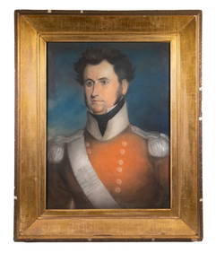
PERIOD PASTEL PORTRAIT OF AN UNIDENTIFIED GENERAL OFFICER, NAPOLEONIC WARS, 29TH FOOT, UNDERThomaston Place Auction Galleries4.4(386)See Sold PriceFeb 24, 2024
Original Milo Modern Art Bull Bronze Statue Figure Abstract Mid CenturyHouse of Treasure4.4(50)See Sold PriceFeb 29, 2024
Bronze Sculpture Statue Abstract Bull Horns Figurine Stock Broker Sale Gift DecorHouse of Treasure4.4(50)See Sold PriceFeb 29, 2024
16 page stamp album Monaco, Spain, France, Portugal 1850-1980Bazaar of Persia4.3(23)See Sold PriceFeb 24, 2024
Signed Original Fierce Bull Bronze Sculpture - 5.5" x 11"Weatherham Estate Treasures3.9(157)See Sold PriceMar 14, 2024
Pair of Large Noble Heraldic Shields in Renaissance carved wood, Spain or Portugal 16th century -Templum Fine Art Auctions4.3(8)See Sold PriceFeb 28, 2024
Book: A Concise Historical, Biographical & Genealogical Atlas of the Principal Events in theClaydon Auctioneers Ltd4.3(125)See Sold PriceFeb 26, 2024
Carte du Canal de Mosambique…. Madagascar Bonne Esperance. BONNE 1780 mapJasper524.5(9.8k)See Sold PriceFeb 28, 2024
Carte de la partie septentrionale d'Afrique, ou de la Barbarie… BONNE 1780 mapJasper524.5(9.8k)See Sold PriceFeb 28, 2024
Carte de la Haute et de la Basse Guinée. Gulf of Guinea Africa. BONNE 1780 mapJasper524.5(9.8k)See Sold PriceFeb 28, 2024
Partie Occidentale de l'Ancien Continent… W Africa Macaronesia. BONNE 1780 mapJasper524.5(9.8k)See Sold PriceFeb 28, 2024
Guthrie, William 1812 Antique Map. Spain and PortugalAlbion Auctions4.6(336)See Sold PriceMar 01, 2024
The Last Coins of Europe 12 Coins Set - Spain, Portugal, France, Italy, Ireland, Belgium, Luxemburg,Andrew's Coin & Jewelry4.5(209)See Sold PriceMar 07, 2024