ATLAS of ANTIENT GEOGRAPHY by SAMUEL BUTLER 1843John McInnis Auctioneers,LLC4.6(502)See Sold PriceFeb 24, 2024
18TH C. ANTIQUE MAP: FRENCH & INDIAN WAR, FRAMEDThomaston Place Auction Galleries4.4(386)See Sold PriceFeb 24, 2024
Rand McNally Railroad Map Cabinet w/ 21 Railroad MapsRail & Road Auctions4.6(165)See Sold PriceMar 08, 2024
Keith Haring - Ink on New York Map, Best Buddies, Inscribed, Signed, and DatedSapphire Auction Gallery4(67)See Sold PriceMar 02, 2024
LATE 17TH C. FRENCH MAP OF THE NEW WORLD BY ALEXIS-HUBERT JAILLOT (1632-1712)Thomaston Place Auction Galleries4.4(386)See Sold PriceFeb 24, 2024
Central Railroad of New Jersey Map of Sandy Hook Route-ca. 1903JM Hobby Supply and Railroad Artifact Auctions4.4(126)See Sold PriceFeb 24, 2024
Lot of Six Mixed Atlas Box Cars-HO Scale-New in BoxJM Hobby Supply and Railroad Artifact Auctions4.4(126)See Sold PriceFeb 25, 2024
Rand McNally/Santa Fe Railroad Map of Iowa-1912JM Hobby Supply and Railroad Artifact Auctions4.4(126)See Sold PriceFeb 24, 2024
NICOLAES VISSCHER (NETHERLANDS, 1618-1709) MAP OF THE NEW WORLDThomaston Place Auction Galleries4.4(386)See Sold PriceFeb 24, 2024
17TH C. WORLD MAP BY NICOLAES VISSCHER (NETHERLANDS, 1618-1709)Thomaston Place Auction Galleries4.4(386)See Sold PriceFeb 24, 2024
Lot of Six Mixed Atlas Cabooses-HO Scale-New in BoxJM Hobby Supply and Railroad Artifact Auctions4.4(126)See Sold PriceFeb 25, 2024
SoldFacsimile of Jefferson's Rare 1849 MapTitle: Map of the Emigrant Road from Independence, Mo. to San Francisco... Author: Jefferson, T. H. Description: Introduction by George R. Stewart. 4-part folding facsimile map loose in rear pocket, aSee Sold Price
SoldFacsimile of Jefferson's Rare 1849 MapTitle: Map of the Emigrant Road from Independence, Mo. to San Francisco, San Francisco Author: Jefferson, T. H. Description: Introduction by George R. Stewart. 4-part folding facsimile map loose in reSee Sold Price
SoldFacsimile of Jefferson's Rare 1849 MapTitle: Map of the Emigrant Road from Independence, Mo. to San Francisco, San Francisco Author: Jefferson, T. H. Description: Introduction by George R. Stewart. 4-part folding facsimile map loose in reSee Sold Price
SoldHistory of Cartography312 pp. Edited with a Preface by R.A. Skelton. Illustrated with plates (some in color including the frontispiece and 1 folding) from over 200 facsimile ancient and rare maps and other illustrations, aSee Sold Price
Rare 1849 NY State History Book - MapsRare 1849 NY State History Book: The Documentary History of the State of New York, Volume One***The Documentary History of the State of New York, Volume OneThe Documentary History of the State of NewSee Sold Price
Sold1926 Jefferson County Montana Mining Map RAREThis is an original 1926 Jefferson County, Montana mining map. The map shows part of the Cataract and High Ore Mining Districts. The mining claims owned or controlled by the Basin Montana Tunnel CompaSee Sold Price
SoldDe Cordova map of Texas 1849 1st edition RareHeading: Author: De Cordova, Jacob Title: J. De Cordova's Map of the State of Texas Compiled from the Records of the General Land Office of the State, by Robert Creuzbaur, Houston, 1849 Place PublishSee Sold Price
SoldLimited Edition Morgan's Overland in 1846Title: Overland in 1846. Diaries and Letters of the California-Oregon Trail Author: Morgan, Dale (Ed.) Description: 2 vols. Facsimile map of T.H. Jefferson (4 parts on 2 sheets) loose in rear pocket oSee Sold Price
Dale Morgan's Overland in 1846Title: Overland in 1846. Diaries and Letters of the California-Oregon Trail Author: Morgan, Dale (editor) Description: 2 volumes. Facsimile map of T.H. Jefferson (4 parts on 2 sheets) loose in rear poSee Sold Price
SoldOverland in 1846 2 vols Talisman Press 1963Title: Overland in 1846. Diaries and Letters of the California-Oregon Trail Author: Morgan, Dale (editor) Description: 2 volumes. Facsimile map of T.H. Jefferson (4 parts on 2 sheets) loose in rear poSee Sold Price
SoldDale Morgan's Overland in 1846Title: Overland in 1846. Diaries and Letters of the California-Oregon Trail Author: Morgan, Dale (Ed.) Description: 2 volumes. Facsimile map of T.H. Jefferson (4 parts on 2 sheets) loose in rear pockeSee Sold Price
SoldWoodrow Wilson "History of the American People"10 volumes by Woodrow Wilson illustrated with contemporary views, portraits, facsimiles & maps selected from rare books & prints. Harper & Brothers NY & London, 1917. Leather is 2 tone burgundy with gSee Sold Price
SoldVery Rare Map of the Washita River 1806Jefferson, Thomas Description:Pp. [1]-8 only of the 180 pp. report. Large folding map, approx. 21x84cm (8x33") plus margins. Disbound. First Edition. Text pages consist of title page, Jefferson's intrSee Sold Price
1849 NY State History Book - MapsRare 1849 NY State History Book: The Documentary History of the State of New York, Volume One***The Documentary History of the State of New York, Volume OneThe Documentary History of the State of NewSee Sold Price
SoldTHORNTON. Oregon and California in 1848Zamorano 80 Earliest Published Account of the Donner Party Colton’s large 1849 Map of California, Oregon,Texas 140. THORNTON, J[essy] Quinn. Oregon and California in 1848: By J. Quinn Thornton,See Sold Price
SoldFacsimile of rare first Masters Golf programTitle: First Annual Invitation Tournament, Augusta National Golf Club Author: ** Description: 44 pp. Illustrated from several photograph portraits of players, golf course illustrations and map drawingSee Sold Price
SoldRare map of Suisun Bay 1849Heading: Author: Hammond, R.P., W.T. Sherman and James Blair Title: Suisun Bay. Tide rises and falls five feet. Soundings made at low tide. Water in the San Joaquin fresh at all tides from the 10th tSee Sold Price
SoldRare map of Stockton CA 1849Heading: Author: Hammond, Richard P. Title: City of Stockton [in upper margin]- Surveyed for the Proprietor Charles M. Weber by Richd. P. Hammond Bvt. Major 3d. Artillery June, 1849 Place Published:See Sold Price
1944 Indians of the U.S.A.By: Louise E. Jefferson Date: 1944 (Published) New York Dimensions: 21 x 33 inches (53.3 cm x 84 cm) This rare pictorial map is by Louise E. Jefferson, one of the few women cartographers in history, aSee Sold Price
Blueback coasting chart of California—1849Blueback coasting chart of California—1849 316. [MAP]. IMRAY, James. Chart of the Coast of California from San BlaSee Sold Price
Ms. Chart of a Voyage to San Diego in 1849California Gold Rush Rare Manuscript Chart of a Voyage from Boston to San Diego in 1849 276. [MAP].See Sold Price
WW2 Paper Lot, Doolittle Map, and MoreGreat lot with a rare 1943 map of Doolittle's Raid with facsimile signatures of crews, a leather embossed bond folder with embossed eagle, 1924 Battle Fleet finals brochure, Civil Defense booklets, 19See Sold Price
SoldRare Russian map of Kodiak Island 1849Heading: Author: Russia, Russian American Company Title: [in Russian] Mercator's Chart of Kodiak Archipelago compiled by the Russian American Company... 1849. [with ten inset maps of bays and ports]See Sold Price
Rare separate issue of Colton map of West 1849Heading: Author: Colton, Joseph Hutchins Title: Map of California, Oregon, Texas, and the Territories adjoining with Routes &c Place Published: New York Publisher:J.H.Colton Date Published:See Sold Price
DAVID ROBERTS - Holy Land / Syria / Egypt etc. 3 x Folio Volumes 1849 Very RareLuis Porretta Fine Arts4.3(10)See Sold PriceMar 02, 2024
AMBROISE TARDIEU c1822 Napoleonic War Map GermanyLuis Porretta Fine Arts4.3(10)See Sold PriceMar 02, 2024
1822 Rare Map by Ambroise Tardieu Napoleon Caldiero Battle of Vento 17" x 11Luis Porretta Fine Arts4.3(10)See Sold PriceMar 02, 2024
1849 Mitchell School ATLAS 24 MAPS America Holy Land France Africa Egypt AsiaSchilb Antiquarian Rare Books4.8(421)See Sold PriceMar 31, 2024
[MAP]. NICHOLLS, Sutton (1668-1729). An Epitome of Sr. Will...Potter & Potter Auctions4.6(539)See Sold PriceMar 07, 2024
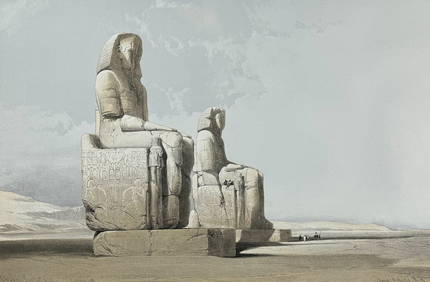
David Roberts - Obelisk of LuxorTrillium Antique Prints & Rare Books4.5(30)See Sold PriceFeb 24, 2024
David Roberts - Approach of the Simoom, Desert of GizehTrillium Antique Prints & Rare Books4.5(30)See Sold PriceFeb 24, 2024
De Jode, Rare, pub. 1593 - Map of Luxembourg (Lutzenburgii montuosissimi ac saltuosissimi ducatusTrillium Antique Prints & Rare Books4.5(30)See Sold PriceFeb 24, 2024
De Jode, Rare, pub. 1593 - Map of the British Isles [England, Scotland, Ireland] (Angliae Scotiae etTrillium Antique Prints & Rare Books4.5(30)See Sold PriceFeb 24, 2024
De Jode, Rare, pub. 1593 - Map of the Czech Republic or Kingdom of Bohemia (Chorographia insignisTrillium Antique Prints & Rare Books4.5(30)See Sold PriceFeb 24, 2024
De Jode, Rare, pub. 1593 - Map of the Middle East, Eastern Asia (Primae Partis Asiae accurataTrillium Antique Prints & Rare Books4.5(30)See Sold PriceFeb 24, 2024
Gould - Sparkling-tail Hummingbird with Nest & EggsTrillium Antique Prints & Rare Books4.5(30)See Sold PriceFeb 24, 2024
Gould - Red-billed Azure-crown HummingbirdTrillium Antique Prints & Rare Books4.5(30)See Sold PriceFeb 24, 2024
Gould - Rufous Flame-bearer HummingbirdTrillium Antique Prints & Rare Books4.5(30)See Sold PriceFeb 24, 2024
Gould - Little Hummingbird with Nest & EggsTrillium Antique Prints & Rare Books4.5(30)See Sold PriceFeb 24, 2024
WESTERN AFRICA.Kong Mountains.Caravan routes.Slave Coast.TALLIS/RAPKIN 1849 mapJasper524.5(9.8k)See Sold PriceFeb 28, 2024


![[MAP]. NICHOLLS, Sutton (1668-1729). An Epitome of Sr. Will... (1 of 1)](https://p1.liveauctioneers.com/928/318880/171361281_1_x.jpg?height=282&quality=70&version=1707501302)


![De Jode, Rare, pub. 1593 - Map of the British Isles [England, Scotland, Ireland] (Angliae Scotiae et (1 of 2)](https://p1.liveauctioneers.com/6581/319571/171593327_1_x.jpg?height=282&quality=70&version=1707853304)


