ATLAS of ANTIENT GEOGRAPHY by SAMUEL BUTLER 1843John McInnis Auctioneers,LLC4.6(502)See Sold PriceFeb 24, 2024
18TH C. ANTIQUE MAP: FRENCH & INDIAN WAR, FRAMEDThomaston Place Auction Galleries4.4(386)See Sold PriceFeb 24, 2024
Rand McNally Railroad Map Cabinet w/ 21 Railroad MapsRail & Road Auctions4.6(165)See Sold PriceMar 08, 2024
Keith Haring - Ink on New York Map, Best Buddies, Inscribed, Signed, and DatedSapphire Auction Gallery4(67)See Sold PriceMar 02, 2024
LATE 17TH C. FRENCH MAP OF THE NEW WORLD BY ALEXIS-HUBERT JAILLOT (1632-1712)Thomaston Place Auction Galleries4.4(386)See Sold PriceFeb 24, 2024
Central Railroad of New Jersey Map of Sandy Hook Route-ca. 1903JM Hobby Supply and Railroad Artifact Auctions4.4(126)See Sold PriceFeb 24, 2024
Lot of Six Mixed Atlas Box Cars-HO Scale-New in BoxJM Hobby Supply and Railroad Artifact Auctions4.4(126)See Sold PriceFeb 25, 2024
Rand McNally/Santa Fe Railroad Map of Iowa-1912JM Hobby Supply and Railroad Artifact Auctions4.4(126)See Sold PriceFeb 24, 2024
NICOLAES VISSCHER (NETHERLANDS, 1618-1709) MAP OF THE NEW WORLDThomaston Place Auction Galleries4.4(386)See Sold PriceFeb 24, 2024
17TH C. WORLD MAP BY NICOLAES VISSCHER (NETHERLANDS, 1618-1709)Thomaston Place Auction Galleries4.4(386)See Sold PriceFeb 24, 2024
Lot of Six Mixed Atlas Cabooses-HO Scale-New in BoxJM Hobby Supply and Railroad Artifact Auctions4.4(126)See Sold PriceFeb 25, 2024
Sold1884 Map of MissouriAuthor: Cram Title: 1884 Map of Missouri Medium: Ink on Paper Dimensions: 13.5"X11" Rail Road and county Map of Missouri dated 1884. Printed and published by George Cram in Chicago. Part of his FamilySee Sold Price
Plot of Part of Higginsville, MO 64315Folded pen and ink colored map, 1884. Approx 12" x 20" City: Higginsville State: Missouri Date: 1884See Sold Price
Sold1884 map of Georgia & Alabama1884 S. Augustus Mitchell map of Georgia & Alabama. Framed size 23"h x 31"wSee Sold Price
Sold1884 MAP OF THE WORLD BY S.A. MITCHELLMercator projection and shows the routh of Lt. Wilkes in 1840, Cpt Cook 1774-1778 and Cpt Gore in 1780. Matted, 14.75 x 18.25 inches. Not examined outside wrapping, appears excellent.See Sold Price
Sold1884 Map of MontanaAuthor: Cram Title: 1884 Map of Montana Medium: Ink on Paper Dimensions: 21.5"X13.5" Map of Montana dated 1884. Printed and published by George Cram in Chicago. Part of The People's Family World AtlasSee Sold Price
Sold1884 Map of LouisianaAuthor: Cram Title: 1884 Map of Louisiana Medium: Ink on Paper Dimensions: 13.5"X11.5" Map of Louisiana dated 1884. Printed and published by George Cram in Chicago. Part of The People's Family World ASee Sold Price
Sold1884 Map of Washington DCAuthor: Watson Title: 1884 Map of Washington DC Medium: Ink on Paper Dimensions: 14.5"X11" Map of Washington DC. dated 1884. Engraved and published by Watson in Chicago. Upper right references to histSee Sold Price
Sold1884 Map of West TexasAuthor: Cram Title: 1884 Map of West Texas Medium: Ink on Paper Dimensions: 14.5"X21.5" Map of the West portion of Texas dated 1884. Engraved and published by George Cram in Chicago. Part of his WorldSee Sold Price
Sold1884 Map Of The City Of New Haven Connecticut FramedFramed map of the City Of New Haven Connecticut. Produced by Price, Lee & Company. Survey by S.W. Searle. Folds, creases, paper loss, and toning. Not inspected out of frame.&nbsSee Sold Price
Sold1884 Map of ScotlandAuthor: Cram Title: 1884 Map of Scotland Medium: Ink on Paper Dimensions: 11.5"X13.5" Map of Scotland dated 1884. Printed and published by George Cram in Chicago. Part of The People's Family World AtlSee Sold Price
Sold1884 Map of ItalyAuthor: Cram Title: 1884 Map of Italy Medium: Ink on Paper Dimensions: 11.5"X13.5" Map of Italy dated 1884. Printed and published by George Cram in Chicago. Part of The People's Family World Atlas. KeSee Sold Price
SoldOriginal 1884 Map of Cork, IrelandHall's Historic Of Ireland 1884 County of Cork.In excellent condition. Matted and ready for framing. Matted size 11x14See Sold Price
SoldU S Coast Survey 1896 Map. Missouri & Kansas"Sketch showing Route Line of Spirit Levels" Lithograph Map Published 1896, Washington for "U.S. Coast and Geodetic Survey" Folds as issued. Rare. Paper Size: 16 x 11.5 inch (40 x 29cm) Good ConditionSee Sold Price
Sold1884 Map of IrelandAuthor: Cram Title: 1884 Map of Ireland Medium: Ink on Paper Dimensions: 11.5"X13.5" Map of Ireland dated 1884. Printed and published by George Cram in Chicago. Part of The People's Family World AtlasSee Sold Price
Sold1884 Map of South CarolinaAuthor: Cram Title: 1884 Map of South Carolina Materials: Ink on Paper Size/Dimensions: 13.5"X11" Description: Map of South Carolina dated 1884. Printed and published by George Cram in Chicago. Part oSee Sold Price
Sold1884 Map of CaliforniaAuthor: Cram Title: 1884 Map of California Medium: Ink on Paper Dimensions: 13.5"X21.5" Map of California dated 1884. Printed and published by George Cram in Chicago. Part of The People's Family WorldSee Sold Price
Sold1884 Map of U.S. Western Transportation Lines"The Principal Transportation Lines West of Chicago, St. Louis & New Orleans, To accompany the report on the Internal Commerce of the United States, 1884". Prepared by Joseph Nimmo Jr. Heavy weight paSee Sold Price
1884 Map of South CarolinaAuthor: Cram Title: 1884 Map of South Carolina Medium: Ink on Paper Dimensions: 13.5"X11" Map of South Carolina dated 1884. Printed and published by George Cram in Chicago. Part of The People's FamilySee Sold Price
Sold1844 Mitchell's Map Missouri & Arkansas1844 Mitchell's Map of the States of Missouri, Arkansas, and the Indian Territory Compiled from the Latest Authorities. Includes Indian Territories by tribe names, steam boat routes and partials of suSee Sold Price
Sold1918 ROAD & HIGHWAY MAP MISSOURI, KANSAS, OK7 x 4 inch booklet that folds out to 26 x 21 inches, side tear, clean, not brittle.See Sold Price
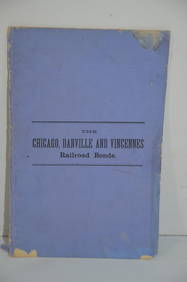
[Map]. Missouri Iron Company. Missouri City.Leaden Dreams 64. [MAP]. MISSOURI IRON COMPANY. Missouri City. Moore’s Lithography - Boston. Prospectus. Missouri City is situated on a beautiful plane [sic], at the base of the celebrated IronSee Sold Price
1884 Map of TexasAuthor: Cram Title: 1884 Map of Texas Medium: Ink on Paper Dimensions: 21.5"X13.5" Map of Texas dated 1884. Printed and published by George Cram in Chicago. Part of The People's Family World Atlas. DoSee Sold Price
Chicago and Eastern Illinois RR Annual Reports-1878 to 1887JM Hobby Supply and Railroad Artifact Auctions4.4(126)See Sold PriceFeb 24, 2024
Chicago Danville and Vincennes RR Gold Bond Prospectus Book-1872JM Hobby Supply and Railroad Artifact Auctions4.4(126)See Sold PriceFeb 24, 2024
Map of Missouri Highways and Railroads-1921JM Hobby Supply and Railroad Artifact Auctions4.4(126)See Sold PriceFeb 24, 2024
Eastern RR Summer Book of Tours-1884JM Hobby Supply and Railroad Artifact Auctions4.4(126)See Sold PriceFeb 24, 2024
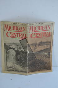
Michigan Central RR May 18, 1884 Public TimetableJM Hobby Supply and Railroad Artifact Auctions4.4(126)See Sold PriceFeb 24, 2024
Three Delaware & Hudson Canal Company Railroad Annual Passes - 1884, 1885, and 1886Rail & Road Auctions4.6(165)See Sold PriceMar 08, 2024
War Diary of 354th Infantry - 89th Division 1919North American Artifact Auctions4.6(182)See Sold PriceApr 20, 2024
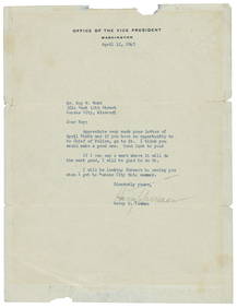
[MISSOURI]. [DONNELL, Forrest C., 1884-1980, subject]. STEV...Potter & Potter Auctions4.6(539)See Sold PriceMar 07, 2024
HARRY TRUMAN AUTOGRAPHED PRINT OF HIS HOUSE BY FRANK STEINMANThe Rug Life4.3(12)See Sold PriceMar 07, 2024
Emory's Notes of a Military Reconnoissance larger issuePBA Galleries4.7(381)See Sold PriceMar 07, 2024
Goode, George Brown 1884 Lot of 4 Natural History & Meteorology MapsAlbion Auctions4.6(336)See Sold PriceMar 01, 2024
Francis McNally - Antique Map of Illinois, Missouri & IowaProverde Auctions4.3(3)See Sold PriceFeb 28, 2024
US Post Lewis And Clark First Day Stamp Sheet BundleRapid Estate Liquidators and Auction Gallery4.5(1.1k)See Sold PriceFeb 29, 2024


![[Map]. Missouri Iron Company. Missouri City. (1 of 5)](https://p1.liveauctioneers.com/514/11740/3078835_1_x.jpg?height=282&quality=70&version=1171465640)


![[MISSOURI]. [DONNELL, Forrest C., 1884-1980, subject]. STEV... (1 of 2)](https://p1.liveauctioneers.com/928/318880/171361282_1_x.jpg?height=282&quality=70&version=1707501302)