ATLAS of ANTIENT GEOGRAPHY by SAMUEL BUTLER 1843John McInnis Auctioneers,LLC4.5(505)See Sold PriceFeb 24, 2024
18TH C. ANTIQUE MAP: FRENCH & INDIAN WAR, FRAMEDThomaston Place Auction Galleries4.4(393)See Sold PriceFeb 24, 2024
Rand McNally Railroad Map Cabinet w/ 21 Railroad MapsRail & Road Auctions4.6(165)See Sold PriceMar 08, 2024
Keith Haring - Ink on New York Map, Best Buddies, Inscribed, Signed, and DatedSapphire Auction Gallery4.1(67)See Sold PriceMar 02, 2024
LATE 17TH C. FRENCH MAP OF THE NEW WORLD BY ALEXIS-HUBERT JAILLOT (1632-1712)Thomaston Place Auction Galleries4.4(393)See Sold PriceFeb 24, 2024
Central Railroad of New Jersey Map of Sandy Hook Route-ca. 1903JM Hobby Supply and Railroad Artifact Auctions4.4(127)See Sold PriceFeb 24, 2024
Lot of Six Mixed Atlas Box Cars-HO Scale-New in BoxJM Hobby Supply and Railroad Artifact Auctions4.4(127)See Sold PriceFeb 25, 2024
Rand McNally/Santa Fe Railroad Map of Iowa-1912JM Hobby Supply and Railroad Artifact Auctions4.4(127)See Sold PriceFeb 24, 2024
NICOLAES VISSCHER (NETHERLANDS, 1618-1709) MAP OF THE NEW WORLDThomaston Place Auction Galleries4.4(393)See Sold PriceFeb 24, 2024
17TH C. WORLD MAP BY NICOLAES VISSCHER (NETHERLANDS, 1618-1709)Thomaston Place Auction Galleries4.4(393)See Sold PriceFeb 24, 2024
Lot of Six Mixed Atlas Cabooses-HO Scale-New in BoxJM Hobby Supply and Railroad Artifact Auctions4.4(127)See Sold PriceFeb 25, 2024
SoldWYLD, JAMES; after WILLIAM FADEN. Map of the CentralWYLD, JAMES; after WILLIAM FADEN. Map of the Central States of Europe Situate Between France and Russia, Describing Their New Limits Conformably with the Definitive Treaty of Peace. Large engraved casSee Sold Price
Sold(CENTRAL AMERICA.) Wyld, James. Map of Central America(CENTRAL AMERICA.) Wyld, James. Map of Central America Shewing the Different Lines of Atlantic & Pacific Communication. Large hand-colored engraved map of Central America with an inset of the IsthmusSee Sold Price
Wyld: Map of Central America, 1856WYLD, James. Wyld's Map of Central America, Nicaragua, Honduras, Costa Rica, Mosquita, The British Colonies with the Boundaries & Treaty Lines of the Central American States. London : James Wyld, GeogSee Sold Price
SoldWyld (James) Central AsiaWyld (James) (publisher) Military Staff Map of Central Asia, Turkistan, and Afghanistan,Central Asia, lithographed map, dissected into 32 sheets, linen-backed, original outline hand-colouring,See Sold Price
[MAP]. WYLD, James. Mexico and Central America.618. [MAP]. WYLD, James. Mexico and Central America. James Wyld. Geographer to the Queen & H.R.H. The Prince Consort. Charing Cross East. 457. Strand & 2. Royal Exchange London. [inset map atSee Sold Price
SoldWyld (James) Eastern HemisphereWyld (James) Eastern Hemisphere,engraved map, 595 x 595mm., central horizontal fold, thread margins, some spotting and surface dirt, 1842.See Sold Price
Wyld (James) Eastern HemisphereWyld (James) Eastern Hemisphere,engraved map, 595 x 595mm., central horizontal fold, thread margins, some spotting and surface dirt, 1842.See Sold Price
SoldWilliam Faden Map of Scotland & 2 others.William Faden coloured engraving, Map of Scotland, sectional, 44 x 38 ins. a Cary of Northumberland and a Wyld of Great Britain.See Sold Price
SoldWyld (James) Map of the Kingdom of HanoverWyld (James) Map of the Kingdom of Hanover,north-west Germany showing Hanover and environs, engraved map with original hand-colouring, 545 x 680mm., central vertical fold, slightly discolouredSee Sold Price
Wyld (James) Map of the Kingdom of DenmarkWyld (James) Map of the Kingdom of Denmark,including the Duchies of Holstein & Lauenburg, engraved map with original hand-colouring, 730 x 530mm., faint browning on central horizontal fold, 18See Sold Price
SoldWyld (James) Map of the Kingdom of HanoverWyld (James) Map of the Kingdom of Hanover,north-west Germany showing Hanover and environs, engraved map with original hand-colouring, 545 x 680mm., central vertical fold, slightly discolouredSee Sold Price
SoldWyld map of Central America & isthmuse crossing 1852Heading: Author: Wyld, James Title: Map of Central America, Shewing the Different Lines of Atlantic & Pacific Communication Place Published: London Publisher:Published by James Wyld Date PublishSee Sold Price
Wyld map of Central America & isthmuse crossing 1852Heading: Author: Wyld, James Title: Map of Central America, Shewing the Different Lines of Atlantic & Pacific Communication Place Published: London Publisher:Published by James Wyld Date PublishSee Sold Price
SoldFaden (William) Map of the Kingdom of DenmarkFaden (William) A Map of the Kingdom of Denmark, with the Duchy of Holstein,title cartouche upper left, scale cartouche lower right, engraved map with original hand-colouring, 730 x 535mm., ceSee Sold Price
SoldAFTER JAMES WYLD SR, "MAP OF AMERICA", 1845After James Wyld Sr. (British 1790-1836), "Map of America", 1845, colored copper engraving on paper, terrestrial map depicting North, Central, and South America, framed. Provenance: From the Estate ofSee Sold Price
SoldHeger, Map of the Post Roads of GermanyHeger (F.J.) A Map of the Post Roads of Germany,folding engraved map hand-coloured, 780 x 950 mm., worn slip-case with title label, Faden, 1795 § Wyld (James) The Germanic Confederated States,See Sold Price
Portugal.- Faden (William) - Chorographical Map of thealso titled in Portuguese above, engraved map with original hand-colouring in outline, 760 x 540mm., central horizontal fold, dampstaining with some associated fraying and loss in right margin, 1797.See Sold Price
[MAP]. BOUCHETTE. Lower & Upper Canada.... 1831243. [MAP]. BOUCHETTE, Joseph, Jun. [Joseph Bouchette, Sr. & James Wyld]. To His Most Excellent Majesty King William IVth. This Map of the Provinces of Lower & Upper Canada, Nova Scotia, New BSee Sold Price
SoldFaden (W) Chorographical Map of The Kingdom of PoFaden (William) Chorographical Map of The Kingdom of Portugal Divided into its Provinces, engraved map with outline hand-colouring, 765 x 535mm., central horizontal fold, reinforced, faint broSee Sold Price
Heger (F.J.) Post Roads of GermanyHeger (F.J.) A Map of the Post Roads of Germany,folding engraved map hand-coloured, 780 x 950 mm., worn slip-case with title label, Faden, 1795 § Wyld (James) The Germanic Confederated States,See Sold Price
A Map of Bengal, Bahar, Oude & Allahabad with Part ofBy James Rennell, F.R.S. Printed for William Faden, London, 1786 71 cm x 106 cm Title in upper right in large pictorial cartouche, with palm and banana trees, a panther, local inhabitants (including aSee Sold Price
SoldFaden (William) France Divided into ProvincesFaden (William) France Divided into Provinces,engraved map with hand-colouring, 540 x 640mm., central vertical fold, minor surface dirt, 1790; with a large mixed group of maps of France, incluSee Sold Price
SoldFaden (William) The Seven United ProvincesFaden (William) The Seven United Provincesengraved map with original hand-colouring, 740 x 555mm., central horizontal fold, some very faint spotting and browning, 1789; A Map of the Kingdom ofSee Sold Price
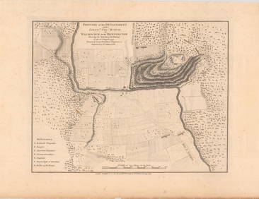
SoldFOUR VARIIOUS MAPSRobert Morden Buckinghamshire, engraved map coloured in outline, 42 x 34cm; William Kip, Essex Comitatus, hand coloured engraved map, 29 x 37cm; James Wyld. The Country Round Washington from 'StrategiSee Sold Price
American Express/New York Central Railroad Map of the United States-1934JM Hobby Supply and Railroad Artifact Auctions4.4(127)See Sold PriceFeb 24, 2024
Central Railroad of New Jersey Map of Sandy Hook Route-ca. 1903JM Hobby Supply and Railroad Artifact Auctions4.4(127)See Sold PriceFeb 24, 2024
MATTHEWS c1856 Map Of Upper Canada Ontario Indian Land Agency Divisions Scarce!Luis Porretta Fine Arts4.3(10)See Sold PriceMar 02, 2024
Memorial Addresses of Abraham Lincoln, James Garfield and William McKinley Dated 1903Swisher Bros. Auction LLC4.4(255)See Sold PriceFeb 24, 2024
Moorcroft for Macintyre Florian Ware Vase, CornflowerLion and Unicorn4.8(1.9k)See Sold PriceFeb 25, 2024
Catherwood - General View of Uxmal, Taken from the Archway of Las Monjas, Looking SouthTrillium Antique Prints & Rare Books4.5(32)See Sold PriceFeb 24, 2024
PAIR OF PORTRAITS BY WILLIAM JAMES GLACKENS (1870-1938).Amelia Jeffers, Auctioneers & Appraisers4.5(120)See Sold PriceMar 07, 2024
PAIR OF STUDIES BY WILLIAM JAMES GLACKENS (1870-1938).Amelia Jeffers, Auctioneers & Appraisers4.5(120)See Sold PriceMar 07, 2024
TWO WORKS AFTER WILLIAM JAMES GLACKENS (1870-1938).Amelia Jeffers, Auctioneers & Appraisers4.5(120)See Sold PriceMar 07, 2024
SUPPORT YOUR LOCAL SHERIFF! (1969) - Jake (Jack Elam) Promotional StillPropstore4.2(6)See Sold PriceMar 14, 2024
AFRICA. Map pre-dating much exploration. Mountains of Kong. SDUK 1851 oldJasper524.5(9.9k)See Sold PriceFeb 28, 2024
WEST AFRICA explorers' routes. Beaufort Gray Park Dochard Caillie. SDUK 1874 mapJasper524.5(9.9k)See Sold PriceFeb 28, 2024
Antique Map - Views on the coast of Asia. J. Webber del. Engraved after J. Webber and W. Bligh.Proverde Auctions4.3(3)See Sold PriceFeb 28, 2024
EARLY 19TH C. AMERICAN SCHOOL MINIATURE PORTRAIT.William Smith Auctions4.6(147)See Sold PriceMar 06, 2024
CHINESE EXPORT BOAT TEA CADDY/INCENSE BURNER.William Smith Auctions4.6(147)See Sold PriceMar 06, 2024


![[MAP]. WYLD, James. Mexico and Central America. (1 of 3)](https://p1.liveauctioneers.com/514/38482/16709456_1_x.jpg?height=282&quality=70&version=1363615005)


![[MAP]. BOUCHETTE. Lower & Upper Canada.... 1831 (1 of 10)](https://p1.liveauctioneers.com/514/38480/16487090_1_x.jpg?height=282&quality=70&version=1363614971)