ATLAS of ANTIENT GEOGRAPHY by SAMUEL BUTLER 1843John McInnis Auctioneers,LLC4.5(505)See Sold PriceFeb 24, 2024
18TH C. ANTIQUE MAP: FRENCH & INDIAN WAR, FRAMEDThomaston Place Auction Galleries4.4(393)See Sold PriceFeb 24, 2024
Rand McNally Railroad Map Cabinet w/ 21 Railroad MapsRail & Road Auctions4.6(165)See Sold PriceMar 08, 2024
Keith Haring - Ink on New York Map, Best Buddies, Inscribed, Signed, and DatedSapphire Auction Gallery4(67)See Sold PriceMar 02, 2024
LATE 17TH C. FRENCH MAP OF THE NEW WORLD BY ALEXIS-HUBERT JAILLOT (1632-1712)Thomaston Place Auction Galleries4.4(393)See Sold PriceFeb 24, 2024
Central Railroad of New Jersey Map of Sandy Hook Route-ca. 1903JM Hobby Supply and Railroad Artifact Auctions4.4(127)See Sold PriceFeb 24, 2024
Lot of Six Mixed Atlas Box Cars-HO Scale-New in BoxJM Hobby Supply and Railroad Artifact Auctions4.4(127)See Sold PriceFeb 25, 2024
Rand McNally/Santa Fe Railroad Map of Iowa-1912JM Hobby Supply and Railroad Artifact Auctions4.4(127)See Sold PriceFeb 24, 2024
NICOLAES VISSCHER (NETHERLANDS, 1618-1709) MAP OF THE NEW WORLDThomaston Place Auction Galleries4.4(393)See Sold PriceFeb 24, 2024
17TH C. WORLD MAP BY NICOLAES VISSCHER (NETHERLANDS, 1618-1709)Thomaston Place Auction Galleries4.4(393)See Sold PriceFeb 24, 2024
Lot of Six Mixed Atlas Cabooses-HO Scale-New in BoxJM Hobby Supply and Railroad Artifact Auctions4.4(127)See Sold PriceFeb 25, 2024
WORLD AS KNOWN TO ANCIENTS Herodotus Hanno Ptolemy Pliny SDUK 1844 old mapTITLE/CONTENT OF MAP: 'THE WORLD AS KNOWN TO THE ANCIENTS' DATE PRINTED: This map was originally published by Chapman & Hall in 1842; this date is printed on the map. This edition of the map was printSee Sold Price
WORLD KNOWN TO ANCIENTS. Herodotus Ptolemy Pliny Hanno. SDUK 1874 old mapTITLE/CONTENT OF MAP: 'THE WORLD AS KNOWN TO THE ANCIENTS' DATE PRINTED: 1874 IMAGE SIZE: Approx 42.0 x 63.0cm, 16.5 x 24.75 inches (Large) TYPE: Antique steel engraved map with original outline handSee Sold Price
WORLD KNOWN TO ANCIENTS. Herodotus Ptolemy Pliny Hanno. SDUK 1856 old mapTITLE/CONTENT OF MAP: 'THE WORLD AS KNOWN TO THE ANCIENTS' DATE PRINTED: 1856 IMAGE SIZE: Approx 41.5 x 64.5cm, 16.25 x 25.5 inches (Large) TYPE: Antique steel engraved map with original outline handSee Sold Price
WORLD KNOWN TO ANCIENTS. Herodotus Ptolemy Pliny Hanno. On 2 sheets 1845 mapTITLE/CONTENT OF MAP: 'THE WORLD AS KNOWN TO THE ANCIENTS' DATE PRINTED: 1845 IMAGE SIZE: Approx 41.5 x 64.5cm, 16.25 x 25.5 inches (Large) TYPE: Antique steel engraved map with original outline handSee Sold Price
WORLD KNOWN TO ANCIENTS. Herodotus Ptolemy Pliny Hanno. On 2 sheets 1857 mapTITLE/CONTENT OF MAP: 'THE WORLD AS KNOWN TO THE ANCIENTS' DATE PRINTED: 1857 IMAGE SIZE: Approx 41.5 x 64.5cm, 16.25 x 25.5 inches (Large) TYPE: Antique steel engraved map with original hand colourinSee Sold Price
WORLD KNOWN TO ANCIENTS. Herodotus Ptolemy Pliny Hanno.TITLE/CONTENT OF MAP: 'THE WORLD AS KNOWN TO THE ANCIENTS' The top image on the right hand side shows the entire map. To view a close up of the map showing the level of printed detail, please click onSee Sold Price
Sold6 Maps published by Chapman & Hall, 1830-1842.[Mideast/Northern Africa/Ancient Geography]. 6 Maps. Prtd outline color. ++ The World As Known To The Ancients. Uses information from Hanno, Pliny, and Ptolemy. In margin at lower right: “Drawn by RSee Sold Price
MAP, Caucasus & Russia, MaginiCaucasus, Russia & Ukraine. Ptolemy/Magini, Tabula Asiae II, 1598 (circa). Black & White. This Ptolemaic map, presented on a trapezoidal projection, presents a slice of the ancient world known as SarmSee Sold Price
MAP - Caucasus & Central Asia. MaginiCaucasus & Central Asia. Ptolemy/Magini, Tabula Asiae II, 1621 (published). Black & White. This Ptolemaic map, presented on a trapezoidal projection, presents a slice of the ancient world known as SarSee Sold Price
MAP, Eastern Europe, MercatorEastern Europe. Ptolemy/Mercator, Eur: VIII. Tab:, 1618 (published). Hand Color. Attractive Ptolemaic map covering eastern Europe from the Baltic through the Black Sea known in ancient times as SarmatSee Sold Price
MAP - Eastern Europe. Ptolemy/MercatorEastern Europe. Ptolemy/Mercator, Eur: VIII. Tab:, 1618 (published). Hand Color. Attractive Ptolemaic map covering eastern Europe from the Baltic through the Black Sea known in ancient times as SarmatSee Sold Price
Comparative lengths of principal WORLD RIVERS. SDUK 1844 old antique map chartTITLE/CONTENT OF MAP: 'A MAP OF THE PRINCIPAL RIVERS IN THE WORLD, SHEWING THEIR COURSES, COUNTIRES AND COMPARATIVE LENGTHS' DATE PRINTED: This map was originally published by Baldwin & Cradock in 183See Sold Price
WORLD ON MERCATOR'S PROJECTION. Pre-Mexican-American war. SDUK 1844 old mapTITLE/CONTENT OF MAP: 'WORLD ON MERCATOR'S PROJECTION' DATE PRINTED: 1844 IMAGE SIZE: Approx 40.5 x 62.0cm, 16 x 24.25 inches (Large) TYPE: Antique steel engraved map with original outline hand colourSee Sold Price
Géographie Ancienne. World as known to the Ancients. MALTE-BRUN c1871 old mapTITLE/CONTENT OF MAP: 'Géographie Ancienne [Ancient World]' DATE PRINTED: c1871 IMAGE SIZE: Approx 25.5 x 34.0cm, 10 x 13.25 inches (Large) TYPE: Antique 19th century engraved atlas map with origSee Sold Price
BALKANS ANCIENT Macedonia, Thracia, Dacia, Illyria & Moesia SDUK 1844 old mapTITLE/CONTENT OF MAP: 'ANCIENT MACEDONIA, THRACIA, ILLYRIA, MOESIA AND DACIA' DATE PRINTED: This map was originally published by Baldwin & Cradock in 1830; this date is printed on the map. This editioSee Sold Price
BALKANS ANCIENT Macedonia, Thracia, Dacia, Illyria & Moesia SDUK 1844 old mapTITLE/CONTENT OF MAP: 'ANCIENT MACEDONIA, THRACIA, ILLYRIA, MOESIA AND DACIA' DATE PRINTED: This map was originally published by Baldwin & Cradock in 1830; this date is printed on the map. This editioSee Sold Price
AFRICA Brazil Atlantic Gnomonic Projection Mountains of Kong SDUK 1844 old mapTITLE OF MAP (NOT PRINTED ON THE PAGE):'WORLD ON GNOMONIC PROJECTION, I., Africa and South Europe' Marked on this map are the Mountains of Kong, a non-existent mountain range charted on English maps oSee Sold Price
WORLD ON MERCATOR'S PROJECTION. Texas shown as Mexican. SDUK 1844 old mapTITLE/CONTENT OF MAP: 'WORLD ON MERCATOR'S PROJECTION' DATE PRINTED: This map was originally published by The Society for the Diffusion of Useful Knowledge in 1841; this date is printed on the map. ThSee Sold Price
AMERICAS Gnomonic Projection. Texas, Western US is Mexican SDUK 1844 old mapTITLE OF MAP (NOT PRINTED ON THE PAGE):'WORLD ON GNOMONIC PROJECTION, II., America' The national borders on the map have been drawn to show Texas as being part of Mexico, suggesting either that the maSee Sold Price
AUSTRALASIA POLYNESIA PACIFIC OCEAN. On Gnomonic Projection. SDUK 1844 old mapTITLE OF PRINT (NOT PRINTED ON THE PAGE):'WORLD ON GNOMONIC PROJECTION, III., Polynesia' DATE PRINTED: This map was originally published by Baldwin & Cradock in 1831; this date is printed on the map.See Sold Price
ASIA AUSTRALIA on Gnomonic Projection. China India Persia. SDUK 1844 old mapTITLE OF PRINT (NOT PRINTED ON THE PAGE):'WORLD ON GNOMONIC PROJECTION, IV, Asia.' DATE PRINTED: This map was originally published by Baldwin & Cradock in 1831; this date is printed on the map. This eSee Sold Price
SOUTH ASIA AUSTRALIA Indian Ocean Gnomonic Projection China SDUK 1844 old mapTITLE OF MAP (NOT PRINTED ON THE PAGE):'WORLD ON GNOMONIC PROJECTION, IV, Asia.' DATE PRINTED: 1844 IMAGE SIZE: Approx 31.0 x 28.5cm, 12.25 x 11.25 inches (Large) TYPE: Antique steel engraved map withSee Sold Price
SOUTHERN LATITUDES POLE ANTARCTIC Patagonia Tasmania SDUK 1844 old antique mapTITLE OF MAP (NOT PRINTED ON THE PAGE):'WORLD ON GNOMONIC PROJECTION, V., From South Pole to 45˚ S Lat' DATE PRINTED: 1844 IMAGE SIZE: Approx 31.0 x 28.5cm, 12.25 x 11 inches (Large) TYPE: AntiquSee Sold Price
The World as known to the Ancients, by WILLIAM HUGHES 1856 old antique mapCAPTION PRINTED BELOW PICTURE: 'The World as known to the Ancients' DATE PRINTED: 1856 IMAGE SIZE: Approx 31.5 x 42.5cm, 12.5 x 16.75 inches (Large) TYPE: Antique atlas map with original hand colourinSee Sold Price
1789 Captain James Cook Life & Voyages Australia New Zealand Hawaii KippisSchilb Antiquarian Rare Books4.8(428)See Sold PriceMar 10, 2024
1st Class Relic Of Saint Patrick, E.C., Known An The Apostle Of IrelandRbfinearts4.5(578)See Sold PriceFeb 24, 2024
LATE 17TH C. FRENCH MAP OF THE NEW WORLD BY ALEXIS-HUBERT JAILLOT (1632-1712)Thomaston Place Auction Galleries4.4(393)See Sold PriceFeb 24, 2024
Old Catlinite Native American Peace Pipe Pipestone 18.75 inches Carved Stone Plains Tribe SiouxHess Fine Auctions4.5(210)See Sold PriceMar 02, 2024
GEORGE WOSTENHOLM & SON, LTD. "LOBSTER" MULTI-TOOL POCKETKNIFE Sheffield, 19th Century Length 2.75".Eldred's4.7(419)See Sold PriceFeb 28, 2024
Walter Satterlee (NY,1844-1908) oil painting antiqueBroward Auction Gallery4.7(292)See Sold PriceApr 14, 2024
Follower of Rembrandt Huge Family Portrait Interior Oil Painting Dutch Old Master Estate of OlympianHess Fine Auctions4.5(210)See Sold PriceMar 02, 2024
Meindert Hobbema or After "The Old Water Mill" Dutch Old Master Oil on Cradled Panel PaintingHess Fine Auctions4.5(210)See Sold PriceMar 02, 2024
Christo Vladimirov Javacheff (1935-2020) and Jeanne-Claude Denat de Guillebon (1935-2009), known asNeely Auction4.6(224)See Sold PriceFeb 25, 2024
DOEL REED (1895-1985) 'NIGHT IN GARCIA' RARE AQUATINTSoulis Auctions4.8(953)See Sold PriceFeb 24, 2024
[WORLD WAR II – OKINAWA]. Okinawa Shima Western Beaches Top...Potter & Potter Auctions4.6(545)See Sold PriceMar 07, 2024
Heinrich Sperling (German,1844-1924) oil painting antiqueBroward Auction Gallery4.7(292)See Sold PriceMay 05, 2024
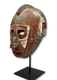
A Very Fine Old Bobo Mask Ex William Wright GalleryTRIBAL GATHERINGS4.6(296)See Sold PriceMar 02, 2024
Very Large Old Master Simon de Chalons Circle Oil on Panel Holy Family Virgin Mary Christ ChildHess Fine Auctions4.5(210)See Sold PriceJun 15, 2024


![[WORLD WAR II – OKINAWA]. Okinawa Shima Western Beaches Top... (1 of 1)](https://p1.liveauctioneers.com/928/318880/171361141_1_x.jpg?height=282&quality=70&version=1707501302)