ATLAS of ANTIENT GEOGRAPHY by SAMUEL BUTLER 1843John McInnis Auctioneers,LLC4.5(505)See Sold PriceFeb 24, 2024
18TH C. ANTIQUE MAP: FRENCH & INDIAN WAR, FRAMEDThomaston Place Auction Galleries4.4(393)See Sold PriceFeb 24, 2024
Rand McNally Railroad Map Cabinet w/ 21 Railroad MapsRail & Road Auctions4.6(165)See Sold PriceMar 08, 2024
Keith Haring - Ink on New York Map, Best Buddies, Inscribed, Signed, and DatedSapphire Auction Gallery4(67)See Sold PriceMar 02, 2024
LATE 17TH C. FRENCH MAP OF THE NEW WORLD BY ALEXIS-HUBERT JAILLOT (1632-1712)Thomaston Place Auction Galleries4.4(393)See Sold PriceFeb 24, 2024
Central Railroad of New Jersey Map of Sandy Hook Route-ca. 1903JM Hobby Supply and Railroad Artifact Auctions4.4(127)See Sold PriceFeb 24, 2024
Lot of Six Mixed Atlas Box Cars-HO Scale-New in BoxJM Hobby Supply and Railroad Artifact Auctions4.4(127)See Sold PriceFeb 25, 2024
Rand McNally/Santa Fe Railroad Map of Iowa-1912JM Hobby Supply and Railroad Artifact Auctions4.4(127)See Sold PriceFeb 24, 2024
NICOLAES VISSCHER (NETHERLANDS, 1618-1709) MAP OF THE NEW WORLDThomaston Place Auction Galleries4.4(393)See Sold PriceFeb 24, 2024
17TH C. WORLD MAP BY NICOLAES VISSCHER (NETHERLANDS, 1618-1709)Thomaston Place Auction Galleries4.4(393)See Sold PriceFeb 24, 2024
Lot of Six Mixed Atlas Cabooses-HO Scale-New in BoxJM Hobby Supply and Railroad Artifact Auctions4.4(127)See Sold PriceFeb 25, 2024
West Indies, Pt Manzanilla to San Juan 1844 British Admiralty MapScarce original 1844 British Admiralty Nautical Chart West Indies, Sheet XI, from Pt Manzanilla to San Juan De Nicaragua, Surveyed by Commander E. Barnett 1837. London Published according to Act of PaSee Sold Price
West Indies, Eastern Cuba 1881 British Admiralty Nautical MapScarce Original 1877 British Admiralty Nautical Chart: West Indies Cuba The Eastern Portion From a Chart Published At The Hydrographical Office Madrid, 1837. Corrected From Surveys and Observations bySee Sold Price
West Indies, Providence, Windward, Cuba 1834 British Admiralty MapScarce Original 1834 British Admiralty Nautical Chart: West Indies, Sheet II, From the Providence Channels to the Windward Passage ty Commander Richard Owen 1831-32. Cuba from the Spanish Survey of 18See Sold Price
West Indies, Western Cuba 1879 British Admiralty Nautical MapScarce Original 1879 British Admiralty Nautical Chart: West Indies Cuba the Western Portion From a Chart Published at the Hydrographical Office Madrid 1837. Corrected from Surveys and Observations bySee Sold Price
West Indies, Cape Gracias to Belize 1843 British Admiralty MapScarce original 1843 British Admiralty Nautical Chart: West Indies, Sheet XIII, from Cape Gracias to Belize Surveyed by Commanders R. Owen and E. Barnett. 1830 - 39. Published according to Act of ParlSee Sold Price
West- Indies, Monserrat. British Admiralty Chart 254,Title/Content of Map: West- Indies, Monserrat. British Admiralty Chart 254, published in 1869 Date Printed: Surveyed: 1867 Engraved: 1869 Edition: 1869 Cartographer: British Admiralty Material/Medium:See Sold Price
West- Indies, Monserrat. British Admiralty Chart 254,Title/Content of Map: West- Indies, Monserrat. British Admiralty Chart 254, published in 1869 Date: Surveyed: 1867 Engraved: 1869 Edition: 1869 Cartographer: British Admiralty Material/Medium: thick pSee Sold Price
Martinique - West Indies, Windwards Islands - BritishTitle/Content of Map: Martinique - West Indies, Windwards Islands - British Admiralty Chart 371, published 1863 Date: 1863 Cartographer: Brittish Admiralty Material/Medium: thick paper Size: standardSee Sold Price
Martinique - West Indies, Windwards Islands - BritishTitle/Content of Map: Martinique - West Indies, Windwards Islands - British Admiralty Chart 371, published 1863 Date: 1863 Cartographer: Brittish Admiralty Material/Medium: thick paper Size: standardSee Sold Price
Martinique - West Indies, Windwards Islands - BritishTitle: Martinique - West Indies, Windwards Islands - British Admiralty Chart 371, published 1863 Date: 1863 Cartographer: British Admiralty Materials: thick paper Size: standard 71x104 cm (28x41 in) ASee Sold Price
West Indies, Nicaragua – Mosquito Coast BritishTitle: West Indies, Nicaragua – Mosquito Coast British Admiralty Chart 2425, published 1900 Date: 1900 Cartographer: British Admiralty Material/Medium:thick paper Size:71x104 cm Additional Info:LittSee Sold Price
West Indies – The Grenadines, part of British AdmiraltyDetailed, large scale chart of the Grenadines with beautiful details as sailing ships, land views, tidal information and so on. The first surveys are from 1861 by J. Parsons, Master. Tidal informationSee Sold Price
Antique Nautical Chart of San Francisco Harbor, 1885Map: 1885 British Admiralty Chart of San Francisco Harbor -- North America; West Coast; San Francisco Harbour from United States Coast Survey 1877 Date Printed: 1885, London Cartographer: British AdmiSee Sold Price
British Admiralty Chart of San Francisco Harbor, 1885Map: 1885 British Admiralty Chart of San Francisco Harbor -- North America; West Coast; San Francisco Harbour from United States Coast Survey 1877 Cartographer: British Admiralty Year / Place: 1885, LSee Sold Price
1885 British Admiralty Chart of San Francisco Harbor --Title/Content of Map: 1885 British Admiralty Chart of San Francisco Harbor -- North America; West Coast; San Francisco Harbour from United States Coast Survey 1877 Date Printed: 1885, London CartograpSee Sold Price
SoldBritish Admiralty: Antique Chart of San FranciscoTitle/Content of Map: 1885 British Admiralty Chart of San Francisco Harbor -- North America; West Coast; San Francisco Harbour from United States Coast Survey 1877 Date Printed: 1885, London CartograpSee Sold Price
Two Very Scarce U.S. Navy Sea Charts of Gulf of MexicoU.S. Navy Hydrographic Office. Gulf of Mexico, West Indies and Caribbean Sea from the Most Recent U.S. Coast Survey Spanish and British Admiralty Charts Sheet I. Lithogaphed map with hand color. 1869.See Sold Price
Jamaica SE coast Morant-Portland Pt Kingston ADMIRALTY sea chart 1963 (1971) mapTITLE/CONTENT OF MAP: 'West Indies - Jamaica - South Coast - Morant Point to Portland Point' DATE PRINTED: Surveyed to 1962. Published 1963. Corrections to 1971 IMAGE SIZE: Approx 70.0 x 103.0cm, 27.5See Sold Price
Jamaica SE coast Morant-Portland Pt Kingston ADMIRALTY sea chart 1963 (1971) mapTITLE/CONTENT OF MAP: 'West Indies - Jamaica - South Coast - Morant Point to Portland Point' DATE PRINTED: Surveyed to 1962. Published 1963. Corrections to 1971 IMAGE SIZE: Approx 70.0 x 103.0cm, 27.5See Sold Price
Gulf of Mexico, West Indies and Caribbean Sea. from theReserve Reduced! Title: Gulf of Mexico, West Indies and Caribbean Sea. from the Most Recent Spanish and British Admiralty Charts. Sheet V. Publication Date: 1870-07-01 Cartographer: ANONYMOUS PublisheSee Sold Price
Gulf of Mexico, West Indies and Caribbean Sea. from theTitle: Gulf of Mexico, West Indies and Caribbean Sea. from the Most Recent Spanish and British Admiralty Charts. Sheet V. Publication Date: 1870-07-01 Publisher: U.S. NAVY. HYDROGRAPHIC OFFICE Size: 2See Sold Price
Gulf of Mexico, West Indies and Caribbean Sea. from the Most Recent Spanish and British AdmiraltyPublication Date: 1870-07-01 Title: Gulf of Mexico, West Indies and Caribbean Sea. from the Most Recent Spanish and British Admiralty Charts. Sheet V. Cartographer: ANONYMOUS Publisher: U.S. NAVY. HYDSee Sold Price
Gulf of Mexico, West Indies and Caribbean Sea. from theTitle: Gulf of Mexico, West Indies and Caribbean Sea. from the Most Recent Spanish and British Admiralty Charts. Sheet V. Publication Date: 1870-07-01 Cartographer: ANONYMOUS Publisher: U.S. NAVY. HYDSee Sold Price
Gulf of Mexico, West Indies and Caribbean Sea from theReserve Reduced! Title: Gulf of Mexico, West Indies and Caribbean Sea from the Most Recent U.S. Coast Survey, Spanish and British Admiralty Charts Sheet I. Publication Date: 1869-04-14 Cartographer: ASee Sold Price
Central Railroad of New Jersey Map of Sandy Hook Route-ca. 1903JM Hobby Supply and Railroad Artifact Auctions4.4(127)See Sold PriceFeb 24, 2024
Northern Pacific RR Washington and Northern Idaho Map Folder-1941JM Hobby Supply and Railroad Artifact Auctions4.4(127)See Sold PriceFeb 24, 2024
Union Pacific RR Across The Continent West From Omaha, NE Book-April 2, 1868JM Hobby Supply and Railroad Artifact Auctions4.4(127)See Sold PriceFeb 24, 2024
LATE 17TH C. FRENCH MAP OF THE NEW WORLD BY ALEXIS-HUBERT JAILLOT (1632-1712)Thomaston Place Auction Galleries4.4(393)See Sold PriceFeb 24, 2024
Bill Graham 1970 Fillmore West Winterland Concert Series Framed Retro PosterPremier Auction Galleries4.4(331)See Sold PriceMar 09, 2024
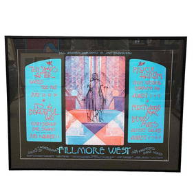
Bill Graham Presents Fillmore West 1970 Summer Line-Up Vintage Concert PosterPremier Auction Galleries4.4(331)See Sold PriceMar 09, 2024
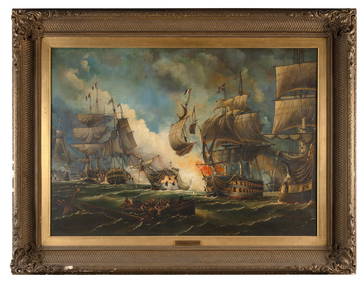
WILLIAM GRIFFIN (United Kingdom, 19th Century), "Battle of the Glorious 1st June"., Oil on canvas,Eldred's4.7(419)See Sold PriceFeb 27, 2024
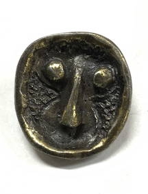
Stone Age Classic British Teardrop-Shaped Knapped Flint HandaxeTimeLine Auctions Ltd.4.6(183)See Sold PriceMar 05, 2024
Portfolio of 15 County Maps by Robert Morden (English 1650-1703)Nadeau's Auction Gallery4.7(409)See Sold PriceFeb 24, 2024
Thomas Fairland (British 1804-1852) After Benjamin West (British/American 1738-1820)Nadeau's Auction Gallery4.7(409)See Sold PriceFeb 24, 2024
Rand McNally Railroad Map Cabinet w/ 21 Railroad MapsRail & Road Auctions4.6(165)See Sold PriceMar 08, 2024
Winifred Mason Modernist Metal Face BroochThe Benefit Shop Foundation Inc.4.3(2.9k)See Sold PriceMar 06, 2024
[ARCTIC]. BOWEN, Emanuel. A New & Accurate Map of the North...Potter & Potter Auctions4.6(545)See Sold PriceMar 07, 2024
Signed Hunt Slonem, Oil on Panel Wall Sculpture, 1999 "Toco"Collective Hudson4.5(58)See Sold PriceMar 01, 2024
Arrowsmith & Lewis - Map of the United StatesTrillium Antique Prints & Rare Books4.5(32)See Sold PriceFeb 24, 2024
Carey, pub. 1796 - Map of KentuckyTrillium Antique Prints & Rare Books4.5(32)See Sold PriceFeb 24, 2024
Carey, pub. 1796 - Map of the Tennassee State formerly part of North Carolina (Tennessee)Trillium Antique Prints & Rare Books4.5(32)See Sold PriceFeb 24, 2024
Map of Part of the West Indies, Etc., Showing the Exact Position Of The U.S. War Steamer SanJasper524.5(9.9k)See Sold PriceFeb 27, 2024
Maria Martinez and Popovi Da (n.d.-1980 and 1923-1971, San Ildefonso Pueblo), A blackware potteryJohn Moran Auctioneers, Inc.4.7(461)See Sold PriceMar 12, 2024


![[ARCTIC]. BOWEN, Emanuel. A New & Accurate Map of the North... (1 of 1)](https://p1.liveauctioneers.com/928/318880/171360917_1_x.jpg?height=282&quality=70&version=1707501302)