ATLAS of ANTIENT GEOGRAPHY by SAMUEL BUTLER 1843John McInnis Auctioneers,LLC4.6(502)See Sold PriceFeb 24, 2024
18TH C. ANTIQUE MAP: FRENCH & INDIAN WAR, FRAMEDThomaston Place Auction Galleries4.4(386)See Sold PriceFeb 24, 2024
Rand McNally Railroad Map Cabinet w/ 21 Railroad MapsRail & Road Auctions4.6(165)See Sold PriceMar 08, 2024
Keith Haring - Ink on New York Map, Best Buddies, Inscribed, Signed, and DatedSapphire Auction Gallery4(67)See Sold PriceMar 02, 2024
LATE 17TH C. FRENCH MAP OF THE NEW WORLD BY ALEXIS-HUBERT JAILLOT (1632-1712)Thomaston Place Auction Galleries4.4(386)See Sold PriceFeb 24, 2024
Central Railroad of New Jersey Map of Sandy Hook Route-ca. 1903JM Hobby Supply and Railroad Artifact Auctions4.4(126)See Sold PriceFeb 24, 2024
Lot of Six Mixed Atlas Box Cars-HO Scale-New in BoxJM Hobby Supply and Railroad Artifact Auctions4.4(126)See Sold PriceFeb 25, 2024
Rand McNally/Santa Fe Railroad Map of Iowa-1912JM Hobby Supply and Railroad Artifact Auctions4.4(126)See Sold PriceFeb 24, 2024
NICOLAES VISSCHER (NETHERLANDS, 1618-1709) MAP OF THE NEW WORLDThomaston Place Auction Galleries4.4(386)See Sold PriceFeb 24, 2024
17TH C. WORLD MAP BY NICOLAES VISSCHER (NETHERLANDS, 1618-1709)Thomaston Place Auction Galleries4.4(386)See Sold PriceFeb 24, 2024
Lot of Six Mixed Atlas Cabooses-HO Scale-New in BoxJM Hobby Supply and Railroad Artifact Auctions4.4(126)See Sold PriceFeb 25, 2024
SoldWest Indies.- Lacroix (Pamphile, Baron) Memoires pourNO RESERVE West Indies.- Lacroix (Pamphile, Baron) Memoires pour servir a l'Histoire de la Revolution de Saint-Domingue, 2 vol., first edition, half-titles, folding engraved battle-plan and large foldSee Sold Price
SoldLacroix (F.J.) Mémoires de...Saint-DomingueLacroix (François J., Pamphile de) Mémoires pour servir a l'histoire de la Revolution de Saint-Domingue, 2 vol., first edition, large folding engraved map, partly hand-coloured in outline, halSee Sold Price
SoldGourgaud (G.) NapoleonGourgaud (Gaspard Baron) Memoires pour servir a l'Histoire de France sous Napoleon, 4 vol., folding map, contemporary calf, gilt, Londres, 1823-24 ? Thiers (M.A.) The History of the French RevSee Sold Price
SoldMemoires pour servir a l'Histoire et a l'Anatomie des( Baron G. L. C.) Memoires pour servir a l'Histoire et a l'Anatomie des Mollusques, 35 engraved plates, some browning and offsetting, ink library stamp to title, modern cloth, [Nissen ZBI 1010], 1817See Sold Price
SoldMemoires pour servir a l'Histoire et a l'Anatomie des( Baron G. L. C.) Memoires pour servir a l'Histoire et a l'Anatomie des Mollusques, 35 engraved plates, some browning and offsetting, ink library stamp to title, modern cloth, [Nissen ZBI 1010], 1817See Sold Price
Cartes de supplément pour les Isles Antilles. West Indies Islands BONNE 1788 mapTITLE/CONTENT OF MAP: Cartes de supplément pour les Isles Antilles // Isles Vierges // Isle St Christophe // Isle Antigoa // Isle de la Dominique // Isle Ste Lucie // Isle de la Barbade // Isle dSee Sold Price
Cartes de supplément pour les Isles Antilles. West Indies Islands BONNE 1788 mapTITLE/CONTENT OF MAP: Cartes de supplément pour les Isles Antilles // Isles Vierges // Isle St Christophe // Isle Antigoa // Isle de la Dominique // Isle Ste Lucie // Isle de la Barbade // Isle dSee Sold Price
Cartes de supplément pour les Isles Antilles. West Indies Islands BONNE 1790 mapTITLE/CONTENT OF MAP: Cartes de supplément pour les Isles Antilles // Isles Vierges // Isle St Christophe // Isle Antigoa // Isle de la Dominique // Isle Ste Lucie // Isle de la Barbade // Isle dSee Sold Price
Cartes de supplément pour les Isles Antilles. West Indies Islands BONNE 1790 mapTITLE/CONTENT OF MAP: Cartes de supplément pour les Isles Antilles // Isles Vierges // Isle St Christophe // Isle Antigoa // Isle de la Dominique // Isle Ste Lucie // Isle de la Barbade // Isle dSee Sold Price
Bonne: Antique Map of British West Indies Islands, 1780Title/Content of Map: 'Supplement pour les Isles Antilles Extrait des Cartes Angloises' A map of (predominantly) British West Indian islands, including The Virgin Islands (present-day British, US & SpSee Sold Price
Bonne: Antique Map of British West Indies, 1780TITLE/CONTENT OF MAP: 'Supplement pour les Isles Antilles Extrait des Cartes Angloises' A map of (predominantly) British West Indian islands, including The Virgin Islands (present-day British, US & SpSee Sold Price
Isles Antilles Extrait des Cartes Angloises. British West Indies. BONNE 1780 mapTITLE/CONTENT OF MAP: 'Supplement pour les Isles Antilles Extrait des Cartes Angloises' A map of (predominantly) British West Indian islands, including The Virgin Islands (present-day British, US & SpSee Sold Price
Isles Antilles Extrait des Cartes Angloises. British West Indies. BONNE 1780 mapTITLE/CONTENT OF MAP: 'Supplement pour les Isles Antilles Extrait des Cartes Angloises' A map of (predominantly) British West Indian islands, including The Virgin Islands (present-day British, US & SpSee Sold Price
SoldEMANUAL BOWEN America & West Indies MapEMANUAL BOWEN America & West Indies Map, inscriptions to upper portion read ‘Particular Draughts and Plans of some of the Principal Towns and Harbours belonging to the English, French, and SpaniardsSee Sold Price
SoldHomann Heirs: Antique Composite Map of West Indies 1740Map: Mappa Geographicae, complectens Indiae Occidentalis/ Carte des Isles de l'Amerique Cartographer: Homann Heirs/J.B.B. d'Anville Place & Date: Nurnberg / 1740 Size: 19" x 22 5/8" Condition: Main WeSee Sold Price
SoldOttens: Antique Map of the Caribbean / West Indies 1730Title/Content of Map: 1730 Ottens Map of the Caribbean / West Indies -- Insula Americana nempe Cuba, Hispaniola, Jamaica, Pto Rico, Lucania,Antillae vulgo Caribe barlo et Soto vento etc. Date Printed:See Sold Price
SoldWest Indies Map, John Thomson, 1817Map: 'West Indies' The top image on the right hand side shows the entire map. To view a close up of the map showing the level of printed detail, please click on the bottom image on the right hand sideSee Sold Price
SoldBellin: Antique Map Gulf of Mexico & West Indies, 1754Title/Content of Map: Carte du Golphe de Mexique et des Isles de l'Amerique Cartographer: Jacques Bellin Place & Date: Paris / 1754/1760 Size: 14 3/4" x 10 3/4" Condition: b&w; old folds as published;See Sold Price
Homann Heirs/ d’Anville: West Indies Antique Map, 1740Map: Mappa Geographicae, complectens Indiae Occidentalis/ Carte des Isles de l'Amerique Cartographer: Homann Heirs/J.B.B. d'Anville Place & Date: Nurnberg / 1740 Size: 19" x 22 5/8" Condition: Main WeSee Sold Price
SoldUS SPANISH AMERICAN WAR USS MASSACHUSETTS SAMPSON MEDAL AND WEST INDIES CAMPAIGN MEDAL.A nice set of medals, including a Sampson Medal and West Indies Campaign Medal. The act of March 3rd, 1901, authorized the striking of bronze medals commemorating the naval engagements in the waters oSee Sold Price
SoldZatta: Antique Map of West Indies, 1783Title/Content of Map: West Indes by Zatta Date Printed: 1783 Cartographer: Antonio Zatta Material/Medium: Paper Size: 16" x 22" Published in Venice. Hand colored. Copperplate engraved. Antonio Zatta (See Sold Price
Soldvan den Keere / Langenes: Antique Map West Indies, 1598Title/Content of Map: Insularum Cubae, Hispaniolae, Iucatanae & circumjacentium describtio Cartographer: van den Keere / Langenes Place & Date: Amsterdam / 1598 Size: 5" x 3 1/4" Condition: b&w; overaSee Sold Price
Sold1827 RARE Spanish Law Institutes West Indies Alvarez1827 RARE Spanish Law Institutes West Indies Alvarez Castile Indies New York 2v A rare, early 19th-century American printing of Jose Maria Alvarez’s ‘Law Institutes of Castile and the Indies’. SSee Sold Price
Sold1840 1st ed SLAVERY Joseph Gurney West Indies Jamaica1840 1st ed SLAVERY Joseph Gurney West Indies Jamaica Cuba Caribbean Henry Clay Joseph Gurney was an early 19th-century English Quaker who wrote an extensive letter to Henry Clay in which he describedSee Sold Price
Nike Air Force 1 Low Retro QS West Indies SneakersDiamond Auctions LLC4.3(10)See Sold PriceFeb 29, 2024
Carey, pub. 1796 - A Chart of the West IndiesTrillium Antique Prints & Rare Books4.5(30)See Sold PriceFeb 24, 2024
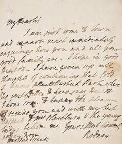
Rodney (Admiral Sir George Rodney, first Baron) Autograph Letter signed “Rodney?? to “MrForum Auctions4.3(52)See Sold PriceFeb 29, 2024
1862 North America Anthony Trollope West Indies AND Spanish Main CANADA NIAGARAJasper524.5(9.8k)See Sold PriceFeb 27, 2024
West Indies. South Coast of Jamaica from Port Royal to Pedro Bluff.Jasper524.5(9.8k)See Sold PriceFeb 27, 2024
Map of Part of the West Indies, Etc., Showing the Exact Position Of The U.S. War Steamer SanJasper524.5(9.8k)See Sold PriceFeb 27, 2024
OLD MAP of the West Indies/ Carta Esperica/ 1804Churchill Galleries3.7(213)See Sold PriceFeb 26, 2024
Cooke, George 1801 Antique Map. West Indies CaribbeanAlbion Auctions4.6(336)See Sold PriceMar 01, 2024