ATLAS of ANTIENT GEOGRAPHY by SAMUEL BUTLER 1843John McInnis Auctioneers,LLC4.6(504)See Sold PriceFeb 25, 2024
18TH C. ANTIQUE MAP: FRENCH & INDIAN WAR, FRAMEDThomaston Place Auction Galleries4.4(389)See Sold PriceFeb 24, 2024
Rand McNally Railroad Map Cabinet w/ 21 Railroad MapsRail & Road Auctions4.6(165)See Sold PriceMar 08, 2024
Keith Haring - Ink on New York Map, Best Buddies, Inscribed, Signed, and DatedSapphire Auction Gallery4.1(67)See Sold PriceMar 02, 2024
LATE 17TH C. FRENCH MAP OF THE NEW WORLD BY ALEXIS-HUBERT JAILLOT (1632-1712)Thomaston Place Auction Galleries4.4(389)See Sold PriceFeb 24, 2024
Central Railroad of New Jersey Map of Sandy Hook Route-ca. 1903JM Hobby Supply and Railroad Artifact Auctions4.4(126)See Sold PriceFeb 24, 2024
Lot of Six Mixed Atlas Box Cars-HO Scale-New in BoxJM Hobby Supply and Railroad Artifact Auctions4.4(126)See Sold PriceFeb 25, 2024
Rand McNally/Santa Fe Railroad Map of Iowa-1912JM Hobby Supply and Railroad Artifact Auctions4.4(126)See Sold PriceFeb 24, 2024
NICOLAES VISSCHER (NETHERLANDS, 1618-1709) MAP OF THE NEW WORLDThomaston Place Auction Galleries4.4(389)See Sold PriceFeb 24, 2024
17TH C. WORLD MAP BY NICOLAES VISSCHER (NETHERLANDS, 1618-1709)Thomaston Place Auction Galleries4.4(389)See Sold PriceFeb 24, 2024
Lot of Six Mixed Atlas Cabooses-HO Scale-New in BoxJM Hobby Supply and Railroad Artifact Auctions4.4(126)See Sold PriceFeb 25, 2024
SoldVisscher & Homann Antique Maps (4)Flandriae Comitatus Pars Batava, N. Visscher, Amsterdam, Late 17th C. Plus 3 maps by J.B. Homann, Nuremberg, 18th C.. 21" x 24".See Sold Price
SoldVisscher: Antique Map of Beloved Land of Canaan, 1650Map: Het Beloofde Landt Canaan Cartographer: N. Visscher Place & Date: Amsterdam / 1650 Size: 18 1/2" x 12 1/4" Condition: outline color (map), wash color (cartouche and vignettes); overall age toningSee Sold Price
SoldHomann Heirs: Antique Map of Asia, 1746Map: Asia Date Printed: 1746 Cartographer: Homann Heirs Material/Medium: Paper Size: 23 3/4" x 21" Printed in Nuremberg. Hand colored copperplate engraved. Beautiful baroque style cartouche. Please noSee Sold Price
Homann Heirs: Antique Map of the World, 1746Map: World Date Printed: 1746 Cartographer: Homann Heirs Material/Medium: Paper Size: 23 3/4" x 21" Printed in Nuremberg. Thick paper. Features the world in double hemispheres. Two projections show poSee Sold Price
SoldHomann Heirs: Antique Map of Europe, 1746Map: Europe ** Nuremberg?? Date Printed: 1746 Cartographer: Homann Heirs Material/Medium: Paper Size: 21" x 23 1/4" Nuremberg. Hand colored copperplate engraved. Beautiful baroque style cartouche. PleSee Sold Price
SoldHomann Heirs: Antique Map of British West Indies, 1740Map: Dominia Anglorum in praecipuis Insulis Americae Cartographer: Homann Heirs Place & Date: Nuremberg / 1740 Size: 22" x 19 1/4" Condition: outline color; overall age toning; repaired splits at centSee Sold Price
Homann Heirs: Antique Map of Hungary & North BalkansTitle/Content of Map: Hvngariae Ampliori Significatu... Carte D'hongrie En General..." Date Printed: 1750 ca. Cartographer: HOMANN HEIRS Size (inches): 7.9x6.4 Detailed map of Hungary and the northernSee Sold Price
SoldHomman Heirs: Antique Map of Africa, 1746Map: Africa Date Printed: 1746 Cartographer: Homann Heirs Material/Medium: Paper Size: 23 1/4" x 21" Printed in Nuremberg. Thick paper. Hand colored copperplate engraved. Beautiful baroque style cartoSee Sold Price
SoldBurgandy France Antique MapComitatus Burgundiae. Hand-colored engraved map. French wine region. J.B. Homann, Nuremberg, 18th C. 24 3/4" x 21".See Sold Price
SoldEARLY MAP TITLED 'AMERICAE SEPTENTRIONALIS ETMERIDONALIS NOUISSIMA REPRESENTATIO QUAM EX FINGULIS GEOGRAPHORUM TABBULIS COLLECTA LUCI PUBLCAE ACCOMMODAVIT". MAKER JOHANN BAPTISTE HOMANN, POSSIBLY 18TH C, HAND COLORED, SIGHT SIZE 22 3/4", FRAMED,See Sold Price
SoldHomann: Antique Map of Italy, 1720Title/Content of Map: Italia Cursoria'. Italy general map Date Printed: c1720 Image Size: Approx 52.0 x 63.0cm, 20.5 x 24.75 inches (Large); Please note that this is a folding map. Type: Large antiqueSee Sold Price
Homann: Antique Map of the Americas, 1746Very beautiful map of America, big size, coloured by hand. Author: Homann Johan Baptist (1674-1724) publiched by Eredi Atlante: Maior Atlas scholasticus ex triginta sex generalibus et specialibus. DatSee Sold Price
Homann: Antique Map of the Solar System, 1752Title/Content of Map: 1752 Homann Solar System Map -- Systema Solare et Planetarium ex hypothesi Copernicana secundum elegantissimas Illustrissimi quondam Hugenii deductiones novissime collectum & exhSee Sold Price
Homann: Antique Map of Malta & Valetta View, 1720Map: Insularum Maltae et Gozae Cartographer: J. B. Homann Place & Date: Nurnberg / 1720 Size: 20" x 18" Condition: old color on islands and inset plan, cartouche and inset view in b&w; light overall aSee Sold Price
Homann: Antique Map of North & South America, 1740Map: Totius Americae Septentrionalis et Meridionalis Novissima Repraesentatio quam ex singulus recentium Geographorum Tabulis collecta luci publicae accomodavit Cartographer: HOMANN, Johannes BaptistaSee Sold Price
Homann: Antique Map of the World in Hemispheres, 1720Map: Planiglobii Terrestris Cumutroo Hemisphaerio Celesti Date Printed: 1720 Cartographer: J. B. Homann Material/Medium: Paper Size: 21" x 24" Condition: Excellent One of the most decorative world mapSee Sold Price
Homann: Antique Map of New England, 1720The map names New England as "Almouchi Cosen" as well as Nova Anglia, while present-day New York State is named variously as New Jork, Nieuw Nederland and Novum Belgium (New York, New Netherlands andSee Sold Price
Homann: Antique Map of New England, 1720Nova Anglia'.New England Novum Belgium.Long Island Jorck Shire. The map names New England as "Almouchi Cosen" as well as Nova Anglia, while present-day New York State is named variously as New Jork, NSee Sold Price
SoldVisscher: Antique Map of Africa, 1670Title: Africæ Accurata Tabula. 17th century Visscher map of Africa Map maker: Nicolas Visscher Place and Year: Amsterdam, c. 1670 Dimensions: 43.5 x 54 cm (17¼ x 21¼ in) Technique: Copperplate engrSee Sold Price
Homann: Antique Map of Denmark, 1720Map: Antique Map of Denmark -- Regni Daniae in quo sunt Ducatus Holsatia et Slesvicum Insulae Danicae Provinciae Iutia Scania Blekingia Nova Tabula Cartographer: J. Homann Year / Place: 1720 c NurnberSee Sold Price
SoldHomann: Antique Map of SouthEast Europe, 1753Title/Content of Map: 1753 Homann Map os the Danube and SouthEast Europe -- Fluviorum in Europa principis Danubii cum adiacentibus Regnis nec non totius Graeciae et Archipelagi Novissima Tabula Date PSee Sold Price
SoldJ.B. HOMANN ANTIQUE MAP OF MEXICO & NEW SPAINJ. B. Homann's map of Mexico, Florida, New England, the West Indies, and the Mississippi Valley. Dimensions: (Frame) H 20.5" x W 24.5", (Sight) H 18.5" x W 22..25" Condition: Colors faded. Some wear tSee Sold Price
Homann: Antique Map British Colonies in North AmericaDominia Anglorum in America Septentrionali'. The map shows British Possessions in North America in four panels. Top left: The gulf of St Lawrence with Newfoundland, New Brunswick and Nova Scotia. TopSee Sold Price
Homann: Antique Map of Germany, Poland, Austria, 1753Map: 1753 Homann Map of Germany, Poland, Austria -- Imperii Romano-Germanici in svos Status et Circulos divisi Tabula Generalis in Usus Iuventutis eru diendae… Cartographer: J. Homann Year / Place:See Sold Price
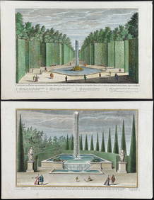
Demortain - 4 Fountain & Garden EngravingsTrillium Antique Prints & Rare Books4.5(30)See Sold PriceFeb 24, 2024
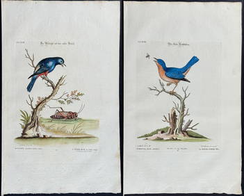
Edwards & Seligmann - 4 Bird EngravingsTrillium Antique Prints & Rare Books4.5(30)See Sold PriceFeb 24, 2024
Audubon, Imperial Folio - 4 Lithographs of Squirrel, Rat, MiceTrillium Antique Prints & Rare Books4.5(30)See Sold PriceFeb 24, 2024
1736 LARGE MAP OF SILESIA POLAND OPPAVIENSIS antique 25 by 34 3/4"Jasper524.5(9.8k)See Sold PriceFeb 28, 2024
1736 LARGE MAP OF SILESIA POLAND KARNOVIENSIS antique 25 x 4 3/4" Duchy of KrnovJasper524.5(9.8k)See Sold PriceFeb 28, 2024
NUBIA. 'Nubie'. Nile Valley. Sudan Ethiopia Egypt. MALLET 1683 old antique mapJasper524.5(9.8k)See Sold PriceFeb 28, 2024
Goode, George Brown 1884 Lot of 4 Natural History & Meteorology MapsAlbion Auctions4.6(341)See Sold PriceMar 01, 2024