ATLAS of ANTIENT GEOGRAPHY by SAMUEL BUTLER 1843John McInnis Auctioneers,LLC4.6(502)See Sold PriceFeb 24, 2024
18TH C. ANTIQUE MAP: FRENCH & INDIAN WAR, FRAMEDThomaston Place Auction Galleries4.4(386)See Sold PriceFeb 24, 2024
Rand McNally Railroad Map Cabinet w/ 21 Railroad MapsRail & Road Auctions4.6(165)See Sold PriceMar 08, 2024
Keith Haring - Ink on New York Map, Best Buddies, Inscribed, Signed, and DatedSapphire Auction Gallery4(67)See Sold PriceMar 02, 2024
LATE 17TH C. FRENCH MAP OF THE NEW WORLD BY ALEXIS-HUBERT JAILLOT (1632-1712)Thomaston Place Auction Galleries4.4(386)See Sold PriceFeb 24, 2024
Central Railroad of New Jersey Map of Sandy Hook Route-ca. 1903JM Hobby Supply and Railroad Artifact Auctions4.4(126)See Sold PriceFeb 24, 2024
Lot of Six Mixed Atlas Box Cars-HO Scale-New in BoxJM Hobby Supply and Railroad Artifact Auctions4.4(126)See Sold PriceFeb 25, 2024
Rand McNally/Santa Fe Railroad Map of Iowa-1912JM Hobby Supply and Railroad Artifact Auctions4.4(126)See Sold PriceFeb 24, 2024
NICOLAES VISSCHER (NETHERLANDS, 1618-1709) MAP OF THE NEW WORLDThomaston Place Auction Galleries4.4(386)See Sold PriceFeb 24, 2024
17TH C. WORLD MAP BY NICOLAES VISSCHER (NETHERLANDS, 1618-1709)Thomaston Place Auction Galleries4.4(386)See Sold PriceFeb 24, 2024
Lot of Six Mixed Atlas Cabooses-HO Scale-New in BoxJM Hobby Supply and Railroad Artifact Auctions4.4(126)See Sold PriceFeb 25, 2024
van der Aa: Rare small Americas mapMap: L'Amerique Cartograper: van der Aa Place / Date: Leiden / 1714 Size: 7 3/4" x 5 5/8" Condition: "b&w. slight overall age toninga strong, dark impression" A beautifully preserved, dark impressionSee Sold Price
SoldVan Der Aa Map of AmericaAmerica, of Nieuw-Ontdekte Weereld, tot de Beschryving... Pieter van der Aa. 1706. Engraved Map with and Color.7 3/4 x 11 3/4 inches sheet. First State of this small map of the Americas, created to ilSee Sold Price
SoldPieter Van der Aa (Dutch, fl ca. 1635-1690)Pieter Van der Aa (Dutch, fl ca. 1635-1690) of Leyden, rare hand-colored engraved map of small size of North American as explored by Marquette and Joliet, 1673, fully signed, left, and titled right, 6See Sold Price
Sold1706 Van der Aa Map of the Americas with California asTitle/Content of Map: 1706 Van der Aa Map of the Americas with California as an Island -- America, of Nieuw-Ontdekte Weereld, to de Beschryving van Joseph d'Acosta afgebakend Date: 1706 c., Leiden CarSee Sold Price
SoldRare map of Formosa c.1720Title: L'Ile de Formosa, ou sont exactement marquez les Bancs de Sables, Rochers at Brasses d'Eau. Le tout fait sur les nouvelles observations des plus habiles Pilotes Author: Van der Aa, Pieter DescrSee Sold Price
SoldA Rare Map of Poland and Prussia,C.1714, Pierre van der Aa (1659-1733), cartouche reads 'Grande Pologne et Prusse avec les frontieres de la Misnie, Lusace, Moravie et Lithuanie . . .' copper plate engraving, hand coloured, no restoraSee Sold Price
SoldMAP, Netherlands, Van der AaNetherlands. Pieter van der Aa, Le Comte de Hollande, from L'Atlas Soulage, 1714 (circa). Hand Color. Charming map with surprisingly good detail for a small map. Shows roads, cities, and the kavels ofSee Sold Price
MAP, Arabia & Southern Asia, Van der AaArabia & Southern Asia. Pieter van der Aa, De Kusten van Arabie, het Roode Meer en Persize Zee..., 1710 (circa). Hand Color. Wonderful small map covering the coasts of Arabia, Persia and western IndiaSee Sold Price
TWO EARLY 1700'S SMALL MAPS, MAGELLAN & BENZOSTwo early 1700s maps comprising Nicholas De Fer (French 1646-1720), "Le Detroit de Magellan", hand colored etching on paper of the straits of Magellan and Pieter van der Aa (Dutch 1659-1773), "H BenzoSee Sold Price
SoldLa Floride, Suivant les Nouvelles ObservationsÉ.La Floride, Suivant les Nouvelles ObservationsÉ., Pierre (or Pieter) van der Aa, 1713. "A black and white copper-engraved map by Pierre (or Pieter) van der Aa, with a spectacular decorative frame-likSee Sold Price
SoldVAN DER AA, Pieter (1659-1733). L'Amerique selon lesVAN DER AA, Pieter (1659-1733). L'Amerique selon les nouvelles observations de Messrs. de l'Academie des Sciences. Leiden: Pieter van der Aa, [1713]. Engraved map of the Americas, image 489 x 661 mm (See Sold Price
MAP - Western Hemisphere. Van der AaWestern Hemisphere. Pieter van der Aa, L'Amerique, 1714 (circa). Black & White. The most dominant feature of this map of the Americas is the curious depiction of the west coast of North America, whichSee Sold Price
SoldMap of the AmericasL'Amerique Selon Les Nouvelles Observations de Messrs de L'Academie des Sciences. A Leide Chez Pierre vander Aa. Avec Privilege 1646. Early 20th Century hand colored engraving. Sight 22 1/2" x 29", ovSee Sold Price
SoldRARE 18TH C. VARIANT OF DUTCH MAP OF FLORIDA AND"'T Amerikaans Gewest van Florida Door Ferdinand de Soto Nader Ontdekt en groot deels Bemagtigd." Published by Leiden: Pieter van der Aa, 1706, Copper engraving. Uncolored. With an additional line ofSee Sold Price
van der Aa: Antique Map, View of Ancient Syracuse, 1725Title: Delineatio Syracusarum Antiquarium Quadriurbium, Rare 1725 bird's-eye-view of ancient Syracuse, Sicily Map maker: Pieter van der Aa Place and Year: Amsterdam, c. 1725 Dimensions: 35 x 46 cm (13See Sold Price
SoldAA, PIETER van der. Nouvelle Holland, (a preseAA, PIETER van der. Nouvelle Holland, (a present Nouvelle-York). Double-page engraved map, 290x365 mm, wide margins; small discreet embossed owner's stamp in lower margin. Deep rich impression. McCorkSee Sold Price
SoldPieter van der Aa: Map of Ireland, 1713Map: L'Irlande Suivant Les Nouvelles Observations De Messrs De l'Academie Royale Des Sciences, Etc. Augmentees De Nouveau. (1713 Map of Ireland) Cartographer: Pieter Van Der Aa Date: 1713 Size: 8.75 xSee Sold Price
SoldPieter Van der Aa Map of Sri Lanka ca. 1706Pieter Van der Aa (1659‒1733), "'tGroot Eiland Ceilon of Ilanare by d'Arabiers, Perisianen en Chineezen, Chilan genoemd," Leiden, ca. 1706. This hand colored map depicts the island of Ceylon, nSee Sold Price
SoldPietre van der Aa Map of India ca. 1700Pietre van der Aa (1659-1733) "Indien Binnen de Ganges Vertoonende de Koninkryken van Golconda, Decan, Bisnaga en Grenzen van Mogol," Leiden, ca. 1700. Hand colored map of India. This map features anSee Sold Price
1719 Van Der Aa Map Of Naples Bay1719 Van Der Aa Map Of Naples Bay, C. 1719 11.5 x16 in. This is a well crafted map of Puteoli (Puzzuolo), west of Napoli. Great deal of detail is given with 94 locations from topographical features toSee Sold Price
SoldPieter van der Aa map of North AmericaCartographer: Pieter van der Aa Title: L'Amerique Septentrionale Suivant les Nouvelles Observations de Messrs. de l'Academie Royale des Sciences, etc. . Subject: America Published: Leiden Date: 1714 DSee Sold Price
Soldvan der Aa: Map of Eastern Adriatic Italy, 1700Map: 1700 Aa Map of Eastern Adriatic Italy -- Cursuum Fluviorum Circa Ariminum et Caesenam Accurata Descriptio. Cartographer: P van der Aa Year / Place: 1700 c. Leiden Map Dimensions: 11.9 x 14.8 in.See Sold Price
Sold1707 van der Aa Map of the Middle East -- J. NewberryTitle/Content of Map: 1707 van der Aa Map of the Middle East -- J. Newberry Reysweg over Zee en Land na Tripoli Aleppo Persien Armenien en d Eylanden der Middellandze Zee Date: 1707, Leiden CartographSee Sold Price
1729 van der Aa Map of Northern European Russia -- LaTitle/Content of Map: 1729 van der Aa Map of Northern European Russia -- La Moscovie Septentrionale Date: 1729, Amsterdam Cartographer: P van der Aa Size: 8.5 x 11.5 in. A very interesting map of theSee Sold Price
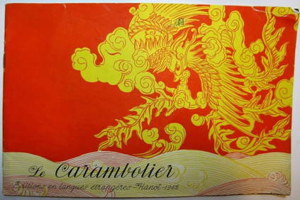
Rare Vietnam Hanoi 1962 French Children's book Comic Le CarambolierLuis Porretta Fine Arts4.3(10)See Sold PriceMar 02, 2024
MARTINET / DE VRIES Catechism of Nature 4 Vol. Set c1788 Engravings Rare!Luis Porretta Fine Arts4.3(10)See Sold PriceMar 02, 2024
JAN VAN DER DESYATER c1732 First Edition Thoughts On Sleepless Nights Rare!Luis Porretta Fine Arts4.3(10)See Sold PriceMar 02, 2024
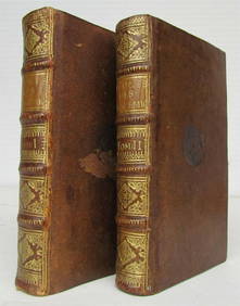
1731 TWO VOLUMES ADVANCED SCIENCE IN FRENCH BY BERNARD FONTENELLENY Elizabeth 4.3(84)See Sold PriceMar 03, 2024