ATLAS of ANTIENT GEOGRAPHY by SAMUEL BUTLER 1843John McInnis Auctioneers,LLC4.6(502)See Sold PriceFeb 24, 2024
18TH C. ANTIQUE MAP: FRENCH & INDIAN WAR, FRAMEDThomaston Place Auction Galleries4.4(386)See Sold PriceFeb 24, 2024
Rand McNally Railroad Map Cabinet w/ 21 Railroad MapsRail & Road Auctions4.6(165)See Sold PriceMar 08, 2024
Keith Haring - Ink on New York Map, Best Buddies, Inscribed, Signed, and DatedSapphire Auction Gallery4(67)See Sold PriceMar 02, 2024
LATE 17TH C. FRENCH MAP OF THE NEW WORLD BY ALEXIS-HUBERT JAILLOT (1632-1712)Thomaston Place Auction Galleries4.4(386)See Sold PriceFeb 24, 2024
Central Railroad of New Jersey Map of Sandy Hook Route-ca. 1903JM Hobby Supply and Railroad Artifact Auctions4.4(126)See Sold PriceFeb 24, 2024
Lot of Six Mixed Atlas Box Cars-HO Scale-New in BoxJM Hobby Supply and Railroad Artifact Auctions4.4(126)See Sold PriceFeb 25, 2024
Rand McNally/Santa Fe Railroad Map of Iowa-1912JM Hobby Supply and Railroad Artifact Auctions4.4(126)See Sold PriceFeb 24, 2024
NICOLAES VISSCHER (NETHERLANDS, 1618-1709) MAP OF THE NEW WORLDThomaston Place Auction Galleries4.4(386)See Sold PriceFeb 24, 2024
17TH C. WORLD MAP BY NICOLAES VISSCHER (NETHERLANDS, 1618-1709)Thomaston Place Auction Galleries4.4(386)See Sold PriceFeb 24, 2024
Lot of Six Mixed Atlas Cabooses-HO Scale-New in BoxJM Hobby Supply and Railroad Artifact Auctions4.4(126)See Sold PriceFeb 25, 2024
US Government Map of Connecticut River, 1838Map: 1838 US Government Map of Connecticut River and Saybrook Harbor -- Map of the Mouth of the Connecticut River and Saybrook Harbour. Reduced from the Orginal Survey of J.W. Adams. Made under the DiSee Sold Price
1838 US Gov Map Of Connecticut River & Saybrook Harbor1838 Us Government Map Of Connecticut River And Saybrook Harbor -- Map Of The Mouth Of The Connecticut River And Saybrook Harbour. Reduced From The Orginal Survey Of J.w. Adams. Made Under The DirectiSee Sold Price
SoldMap of the Mouth of the Connecticut RiverHeading: Author: U.S. Government Title: Map of the Mouth of the Connecticut River and Saybrook Harbour. Reduced from the Original Survey of J.W. Adams, Made under the direction of Capt. W.H. Swift U.See Sold Price
SoldA MAP, "RIVER SABINE FROM ITS MOUTH ON THE GULF OFA MAP, "RIVER SABINE FROM ITS MOUTH ON THE GULF OF MEXICO IN THE SEA TO LOGAN'S FERRY," U.S. GOVERNMENT, 1842, among the most important government maps during the period of Texas independence. It wasSee Sold Price
SoldA MAP, "RIVER SABINE FROM ITS MOUTH ON THE GULF OF MEXIA MAP, "RIVER SABINE FROM ITS MOUTH ON THE GULF OF MEXICO IN THE SEA TO LOGAN'S FERRY," U.S. GOVERNMENT, 1842, among the most important government maps during the period of Texas independence. It wasSee Sold Price
SoldA MAP, "RIVER SABINE FROM ITS MOUTH ON THE GULF OFA MAP, "RIVER SABINE FROM ITS MOUTH ON THE GULF OF MEXICO IN THE SEA TO LOGAN'S FERRY," U.S. GOVERNMENT, 1842, among the most important government maps during the period of Texas independence. It wasSee Sold Price
A MAP, "RIVER SABINE FROM ITS MOUTH ON THE GULF OFA MAP, "RIVER SABINE FROM ITS MOUTH ON THE GULF OF MEXICO IN THE SEA TO LOGAN'S FERRY," U.S. GOVERNMENT, 1842, among the most important government maps during the period of Texas independence. It wasSee Sold Price
Map of the River Sabine surveyed in 1840Title: Map of the River Sabine from its Mouth on the Gulf of Mexico in the Sea to Logan's Ferry...Shewing the Boundary between the United States and the Republic of Texas... Author: U.S. Government DeSee Sold Price
MAP - Connecticut. U.S. Coast SurveyConnecticut. U.S. Coast Survey, Extract from the U.S. Coast Survey New Haven Harbour, 1838 (dated). Black & White. This finely engraved and detailed chart extends from the city of New Haven south to tSee Sold Price
SoldKennebec River and Adjacent Country MaineTitle: The Kennebec River and Adjacent Country Shewing the Routes Examined for a Road from Augusta to the Canada Line in the Direction of Quebec Author: U.S. Government Description: Engraved map. 28x7See Sold Price
SoldR.E. Lee maps St. Houis harbor 1837Title: Map of the Harbor of St. Louis, Mississippi River, Oct. 1837. Surveyed by Lt. R.E. Lee, Corps of Engineers... Author: U.S. Government Description: Engraved map. 42x107 cm. (16½x42").One of thrSee Sold Price
Map of Texas-Oklahoma 1852Title: Map of the Country upon Upper Red-River Explored in 1852 by Capt. R.B. Marcy ... under Orders from the Head Quarters of the U.S. Army Author: U.S. Government Description: Lithographed map. 41x8See Sold Price
SoldMap of Texas-Oklahoma 1852Title: Map of the Country upon Upper Red-River Explored in 1852 by Capt. R.B. Marcy ... under Orders from the Head Quarters of the U.S. Army Author: U.S. Government Description: Lithographed map. 41x8See Sold Price
Map of Texas-Oklahoma 1852Title: Map of the Country upon Upper Red-River Explored in 1852 by Capt. R.B. Marcy ... under Orders from the Head Quarters of the U.S. Army Author: U.S. Government Description: Lithographed map. 41x8See Sold Price
SoldW. Marshall- AtlasMarshall, W. L.- ''Atlas Containing Maps of Chicago River, Illinois and Its Branches, Showing Result of Improvement by the U.S Government Under Direction of Major W.L. Marshall''- Corps of Engineers USee Sold Price
Sold(CHICAGO, ATLAS) MARSHALL, W. L. Atlas Containing(CHICAGO, ATLAS) MARSHALL, W. L. Atlas Containing Maps of Chicago River, Illinois and Its Branches, Showing Result of Improvement by the U.S Government Under Direction of Major W.L. Marshall, Corps ofSee Sold Price
SoldRare map of Sabine River in Texas 1838Title: Sketch of the Sabine River Lake and Pass from Camp Sabine to the Gulf A Distance of about 300 Miles Author: U.S. War Department Description: Lithographed map. 21x88 cm. (8½x34½"), with folds.See Sold Price
SoldMap of Military Road in Oregon 1859Title: Map of a Reconnoisance for a Military Road from the "Dalles" of the Columbia River to the Great Salt Lake under the Command of Capt. H.D. Wallen ... Author: U.S. Government Description: LithogrSee Sold Price
MAP: United States - East Coast. Thames River New York London Harbor Long Island to NorwichDescription: United States - East Coast Connecticut - New York. Thames River/ New York London Harbor Long Island to Norwich. Published at Washington D.C. US Department of Commerce, Environmental ScienSee Sold Price
SoldH. Aston 1851 Percussion Pistol .54 Caliber/SC5H. Aston 1851 Percussion Pistol .54 Caliber with case. Ordered by US 1845 War Dept. of Government, inspected marks. 30,000 made between 1846-1852 Connecticut.See Sold Price
Sold1900 US Government Map of Proportion of AfricanTitle: 1900 US Government Map of Proportion of African American Population -- Proportion of Negro Total Population of the United States at the Twelfth Census 1900 Cartographer: US Department of the InSee Sold Price
Sold1880 US Government Map of US Population Distribution --Title/Content of Map: 1880 US Government Map of US Population Distribution -- Distribution of the Population (Excluding Indians Not Taxed) Cartographer: US Department of the Interior Year/Place: 1880See Sold Price
1900 US Government Map of Proportion of WhiteTitle: 1900 US Government Map of Proportion of White Illiterates Population -- Proportion of Illiterates Among Native White Voters of the United States at the Twelfth Census 1900 Cartographer: US DepaSee Sold Price
Sold1900 US Government Map of US Manufacturing Output -- Value of Products of Manufacturers Per SquareTitle: 1900 US Government Map of US Manufacturing Output -- Value of Products of Manufacturers Per Square Mile at the Twelfth Census 1900 Cartographer: US Department of the Interior Year / Place: 1900See Sold Price
FLYING A TOURING SERVICE U.S. ROAD MAPS TIN WALL DISPLAY.Dan Morphy Auctions4.2(1.3k)See Sold PriceFeb 25, 2024
1885 CIVIL WAR 1ed Famous Memoirs US Grant Sheridan Sherman 6v RARE LOT MapsSchilb Antiquarian Rare Books4.8(421)See Sold PriceMar 10, 2024
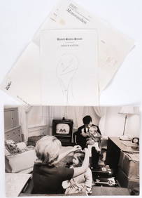
LIFE MAGAZINE UNPUBLISHED TED KENNEDY PHOTOGRAPHJohn McInnis Auctioneers,LLC4.6(502)See Sold PriceFeb 25, 2024
1853 Colton's Railroad & Township Map of Massachusetts, Rhode Island, and ConnecticutRail & Road Auctions4.6(165)See Sold PriceMar 07, 2024
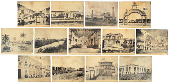
[VIETNAM]. A group of approx. 120 photographs assembled by African American soldier Vernon CliftonFreeman's | Hindman4.4(1.6k)See Sold PriceFeb 27, 2024
William Crothers Fitler (NY,1857-1915) oil painting antiqueBroward Auction Gallery4.8(277)See Sold PriceMay 19, 2024
1838 $20 The Government of Texas Houston, TX Obsolete Bank Note Cut CanceledBK Auctions4.7(1.4k)See Sold PriceFeb 25, 2024
John Senex Map of Louisiana & Mississippi RiverWillow Auction House4.5(283)See Sold PriceMar 14, 2024


![[VIETNAM]. A group of approx. 120 photographs assembled by African American soldier Vernon Clifton (1 of 6)](https://p1.liveauctioneers.com/197/319238/171468143_1_x.jpg?height=282&quality=70&version=1707520367)