SoldTwo Early John Speede MapsThe Kingdome of Persia with the cheef citties and habites described. Sheet size: 22" x 17 1/2" Plate impression visible. Plate size: 20 1/2" x 15 3/4". Hand colored on laid paper.See Sold Price
SoldJohn Speede Map of Britain & 2 other mapsJohn Speede engraving Two Maps of Britain as divided at the time of the Saxons 15 x 20in. New Mappe of the Romane Empire, 15 x 20in and A New Map of Asia, 19 x 22in.See Sold Price
SoldTWO HAND-COLORED MAPS BY JOHN SPEEDE 17th CenturyTWO HAND-COLORED MAPS BY JOHN SPEEDE 17th Century "Anglesey Antiently called Mona" and "Merionethshire Described 1610". Speede alternately spelled Speed. Both 16.5" x 21" sight. Both framed 18" x 22.5See Sold Price
Sold1626 John Speede map Kingdom of Denmark1626 John Speede map of the Kingdom of Denmark- two sheet hand colored map w/ towns, costumes, & types vignettes border, double framed, 16" x 20 1/2"See Sold Price
Sold1610 John Speede Map of Cambridgeshire1610 John Speede hand colored two-sheet map of Cambridgeshire, on laid paper, double sided glass frame, sight 14 3/4" x 20 1/4"See Sold Price
SoldTwo Early Framed Engraved MapsA lot of two early hand-colored engraved maps to include a W. J. Bleau map of Amsterdam, ca. 1634-1635, "Sabaudia Ducatus Savoye", together with a John Speed map of Britain, ca. 1611-1614, "DevonshireSee Sold Price
Sold2 Early Maps of PennsylvaniaDESCRIPTION: Two early maps of Pennsylvania. Includes: 1) 1805 handcolored engraved map by John Carey in two parts. 17" x 21-1/4". Hinged at center. Small pinhole to York County. Light edge toning. CoSee Sold Price
SoldEarly 19th Century hand coloured map of France byEarly 19th Century hand coloured map of France by John Speede, together with a similar map depicting Asia, both framed, 39cm x 52cmSee Sold Price
Sold1626 John Speede London "Mape of Hungri" two sheet1626 John Speede London "Mape of Hungri" two sheet hc mapSee Sold Price
SoldTwo Early English Maps of the United States,Two Early English Maps of the United States, GUTHRIE, William. – DARTON, William. A Map of the United States of America, Agreeable to the Peace of 1783. and GIBSON, John. The British Governments inSee Sold Price
SoldTwo early American mapsDesc: "An Accurate Map of the British Empire in Nth America as settled by the Preliminaries in 1762" by John Gibson published in Gentlesman's Magazine, London 1762; accompanied by "Eastern United StatSee Sold Price
SoldAntique Map LotLot of two antique maps: (1). "Canaan /Â Begun by Mr. John More, continued and finished by John Speede. Anno Domini 1651". English. Hand-colored copperplate engraving. From: Speed, John, The ProspecSee Sold Price
SoldEarly map of Galway dated 1610, "Performet by JohnEarly map of Galway dated 1610, "Performet by John Speede," 15 by 20 inches, framed.See Sold Price
SoldAfter John Speede (1552-1629) British, ‘The Kingdome ofAfter John Speede (1552-1629) British, ‘The Kingdome of Ireland’, Map, with Inscriptions verso, 16" x 21", together with a hunting print, two (2).See Sold Price
Sold2 Antique Maps, c. 1600, Florence & YorkshireTwo Antique Handcolored Maps, c. 1600, Florence by Don Stephano, late 16th c. & Yorkshire by John Speed, early 17th c. {ACGQ7041/2} (TC ) Dimensions: Florence 13.5 x 18.5, framed 20x25; the YorkshireSee Sold Price
SoldPAIR OF CIRCA 1675 ROAD MAPS BY JOHN OGILBYThe Road from CHELMSFORD and the Continuation of the Road from LONDON to the Lands End Part two. Both by John Ogilby. Hand coloring appears early. We happily provide seamless in-house packing and shipSee Sold Price
Sold[Travel & Exploration] Cook, Captain James, The Voyages[Travel & Exploration] Cook, Captain James The Voyages of Captain James Cook Round the World... London and New York: John Tallis & Company, no date (ca. early 1850s). In two volumes. 4to. xx, 596; xi,See Sold Price
Sold(3) EARLY MAPS and a PRINT AFTER WILLIAM BLAKEIncluding: 1886 Fulton's Territory of Alaska, Hawaiian Group or Sandwich Islands, New Zealand, Feejee Islands, 1867 "The World in Two Hemispheres" by Mitchell (colored) and "The Day of Judgement" prinSee Sold Price
SoldThe Coldstream GuardsFive books on the Coldstream guards including "Coldstream Guards 1855 to 1914" written by Sir John Hall 1929, a two volume set 1914 to 1918 from The Oxford University Press 1928, "Early History of theSee Sold Price
SoldTwo Early Maps of Poland,Matthaus Quad, Printed in Cologne, c.1592, detailed map of Southern Poland and the from the Weysel River in the north to the Carpathian Mountains in the south, centered on Auschwitz,Nicholas de Fer, PSee Sold Price
SoldTwo early maps of the United States including Northern Two early maps of the United States including Northern Provinces & Southern Provinces - Drawn and engraved for Thomsons New General Atlas 1817. No. 56 & 57.See Sold Price
SoldLot of Two Early Maps.Includes 17th century Hand Colored Mariette Map of India and Indes Orientales 18" x 24" with huge margins and a Map of Arabia Deserta. 13 1/2" x 16" Black and White.See Sold Price
SoldTwo Early Maps of Poland,Printed in Cologne, c.1592, detailed map of Southern Poland and the from the Weysel River in the north to the Carpathian Mountains in the south, centered on Auschwitz, Nicholas de Fer, Paris 1705, BirSee Sold Price
EARLY 18TH C. MAP OF ITALY, FRAMEDThomaston Place Auction Galleries4.4(394)See Sold PriceFeb 24, 2024
17TH C. MAP OF THE BERKSHIRES BY JOHN SPEED, FRAMEDThomaston Place Auction Galleries4.4(394)See Sold PriceFeb 24, 2024
Joseph Martin Kronheim Pair Early Color Glamor Prints c1850Luis Porretta Fine Arts4.3(10)See Sold PriceMar 02, 2024
AMERICAN SCHOOL (Early 20th c) Two WorksJohn McInnis Auctioneers,LLC4.5(505)See Sold PriceFeb 25, 2024
Hand Colored Map of the city of Amsterdam 1720Global Auctions Company4.3(36)See Sold PriceMar 03, 2024
Early 1990s Chicago Transit Authority Fiberglass Line MapRail & Road Auctions4.6(165)See Sold PriceMar 08, 2024
Battle of the Nile: Disposition of the English & French Fleets, at the Commencement of the Action,Trillium Antique Prints & Rare Books4.5(33)See Sold PriceFeb 24, 2024
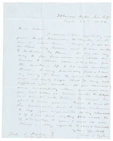
1850 California gold rush letter from Fred Snyder to brotherPBA Galleries4.7(389)See Sold PriceMar 07, 2024
THE ANTIQUE ILLUSTRATED BOOK "1856 ARCTIC EXPLORATIONS: SECOND GIRNEL EXPEDITION 2" BY E. KANENY Elizabeth 4.1(88)See Sold PriceMar 03, 2024


![[Travel & Exploration] Cook, Captain James, The Voyages (1 of 3)](https://p1.liveauctioneers.com/65/192593/97105651_1_x.jpg?height=282&quality=70&version=1611610147)