ATLAS of ANTIENT GEOGRAPHY by SAMUEL BUTLER 1843John McInnis Auctioneers,LLC4.5(494)See Sold PriceFeb 24, 2024
18TH C. ANTIQUE MAP: FRENCH & INDIAN WAR, FRAMEDThomaston Place Auction Galleries4.4(386)See Sold PriceFeb 24, 2024
Rand McNally Railroad Map Cabinet w/ 21 Railroad MapsRail & Road Auctions4.6(165)See Sold PriceMar 08, 2024
Keith Haring - Ink on New York Map, Best Buddies, Inscribed, Signed, and DatedSapphire Auction Gallery3.9(67)See Sold PriceMar 02, 2024
LATE 17TH C. FRENCH MAP OF THE NEW WORLD BY ALEXIS-HUBERT JAILLOT (1632-1712)Thomaston Place Auction Galleries4.4(386)See Sold PriceFeb 24, 2024
Central Railroad of New Jersey Map of Sandy Hook Route-ca. 1903JM Hobby Supply and Railroad Artifact Auctions4.4(126)See Sold PriceFeb 24, 2024
Lot of Six Mixed Atlas Box Cars-HO Scale-New in BoxJM Hobby Supply and Railroad Artifact Auctions4.4(126)See Sold PriceFeb 25, 2024
Rand McNally/Santa Fe Railroad Map of Iowa-1912JM Hobby Supply and Railroad Artifact Auctions4.4(126)See Sold PriceFeb 24, 2024
NICOLAES VISSCHER (NETHERLANDS, 1618-1709) MAP OF THE NEW WORLDThomaston Place Auction Galleries4.4(386)See Sold PriceFeb 24, 2024
17TH C. WORLD MAP BY NICOLAES VISSCHER (NETHERLANDS, 1618-1709)Thomaston Place Auction Galleries4.4(386)See Sold PriceFeb 24, 2024
Lot of Six Mixed Atlas Cabooses-HO Scale-New in BoxJM Hobby Supply and Railroad Artifact Auctions4.4(126)See Sold PriceFeb 25, 2024
SoldThree framed Beers atlas local Dutchess County handThree framed Beers atlas local Dutchess County hand colored maps including Rhinebeck, Rhinecliff, and Red Hook. Published in 1867. Provenance: Private donation to the Northern Dutchess Hospital in RhiSee Sold Price
SoldThree framed local maps including Dutchess County NY,Three framed local maps including Dutchess County NY, Putnam County NY, and a hand colored City of Poughkeepsie. All in good condition, late 19th to early 20th century.See Sold Price
Antique Hand Colored Maps of Dutchess County, NY.Antique Hand Colored Maps of Dutchess County, NY. This lot includes three 19th century hand colored maps from the "Atlas of New York and Vicinity" by F.W. Beers. Includes one map of Hyde Park, one mapSee Sold Price
Antique Hand Colored Maps of Dutchess County, NYAntique Hand Colored Maps of Dutchess County, NY. This lot includes three 19th century hand colored maps from the "Atlas of New York and Vicinity" by F.W. Beers. Includes one map of Hyde Park, one mapSee Sold Price
Antique Hand Colored Maps of Dutchess County, NYAntique Hand Colored Maps of Dutchess County, NY. This lot includes three 19th century hand colored maps from the "Atlas of New York and Vicinity" by F.W. Beers. Includes one map of Pleasant Valley anSee Sold Price
Antique Hand Colored Maps of Dutchess County, NYAntique Hand Colored Maps of Dutchess County, NY. This lot includes three 19th century hand colored maps from the "Atlas of New York and Vicinity" by F.W. Beers. Includes one map of Pleasant Valley anSee Sold Price
Antique Hand Colored Maps of Dutchess County, NYAntique Hand Colored Maps of Dutchess County, NY. This lot includes three 19th century hand colored maps from the "Atlas of New York and Vicinity" by F.W. Beers. Includes one map of Hyde Park, one mapSee Sold Price
SoldAntique Hand Colored Maps of Dutchess County, NY.Antique Hand Colored Maps of Dutchess County, NY. This lot includes three 19th century hand colored maps from the "Atlas of New York and Vicinity" by F.W. Beers. Includes one map of Hyde Park, one mapSee Sold Price
Antique Hand Colored Maps of Dutchess County, NYAntique Hand Colored Maps of Dutchess County, NY. This lot includes three 19th century hand colored maps from the "Atlas of New York and Vicinity" by F.W. Beers. Includes one map of Hyde Park, one mapSee Sold Price
SoldFive framed Dutchess County maps, probably from BeersFive framed Dutchess County maps, probably from Beers Atlas, 1860's. Including Dover Plains, Union Vale, Pleasant Valley, Amenia, Channingville. All with newer cherry frames in excellent condition.See Sold Price
SoldThree hand colored maps of Dutchess County areaThree hand colored maps of Dutchess County area including a Beers map of Unionvale, and 2 of Dutchess itself. All circa 1860-70.See Sold Price
SoldAntique Hand Colored Maps of Westchester County NYAntique Hand Colored Maps of Westchester County NY. This lot includes three 19th century hand colored maps including two from F.W. Beers "Atlas of New York and Vicinity" and one unmarked. Includes oneSee Sold Price
SoldAtlas of New York and Vicinity by F.W. Beers -Atlas of New York and Vicinity by F.W. Beers - Published by Beers, Ellis, and Soule - New York 1867. Includes hand colored maps of NYC, Westchester, Putnam and Dutchess Counties. Complete. Some use weSee Sold Price
SoldAtlas of New York and Vicinity by F.W. Beers -Atlas of New York and Vicinity by F.W. Beers - Published by Beers, Ellis, and Soule - New York 1867. Includes hand colored maps of NYC, Westchester, Putnam and Dutchess Counties. Complete. Fishkill onSee Sold Price
SoldAntique Hand Colored Maps of Fairfield County CTAntique Hand Colored Maps of Fairfield County CT. This lot includes three 19th century hand colored maps from the "Atlas of Fairfield County CT" by F.W. Beers. Includes one map of Bethel, one map of DSee Sold Price
Antique Hand Colored Maps of Fairfield County CTAntique Hand Colored Maps of Fairfield County CT. This lot includes three 19th century hand colored maps from the "Atlas of Fairfield County CT" by F.W. Beers. Includes one map of Bethel, one map of DSee Sold Price
SoldENGLISH MAPS. SAXTON, CHRISTOPHER. c. 1540-c. 1610. Three English county maps.ENGLISH MAPS. SAXTON, CHRISTOPHER. c. 1540-c. 1610. Three English county maps. Engraved maps, hand colored, matted and framed, comprising: Mongomery comitatus qui olim pars Ordovicum; Cardigan comitatSee Sold Price
SoldLocal Interest: A framed hand coloured map of theLocal Interest: A framed hand coloured map of the county of Buckinghamshire, engraved by J. Cary, published by John Stockdale, 1805. Approx. 21'' x 14''See Sold Price
SoldGrouping of 1867 Beer's Atlas Maps from WestchesterGrouping of 1867 Beer's Atlas Maps from Westchester, Putnam and Dutchess CountiesSee Sold Price
Sold1875 BEERS ATLAS MIDDLESEX COUNTY MASS:1875 1ST EDITION F. W. BEERS ATLAS OF MIDDLESEX COUNTY MASSACHUSETTS: Consisting of 106 hand colored plates. Measures 16 inches x 13 inches. Leather cover. Some wear, oldrebound, foxing, stains.See Sold Price
Sold1872 BEERS ATLAS ESSEX COUNTY MASS1872 1ST EDITION F. W. BEERS ATLAS OF ESSEX COUNTY MASSACHUSETTS: Consisting of 58 hand colored plates. Measures 17 inches x 14 inches. Leather cover. Some wear, foxing, old rebound, stains.See Sold Price
SoldThree 19th century photo albums with many good images,Three 19th century photo albums with many good images, most of local Dutchess County NY families. Includes 2 CDV albums (2 Civil War soldier CDV's, tintype & CDV's of theatrical performers in PoughkeeSee Sold Price
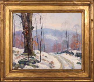
SoldFramed Beers Atlas Page New Haven Connecticut 1863Framed plan of the Fair Haven section of New Haven Connecticut. From the page of Beers New Haven County Atlas 1863. Good overall, not inspected out of frame. Minor foxing and toning.See Sold Price
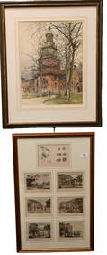
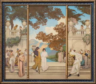
Lot Of 2: Framed Prints.Lot consists of 1- "New Illustrated Atlas Of Dutchess County" advertisement for the Reading Publishing House, also offering "Maps & Atlases" as well as "Historical Works & Charts." The print is CopyriSee Sold Price
BONAPARTE, Joseph-Napoleon (1764-1844). Autograph Letter Si...Potter & Potter Auctions4.6(538)See Sold PriceMar 07, 2024
Vintage Chinese Porcelain Items, Two Total, Table Screen and Figurines on StandNorthgate Gallery, Inc.4.4(34)See Sold PriceMar 02, 2024
MARGUERITE THOMPSON ZORACH (1887-1968) "THREE FIGURES".Amelia Jeffers, Auctioneers & Appraisers4.6(97)See Sold PriceMar 07, 2024