ATLAS of ANTIENT GEOGRAPHY by SAMUEL BUTLER 1843John McInnis Auctioneers,LLC4.6(502)See Sold PriceFeb 24, 2024
18TH C. ANTIQUE MAP: FRENCH & INDIAN WAR, FRAMEDThomaston Place Auction Galleries4.4(386)See Sold PriceFeb 24, 2024
Rand McNally Railroad Map Cabinet w/ 21 Railroad MapsRail & Road Auctions4.6(165)See Sold PriceMar 08, 2024
Keith Haring - Ink on New York Map, Best Buddies, Inscribed, Signed, and DatedSapphire Auction Gallery4(67)See Sold PriceMar 02, 2024
LATE 17TH C. FRENCH MAP OF THE NEW WORLD BY ALEXIS-HUBERT JAILLOT (1632-1712)Thomaston Place Auction Galleries4.4(386)See Sold PriceFeb 24, 2024
Central Railroad of New Jersey Map of Sandy Hook Route-ca. 1903JM Hobby Supply and Railroad Artifact Auctions4.4(126)See Sold PriceFeb 24, 2024
Lot of Six Mixed Atlas Box Cars-HO Scale-New in BoxJM Hobby Supply and Railroad Artifact Auctions4.4(126)See Sold PriceFeb 25, 2024
Rand McNally/Santa Fe Railroad Map of Iowa-1912JM Hobby Supply and Railroad Artifact Auctions4.4(126)See Sold PriceFeb 24, 2024
NICOLAES VISSCHER (NETHERLANDS, 1618-1709) MAP OF THE NEW WORLDThomaston Place Auction Galleries4.4(386)See Sold PriceFeb 24, 2024
17TH C. WORLD MAP BY NICOLAES VISSCHER (NETHERLANDS, 1618-1709)Thomaston Place Auction Galleries4.4(386)See Sold PriceFeb 24, 2024
Lot of Six Mixed Atlas Cabooses-HO Scale-New in BoxJM Hobby Supply and Railroad Artifact Auctions4.4(126)See Sold PriceFeb 25, 2024
Tallis: Antique Map of Peru & Bolivia, 1851Map: Peru & Bolivia Cartographer: Tallis / Rapkin Place & Date: London / 1851 Size: 9 3/4" x 13 1/4" Condition: outline color; overall age toning Tallis' beautifully illustrated map of Peru and BoliviSee Sold Price
Tallis / Rapkin: Antique Map of Peru & Bolivia, 1851Title/Content of Map: 'Peru & Bolivia' The map shows Peru & Bolivia in 1851, at which time Bolivia still had a sea coast (Litoral) adjacent to the Atacama desert which it subsequently lost in the WarSee Sold Price
Tallis / Rapkin: Antique Map of South America, 1849Title/Content of Map: 'South America' This fascinating map shows Peru & Bolivia unified as the short-lived PeruBolivian Confederation, although this had ceased to exist in 1839. It also shows a unitedSee Sold Price
SoldTallis / Rapkin: Peru, BoliviaCartographer: Tallis / Rapkin Place & Date: London / 1851 Size: 9 3/4" x 13 1/4" Condition: outline color; overall age toning Tallis' beautifully illustrated map of Peru and Bolivia ncludes four charmSee Sold Price
Malte-Brun: Antique Map of Peru & Bolivia, 1836TITLE/CONTENT OF MAP: 'Perou et Bolivia' The borders of both Bolivia and Peru differ markedly from those of today, due to the several wars that have been fought in the intervening period. Notably, theSee Sold Price
Colton: Antique Map of Peru & Bolivia, 1859Title/Content of Map: Peru & Bolivia by Colton Date Printed: 1859 Cartographer: H.J. Colton Material/Medium: Paper Size: 17 1/2" x 15" Hand colored, engraved Map. Published in New York in Colton's 'GeSee Sold Price
Tallis: Antique Map of Boston, 1851Title/Content of Map: 1851 Tallis Map of Boston -- Boston Date Printed: 1851, London Cartographer: J Tallis Size: 9.5 x 12.5 in. A very attractive map of Boston, offering great deal of detail of streeSee Sold Price
Tallis: Antique Map of Boston, 1851Map: 1851 Tallis Map of Boston -- Boston Cartographer: J Tallis Year / Place: 1851, London Map Dimensions: 9.5 x 12.5 in. Condition: Excellent. Excellent print and hand color. Virtually no toning. A vSee Sold Price
Tallis: Antique Map of Tartary, 1851Map: 1851 Tallis Map of Tartary -- Independent Tartary Cartographer: J. Tallis Year / Place: 1851 London Dimensions: 10 x 13 in. Condition: Very Good. Slight age toning on edges, Issued center fold. TSee Sold Price
Tallis: Antique Map of Europe, 1851Map: 1851 Tallis Map of Europe -- Europe Cartographer: J Tallis Year / Place: 1851, London Map Dimensions: 9.5 x 12.5 in. Condition: Very good. Nice strike and nice hand color of vignettes and outlineSee Sold Price
Colton: Antique Map of Peru and Bolivia, 1855Title/Content of Map: 1855 Colton's Map of Peru and Bolivia -- Colton's Map of Peru and Bolivia Date Printed: 1855, Philadelphia Cartographer: J Colton Size: 13.3 X 15.8 in. Handsome and highly detailSee Sold Price
Tallis: Antique Map of Boston, 1851Title/Content of Map: 1851 Tallis Map of Boston -- Boston Date Printed: 1851, London Cartographer: J Tallis Size: 9.5 x 12.5 in. A very attractive map of Boston, offering great deal of detail of streeSee Sold Price
SoldTallis: Antique Map of Europe, 1851Map: 1851 Tallis Map of Europe -- Europe Cartographer: J Tallis Year / Place: 1851, London Dimensions: 9.5 x 12.5 in. Condition: Very good. Nice strike and nice hand color of vignettes and outline hanSee Sold Price
Tallis: Antique Map of Tartary, 1851Title/Content of Map: 1851 Tallis Map of Tartary -- Independent Tartary Date Printed: 1851 London Cartographer: J. Tallis Size: 10 x 13 in. This is an ornate and highly decorative map illustrates IndeSee Sold Price
1855 Colton's Antique Map of Peru and BoliviaTitle/Content of Map: 1855 Colton's Map of Peru and Bolivia -- Colton's Map of Peru and Bolivia Date Printed: 1855, Philadelphia Cartographer: J Colton Size: 13.3 X 15.8 in. Handsome and highly detailSee Sold Price
1855 Colton's Antique Map of Peru and BoliviaTitle/Content of Map: 1855 Colton's Map of Peru and Bolivia -- Colton's Map of Peru and Bolivia Date Printed: 1855, Philadelphia Cartographer: J Colton Size: 13.3 X 15.8 in. Handsome and highly detailSee Sold Price
PERU & BOLIVIA. Bolivia with Atacama litoral.PotosiTITLE/CONTENT OF MAP: 'Peru & Bolivia' The map shows Peru & Bolivia in 1851, at which time Bolivia still had a sea coast (Litoral) adjacent to the Atacama desert which it subsequently lost in the WarSee Sold Price
PERU & BOLIVIA: Bolivia with Atacama litoral.PotosiTITLE/CONTENT OF MAP: 'Peru & Bolivia' The map shows Peru & Bolivia in 1851, at which time Bolivia still had a sea coast (Litoral) adjacent to the Atacama desert which it subsequently lost in the WarSee Sold Price
PERU & BOLIVIA: Bolivia with Atacama litoral.PotosiTITLE/CONTENT OF MAP: 'Peru & Bolivia' The map shows Peru & Bolivia in 1851, at which time Bolivia still had a sea coast (Litoral) adjacent to the Atacama desert which it subsequently lost in the WarSee Sold Price
Tallis: Antique Map of North America, 1851Title/Content of Map: 1851 Tallis Map of North America -- North America Date Printed: 1851, London Cartographer: J Tallis Size: 14 x 9.5 in. This is a decorative and striking steel engraved map of NorSee Sold Price
SoldTallis: Antique Map of North America, 1851Map: 1851 Tallis Map of North America -- North America Cartographer: J Tallis Year / Place: 1851, London Map Dimensions: 14 x 9.5 in. Condition: Very good. Nice strike and nice hand color of vignettesSee Sold Price
SoldTallis: Antique Map of North America, 1851Title/Content of Map: 1851 Tallis Map of North America -- North America Date Printed: 1851 London Cartographer: J. Tallis Size: 14 x 9.5 in. Condition: Very good - good, some age toning mostly in margSee Sold Price
Tallis: Antique Map of North America, 1851Map: 1851 Tallis Map of North America -- North America Cartographer: J. Tallis Year / Place: 1851 London Dimensions: 14 x 9.5 in. Condition: Very good - good, some age toning mostly in margins and cenSee Sold Price
Tallis: 3 Antique Maps of Russia, 1851Title/Content of Map: 1851 Three Tallis Maps of Russia in Europe, Russia in Asia, Tartary, all in Book -- The History of Russia containing Russia in Asia; Part of Russia and Independent Tartary; RussiSee Sold Price
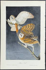
Audubon - Common Osprey Fish Hawk. 15Trillium Antique Prints & Rare Books4.5(30)See Sold PriceFeb 24, 2024
Audubon, Imperial Folio - American Cross Fox. 6Trillium Antique Prints & Rare Books4.5(30)See Sold PriceFeb 24, 2024
Audubon, Imperial Folio - Canada Lynx. 16Trillium Antique Prints & Rare Books4.5(30)See Sold PriceFeb 24, 2024
NORTHERN AFRICA. Morocco Tunisia Algeria. Caravan routes. RAPKIN/TALLIS 1851 mapJasper524.5(9.8k)See Sold PriceFeb 28, 2024
AFRICA. Map pre-dating much exploration. Mountains of Kong. SDUK 1851 oldJasper524.5(9.8k)See Sold PriceFeb 28, 2024
WEST AFRICA I Explorers' routes Senegal Ashanti Ivory Gold Coast. SDUK 1851 mapJasper524.5(9.8k)See Sold PriceFeb 28, 2024
WEST AFRICA II. NIGERIA. Bight of Benin-Lake Chad. Yariba Houssa. SDUK 1851 mapJasper524.5(9.8k)See Sold PriceFeb 28, 2024
NORTH AFRICA OF BABRBARY V Parts of Tripoli & Egypt. Libya Tribes. SDUK 1851 mapJasper524.5(9.8k)See Sold PriceFeb 28, 2024
AFRICA. Shows Mountains of Kong/the Moon. Caravan routes. RAPKIN/TALLIS 1851 mapJasper524.5(9.8k)See Sold PriceFeb 28, 2024
WESTERN AFRICA.Kong Mountains.Caravan routes.Slave Coast.TALLIS/RAPKIN 1851 mapJasper524.5(9.8k)See Sold PriceFeb 28, 2024
NORTHERN AFRICA. Morocco Tunisia Algeria. Caravan routes.TALLIS/RAPKIN 1851 mapJasper524.5(9.8k)See Sold PriceFeb 28, 2024
NORTHERN AFRICA. Morocco Tunisia Algeria. Caravan routes. RAPKIN/TALLIS 1851 mapJasper524.5(9.8k)See Sold PriceFeb 28, 2024