SoldSTEVENS, JAMES. A Topographical Map of the StaSTEVENS, JAMES. A Topographical Map of the State of Rhode Island and Providence Plantations. Hand-colored engraved wall map, 1120x740 mm; few cracks in paper without loss, marginal dampstaining bleediSee Sold Price
SoldFramed Topographical Map of the State of Rhode IsFramed Topographical Map of the State of Rhode Island and Providence Plantations, after James Stevens, 1831, mounted on canvas, (toning, tears, losses, foxing), 44 x 27 3/4 in.See Sold Price
A Topographical Map of the State of Rhode Island andA Topographical Map of the State of Rhode Island and Providence Plantations, Surveyed Trigonometrically by James Stevens, Topographer and Civil Engineer, with Additions and Corrections By S.B. CushingSee Sold Price
Sold-. Lloyd (James) Lloyd's New Map of the United Sta-. Lloyd (James) Lloyd's New Map of the United States the Canadas and New Brunswick from the Latest Surveys, double-sided folded map, of the United States to the Dakotas, Indian Territory, KanSee Sold Price
SoldFowler and Moyer topographical map California Pa.Artist: Fowler, T.M., and James B. Moyer Title: California, Washington County, Pennsylvania Date: 1902 Medium: chromolithograph Dimensions: 10.2 x 18.6 inches Edition Number: Signature: Printed in plaSee Sold Price
Lot Of 2: Collection of Topographical Map of New1) Topographical maps, produced in 1972 by the Department of the Interior's Geological survey, many of which were formally in the possession of Congressman James C. Cleveland, New Hampshire. The largeSee Sold Price
Map of Johnson's Island Prison Camp Near Sandusky, OhioMap of Johnson's Island Prison Camp Near Sandusky, Ohio Pen and ink drawing, 9.75 x 13 in., by Captain James T. Hogane, Topographical Engineer, CSA. Hogane drew at least three known full-color maps foSee Sold Price
Lloyd Map of the Mississippi River, 1863LLOYD, James T. (19th Century). Lloyd's Map of the Lower Mississippi River from St. Louis to the Gulf of Mexico. Compiled from Government Surveys in the Topographical Bureau. Lithographed map with oriSee Sold Price
SoldTennent. Ceylon, 1859Tennent (Sir James Emerson) Ceylon, an Account of the Island, Physical, Historical, and Topographical,third edition, 4 maps, 2 folding, 1 torn at folds, plate, text-illustrations, contemporarySee Sold Price
Maps - Northamptonshire from Lewis' TopographicalMaps - Northamptonshire from Lewis' Topographical Dictionary, engraved by J&C Wallace; Kingdoms of Spain and Portugal by James Wyld engraved by Stockley; Chart of the World on Mercators Projection, haSee Sold Price
Maps - Northamptonshire from Lewis' TopographicalMaps - Northamptonshire from Lewis' Topographical Dictionary, engraved by J&C Wallace; Kingdoms of Spain and Portugal by James Wyld engraved by Stockley; Chart of the World on Mercators Projection, haSee Sold Price
SoldTribes of the Territories of Washington and NebraskaStevens ( Governor of Washington Territory and Superintendent of Indian Affairs) Isaac Ingalls and William H. Carlton ( Surveyor and topographical engineer) Portion of the map of the Indian nations anSee Sold Price
Tribes of the Territories of Washington and NebraskaStevens ( Governor of Washington Territory and Superintendent of Indian Affairs) Isaac Ingalls and William H. Carlton ( Surveyor and topographical engineer) Portion of the map of the Indian nations anSee Sold Price
Sold1871 Topographical Atlas of Massachusetts, Walling1871 Atlas of Massachusetts complete with twenty-six hand colored printed maps of individual counties and cities with New England and U.S. Map included. Atlas titled, "OFFICIAL TOPOGRAPHICAL ATLAS OFSee Sold Price
SoldAntique Framed Map of Cork, Ireland by I.DowerHand-colored map of Cork. Engraved by I. Dower. Drawn and engraved for Lewis Topographical Dictionary. The overall measurement of the map, 11" x 8.5-8". Framed measurement, 9.75" x 12.75".See Sold Price
SoldJames Abbott McNeill Whistler (1834-1903, MA,England), J. Young, and C. A. Knight, engraving-US Coast Guard Survey Map of Anacapa Island in the Santa Barbara Channel, 1854, by Lieut. T. H. Stevens. Shows Smiths or Blunt's Island, Washington. PlaSee Sold Price
SoldJames T. Lloyd/ PublisherJames T. Lloyd/ Publisher, "Lloyd's Map of the Lower Mississippi River from St. Louis to the Gulf of Mexico. Compiled from Government surveys in the Topographical Bureau, Washington, D.C.. Revised andSee Sold Price
SoldAbert explores New Mexico with map 1848Heading: Author: Abert, James William Title: Report of the Secretary of War, communicating... a report and map of the examination of New Mexico, made by Lieutenant J.W. Abert, of the topographical coSee Sold Price
SoldLANMAN, James H. (1812–1887). History of Michigan,LANMAN, James H. (1812–1887). History of Michigan, civil and topographical, in a compendious form; with a view of the surrounding lakes. New York: E. French, 1839. 8vo. [2 blanks], xvi, [1]-398pp.,See Sold Price
SoldEphemera, maps and facsimilies - a mized collectionEphemera, maps and facsimilies - a mized collection: The Kentish Town Panorama, drawn by James Frederick King with a commentary by John Richardson, The London Topographical Society, London 1986, a folSee Sold Price
SoldWW2 USAAF Radar Navigation Charts, Japan (5pc)WW2 USAAF Radar Navigation Charts, Japan (5pc). This lot includes 5 Radar Navigation Charts prepared by the 949th Engineer Aviation Topographical Company" of the following: (1) Radar Navigation Chart-See Sold Price
Simpson explores the Great Basin w/mapHeading: Author: Simpson, James H. Title: The Shortest Route to California Illustrated by a History of Explorations of the Great Basin of Utah with its Topographical and Geological Character and SomeSee Sold Price
SoldSimpson explores the Great Basin w/mapHeading: Author: Simpson, James H. Title: The Shortest Route to California Illustrated by a History of Explorations of the Great Basin of Utah with its Topographical and Geological Character and SomeSee Sold Price
SoldAbert's Examination of New Mexico 1848Heading: Author: Abert, James W. Title: Report of the Secretary of War, communicating...a report and map of the examination of New Mexico, made by Lieutenant J.W. Abert, of the topographical corps. PSee Sold Price
THOMAS MOULE 1837 Colored Map of Warwickshire Framed vgcLuis Porretta Fine Arts4.3(10)See Sold PriceMar 02, 2024
Group of 15 Printed or Lithographed Items, including: litho...Potter & Potter Auctions4.6(550)See Sold PriceMar 07, 2024
Steven Bauer Signed Autographed Baseball Scarface "Manny" Inscribed JSA S71463Mynt Auctions4.6(711)See Sold PriceFeb 24, 2024
Andrew Stevens Sam Jones Signed Autographed TV Script Code Red JSA JJ39915Mynt Auctions4.6(711)See Sold PriceFeb 25, 2024
1834 Malte-Brun Map of the Caribbean -- West India IslandsJasper524.5(9.9k)See Sold PriceFeb 27, 2024
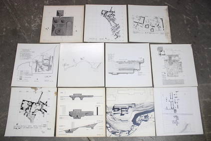
Set of 11 Mid Century Modern Architectural Plans & Site Map RenderingsPUBLIC SALE4.7(227)See Sold PriceMar 02, 2024
WEST AFRICA Explorers' routes Senegal Ashanti. Mountains of Kong. SDUK 1857 mapJasper524.5(9.9k)See Sold PriceFeb 28, 2024
AFRICA. Map pre-dating much exploration. Mountains of Kong. SDUK 1851 oldJasper524.5(9.9k)See Sold PriceFeb 28, 2024
Connie Stevens Signed 11x14 Custom Matted Photo Display (JSA COA)3 Kings Auction4.1(205)See Sold PriceFeb 25, 2024
James Cook - Antique map Australia titled 'Gezigt van het Eil. Suffren'. Antique map of SuffrenProverde Auctions4.3(3)See Sold PriceFeb 28, 2024
Antique Map - Views on the coast of Asia. J. Webber del. Engraved after J. Webber and W. Bligh.Proverde Auctions4.3(3)See Sold PriceFeb 28, 2024
James Cook - Map of the Friendly Isles - Tonga IslandsProverde Auctions4.3(3)See Sold PriceFeb 28, 2024