SoldBLUEBACK CHART "A NEW CHART OF THE NORTH SEA, OR GERMANBLUEBACK CHART "A NEW CHART OF THE NORTH SEA, OR GERMAN OCEAN."Dated 1840Published by M. Blachford.Approx. 37.75" x 50.5".See Sold Price
TWO BLUEBACK CHARTS BY E. & G.W. BLOUNT, NEW YORK 1) "TWO BLUEBACK CHARTS BY E. & G.W. BLOUNT, NEW YORK 1) " ... Sheet No. 2 From Cape Lookout to Cape Carnaveral [sic]...". Circa 1860. 47.5" x 32.25". 2) "Chart of the South Atlantic Ocean ...". Circa 184See Sold Price
A New & Accurate Chart of the Discoveries of Captn CookTITLE OF MAP (NOT PRINTED ON THE PAGE):'A New & Accurate Chart of the Discoveries of Captn Cook & other Later Circumnavigators : Exhibiting the whole coast of New South Wales, shewing the situations oSee Sold Price
SoldBowen chart of Atlantic Ocean 1744Title: A New & Accurate Chart of the Western or Atlantic Ocean Drawn from Surveys and Most Approved Maps & Charts Author: Bowen, Emanuel Description: Copper-engraved chart, later hand-coloring in outlSee Sold Price
A New & Accurate Chart of the Discoveries of Captn CookTITLE OF MAP (NOT PRINTED ON THE PAGE):'A New & Accurate Chart of the Discoveries of Captn Cook & other Later Circumnavigators : Exhibiting the whole coast of New South Wales, shewing the situations oSee Sold Price
A New & Accurate Chart of the Discoveries of Captn Cook… CONDER 1794 old mapTitle: A New & Accurate Chart of the Discoveries of Captn Cook… CONDER 1794 old map Description: A New & Accurate Chart of the Discoveries of Captn Cook & other Later Circumnavigators : ExhibitiSee Sold Price
Antique Map - North Atlantic Ocean - Chart of Atlantic Ocean - Thomas Bowen - 18thCentury"A New & Accurate Chart of the Western or Atlantic Ocean Drawn from the Most Approved Modern Maps &c" by Bowen, Thomas. Finely engraved small chart centered on the Atlantic, including a small part ofSee Sold Price
SoldBlunt's New Chart of South Atlantic Ocean 1828Title: Blunt's New Chart of the South Atlantic Ocean. Revised, Improved & Engraved according to the latest Spanish & Other Surveys Author: Blunt, E. & G.W. Description: Engraved blueback chart. 87x123See Sold Price
SoldThomas Bowen,1778, Map, Western Atlantic Ocean"Thomas Bowen, London 1778, A New & Accurate Chart of the Western or Atlantic Ocean Drawn from Surveys and most approved Maps & Charts" by Thomas Bowen. Hand colored, modern framing. Dimensions:SightSee Sold Price
SoldMap, Bowen, Western Atlantic, 1778Map of the Western Atlantic Ocean, Thomas Bowen, London 1778, A New & Accurate Chart of the Western or Atlantic Ocean Drawn from Surveys and most approved Maps & Charts, map of the Atlantic and contigSee Sold Price
TWO 18TH CENTURY ENGRAVED MAPSTWO 18TH CENTURY ENGRAVED MAPS Comprising 'New & Complete Mercator Chart of the World', hand colored engraving and 'A New & Accurate Chart of the Western or Atlantic Ocean' by Thomas Bowen, 1788, engrSee Sold Price
SoldEmanuel Bowen (1694-1767), "A New and Accurate ChartEmanuel Bowen (1694-1767), "A New and Accurate Chart of the Western or Atlantic Ocean," 1788, matted and mounted, hand colored, H. - 10 in., W. - 12 1/2 in.See Sold Price
SoldEmanuel Bowen (1693-1767, "A New and Accurate Chart ofEmanuel Bowen (1693-1767, "A New and Accurate Chart of the Western Atlantic Ocean," 1778, H.- 9 in., W.- 14 1/2 in.See Sold Price
SoldBLUEBACK CHART OF THE CAROLINA COAST 19th CenturyBLUEBACK CHART OF THE CAROLINA COAST19th CenturyPublished by E. & G.W. Blunt, New York. Detailed with Carolina harbor vignettes.Approx. 27.25" x 38".See Sold Price
SoldBLUEBACK CHART OF THE NORTH ATLANTIC OCEAN PublishedBLUEBACK CHART OF THE NORTH ATLANTIC OCEANPublished 1844Published by E. & G.W. Blunt, New York. Marked with numerous navigational notations in pen and pencil.Approx. 38" x 48.5".See Sold Price
Sold(MAP) BOWEN, EMANUAL. A New and Accurate Chart of the W(MAP) BOWEN, EMANUAL A New and Accurate Chart of the World. Drawn from Authentic Surveys, assisted by the most approved modern Maps & Charts... London, 1747. Engraved world map, Mercator projection, uSee Sold Price
SoldHeather (William) A New and Accurate Chart of theHeather (William) A New and Accurate Chart of the Coast of Norway,with large inset New Chart of the White Sea, this with smaller inset harbour plans including Archangel, the main chart also coSee Sold Price
Antique Map - Chart of America - Andrea Scacciati - Giuseppe Pazzi - LivornoThis wonderful engraving " Nuova ed esatta Carla Della America Ricavata dalle Mappe, e Carte piu approvate " (New and Accurate Chart of America Derived from the Most Approved Maps and Charts.) originaSee Sold Price
SoldFOUR BLUEBACK CHARTS OF CANADA AND THE EAST COAST OFFOUR BLUEBACK CHARTS OF CANADA AND THE EAST COAST OF THE UNITED STATES1) Coast of the United States from New York to Cape Fear, published by the U.S. Government, dated 1886.2) Bahama Banks and Gulf ofSee Sold Price
SoldJOHN WILLIAM NORIE (1772-1843) BLUE BACK NAUTICAL CHART"A New Chart of the West Coast of South America from Truxillo to Panama, including the Galapagos Islands and Plans of the Principal Harbors". Drawn from the Best Spanish Surveys by J.W. Norie, HydrogrSee Sold Price
EARLY HANDSOME BLUE BACK SEA CHART - BRITAIN toHeather, William M. (1793 - 1812) & Stephenson, John (fl. c. 1790 - 1836). New Chart of the Atlantic Or Western Ocean Improved by W. Heather. c. 1809. 37" x 45 " sheet Extensive sailing grids, compassSee Sold Price
MAP, Spain & Portugal, BowenSpain & Portugal. Emanuel Bowen, A New & Accurate Map of Spain and Portugal. Drawn from Surveys Assisted by ye Most Approved Modern Maps and Charts..., from The Maps and Charts to the Modern Part of tSee Sold Price
Sold(Maps and Charts, North America), Bowen, Thomas, A(Maps and Charts, North America), Bowen, Thomas, A New & Accurate Map of North America Drawn from the Most Authentic Modern Maps and Charts, 1777, taken from Middleton's Complete System of Geography,See Sold Price
SoldTwo maps and a chart of North AmericaDescription: Map 1:This antique map came from Johnson's New Illustrated (Steel Plate) Family Atlas, published, by A.J. Johnson. These maps are some of the most colorful and accurate maps produced in tSee Sold Price
CHART "LONG ISLAND SOUND FROM NEW YORK TO MONTOCK POINT ..." New York, 1830 21" x 77" sight. FramedEldred's4.7(423)See Sold PriceFeb 27, 2024
Medicine.- Kennedy (James) The History of the Contagious Cholera, first edition, 1831 & others (11)Forum Auctions4.4(54)See Sold PriceFeb 29, 2024
Windward Islands and Spanish Main from the Latest Surveys 1860Jasper524.5(9.9k)See Sold PriceFeb 27, 2024
South Namibia coast. Walvis Bay-Orange River ADMIRALTY sea chart 1881 (1954) mapJasper524.5(9.9k)See Sold PriceFeb 28, 2024
CHARTS: United States - East Coast New Jersey/ PASSAIC AND HACKENSACK RIVERSChurchill Galleries3.7(217)See Sold PriceFeb 26, 2024
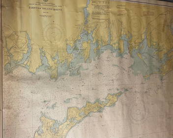
CHART: UNITED STATES - EAST COAST/ RHODE ISLAND - CONNECTICUT - NEW YORK/ Fishers IslandChurchill Galleries3.7(217)See Sold PriceFeb 26, 2024
CHART: UNITED STATES - EAST COAST NEW YORK/ HUDSON RIVER/ POUGHKEEPSIE TO HUDSONChurchill Galleries3.7(217)See Sold PriceFeb 26, 2024