ATLAS of ANTIENT GEOGRAPHY by SAMUEL BUTLER 1843John McInnis Auctioneers,LLC4.6(504)See Sold PriceFeb 24, 2024
18TH C. ANTIQUE MAP: FRENCH & INDIAN WAR, FRAMEDThomaston Place Auction Galleries4.4(389)See Sold PriceFeb 24, 2024
Rand McNally Railroad Map Cabinet w/ 21 Railroad MapsRail & Road Auctions4.6(165)See Sold PriceMar 08, 2024
Keith Haring - Ink on New York Map, Best Buddies, Inscribed, Signed, and DatedSapphire Auction Gallery4.1(67)See Sold PriceMar 02, 2024
LATE 17TH C. FRENCH MAP OF THE NEW WORLD BY ALEXIS-HUBERT JAILLOT (1632-1712)Thomaston Place Auction Galleries4.4(389)See Sold PriceFeb 24, 2024
Central Railroad of New Jersey Map of Sandy Hook Route-ca. 1903JM Hobby Supply and Railroad Artifact Auctions4.4(126)See Sold PriceFeb 24, 2024
Lot of Six Mixed Atlas Box Cars-HO Scale-New in BoxJM Hobby Supply and Railroad Artifact Auctions4.4(126)See Sold PriceFeb 25, 2024
Rand McNally/Santa Fe Railroad Map of Iowa-1912JM Hobby Supply and Railroad Artifact Auctions4.4(126)See Sold PriceFeb 24, 2024
NICOLAES VISSCHER (NETHERLANDS, 1618-1709) MAP OF THE NEW WORLDThomaston Place Auction Galleries4.4(389)See Sold PriceFeb 24, 2024
17TH C. WORLD MAP BY NICOLAES VISSCHER (NETHERLANDS, 1618-1709)Thomaston Place Auction Galleries4.4(389)See Sold PriceFeb 24, 2024
Lot of Six Mixed Atlas Cabooses-HO Scale-New in BoxJM Hobby Supply and Railroad Artifact Auctions4.4(126)See Sold PriceFeb 25, 2024
Southern Hemisphere of London, Thomson 1817 MapTitle/content of Map: 'southern Hemisphere, Projected on the Plane of the Horizon of London' This Map Is Folding Hence the Centrefold Line May Show on the Image Below date Printed: 1817 image Size: ApSee Sold Price
Southern hemisphere… on the plane of the horizon of London. THOMSON 1817 mapTITLE/CONTENT OF MAP: 'Southern hemisphere, projected on the plane of the horizon of London' DATE PRINTED: 1817 IMAGE SIZE: Approx 61.0 x 53.0cm, 24 x 20.75 inches (Large); Please note that this is aSee Sold Price
Thomson: Antique Map of Southern Hemisphere, 1817Title/Content of Map: 'Southern hemisphere, projected on the plane of the horizon of London' Date Printed: 1817 Image Size: Approx 61.0 x 53.0cm, 24 x 20.75 inches (Large); Please note that this is aSee Sold Price
Thomson: Antique Map of the Southern Hemisphere, 1817Title/Content of Map: 'Southern hemisphere, projected on the plane of the horizon of London' Date Printed: 1817 Image Size: Approx 61.0 x 53.0cm, 24 x 20.75 inches (Large); Please note that this is aSee Sold Price
Thomson: Antique Map of the Southern Hemisphere, 1817TITLE/CONTENT OF MAP: 'Southern hemisphere, projected on the plane of the horizon of London' DATE PRINTED: 1817 IMAGE SIZE: Approx 61.0 x 53.0cm, 24 x 20.75 inches (Large); Please note that this is aSee Sold Price
Southern Hemisphere, Thomson 1817 MapTitle/content of Map: 'southern Hemisphere' This Map Is Folding Hence the Centrefold Line May Show on the Image Below date Printed: 1817 image Size: Approx 53.0 X 52.5cm, 20.75 X 20.75 Inches (large);See Sold Price
Southern hemisphere Antarctic Australia South America/Africa. THOMSON 1817 mapTITLE/CONTENT OF MAP: 'Southern hemisphere' DATE PRINTED: Published in 1817 IMAGE SIZE: Approx 53.0 x 52.5cm, 20.75 x 20.75 inches (Large); Please note that this is a folding map. TYPE: Antique earlySee Sold Price
Northern hemisphere… on the plane of the horizon of London. THOMSON 1817 mapTITLE/CONTENT OF MAP: 'Northern hemisphere, projected on the plane of the horizon of London' A large map centred on London. The map was published at a time when Africa's internal geography was littleSee Sold Price
Southern hemisphere… on the plane of the horizon of London. THOMSON 1830 mapTITLE/CONTENT OF MAP: 'Southern hemisphere, projected on the plane of the horizon of London' DATE PRINTED: 1830 IMAGE SIZE: Approx 59.0 x 53.0cm, 23.25 x 20.75 inches (Large); Please note that this isSee Sold Price
SoldMap of the Southern HemisphereMap of the Southern Hemisphere: Projected on the plane of the horizon of London. Thomson's New General Atlas 1816. Hand-colored engraving. Size: 23.5" x 21", 60 x 53 cm (sight); 33" x 30", 84 x 76 cmSee Sold Price
Southern hemisphere on the plane of the horizon ofTITLE/CONTENT OF MAP: 'Southern hemisphere, projected on the plane of the horizon of London' DATE PRINTED: 1817 IMAGE SIZE: Approx 61.0 x 53.0cm, 24 x 20.75 inches (Large); Please note that this is aSee Sold Price
"Southern hemisphere on the plane of the horizon ofTITLE/CONTENT OF MAP: 'Southern hemisphere, projected on the plane of the horizon of London' DATE PRINTED: 1817 IMAGE SIZE: Approx 61.0 x 53.0cm, 24 x 20.75 inches (Large); Please note that this is aSee Sold Price
Southern Part of Ireland Map 1817Drawn and engraved for Thomson's New General Atlas 1817. Together with a print map "A Balloon View of London." 20 1/2"h x 24"wSee Sold Price
SoldThomson, Northern Hemisphere, 1814.Northern Hemisphere Projected on a plane of the horizon of London by Geo. Buchanan. Double-page engraved map of the Northern Hemisphere and portions of the Southern Hemisphere, engraved by J. & G. MenSee Sold Price
SoldThomson/Hewitt Map, 1817 Southern Provinces of US"Map of the Southern Provinces of the United States", drawn and engraved by N. R. Hewitt, published by John Thomson, Edinburgh, John Cumming, Dublin, and Baldwin, Cradock, and Joy, London, 1817. FromSee Sold Price
SoldSouthern Hemisphere Maps - Strahan, London[Southern Hemisphere Maps], "A Chart of the Southern Hemisphere showing the Tracks of some of the Most Distinguished Navigators by Captain James Cook of His Majesty's Navy", engraved map, published bySee Sold Price
Western hemisphere. North / South America. Polynesia. THOMSON 1817 old mapTITLE/CONTENT OF MAP: 'Western hemisphere' DATE PRINTED: Published in 1817. Engraved in 1815; this date is marked on the map IMAGE SIZE: Approx 54.0 x 53.0cm, 21.25 x 20.75 inches (Large); Please noteSee Sold Price
Eastern hemisphere. Europe Africa Asia Australasia. THOMSON 1817 old mapTITLE/CONTENT OF MAP: 'Eastern hemisphere' DATE PRINTED: Published in 1817. Engraved in 1815; this date is marked on the map IMAGE SIZE: Approx 55.5 x 53.5cm, 21.75 x 21 inches (Large); Please note thSee Sold Price
Eastern hemisphere. Europe Asia Africa Australasia. THOMSON 1817 old mapTITLE/CONTENT OF MAP: 'Eastern hemisphere' DATE PRINTED: Published in 1817 IMAGE SIZE: Approx 55.0 x 53.0cm, 21.5 x 20.75 inches (Large); Please note that this is a folding map. TYPE: Antique early 19See Sold Price
E. Hemisphere: Europe Africa Asia Australasia 1817 MapEastern Hemisphere. Europe Africa Asia Australasia. Thomson 1817 Old Map. Title/content of Map: 'eastern Hemisphere' This Map Is Folding Hence the Centrefold Line May Show on the Image Below date PrinSee Sold Price
Thomson: Antique Map of Southern Hemisphere, 1816Southern Hemisphere Projected on the Plane of the Horizon of London A fascinating southern hemisphere focused on the "Antarctic Ocean" and encompasing Australia, New Zealand and all of Oceania, from TSee Sold Price
Northern hemisphere. Arctic Europe Asia Africa America. THOMSON 1817 old mapTITLE/CONTENT OF MAP: 'Northern hemisphere' DATE PRINTED: Published in 1817. Engraved on 12th August 1814; this date is marked on the map IMAGE SIZE: Approx 56.5 x 53.0cm, 22.25 x 20.75 inches (Large)See Sold Price
MAP - Dufour, A. H. ( Malte / Brun ) :MAP - ESPAGNE PARTIE SUD DIVISEE EN PROVINCES ANCIENNES ( MAPLuis Porretta Fine Arts4.3(10)See Sold PriceMar 02, 2024
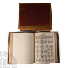
Numismatic Books - Rudding's Coinage of Britain Vol I-III, Plus SuplementTimeLine Auctions Ltd.4.6(182)See Sold PriceMar 09, 2024
1816 MAP SOUTHERN PART OF RUSSIA or MUSCOVY in EUROPE copper engraving ANTIQUEJasper524.5(9.8k)See Sold PriceFeb 27, 2024
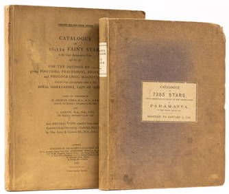
Astronomy.- Richardson (William) A Catalogue of 7385 Stars, chiefly in the Southern Hemisphere,Forum Auctions4.3(53)See Sold PriceFeb 29, 2024
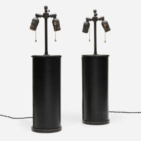
In the manner of Jacques Adnet, Table lamps, pairToomey & Co. Auctioneers4.7(391)See Sold PriceFeb 29, 2024
West Indies Islands. Guadaloupe. | Mariegalante &C. | Antigua.Jasper524.5(9.8k)See Sold PriceFeb 27, 2024
Pre-colonial Africa. Mountains of Kong/Moon. Caravan routes. THOMSON 1817 mapJasper524.5(9.8k)See Sold PriceFeb 28, 2024
Stanford, Edward 1901 Large Map. Geological Map of the British IslesAlbion Auctions4.6(341)See Sold PriceMar 01, 2024
Paterson & Mogg 1822 Pair of British Road Maps. Deal, Hythe, Shoreham, ChichesterAlbion Auctions4.6(341)See Sold PriceMar 01, 2024
1849 Hand Colored Blair Map of World in HemispheresMatthew Bullock Auctioneers4.7(1.8k)See Sold PriceMar 02, 2024
ANTIQUE ILLUSTRATED HANDBOOK OF GEOGRAPHY AND TRAVEL IN ASIA, VOLUME 2, 1896NY Elizabeth 4.3(85)See Sold PriceMar 03, 2024
Antique Map - Views on the coast of Asia. J. Webber del. Engraved after J. Webber and W. Bligh.Proverde Auctions4.3(3)See Sold PriceFeb 28, 2024