ATLAS of ANTIENT GEOGRAPHY by SAMUEL BUTLER 1843John McInnis Auctioneers,LLC4.6(502)See Sold PriceFeb 24, 2024
18TH C. ANTIQUE MAP: FRENCH & INDIAN WAR, FRAMEDThomaston Place Auction Galleries4.4(386)See Sold PriceFeb 24, 2024
Rand McNally Railroad Map Cabinet w/ 21 Railroad MapsRail & Road Auctions4.6(165)See Sold PriceMar 08, 2024
Keith Haring - Ink on New York Map, Best Buddies, Inscribed, Signed, and DatedSapphire Auction Gallery4(67)See Sold PriceMar 02, 2024
LATE 17TH C. FRENCH MAP OF THE NEW WORLD BY ALEXIS-HUBERT JAILLOT (1632-1712)Thomaston Place Auction Galleries4.4(386)See Sold PriceFeb 24, 2024
Central Railroad of New Jersey Map of Sandy Hook Route-ca. 1903JM Hobby Supply and Railroad Artifact Auctions4.4(126)See Sold PriceFeb 24, 2024
Lot of Six Mixed Atlas Box Cars-HO Scale-New in BoxJM Hobby Supply and Railroad Artifact Auctions4.4(126)See Sold PriceFeb 25, 2024
Rand McNally/Santa Fe Railroad Map of Iowa-1912JM Hobby Supply and Railroad Artifact Auctions4.4(126)See Sold PriceFeb 24, 2024
NICOLAES VISSCHER (NETHERLANDS, 1618-1709) MAP OF THE NEW WORLDThomaston Place Auction Galleries4.4(386)See Sold PriceFeb 24, 2024
17TH C. WORLD MAP BY NICOLAES VISSCHER (NETHERLANDS, 1618-1709)Thomaston Place Auction Galleries4.4(386)See Sold PriceFeb 24, 2024
Lot of Six Mixed Atlas Cabooses-HO Scale-New in BoxJM Hobby Supply and Railroad Artifact Auctions4.4(126)See Sold PriceFeb 25, 2024
South America. BLAEU. Guiana sive Amazonum Regio.BLAEU, Johannes. Guiana sive Amazonum Regio.Amsterdam, 1630Acquaforte di 375x500 mm. Coloritura coeva. Bell’esemplare.La magnifica mappa mostra la Guyana in Sud America con tre cartigli, una rosSee Sold Price
SoldAmericas.- South America.- Blaeu (Willem Jansz.) GuianaAmericas.- South America.- Blaeu (Willem Jansz.) Guiana sive Amazonum Regio, map extending from the Isla Margarita in the northwest to the coast of northern Brazil near Sao Luis east of the Amazon delSee Sold Price
South America.- Blaeu (Johann & Willem) Guiana, siSouth America.- Blaeu (Johann & Willem) Guiana, sive Amazonum Regio,coast of Guyana, ornamental cartouche, ships at battle, engraved map with hand-colouring, 380 x 500mm., Latin text on verso,See Sold Price
SoldBLAEU, WILLEM. Guiana sive Amazonum Regio.BLAEU, WILLEM. Guiana sive Amazonum Regio. Double-page engraved map of northeastern South America showing a large mythical Lake Parime with El Dorado on the upper coast. 21x24 inches sheet size, wideSee Sold Price
Blaeu map of Guiana and Amazon, c.1640Title: Guiana sive Amazonum Regio Author: Blaeu, Willem Description: Copper-engraved map, hand-colored; colored cartouche. 37x49 cm. (14½x19½").Northeast portion of South America, with the Amazona aSee Sold Price
SoldBlaeu. GUIANA SIVE AMAZONVM REGIO. [ca. 1635].[South America]. Willem Blaeu. GUIANA SIVE AMAZONVM REGIO. Amst: [c. 1635]. 14 5/8” x 19 ½”. Double-page engraved map, uncolored, with handsome foliated title cartouche, compass rose, engraved shSee Sold Price
SoldHondius, ''Guiana Sive Amazonum Regio,'' [ca. 163[South America]. Henricus Hondius. Guiana Sive Amazonum Regio. Double-page engraved map, c.1630s. 14 5/8 x 18 7/8 inches. Hand-colored outline, with color to scale, cartouche, and ships.See Sold Price
SoldSouth America.- Brazil.- Jansson (Jan) Guiana siveSouth America.- Brazil.- Jansson (Jan) Guiana sive Amazonum Regio, map of Guiana illustrating the coastline from the Isla Margarita in the northwest to the coast of northern Brazil near Sao Luis eastSee Sold Price
SoldHondius Family map of GuianaCartographer: Hondius Family Title: Guiana sive Amazonum Regio Subject: South America, Guyana, Suriname Published: Amsterdam Date: c. 1630 Description: Hondius's map shows Guiana (Guyana), which is doSee Sold Price
1631 W. Blaeu - Guiana sive Amazonum Regio [fabledTitle: Guiana sive Amazonum Regio "Map maker: Willem Blaeu" "Place and Year: Amsterdam, 1631" "Dimensions: 49.3 x 37.6 cm (19.4 x 14.8 in)" "Technique: Copperplate engraving" "Coloring: Hand color" "CSee Sold Price
SoldGuiana Sive Amazonum RegioHendrick Hondius (1573–1650). Amsterdam: Hondius, c. 1636. 15 1/2 x 20 inches. A rare old color example of the English edition of Henricus Hondius’ map of the coast of South America, between the OSee Sold Price
MAP, Northern South America, MontanusGuyana, Suriname, French Guiana. Arnoldus Montanus, Guiana sive Amazonum Regio, 1671 (circa). Black & White. This decorative map covers the region from the Isla Margarita in the northwest to the coastSee Sold Price
MAP - Northern South America. JanssonGuyana, Suriname, French Guiana. Jan Jansson, Guiana sive Amazonum Regio, 1666 (circa). Black & White. This striking map of Guiana covers the coastline from the Isla Margarita in the northwest to theSee Sold Price
Sold17th Century S. American Map and Engraving, 2 item1st item: A framed 17th century colored engraved map titled "Guiana Sive Amazonum Regio". Showing the North East coast of South America between the Orinoco river and the Amazon and the inlanSee Sold Price
SoldHondius map of Guiana and Amazon, c.1633Title: Guiana sive Amazonum Regio Author: Hondius, Henricus Description: Copper-engraved map, hand-colored; colored cartouche. 37x49 cm. (14½x19½").Northeast portion of South America, with the AmazoSee Sold Price
SoldHondius map of Guiana and Amazon, c.1633Title: Guiana sive Amazonum Regio Author: Hondius, Henricus Description: Copper-engraved map, hand-colored; colored cartouche. 37x49 cm. (14½x19½").Northeast portion of South America, with the AmazoSee Sold Price
SoldGuiana siue Amazonum Regio. [Ca. 1640.][SOUTH AMERICA/GUIANA]. Guiana Siue Amazonum Regio. Amst: Blaeu, ca.1640. 14 1/2 x 19 1/4. Doublepage engraving, contemporary and later color, with lake Parime Lucus. Wide margins, tack hole in each cSee Sold Price
SoldCartografia - Willem Blaeu Guiana sive Amazonum RegioCarta geografica incisa in rame ed in coloritura coeva, [Amsterdam, 1662], testo latino al verso, mm 490 x 375, leggera brunitura uniforme, piccolo strappo al margine inferiore bianco in prossimità dSee Sold Price
SoldBlaeu (Willem) Guiana sive Amazonum RegioBlaeu (Willem) Guiana sive Amazonum Regiodecorative title cartouche, ships in battle and a sea monster, with Trinidad and Tobago upper left, engraved map with hand-colouring, 380 x 495mm., LatSee Sold Price
Blaeu map of Guiana and Amazon, c.1640Heading: Author: Blaeu, Willem Title: Guiana sive Amazonum Regio Place Published: Amsterdam Publisher: Date Published: c.1640 Description: Copper-engraved map, hand-coloredSee Sold Price
SoldBlaeu (J & W) Guiana, sive Amazonum RegioBlaeu (J & W) Guiana, sive Amazonum Regiocoast of Guyana, ornamental cartouche, ships at battle, engraved map with hand-colouring, 375 x 495mm., French text on verso, light creasing to centralSee Sold Price
Blaeu Map of GuianaBlaeu, Willem (1571-1638). Guiana sive Amazonum Regio. Engraved map with original hand color. Amsterdam, c. 1640. 18 1/2” x 22 3/4” sheet. Nice map extending from the Isla Margarita in the northweSee Sold Price
SoldWillem Blaeu (1571 - 1638) hand-colored engraved map,Willem Blaeu (1571 - 1638) hand-colored engraved map, Guiana Sive Amazonum Regio, Amsterdam, 1640, plate size 14 3/4" x 19 1/2".See Sold Price
Blaeu: Antique Map of Amazon & Mythical Incan City 1631Title: Guiana sive Amazonum Regio Map maker: Willem Blaeu Place and Year: Amsterdam, 1631 Dimensions: 49.3 x 37.6 cm (19.4 x 14.8 in) Technique: Copperplate engraving Coloring: Hand color Condition RaSee Sold Price
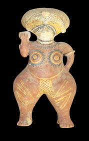
5.5/16" Pre Columbian Pottery Figurine, Painted Red, South AmericaHeartland Artifact Auctions Inc4.7(780)See Sold PriceFeb 25, 2024
Large Human Effigy Pottery Vessel, Nicely Painted, Pre Columbian Pottery Vessle, South America. 14"Heartland Artifact Auctions Inc4.7(780)See Sold PriceFeb 25, 2024
Hand Crafted / Painted Pottery Dish Signed by "Callen Eldui La Serena Chile" South America PotteryHeartland Artifact Auctions Inc4.7(780)See Sold PriceFeb 25, 2024
1 1/2" Pre Columbian Pottery Face Effigy Head Mayan Aztec found in South AmericaHeartland Artifact Auctions Inc4.7(780)See Sold PriceFeb 25, 2024
Two Mother-of-Pearl Relicario Medallions of Jesus.Turner Auctions + Appraisals4.3(311)See Sold PriceFeb 24, 2024
4 3/16" Ancient Inca Stone Mace. South America. Motley COATony Putty Artifacts4.7(404)See Sold PriceMar 09, 2024
Collection 60 pages stamps South America and America 18-1900sBazaar of Persia4.3(23)See Sold PriceFeb 24, 2024
Schomburgk - The Comuti or Taquiare (Taquiari) Rock on the River EssequiboTrillium Antique Prints & Rare Books4.5(30)See Sold PriceFeb 24, 2024
Schomburgk - Pirara and Lake Amucu, The Site of El DoradoTrillium Antique Prints & Rare Books4.5(30)See Sold PriceFeb 24, 2024
Map: An 18thC engraved and hand coloured map of North America and South America, titled DeClaydon Auctioneers Ltd4.3(125)See Sold PriceFeb 26, 2024
1822 MAP of NORTH & SOUTH AMERICA GEOGRAPHICAL STATISTICAL HISTORICAL antiqueJasper524.5(9.8k)See Sold PriceFeb 27, 2024
7" Jade Pre-Colombian Tirona Batwing Gorget, 2000 Yrs Old, found in Tirona Colombia South America,Heartland Artifact Auctions Inc4.7(780)See Sold PriceMar 10, 2024
8 3/8" Jade Pre-Colombian Tirona Batwing Gorget, 2000 Yrs Old, found in Tirona Colombia SouthHeartland Artifact Auctions Inc4.7(780)See Sold PriceMar 10, 2024
5" Olmec God Effigy Pre-Colombian Pendant, South AmericaHeartland Artifact Auctions Inc4.7(780)See Sold PriceMar 10, 2024
5" Pre-Colombian Obsidian 3-sided Dagger, South AmericaHeartland Artifact Auctions Inc4.7(780)See Sold PriceMar 10, 2024


![Blaeu. GUIANA SIVE AMAZONVM REGIO. [ca. 1635]. (1 of 5)](https://p1.liveauctioneers.com/179/49347/23134493_1_x.jpg?height=282&quality=70&version=1388425910)


![Guiana siue Amazonum Regio. [Ca. 1640.] (1 of 1)](https://p1.liveauctioneers.com/179/10971/2682769_1_x.jpg?height=282&quality=70&version=1162265652)