ATLAS of ANTIENT GEOGRAPHY by SAMUEL BUTLER 1843John McInnis Auctioneers,LLC4.6(502)See Sold PriceFeb 24, 2024
18TH C. ANTIQUE MAP: FRENCH & INDIAN WAR, FRAMEDThomaston Place Auction Galleries4.4(386)See Sold PriceFeb 24, 2024
Rand McNally Railroad Map Cabinet w/ 21 Railroad MapsRail & Road Auctions4.6(165)See Sold PriceMar 08, 2024
Keith Haring - Ink on New York Map, Best Buddies, Inscribed, Signed, and DatedSapphire Auction Gallery4(67)See Sold PriceMar 02, 2024
LATE 17TH C. FRENCH MAP OF THE NEW WORLD BY ALEXIS-HUBERT JAILLOT (1632-1712)Thomaston Place Auction Galleries4.4(386)See Sold PriceFeb 24, 2024
Central Railroad of New Jersey Map of Sandy Hook Route-ca. 1903JM Hobby Supply and Railroad Artifact Auctions4.4(126)See Sold PriceFeb 24, 2024
Lot of Six Mixed Atlas Box Cars-HO Scale-New in BoxJM Hobby Supply and Railroad Artifact Auctions4.4(126)See Sold PriceFeb 25, 2024
Rand McNally/Santa Fe Railroad Map of Iowa-1912JM Hobby Supply and Railroad Artifact Auctions4.4(126)See Sold PriceFeb 24, 2024
NICOLAES VISSCHER (NETHERLANDS, 1618-1709) MAP OF THE NEW WORLDThomaston Place Auction Galleries4.4(386)See Sold PriceFeb 24, 2024
17TH C. WORLD MAP BY NICOLAES VISSCHER (NETHERLANDS, 1618-1709)Thomaston Place Auction Galleries4.4(386)See Sold PriceFeb 24, 2024
Lot of Six Mixed Atlas Cabooses-HO Scale-New in BoxJM Hobby Supply and Railroad Artifact Auctions4.4(126)See Sold PriceFeb 25, 2024
SoldScarce 1700s British Map of the East IndiesCreator: Edward Wells (British, 1667-1727). Based on map by Nicholas de Fer (1646-1720). Engraver: Sutton Nicholls (British, 1668-1729). Title: "A new map of the East Indies, taken from Mr. de Fer's mSee Sold Price
Philip Cluver - Isles de L'inde OrientalePhilip Cluver - Isles de L'inde Orientale Scarce map of the East Indies by Philip Cluver. Originally issued in the early 1600s, this is a reissue from the early 18th century. With outline hand-colorinSee Sold Price
SoldMap of East Indies (Southeast Asia) by Colton, 1854Original engraving from A General Atlas by J.H. Colton, 1854. Map features decorative border and color key shows the Dutch, British, Spanish and Portugesse Possession. Dimensions: 17 1/4” x 20”See Sold Price
Speed Map of East Indies*** START PRICE IS THE RESERVE *** [Asia] SPEED, John (1552-1629). A New Map of East India. Engraved map. London: 1676. 17" x 21 1/2" sheet. Comparable: Bloomsbury Auctions, 2013 - £1,769. The mSee Sold Price
Thomas Jeffreys Map of East IndiesBritish, 18th century, engraving with hand coloring, map depicting "The East Indies, with the Roads". By Thomas Jefferys, Geographer to the King. MDCCLXVIII. The Second edition. To the directorsSee Sold Price
SoldScarce Spanish maps of Africa & East AsiaHeading: Author: Lopez de Vargas Machuca, Thomas Title: Two maps by Thomas Lopez de Vargas Machuca, of Africa and the East Indies Place Published: Madrid Publisher: Date Published: 1792 <See Sold Price
SoldLate 18th Century British Map of the Caribbean andLate 18th Century British Map of the Caribbean and Adjacent LandsThe West Indies including Part of Virginia, North Carolina, South Carolina, Georgia, East Florida, West Florida, Louisiana and the GulfSee Sold Price
SoldBlair (John) The East IndiesBlair (Rev'd John) The East Indies, including more particularly the British Dominions on the Continent of India,India and Ceylon, engraved map by Kitchin, 425 x 570mm., central vertical fold,See Sold Price
SoldBlair's map of India 1773Title: The East Indies including more particularly the British Dominions on the Continent of India.... Author:Blair, John Description:Copper-engraved map. 42.2x56.7 cm. (16½x22¼"). Detailed map of ISee Sold Price
Blair (Rev. John) The East IndiesBlair (Rev. John) The East Indiesincluding more particularly The British Dominions on the Continent of India, engraved map by Thomas Kitchin, 430 x 575mm., on Whatman laid paper, watermarked 1See Sold Price
SoldBlair (John) The East IndiesBlair (John) The East Indies, including more particularly the British Dominions on the Continent of India,engraved map by Kitchin, 425 x 570mm., 2 vertical folds, light offsetting, a few nicksSee Sold Price
SoldLe Bruyn Views of Russia and PersiaPont-Alla-Werdie-Chan, No. 77. Cornelius Le Bruyn (1652 – 1726/7). Engraving from Travels into Muscovy, Persia and Part of the East Indies.... London: A. Bettersworth & C. Hitch...,1737. 13 3/4 x 16See Sold Price
Le Bruyn Views of Russia and PersiaRoute D'Amsterdam a Moscow et de la a Ispahan et Gamron, No. 1. Cornelius Le Bruyn (1652 – 1726/7). Engraving from Travels into Muscovy, Persia and Part of the East Indies.... London: A. BetterswortSee Sold Price
Le Bruyn Views of Russia and PersiaAstrakan, No. 32. Cornelius Le Bruyn (1652 – 1726/7). Engraving from Travels into Muscovy, Persia and Part of the East Indies.... London: A. Bettersworth & C. Hitch...,1737. 13 3/4 x 16 or 25 1/2 inSee Sold Price
Le Bruyn Views of Russia and PersiaArchangel, No. 18. Cornelius Le Bruyn (1652 – 1726/7). Engraving from Travels into Muscovy, Persia and Part of the East Indies.... London: A. Bettersworth & C. Hitch...,1737. 13 3/4 x 16 or 25 1/2 iSee Sold Price
Le Bruyn Views of Russia and PersiaVeronis, No. 15. Cornelius Le Bruyn (1652 – 1726/7). Engraving from Travels into Muscovy, Persia and Part of the East Indies.... London: A. Bettersworth & C. Hitch...,1737. 13 3/4 x 16 or 25 1/2 incSee Sold Price
Le Bruyn Views of Russia and PersiaA Tres-haut et tres-puissant Price Pierre Alexewitz Empereur de Russie, No. 2. Cornelius Le Bruyn (1652 – 1726/7). Engraving from Travels into Muscovy, Persia and Part of the East Indies.... London:See Sold Price
West Indies, Pt Manzanilla to San Juan 1844 British Admiralty MapScarce original 1844 British Admiralty Nautical Chart West Indies, Sheet XI, from Pt Manzanilla to San Juan De Nicaragua, Surveyed by Commander E. Barnett 1837. London Published according to Act of PaSee Sold Price
West Indies, Cape Gracias to Belize 1843 British Admiralty MapScarce original 1843 British Admiralty Nautical Chart: West Indies, Sheet XIII, from Cape Gracias to Belize Surveyed by Commanders R. Owen and E. Barnett. 1830 - 39. Published according to Act of ParlSee Sold Price
West Indies, Providence, Windward, Cuba 1834 British Admiralty MapScarce Original 1834 British Admiralty Nautical Chart: West Indies, Sheet II, From the Providence Channels to the Windward Passage ty Commander Richard Owen 1831-32. Cuba from the Spanish Survey of 18See Sold Price
West Indies, Eastern Cuba 1881 British Admiralty Nautical MapScarce Original 1877 British Admiralty Nautical Chart: West Indies Cuba The Eastern Portion From a Chart Published At The Hydrographical Office Madrid, 1837. Corrected From Surveys and Observations bySee Sold Price
West Indies, Western Cuba 1879 British Admiralty Nautical MapScarce Original 1879 British Admiralty Nautical Chart: West Indies Cuba the Western Portion From a Chart Published at the Hydrographical Office Madrid 1837. Corrected from Surveys and Observations bySee Sold Price
ASIA/EAST INDIES British India Siam French Indochina 1912 old antique mapTITLE/CONTENT OF MAP: 'Commercial Chart of The Far East' DATE PRINTED: 1912 IMAGE SIZE: Approx 33.5 x 43.5cm, 13.25 x 17 inches (Large); Please note that this is a folding map. TYPE: Antique colour atSee Sold Price
Two Very Scarce U.S. Navy Sea Charts of Gulf of MexicoU.S. Navy Hydrographic Office. Gulf of Mexico, West Indies and Caribbean Sea from the Most Recent U.S. Coast Survey Spanish and British Admiralty Charts Sheet I. Lithogaphed map with hand color. 1869.See Sold Price
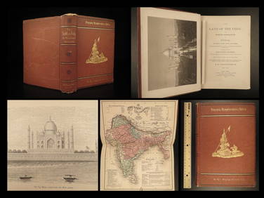
1872 INDIA Land of the Veda Travel Exploration Voyages Hindu Sepoy RebellionSchilb Antiquarian Rare Books4.8(421)See Sold PriceMar 31, 2024
[ARCTIC]. BOWEN, Emanuel. A New & Accurate Map of the North...Potter & Potter Auctions4.6(539)See Sold PriceMar 07, 2024
Tour of the Dutch East Indies, with exceptional platesPBA Galleries4.7(381)See Sold PriceMar 07, 2024
Churchill & Nieuhof 1744 Folio Map. Cape of Good Hope, South AfricaAlbion Auctions4.6(336)See Sold PriceMar 01, 2024
Churchill & Nieuhof 1744 Folio Map. Batavia Indonesia East IndiesAlbion Auctions4.6(336)See Sold PriceMar 01, 2024
Churchill & Nieuhof 1744 Map. Batavia Jakarta IndonesiaAlbion Auctions4.6(336)See Sold PriceMar 01, 2024
Blackie (Pub) 1882 Folio Map. East Indies - Indian ArchipelagoAlbion Auctions4.6(336)See Sold PriceMar 01, 2024


![[ARCTIC]. BOWEN, Emanuel. A New & Accurate Map of the North... (1 of 1)](https://p1.liveauctioneers.com/928/318880/171360917_1_x.jpg?height=282&quality=70&version=1707501302)


