SAMUEL AUGUSTUS MITCHELL - COUNTY MAP OF TEXAS, 1860Samuel Augustus Mitchell - County Map Of Texas, 1860 - 22 X 17 3/4 In. - This Giclée Print Is Gallery Stretched And Ready To Hang Or Lean Against A Wall, Or Display On An Easel. - A Giclée Print IsSee Sold Price
SAMUEL AUGUSTUS MITCHELL - COUNTY MAP OF TEXAS, 1860Samuel Augustus Mitchell - County Map Of Texas, 1860 - Giclée On Canvas - 22 X 17 3/4 In. - A Giclée Print Is The Highest Quality Print Available Today. Because There Is No Visible Dot Screen PatterSee Sold Price
SAMUEL AUGUSTUS MITCHELL - COUNTY MAP OF TEXAS, 1860Samuel Augustus Mitchell - County Map Of Texas, 1860 - Giclée On Canvas - 22 X 17 3/4 In. - A Giclée Print Is The Highest Quality Print Available Today. Because There Is No Visible Dot Screen PatterSee Sold Price
SAMUEL AUGUSTUS MITCHELL - COUNTY MAP OF TEXAS, 1860Samuel Augustus Mitchell - County Map Of Texas, 1860 - Giclée On Canvas - 22 X 17 3/4 In. - A Giclée Print Is The Highest Quality Print Available Today. Because There Is No Visible Dot Screen PatterSee Sold Price
SAMUEL AUGUSTUS MITCHELL - COUNTY MAP OF TEXAS, 1860Samuel Augustus Mitchell - County Map Of Texas, 1860 - Giclée On Canvas - 22 X 17 3/4 In. - A Giclée Print Is The Highest Quality Print Available Today. Because There Is No Visible Dot Screen PatterSee Sold Price
SAMUEL AUGUSTUS MITCHELL - COUNTY MAP OF TEXAS, 1860Samuel Augustus Mitchell - County Map Of Texas, 1860 - Giclée On Canvas - 22 X 17 3/4 In. - A Giclée Print Is The Highest Quality Print Available Today. Because There Is No Visible Dot Screen PatterSee Sold Price
SAMUEL AUGUSTUS MITCHELL - COUNTY MAP OF TEXAS, 1860Samuel Augustus Mitchell - County Map Of Texas, 1860 - Giclée On Canvas - 30 X 24 1/4 In. - A Giclée Print Is The Highest Quality Print Available Today. Because There Is No Visible Dot Screen PatterSee Sold Price
SoldMITCHELL, S[amuel] Augustus. County Map of Texas96. [MAP]. MITCHELL, S[amuel] Augustus. County Map of Texas. [below neat line, faintly printed] Entered According to Act of Congress in the Year 1860 by S. Augustus Mitchell in the Clerks Office of thSee Sold Price
Sold1870 County Map of Texas - Mitchell, Samuel AMitchell, Samuel Augustus. County map of Texas, hand-col. Philadelphia: W.H. Gamble, 1870One hundred mile scaleDimensions: 9 1/4" X 11 7/8"Note: Insert of Galveston Bay and vicinityInv.30See Sold Price
1870 County Map of Texas Mitchell, Samuel AugustusMitchell, Samuel Augustus. County map of Texas, hand-col. Philadelphia: W.H. Gamble, 1870One hundred mile scaleDimensions: 9 1/4" X 11 7/8"Note: Insert of Galveston Bay and vicinityInv.98See Sold Price
1870 County Map of Texas Mitchell, Samuel AugustusMitchell, Samuel Augustus. County map of Texas, hand-col. Philadelphia: W.H. Gamble, 1870One hundred mile scaleDimensions: 9 1/4" X 11 7/8"Note: Insert of Galveston Bay and vicinityInv.98See Sold Price
SoldThree Maps by Samuel Augustus Mitchell (1790-1868),Three Maps by Samuel Augustus Mitchell (1790-1868), "County Map of England and Wales," 1860, hand colored, H.-15 3/8 in., W.- 12 1/8 in. (3 Pcs.)See Sold Price
SoldSamuel Augustus Mitchell (1790-1868), "County Map ofSamuel Augustus Mitchell (1790-1868), "County Map of the States of Georgia and Alabama," 1860, H.- 12 1/4 in., W.- 15 3/8 in.See Sold Price
SoldSamuel Augustus Mitchell (1790-1868), "County Map ofSamuel Augustus Mitchell (1790-1868), "County Map of Pennsylvania, New Jersey, Maryland and Delaware," 1860, hand colored, H. -12 3/4 in., W. - 15 3/8 in.See Sold Price
Samuel Augustus Mitchell (1790-1868), "County Map ofSamuel Augustus Mitchell (1790-1868), "County Map of New York, New Hampshire, Vermont, Massachusettes, Rhode Island and Connecticut," 1860, H. - 15 1/4 in., W. - 22 1/2 in.See Sold Price
SoldSamuel Augustus Mitchell (1790-1868), "County Map ofSamuel Augustus Mitchell (1790-1868), "County Map of Florida, North Carolina, South Carolina," 1860, H. - 12 1/4 in., W. - 15 3/8 in.See Sold Price
SoldCounty Map of Texas.Reserve Reduced! Title: County Map of Texas. Publication Date: 1861 Cartographer: MITCHELL, SAMUEL AUGUSTUS (JR.) Publisher: S. Augustus Mitchell, Jr. Size: 10.75 X 13.25 Map 29 from Mitchell's New GeSee Sold Price
SoldCounty Map of Texas.Title/Content of Map: County Map of Texas. Date Printed: 1870 Cartographer: MITCHELL, SAMUEL AUGUSTUS (JR.) Material/Medium: S. Augustus Mitchell, Jr. Size: 9.25X12 Inset of Galveston Bay and VicinitySee Sold Price
SoldCivil War Era County Map of Kentucky & Tennessee, 18601860 Hand-Colored Engraved Civil War Era County Map of Kentucky & Tennessee by Samuel Augustus Mitchell, Jr., Philadelphia, 1860, From Mitchell's Atlas, Plate 31, Steel engraved floral border | A detaSee Sold Price
SoldCounty Map of Texas, S. A. Mitchell, 1860Reserve Reduced! Authentic handcolored map of Texas with 1860 date but from Mitchell’s New General Atlas published 1864 by S. Augustus Mitchell. Detailed early map of Texas, immediately prior to theSee Sold Price
SoldCounty Map of the State of TexasCounty Map of the State of Texas, Samuel Augustus Mitchell Co., 1880. This decorative double-page colored county map has the attractively engraved grape vine border that characterized virtually all MiSee Sold Price
SoldCounty Map of Texas by Mitchell 1860Title: County Map of Texas Author: Mitchell, S[amuel] Augustus Description: Lithographed map, hand-colored. 27x34 cm. (10½x13½"), hinged to mat.With inset of Galveston Bay and vicinity. Heading: zzfSee Sold Price
County Map of Florida (mit Nebenkarten: County Map of"County Map of Florida (mit Nebenkarten: County Map of North Carolina u. Map of South Carolina). Kol. Lithographie. Von Samuel Augustus Mitchell 1860. 295 x 36 cm. - Unter Glas gerahmt. Aus: Mitchell'See Sold Price
SoldMitchell New Map of Texas...Mitchell, Samuel Augustus (1790-1860). A new map of Texas, Oregon and California with Regions Adjoining. Lithographed map with original hand color in full, original case on verso. Philadelphia: MitcheSee Sold Price
Crams Map of North Dakota-Complete Railroad System and County Map-1907JM Hobby Supply and Railroad Artifact Auctions4.4(126)See Sold PriceFeb 24, 2024
DUNLEVIE c1856 Map Counties Of Gaspe & Bonaventure Quebec Canada SCARCE! #1Luis Porretta Fine Arts4.3(10)See Sold PriceMar 02, 2024
Vintage County Map Of NY State Plate EngravingThe Benefit Shop Foundation Inc.4.3(2.9k)See Sold PriceFeb 28, 2024
Portfolio of 15 County Maps by Robert Morden (English 1650-1703)Nadeau's Auction Gallery4.7(401)See Sold PriceFeb 24, 2024
1849 Mitchell School ATLAS 24 MAPS America Holy Land France Africa Egypt AsiaSchilb Antiquarian Rare Books4.8(421)See Sold PriceMar 31, 2024
3 3/4" Pedernales Drill. Light Grey Chert. Coryell Co, TX. Rogers COATony Putty Artifacts4.7(404)See Sold PriceMar 09, 2024
3 3/4" Oakalla. Grey Color Chert. Texas. Rogers COATony Putty Artifacts4.7(404)See Sold PriceMar 09, 2024
4 9/16" Ensor knife. Tan Chert. Hays Co, Texas. Rogers COATony Putty Artifacts4.7(404)See Sold PriceMar 09, 2024
4" Angostura. Travis County, Texas. Stermer COATony Putty Artifacts4.7(404)See Sold PriceMar 09, 2024
2 15/16" Ensor. Grey Banded Flint. Ex Terry Allen. Arnold COATony Putty Artifacts4.7(404)See Sold PriceMar 09, 2024
Mitchell - Map of the City of Washington (Washington, DC)Trillium Antique Prints & Rare Books4.5(30)See Sold PriceFeb 24, 2024
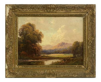
OIL / BOARD "MOUNTAIN LANDSCAPE" SGND A. SPENCER AUGUSTUS SPENCER (1860 - 1924) 12" X 16"Carlsen Gallery, Inc.4.6(163)See Sold PriceMar 03, 2024
Two Hand-Colored 19th Century Maps of New Orleans and Louisiana, Larger- H.- 12 1/2 in., W.- 15 1/2Crescent City Auction Gallery4.3(229)See Sold PriceMar 08, 2024


![MITCHELL, S[amuel] Augustus. County Map of Texas (1 of 1)](https://p1.liveauctioneers.com/514/10700/2579974_1_x.jpg?height=282&quality=70&version=1160418848)