ATLAS of ANTIENT GEOGRAPHY by SAMUEL BUTLER 1843John McInnis Auctioneers,LLC4.6(502)See Sold PriceFeb 24, 2024
18TH C. ANTIQUE MAP: FRENCH & INDIAN WAR, FRAMEDThomaston Place Auction Galleries4.4(386)See Sold PriceFeb 24, 2024
Rand McNally Railroad Map Cabinet w/ 21 Railroad MapsRail & Road Auctions4.6(165)See Sold PriceMar 08, 2024
Keith Haring - Ink on New York Map, Best Buddies, Inscribed, Signed, and DatedSapphire Auction Gallery4(67)See Sold PriceMar 02, 2024
LATE 17TH C. FRENCH MAP OF THE NEW WORLD BY ALEXIS-HUBERT JAILLOT (1632-1712)Thomaston Place Auction Galleries4.4(386)See Sold PriceFeb 24, 2024
Central Railroad of New Jersey Map of Sandy Hook Route-ca. 1903JM Hobby Supply and Railroad Artifact Auctions4.4(126)See Sold PriceFeb 24, 2024
Lot of Six Mixed Atlas Box Cars-HO Scale-New in BoxJM Hobby Supply and Railroad Artifact Auctions4.4(126)See Sold PriceFeb 25, 2024
Rand McNally/Santa Fe Railroad Map of Iowa-1912JM Hobby Supply and Railroad Artifact Auctions4.4(126)See Sold PriceFeb 24, 2024
NICOLAES VISSCHER (NETHERLANDS, 1618-1709) MAP OF THE NEW WORLDThomaston Place Auction Galleries4.4(386)See Sold PriceFeb 24, 2024
17TH C. WORLD MAP BY NICOLAES VISSCHER (NETHERLANDS, 1618-1709)Thomaston Place Auction Galleries4.4(386)See Sold PriceFeb 24, 2024
Lot of Six Mixed Atlas Cabooses-HO Scale-New in BoxJM Hobby Supply and Railroad Artifact Auctions4.4(126)See Sold PriceFeb 25, 2024
Rocque's Classic British National MapRocque, John (1709-1762). England and Wales... Engraved map with color in outline. Robert Sayer, c 1760. 25 ½" x 39" sheet. "...drawn from the most accurate surveys containing all the cities, borouSee Sold Price
SoldJOHN ROCQUE (BRITISH, 1709-1762) MAP OF WINDSOR CASTLEJOHN ROCQUE (BRITISH, 1709-1762) MAP OF WINDSOR CASTLE GROUNDS, hand-colored engraving on paper, containing five inserts, four differing prospects of the castles and associated buildings, and a plan oSee Sold Price
SoldBritain.- a mixed group of mapsa mixed group of maps, the entire British Isles, also national and regional maps of England and Wales, Scotland, and Ireland, by or after Rapin, Macpherson, Dower and others, engraved or lithSee Sold Price
SoldAnon National Savings Map of the British Isles shoAnon National Savings Map of the British Isles showing Festivals and Customs, original National Savings poster printed for HMSO by - 101 x 77 cmSee Sold Price
SoldAnon National Savings Map of the British Isles shoAnon National Savings Map of the British Isles showing Festivals and Customs, original National Savings poster printed for HMSO by - 101 x 77 cmSee Sold Price
SoldAnon National Savings Map of the British Isles shoAnon National Savings Map of the British Isles showing Festivals and Customs, original National Savings poster printed for HMSO by - 101 x 77 cmSee Sold Price
Sold(North America, United States), MITCHELL'S NEW NAT(North America, United States), MITCHELL'S NEW NATIONAL MAP, UNITED STATES, NORTH AMERICAN BRITISH PROVINCES, Philadelphia, 1861, wall map with colored state borders, with rollers, 62 x 60 in., (creasSee Sold Price
SoldA small, mixed group of national maps and town plBritish Isles.- A small, mixed group of national maps and town plans, including plans of New York, Brussels, Liverpool, Odessa and others, mostly European, engraved and lithographic maps, someSee Sold Price
SoldWall map of U.S. titled "Mitchell's New National MapWall map of U.S. titled "Mitchell's New National Map Exhibiting the US with the North American British Provenances......." dated 1856 - Poor condition with some losses, paper peeling from canvas, wearSee Sold Price
SoldMITCHELL'S NEW NATIONAL MAP EXHIBITING THE UNITEDMITCHELL'S NEW NATIONAL MAP EXHIBITING THE UNITED STATES WITH THE NORTH AMERICAN BRITISH PROVINCES, SANDWICH ISLANDS, MEXICO AND CENTRAL AMERICA, CUBA AND WEST INDIA ISLANDS. PUBLISHED BY S. AUGUSTUSSee Sold Price
SoldMitchell's New National Map of the U.S. 1858with British Provinces, engraved by W. Williams, published by S. Augustus Mitchell, Phila. 62" x 62" Condition damage along entire top ofSee Sold Price
Mitchell's New National Map Exhibiting the United States with the North AmericanDescription: Description: MAP Year - 1857. : Mitchell's New National Map Exhibiting the United States with the North American British Provinces, Sandwich Islands, Mexico and Central American, TogetherSee Sold Price
Sold[MAP]. Mitchell’s New National Map.... 1860336. [MAP]. MITCHELL, S. Augustus. Mitchell’s New National Map, Exhibiting the United States with the North American British Provinces, Sandwich Islands, Mexico and Central America, together witSee Sold Price
MAP -- UNITED STATES. Mitchell's National Map ExhiMAP -- UNITED STATES. Mitchell's National Map Exhibiting the United States with the North American British Provinces, Sandwich Islands, Mexico and Central America together with Cuba and other West ISee Sold Price
Map of British America.Title: Map of British America. Publication Date: 1884 Cartographer: RAND, MCNALLY & CO. Publisher: H.H. HARDESTY & CO. Dimension: 13 X 19.6 30, 31 double-page national map from a first edition HardestSee Sold Price
SoldA group of diecast 1/43 Classic British Sports carsA group of diecast 1/43 Classic British Sports cars plus Dinky Atlas Issues. E to NM in Boxes. (7)See Sold Price
Sold3 vols relating to British Expeditions.[Polar] 3 vols relating to British expeditions. (1) Armitage, Albert B. Two Years in the Antarctic: Being a Narrative of the British National Antarctic Expedition. The Paradigm Press/Bluntisham Books,See Sold Price
Sold1856 MITCHELL'S WALL MAP OF NORTH AMERICAFull title being: “Mitchell’s New National Map, Exhibiting the United States with the North American British Provinces Sandwich Islands, Mexico and Central America, Cuba, West India Islands.” PuSee Sold Price
Sold* ARMITAGE, Albert Borlase (1864-1943). Two Years in* ARMITAGE, Albert Borlase (1864-1943). Two Years in the Antarctic: Being a Narrative of the British National Antarctic Expedition. London: Edward Arnold, 1905. 8vo. With folding map, 16 photographicSee Sold Price
EARLY WALL MAP BY MITCHELLEARLY WALL MAP BY MITCHELL. "Mitchell's New National Map Exhibiting the United States with the North American British Provinces, Sandwich Islands, Mexico, and Latin American, Together with Cuba and OtSee Sold Price
SoldLarge wall map of U.S. & Central AmericaHeading: Author: Mitchell, Samuel Augustus Title: Mitchell's New National Map Exhibiting the United States with the North American British Provinces, Sandwich Islands, Mexico and Central America, TogSee Sold Price
SoldHanging Wall Map of North America-19th centuryWall map titled "Mitchells' New National Map Exhibiting the United States with North American British Provinces, Sandwich Islands, Mexico and Central America, Together with Cuba and the other West IndSee Sold Price
SoldS. Augustus Mitchell/Publisher 1856S. Augustus Mitchell/Publisher, "Mitchell's New National Map, Exhibiting the United States with the North American British Provinces, Sandwich Islands, Mexico and Central America, together with Cuba aSee Sold Price
Lithographed paper on canvas wall map of the US dated eLithographed paper on canvas wall map of the US dated entitled "Mitchell's New National Map exhibiting the United States with the North American British Provinces, Sandwich Islands, Mexico and CentralSee Sold Price
Stone Age Classic British Teardrop-Shaped Knapped Flint HandaxeTimeLine Auctions Ltd.4.5(183)See Sold PriceMar 05, 2024
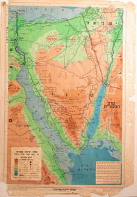
Jerusalem Map for British Soldiers in Palestine - WW2Levy Auction House4.3(11)See Sold PriceFeb 27, 2024
Classic Art National Style Miao Silver Double Dragon Hollow Necklace with Ruby PendantWeatherham Estate Treasures3.9(157)See Sold PriceFeb 28, 2024
7 boxebaseball cards: Diamond Classics, National Pass Time, Hall of Fame Baseball Stars & othersSouth Jersey Auction by Babington Auction Inc4.6(122)See Sold PriceFeb 25, 2024
Gordon Smith Handmade Classic Telecaster Cherryburst British Electric GuitarShakespeare Auctions4.3(1)See Sold PriceFeb 25, 2024
Hanley Handmade Classic British Pro Electric GuitarShakespeare Auctions4.3(1)See Sold PriceFeb 25, 2024
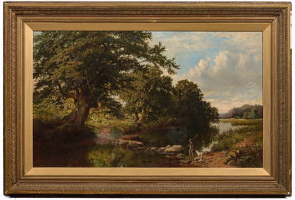
ATTRIBUTED THOMAS CRESWICK (1811-1869) OIL ON CANVASSoulis Auctions4.8(953)See Sold PriceFeb 24, 2024
THE GREAT COURSES SERIES – SHAKESPEARE AND BRITISH LITERATUREThe Rug Life4.3(12)See Sold PriceMar 07, 2024
INDIA WITHIN THE GANGES SUSAN GOLE ILLUSTRATED MAPS EARLY CARTOGRAPHYJasper524.5(9.8k)See Sold PriceFeb 27, 2024
Hate British characters story map silk scroll vertical axisJapan Ancient Art Co. LTD4.4(37)See Sold PriceFeb 28, 2024
Paterson & Mogg 1822 Pair of British Road Maps. Isle of Thanet & WightAlbion Auctions4.6(336)See Sold PriceMar 01, 2024
Paterson & Mogg 1822 Pair of British Road Maps. Rye, Eastbourne, SouthamptonAlbion Auctions4.6(336)See Sold PriceMar 01, 2024
Paterson & Mogg 1822 Pair of British Road Maps. Deal, Hythe, Shoreham, ChichesterAlbion Auctions4.6(336)See Sold PriceMar 01, 2024


![[MAP]. Mitchell’s New National Map.... 1860 (1 of 1)](https://p1.liveauctioneers.com/514/38482/16500372_1_x.jpg?height=282&quality=70&version=1363615005)