SoldRockwell Report with 7-sheet Preuss map 1849Title: Report... survey of certain routes for a canal or railroad between the Atlantic and Pacific Oceans; also, the memorial of the General Assembly of the State of Arkansas for the establishment ofSee Sold Price
SoldPreuss map Oregon Road in 7 sheets 1849Heading: Author: Preuss, Charles Title: Topographical Map of the Road from Missouri to Oregon, Commencing at the Mouth of the Kansas in the Missouri River and Ending at the Mouth of the Wallah WallahSee Sold Price
SoldPreuss map Oregon Road in 7 sheets 1849Title: Topographical Map of the Road from Missouri to Oregon, Commencing at the Mouth of the Kansas in the Missouri River and Ending at the Mouth of the Wallah Wallah in the Columbia, In VII Sections.See Sold Price
SoldPreuss map Oregon Road in 7 sheets 1849Title: Topographical Map of the Road from Missouri to Oregon, Commencing at the Mouth of the Kansas in the Missouri River and Ending at the Mouth of the Wallah Wallah in the Columbia, In VII Sections.See Sold Price
SoldPreuss' Topographical Map on 7 sheets 1846Heading: Author: Preuss, Charles Title: Topographical Map of the Road from Missouri to Oregon, Commencing at the Mouth of the Kansas in the Missouri River and Ending at the Mouth of the Wallah WallahSee Sold Price
SoldPreuss' Topographical Map on 7 sheets 1846Title: Topographical Map of the Road from Missouri to Oregon, Commencing at the Mouth of the Kansas in the Missouri River and Ending at the Mouth of the Wallah Wallah in the Columbia, In VII Sections.See Sold Price
SoldPreuss' Topographical Map on 7 sheets 1846Title: Topographical Map of the Road from Missouri to Oregon, Commencing at the Mouth of the Kansas in the Missouri River and Ending at the Mouth of the Wallah Wallah in the Columbia, In VII Sections.See Sold Price
SoldReports of Explorations and Surveys, to AscertainVol. V only. Illustrated with 26 color lithograph plates; 4 maps (1 folding); 14 sections on 8 sheets (a few color, 7 sheets folding); 11 fossil plates; 28 botany plates. 11½x9, original brown cloth.See Sold Price
SoldAlbert Besnard (French, 1849 - 1934)Portrait of his son. Graphite on paper. Signed on the lower edge. Sheet size 7 x 9.8 inches. Notice to bidders: Condition reports and additional photographs are provided by request as a courtesy to ouSee Sold Price
SoldEarly Engraving Hand-Colored [Map, People]Early engraving hand-colored. Image measures 7 in. x 8.25 in. and sheet measures 8.5 in. x 11.5 in. Unframed, loose and not glued or mounted. If lot is absent of a condition report one may be requesteSee Sold Price
Sold6 Maps (7 Sheets): 3 by Jaillot, 1709-20 + others.[Europe/Atlantic]. 6 Maps on 7 Sheets. Largest: 18 1/8” x 30 ¼”. Smallest: 21 ¾” x 16 7/8”. Sold with all faults. Most have early hand-colored outline. ++ Le Comte De Haynaut, Divise en ChatSee Sold Price
Sold7 Ordnance Survey maps7 Ordnance Survey maps,sheets 7, 46, 50-52, 65, and one unnumbered, engraved maps, some later hand-colouring, each c.620 x 920mm., dissected and linen-backed, in cloth bound slipcase c.1805-1See Sold Price
SoldPOPPLE, HENRY. [Sheet 7, from]: Map of the BritishPOPPLE, HENRY. [Sheet 7, from]: Map of the British Empire in America with the French and Spanish Settlements Adjacent Thereto. Double-page engraved mapsheet of New England and Nova Scotia. 20¼x28See Sold Price
SoldNormandy/Ile de France. World War 2 pre-D-Day militaryTITLE/CONTENT OF MAP: 'North west Europe. Rouen-Paris - Army/Air. Sheet 7' The map was published by the (British) War Office in 1943, with magnetic north dated to June 1943 - a year before the D-Day lSee Sold Price
Normandy/Ile de France. WWII pre-D-Day military mapTITLE/CONTENT OF MAP: 'North west Europe. Rouen-Paris - Army/Air. Sheet 7' The map was published by the (British) War Office in 1943, with magnetic north dated to June 1943 - a year before the D-Day lSee Sold Price
Goad (Charles E.) Insurance Plan of LondonGoad (Charles E.) Insurance Plan of London,extending from All Hallows Lane to London Bridge, and from Cannon Street to the Thames from 1922, Sheet 7, lithographed map in original hand-colourinSee Sold Price
SoldGeology.- Greenough (George Bellas) A Geological Map ofGeology.- Greenough (George Bellas) A Geological Map of England & Wales, second edition, hand-coloured engraved map on 7 sheets, plus accompanying key, folding in sections and linen-backed, 1950 x 161See Sold Price
SoldAtlas de L'Histoire du Consulat et de L'Empire. DAuthor: Dufour, A[dolphe] & [Thunot] Duvotenay 4 pp + 66 map sheets including 7 double page, a few hand colored in outline. 17¼x11, loose in original portfolio, as issued. The atlas to accompany AdolSee Sold Price
SoldOrdnance Survey. Wiltshire and SomersetOrdnance Survey. Wiltshire and Somerset,the former on 3 sheets, XIV, XV and XXXIV, the latter on 4 sheets, XVIII-XXI, 7 electrotype map sheets, 665 x 830mm. to 660 x 980mm., all dissected andSee Sold Price
SoldDescripion of Gulf of Tonkin 1732Title: A Description of the Kingdom of Tonqueen Author: Baron, S[amuel] Description: [2], 40 pp. With 13 copper-engraved plates (including frontispiece map) on 7 sheets, 2 of them double-page. (folio)See Sold Price
Ordnance Survey. Wiltshire and SomersetOrdnance Survey. Wiltshire and Somerset,the former on 3 sheets, XIV, XV and XXXIV, the latter on 4 sheets, XVIII-XXI, 7 electrotype map sheets, 665 x 830mm. to 660 x 980mm., all dissected andSee Sold Price
SoldAfrica.- Salt (Henry) A Voyage to Abyssinia, firstAfrica.- Salt (Henry) A Voyage to Abyssinia, first edition, half-title, 2 engraved vignettes, 8 maps on 7 sheets, most folding, one hand-coloured, 27 plates, some offsetting, foxing and occasional staSee Sold Price
SoldDescription of Active and Extinct VolcanosTitle: A Description of Active and Extinct Volcanos, of Earthquakes, and of Thermal Springs Author: Daubeny, Charles Description: xxiv, 829, [1] pp. 4 plates; 11 maps on 7 sheets (1 folding). (8vo) moSee Sold Price
SoldJorio (Andrea de) Pompei AtlanteJorio (Andrea de) Pompei Atlante, 8 engraved plans etc. on 7 sheets, folding hand-coloured engraved map, original printed boards, rubbed and soiled, Naples, 1839 § Mason (John) Self Knowledge.See Sold Price
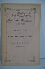
Boston and Maine RR Annual Report-September 12, 1849JM Hobby Supply and Railroad Artifact Auctions4.4(127)See Sold PriceFeb 24, 2024
Ohio and Pennsylvania RR 1st Annual Report-1849JM Hobby Supply and Railroad Artifact Auctions4.4(127)See Sold PriceFeb 24, 2024
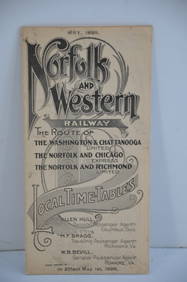
Norfolk and Western RY May 1898 Public TimetableJM Hobby Supply and Railroad Artifact Auctions4.4(127)See Sold PriceFeb 24, 2024
18th Century Hess Germany Hand colored Engraved MapGlobal Auctions Company4.3(36)See Sold PriceMar 03, 2024
Gustave Fraipont - Les Maitres de l'Affiche : Pierrefonds, Compiegne et Coucy, 1900NCAG4.4(36)See Sold PriceMar 10, 2024
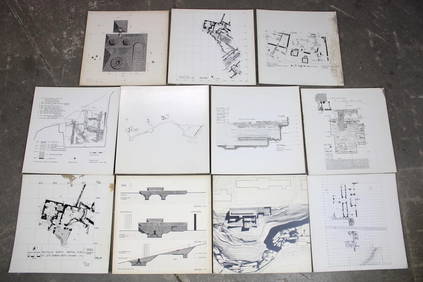
Set of 11 Mid Century Modern Architectural Plans & Site Map RenderingsPUBLIC SALE4.7(227)See Sold PriceMar 02, 2024
Herman Moll A New Map of Ye North Parts of AmericaWillow Auction House4.5(292)See Sold PriceMar 14, 2024
ANDY WARHOL "MICK JAGGER 1975" ROLLING STONES FRAMEDWhite Knight Auction, Inc4.7(259)See Sold PriceFeb 29, 2024


![Early Engraving Hand-Colored [Map, People] (1 of 3)](https://p1.liveauctioneers.com/5755/195519/98659024_1_x.jpg?height=282&quality=70&version=1614114976)


![POPPLE, HENRY. [Sheet 7, from]: Map of the British (1 of 1)](https://p1.liveauctioneers.com/199/186755/93896183_1_x.jpg?height=282&quality=70&version=1606331513)