ATLAS of ANTIENT GEOGRAPHY by SAMUEL BUTLER 1843John McInnis Auctioneers,LLC4.5(505)See Sold PriceFeb 24, 2024
18TH C. ANTIQUE MAP: FRENCH & INDIAN WAR, FRAMEDThomaston Place Auction Galleries4.4(393)See Sold PriceFeb 24, 2024
Rand McNally Railroad Map Cabinet w/ 21 Railroad MapsRail & Road Auctions4.6(165)See Sold PriceMar 08, 2024
Keith Haring - Ink on New York Map, Best Buddies, Inscribed, Signed, and DatedSapphire Auction Gallery4(67)See Sold PriceMar 02, 2024
LATE 17TH C. FRENCH MAP OF THE NEW WORLD BY ALEXIS-HUBERT JAILLOT (1632-1712)Thomaston Place Auction Galleries4.4(393)See Sold PriceFeb 24, 2024
Central Railroad of New Jersey Map of Sandy Hook Route-ca. 1903JM Hobby Supply and Railroad Artifact Auctions4.4(127)See Sold PriceFeb 24, 2024
Lot of Six Mixed Atlas Box Cars-HO Scale-New in BoxJM Hobby Supply and Railroad Artifact Auctions4.4(127)See Sold PriceFeb 25, 2024
Rand McNally/Santa Fe Railroad Map of Iowa-1912JM Hobby Supply and Railroad Artifact Auctions4.4(127)See Sold PriceFeb 24, 2024
NICOLAES VISSCHER (NETHERLANDS, 1618-1709) MAP OF THE NEW WORLDThomaston Place Auction Galleries4.4(393)See Sold PriceFeb 24, 2024
17TH C. WORLD MAP BY NICOLAES VISSCHER (NETHERLANDS, 1618-1709)Thomaston Place Auction Galleries4.4(393)See Sold PriceFeb 24, 2024
Lot of Six Mixed Atlas Cabooses-HO Scale-New in BoxJM Hobby Supply and Railroad Artifact Auctions4.4(127)See Sold PriceFeb 25, 2024
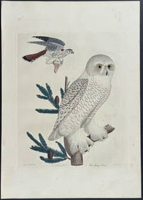
Robert Morden, Hand Coloured Engraving - "Map of Kent"Robert Morden (fl. 1668-1703) - Hand Coloured engraving - "Map of Kent", 13.75" x 24.75", sold by Able Swale, Alwnsham & John Churchill, published for Camden's Britannia, 1695-1715, Housed in an oak fSee Sold Price
SoldA Robert Morden hand coloured engraving, map ofA Robert Morden hand coloured engraving, map of Hertfordshire, 18" x 15"See Sold Price
SoldRobert Morden, antique hand coloured map of Kent,Robert Morden, antique hand coloured map of Kent, framedSee Sold Price
SoldRobert Morden, hand coloured map, the county of Kent,Robert Morden, hand coloured map, the county of Kent, 14ins x 25ins, framed together with another framed map of Kent, by B.R. Davies and another small map of TunbridgeSee Sold Price
SoldRobert Morden (died 1703) - Coloured engraving - “Map oRobert Morden (died 1703) - Coloured engraving - “Map of Kent”, 13.5ins x 25ins (from 1695 edition of “Camden’s Britannia”), and two others (all framed and glazed)See Sold Price
SoldRobert Morden (died 1703) - Coloured engraving - “Map oRobert Morden (died 1703) - Coloured engraving - “Map of Kent”, 13.5ins x 25ins (from 1695 edition of “Camden’s Britannia”), in black and gilt frame and glazedSee Sold Price
Sold"Map of Kent"by Robert Morden; Hand Colored EngravingRobert Morden (fl. 1668-1703) - Hand Colored engraving - "Map of Kent", 13.75" x 24.75", sold by Able Swale, Alwnsham and John Churchill, published for Camden's Britannia, 1695-1715, Housed in an oakSee Sold Price
SoldROBERT MORDENRobert Morden Kent, hand coloured engraved map, 35 x 63cm; together with a copy of the The Kentish Gazette, broadsheet, dated Saturday July 27th to Wednesday July 31st 1776, published by Simmons and KSee Sold Price
SoldRobert Morden (17th-18th Century) British. "Kent", HandRobert Morden (17th-18th Century) British. "Kent", Hand Coloured Map, 13.5" x 24.5"See Sold Price
SoldRobert Morden, 'Shropshire', hand coloured engravRobert Morden, 'Shropshire', hand coloured engraving, unframed, 14" x 16", also Richard Blome, 'Shropshire', and various other maps and topographical engravings - all unframed (a folder)See Sold Price
SoldJ Harrison, 'A map of Shropshire', hand colouredJ Harrison, 'A map of Shropshire', hand coloured engraving, published London 1788, 13.5" x 18.5", also C S Smith, 'A new map of Salop', and Robert Morden, 'Devonshire', (3)See Sold Price
SoldRobert Morden (1650-1703) Early Map Of Sussex"Map Of Sussex" (1696) hand-coloured engraving (later print) 52 x 40cmSee Sold Price
Robert Morden (1650-1703) Early Map Of Sussex"Map Of Sussex" (1696) hand-coloured engraving (later print) 52 x 40cmSee Sold Price
SoldAndrew Dury and John Andrews, 'A Topographical Map ofAndrew Dury and John Andrews, 'A Topographical Map of Hartford-shire From An Actual Survey...', hand coloured engraving, published 1766, mounted over margins, 52 x 69cm; and: Robert Morden, 'ShropshirSee Sold Price
SoldJohn OgilvyJohn Ogilvy The Road from London to Yarmouth; The Road from King's Lynn to Harwich; 17th century hand coloured engravings, with margins, 36 x 45cm (plate); Robert Morden Map of Suffolk, hand colouredSee Sold Price
SoldKent.- Morden (Robert) Kent, [c. 1695].Kent.- Morden (Robert) Kent, county map, engraving with some outline hand-colouring on laid paper, platemark 360 x 640 mm. (14 1/4 x 25 1/8 in), sheet 415 x 655 mm. (16 1/4 x 25 3/4 in), folds as issuSee Sold Price
SoldMAP OF NORTHAMPTONSHIRE,ROBERT MORDEN 1650-1703Hand-coloured copper plate cartographic engraving of Northamptonshire by Robert MORDEN (British 1650-1703), featuring a colourful cartouche in the upper right corner.See Sold Price
SoldRobert Morden hand coloured Map of SurreyRobert Morden hand coloured Map of Surrey, 14.5" by 17"See Sold Price
SoldRobert Morden, hand coloured map of ChesterRobert Morden, hand coloured map of ChesterSee Sold Price
A Robert Morden hand coloured map of Bark Shire, 36 xA Robert Morden hand coloured map of Bark Shire, 36 x 43 cm, other assorted maps and prints (9)See Sold Price
SoldHertford Shine by Robert Morden, handcoloured mapHertford Shine by Robert Morden, handcoloured map of England, Middlesex, dated between 1608-1703 10 1/2 by 7 1/4See Sold Price
SoldRobert Morden Map of Sussex, 13.5 x 16 ins.Robert Morden coloured engraving, Map of Sussex, 13.5 x 16 ins.See Sold Price
SoldRobert Morden Map of Durham 14in. x 16.5in.Robert Morden coloured engraving Map of Durham 14in. x 16.5in.See Sold Price
SoldRobert Morden Map of Buckingham Shire 16.5 x 13.5Robert Morden coloured engraving Map of Buckingham Shire 16.5 x 13.5in.See Sold Price
CHARLES ROLLIN c1828 Ceasar Hand Colored Africa Military MapLuis Porretta Fine Arts4.3(10)See Sold PriceMar 02, 2024
Numismatic Books - Lelewel - Numismatique du Moyen-AgeTimeLine Auctions Ltd.4.6(183)See Sold PriceMar 09, 2024
Wilson - Snow Owl (Snowy Owl) & Sparrow Hawk. 32Trillium Antique Prints & Rare Books4.5(32)See Sold PriceFeb 24, 2024
Wilson - Ivory-billed Woodpecker, Red-headed & Pileated Woodpeckers. 29Trillium Antique Prints & Rare Books4.5(32)See Sold PriceFeb 24, 2024
Wilson - Carolina Parrot & Flycatchers. 26Trillium Antique Prints & Rare Books4.5(32)See Sold PriceFeb 24, 2024
Map: An 18thC engraved and hand coloured map of Buckinghamshire after Robert Morden. Approx. 8 1/4"Claydon Auctioneers Ltd4.3(125)See Sold PriceFeb 26, 2024
Map: A 17thC engraved and hand coloured map of Bedfordshire after Robert Morden. Approx. 12 1/2" xClaydon Auctioneers Ltd4.3(125)See Sold PriceFeb 26, 2024
Set of 3 Gentlemen’s Fashion Prints - Journal des Dames et des Modes: Men’s FashionProverde Auctions4.3(3)See Sold PriceFeb 28, 2024
James Sowerby (1757 - 1822) - Set of 8 Botanical Prints - Heath Cudweed - Saxifraga Nivalis -Proverde Auctions4.3(3)See Sold PriceFeb 28, 2024
James Sowerby (1757 - 1822) - Set of 8 Botanical Prints - Birthwort, Aristolochia clematitis -Proverde Auctions4.3(3)See Sold PriceFeb 28, 2024
James Sowerby (1757 - 1822) - Set of 10 Botanical Prints -Proverde Auctions4.3(3)See Sold PriceFeb 28, 2024
James Sowerby (1757 - 1822) - Set of 10 Botanical Prints - Common Sea-Buckthorn - Orobanche RapumProverde Auctions4.3(3)See Sold PriceFeb 28, 2024
James Sowerby (1757 - 1822) - Set of 10 Botanical Prints - Orobanche Common Lesser - CentrolepisProverde Auctions4.3(3)See Sold PriceFeb 28, 2024
James Sowerby (1757 - 1822) - Set of 10 Botanical Prints - Potentilla anserina - Poa aquatica -Proverde Auctions4.3(3)See Sold PriceFeb 28, 2024