ATLAS of ANTIENT GEOGRAPHY by SAMUEL BUTLER 1843John McInnis Auctioneers,LLC4.5(505)See Sold PriceFeb 24, 2024
18TH C. ANTIQUE MAP: FRENCH & INDIAN WAR, FRAMEDThomaston Place Auction Galleries4.4(393)See Sold PriceFeb 24, 2024
Rand McNally Railroad Map Cabinet w/ 21 Railroad MapsRail & Road Auctions4.6(165)See Sold PriceMar 08, 2024
Keith Haring - Ink on New York Map, Best Buddies, Inscribed, Signed, and DatedSapphire Auction Gallery4.1(67)See Sold PriceMar 02, 2024
LATE 17TH C. FRENCH MAP OF THE NEW WORLD BY ALEXIS-HUBERT JAILLOT (1632-1712)Thomaston Place Auction Galleries4.4(393)See Sold PriceFeb 24, 2024
Central Railroad of New Jersey Map of Sandy Hook Route-ca. 1903JM Hobby Supply and Railroad Artifact Auctions4.4(127)See Sold PriceFeb 24, 2024
Lot of Six Mixed Atlas Box Cars-HO Scale-New in BoxJM Hobby Supply and Railroad Artifact Auctions4.4(127)See Sold PriceFeb 25, 2024
Rand McNally/Santa Fe Railroad Map of Iowa-1912JM Hobby Supply and Railroad Artifact Auctions4.4(127)See Sold PriceFeb 24, 2024
NICOLAES VISSCHER (NETHERLANDS, 1618-1709) MAP OF THE NEW WORLDThomaston Place Auction Galleries4.4(393)See Sold PriceFeb 24, 2024
17TH C. WORLD MAP BY NICOLAES VISSCHER (NETHERLANDS, 1618-1709)Thomaston Place Auction Galleries4.4(393)See Sold PriceFeb 24, 2024
Lot of Six Mixed Atlas Cabooses-HO Scale-New in BoxJM Hobby Supply and Railroad Artifact Auctions4.4(127)See Sold PriceFeb 25, 2024
Revised Edition. Mitchell's School AtlasTitle/Content of Map: Revised Edition. Mitchell's School Atlas Date: 1840 Cartographer: MITCHELL, SAMUEL AUGUSTUS Publisher: THOMAS, COWPERTHWAIT & CO Size: 12"H x 9.8"W 4to 18 maps (3 show Rep. of TeSee Sold Price
SoldMitchell's School Atlas. Revised EditionTitle/Content of Map: Mitchell's School Atlas. Revised Edition Date: 1840 Cartographer: MITCHELL, SAMUEL AUGUSTUS Publisher: THOMAS, COWPERTHWAIT & CO Size: 12"H x 9.8"W Second issue. (contents on bacSee Sold Price
Mitchell's School Atlas, 1839"Deserves most careful attention in any study of the spread of ideas by the printed pages"-Karpinski 4. [ATLAS]. MITCHELL, S[amuel] Augustus. [cover title (issued without title)] Revised Edition. MitcSee Sold Price
Sold2 books: Mitchell's Atlas and Maury's Geography1st item: S. Augustus Mitchell's SCHOOL ATLAS: COMPRISING THE MAPS AND TABLES DESIGNED TO ACCOMPANY MITCHELL'S SCHOOL AND FAMILY GEOGRAPHY REVISED EDITION. Philadelphia, E. H. Butler & Co., 1871. InclSee Sold Price
Mitchell's School Geography 2nd Revised 1848Heading: Author: Mitchell, Samuel Augustus Title: Mitchell's School Geography. Second Revised Edition. A System of Modern Geography Comprising a Description of the Present State of the World... PlaceSee Sold Price
SoldLot of 8 Civil War era School AtlasesTitle: Lot of 8 Civil War era School Atlases Author: ** Description: Comprises: Mitchell's School Atlas. 5 copies, each with 18 maps (5 double page). Revised Eds. One 1862, two are 1863, one 1864 andSee Sold Price
World in HemispheresTitle/Content of Map: World in Hemispheres Date: 1880 Cartographer: CORNELL, SARAH SOPHIA Size: Height - 7.25Width Publisher: D. APPLETON From her Revised edition. Cornell's Grammar-School geography.See Sold Price
Revised & Improved. No.2, Mitchell's Series of OutlineTitle/Content of Map: Revised & Improved. No.2, Mitchell's Series of Outline Maps for the Use of Academies & Schools. Date: 1848 ca. Cartographer: S. Augustus Mitchell Publisher: O. D. Case & Co. | JoSee Sold Price
Revised & Improved. No.2, Mitchell's Series of OutlineTitle: Revised & Improved. No.2, Mitchell's Series of Outline Maps for the Use of Academies & Schools. Publicaiton Date: c1848 Cartographer: S. Augustus Mitchell Publisher: O. D. Case & Co. | John W.See Sold Price
SoldMitchell's School Atlas, 1939Heading: Author: Mitchell, [S.A.] Title: Mitchell's School Atlas Place Published: [Philadelphia] Publisher:[Thomas, Cowperthwait & Company] Date Published: [1839] Description: <See Sold Price
Sold6 Atlases incl: MITCHELL’S SCHOOL ATLAS. 1851.[Atlases/School Use]. 6 Atlases. 4to. Orig ¼ cloth and printed paper-covered boards. Sold with all faults. ++ MITCHELL’S SCHOOL ATLAS: Comprising the Maps, Etc., Designed to Illustrate Mitchell’sSee Sold Price
SoldMitchell's school atlas with "maximum" Texas, 1848Heading: (School Atlas) Author: Mitchell, Samuel Augustus Title: Mitchell's School Atlas: Comprising the Maps, Etc., Designed to Illustrate Mitchell's School and Family Geography Place Published: PhilSee Sold Price
SoldMitchell's School Atlas 1854, hand-colored mapsTitle: Mitchell's School Atlas: Comprising the Maps and Tables Designed to Accompany Mitchell's School and Family Geography Author: Mitchell, [Samuel Augustus] Description: With 18 hand-colored maps (See Sold Price
Mitchell's School Atlas 1853, hand-colored mapsTitle: Mitchell's School Atlas Author: Mitchell, S[amuel] Augustus Description: With 18 hand-colored copper-engraved maps (5 are double-page), plus insets. 11¾x9½, original pictorial paper over boarSee Sold Price
SoldMitchell's School Atlas 1855, w/ 18 colored mapsTitle: Mitchell's School Atlas: Comprising the Maps and Tables Designed to Accompany Mitchell's School and Family Geography Author: Mitchell, S[amuel] Augustus Description: With 18 hand-colored maps (See Sold Price
SoldMitchell's School Atlas 1858, hand-colored mapsTitle: Mitchell's School Atlas: Comprising the Maps and Tables Designed to Accompany Mitchell's School and Family Geography Author: Mitchell, [Samuel Augustus] Description: With 18 hand-colored maps (See Sold Price
Mitchell's School AtlasPublication Date: 1855 Title: Mitchell's School Atlas Primary Authors: MITCHELL, SAMUEL AUGUSTUS Publisher: COWPERTHWAIT, DESILVER & BUTLER comprising the maps and tables designed to accompany MitchelSee Sold Price
SoldMitchell's School Atlas: Comprising the Maps, EtcAuthor: Mitchell, S[amuel] Augustus With 17 hand-colored copper-engraved mapsheets (5 are double-page), plus insets to make a total of 28 maps, as called for on title page. 11¾x9½, publisher's origiSee Sold Price
SoldMitchell's School Atlas 1854, hand-colored mapsTitle: Mitchell's School Atlas: Comprising the Maps and Tables Designed to Accompany Mitchell's School and Family Geography Author: Mitchell, [Samuel Augustus] Description: With 18 hand-colored maps (See Sold Price
Mitchell's School Atlas 1858, hand-colored mapsTitle: Mitchell's School Atlas Author: Mitchell, S[amuel] Augustus Description: With 18 hand-colored copper-engraved maps (5 are double-page), plus insets. 11¾x9½, original ¼ black calf & pictorialSee Sold Price
SoldMitchell's School Atlas 1858, hand-colored mapsTitle: Mitchell's School Atlas Author: Mitchell, S[amuel] Augustus Description: With 18 hand-colored copper-engraved maps (5 are double-page), plus insets. 11¾x9½, original ¼ black calf & pictorialSee Sold Price
Mitchell's School AtlasTitle/Content of Map: Mitchell's School Atlas Date: 1866 Cartographer: MITCHELL, SAMUEL AUGUSTUS Publisher: E.H. BUTLER & CO Size: 12"H x 9.5"W comprising the maps and tables designed to accompany MitSee Sold Price
SoldMitchell's School Atlas: Comprising the Maps andAuthor: Mitchell, S[amuel] Augustus With 18 hand-colored copper-engraved mapsheets (5 are double-page), plus insets to make a total of 32 maps, as called for on title page. 11¾x9½, publisher's origiSee Sold Price
SoldMitchell's School Atlas 1853, hand-colored mapsTitle: Mitchell's School Atlas Author: Mitchell, S[amuel] Augustus Description: With 18 hand-colored copper-engraved maps (5 are double-page), plus insets. 11¾x9½, original pictorial paper over boarSee Sold Price
Numismatic Books - Roman Imperial Coinage Set [14]TimeLine Auctions Ltd.4.6(183)See Sold PriceMar 09, 2024
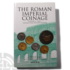
Numismatic Books - Roman Imperial Coinage - Volume II, Part I (New Edition)TimeLine Auctions Ltd.4.6(183)See Sold PriceMar 09, 2024
1818 RARE Geography Made Easy MAPS Jedidiah Morse Boston Indians Atlas AsiaSchilb Antiquarian Rare Books4.8(428)See Sold PriceMar 31, 2024
1849 Mitchell School ATLAS 24 MAPS America Holy Land France Africa Egypt AsiaSchilb Antiquarian Rare Books4.8(428)See Sold PriceMar 31, 2024
1883 A Treatise on Uterine DisplacementsNorth American Artifact Auctions4.7(198)See Sold PriceApr 20, 2024
Nobody Knows Yoshitomo Nara Drawings, Yoshitomo Nara Tokyo: Revised edition.Medusa Auctioneers4.3(6)See Sold PriceMar 04, 2024
De Jode, Rare, pub. 1593 - Map of Luxembourg (Lutzenburgii montuosissimi ac saltuosissimi ducatusTrillium Antique Prints & Rare Books4.5(32)See Sold PriceFeb 24, 2024
De Jode, Rare, pub. 1593 - Map of the British Isles [England, Scotland, Ireland] (Angliae Scotiae etTrillium Antique Prints & Rare Books4.5(32)See Sold PriceFeb 24, 2024
De Jode, Rare, pub. 1593 - Map of Italy (Italiae Totius Orbis olim Domatricis Nova ExactissTrillium Antique Prints & Rare Books4.5(32)See Sold PriceFeb 24, 2024
De Jode, Rare, pub. 1593 - Map of the Czech Republic or Kingdom of Bohemia (Chorographia insignisTrillium Antique Prints & Rare Books4.5(32)See Sold PriceFeb 24, 2024
De Jode, Rare, pub. 1593 - Map of the Middle East, Eastern Asia (Primae Partis Asiae accurataTrillium Antique Prints & Rare Books4.5(32)See Sold PriceFeb 24, 2024
Joan Mitchell - Untitled II From Fresh Air SchoolDane Fine Art Auctions4.4(498)See Sold PriceMar 28, 2024
Carl J. Sundevall (1801 - 1875) Set of 4 Bird Prints - Dove - Woodpecker - DuckProverde Auctions4.3(3)See Sold PriceFeb 28, 2024
Magic: The Gathering - Forest (Mushrooms) Artist Proof - Revised - CGC 9Baldwin's Auctions4.3(1)See Sold PriceMar 01, 2024
Magic: The Gathering - Rod of Ruin Artist Proof - Revised - CGC 9.5Baldwin's Auctions4.3(1)See Sold PriceMar 01, 2024
Magic: The Gathering - Mana Flare Artist Proof - Revised - CGC 10Baldwin's Auctions4.3(1)See Sold PriceMar 01, 2024
Joan Mitchell - Untitled I From Fresh Air SchoolDane Fine Art Auctions4.4(498)See Sold PriceApr 04, 2024


![Numismatic Books - Roman Imperial Coinage Set [14] (1 of 1)](https://p1.liveauctioneers.com/1191/317894/170617586_1_x.jpg?height=282&quality=70&version=1706620797)


![De Jode, Rare, pub. 1593 - Map of the British Isles [England, Scotland, Ireland] (Angliae Scotiae et (1 of 2)](https://p1.liveauctioneers.com/6581/319571/171593327_1_x.jpg?height=282&quality=70&version=1707853304)