ATLAS of ANTIENT GEOGRAPHY by SAMUEL BUTLER 1843John McInnis Auctioneers,LLC4.6(502)See Sold PriceFeb 24, 2024
18TH C. ANTIQUE MAP: FRENCH & INDIAN WAR, FRAMEDThomaston Place Auction Galleries4.4(386)See Sold PriceFeb 24, 2024
Rand McNally Railroad Map Cabinet w/ 21 Railroad MapsRail & Road Auctions4.6(165)See Sold PriceMar 08, 2024
Keith Haring - Ink on New York Map, Best Buddies, Inscribed, Signed, and DatedSapphire Auction Gallery4(67)See Sold PriceMar 02, 2024
LATE 17TH C. FRENCH MAP OF THE NEW WORLD BY ALEXIS-HUBERT JAILLOT (1632-1712)Thomaston Place Auction Galleries4.4(386)See Sold PriceFeb 24, 2024
Central Railroad of New Jersey Map of Sandy Hook Route-ca. 1903JM Hobby Supply and Railroad Artifact Auctions4.4(126)See Sold PriceFeb 24, 2024
Lot of Six Mixed Atlas Box Cars-HO Scale-New in BoxJM Hobby Supply and Railroad Artifact Auctions4.4(126)See Sold PriceFeb 25, 2024
Rand McNally/Santa Fe Railroad Map of Iowa-1912JM Hobby Supply and Railroad Artifact Auctions4.4(126)See Sold PriceFeb 24, 2024
NICOLAES VISSCHER (NETHERLANDS, 1618-1709) MAP OF THE NEW WORLDThomaston Place Auction Galleries4.4(386)See Sold PriceFeb 24, 2024
17TH C. WORLD MAP BY NICOLAES VISSCHER (NETHERLANDS, 1618-1709)Thomaston Place Auction Galleries4.4(386)See Sold PriceFeb 24, 2024
Lot of Six Mixed Atlas Cabooses-HO Scale-New in BoxJM Hobby Supply and Railroad Artifact Auctions4.4(126)See Sold PriceFeb 25, 2024
SoldRare 1775 Map of BostonHeading: (American Revolution) Author: Hutchins, John Nathan Title: Plan of Boston [in] Hutchins Improved: Being an Almanack and Ephemeris ... For the Year of Our Lord 1776... Place Published: New YorSee Sold Price
Rare 1775 Map of BostonHeading: (American Revolution) Author: Hutchin's, John Nathan Title: Plan of Boston [in] Hutchin's Improved: Being an Almanack and Ephemeris ... For the Year of Our Lord 1776... Place Published: New YSee Sold Price
SoldRARE 1775 SIEGE OF BOSTON MAP AND BUNKER HILL BATTLEExact Plan of General Gage's Lines on BOSTON Neck in America. Folding, copperplate-engraved map, 12 1/4 x 19 3/4 inches. "Engraved for the Pennsylvania Magazine", it was published in the August 1775 iSee Sold Price
Sold1775 Rare Map of the Town and Harbour of BostonAmerican Revolution 1775-Dated Revolutionary War Map of the Town of Boston, Days before it was Declared in Rebellion 1775-Dated Revolutionary War Era Map titled, "A PLAN OF THE TOWN AND CHART OF THE HSee Sold Price
SoldRare 1775 Boston Almanac With Patriotic EngravingAmerican RevolutionRare 1775 Boston Almanac With Patriotic Engraving 1775, An Astronomical Diary; Or, Almanack for the Year of Christian Era 1775" by Nathanael Low, Published in Boston, With a Title PSee Sold Price
SoldHistoric Rare 1775 Boston Tea Purchase StatementAmerican RevolutionHistoric & Rare 1775 Boston "Tea" Purchase Statement August 17, 1775-Dated, Manuscript Document, Doctor's "Tea" Purchase Request Statement, Boston, Fine. This oSee Sold Price
SoldAitken Revolutionary War Boston Map 1775Robert Aitken (1735-1808), "A New and Correct Plan of the Town of Boston," London: The Gentleman's Magazine, 1775. This map of Boston depicts the city early in the American Revolution, including the rSee Sold Price
SoldUniversal Magazine for 1774 rare Boston MapHeading: (American Revolution) Author: Title: A New and Accurate Plan of the Town of Boston, in New England [on sheet with] A New Plan of Boston Harbor, from an Actual Survey [in] The Universal MagazSee Sold Price
SoldRare Map Cane of Boston, Massachusetts.This is a rare working example of a tourist's map. It works like the old fashioned blinds on windows. It is in excellent condition and in working order. Try not to handle it to much as they are fragilSee Sold Price
Sold1775 Map, 100 Miles Round Boston, LondonHand colored copper plate printed map, titled "100 Miles Round Boston", Published 1775, "The Gentleman's Magazine", London. Framed and matted under glass. Measures 9.25"H x 10" W.See Sold Price
SoldRARE AMERICAN MAP IN CABINETRare map, housed in a Boston made classical mahogany breakfront who's entablature opens to reveal the pull down hand-colored map of the United States published in Philadelphia by S. Augustus Mitchell,See Sold Price
SoldExtremely fine & rare ca 1755-1775 QA Boston carvedExtremely fine & rare ca 1755-1775 QA Boston carved walnut triple line inlay lowbow/dressing table w orig engraved QA brasses featuring the best form, very nice surface & great structural condSee Sold Price
SoldMaps of the street lines of Boston, 1819.Rare book “Street Maps of Boston” drawn by John Groves Hales. Inside cover reads: Maps of the street lines of Boston made for the selectmen in 1819 and 1820 by John Groves Hales. Reproduced in facSee Sold Price
Soldc. 1775 Map, A NEW PLAN of BOSTON HARBOUR...American Revolution c. 1775 Revolutionary War Period Map, "A NEW PLAN of BOSTON HARBOUR from an Actual SURVEY" c. 1775 Revolutionary War Period Map, "A NEW PLAN of BOSTON HARBOUR from an Actual SURVEYSee Sold Price
Rare Early Framed Map City Of BostonRare early Plan of the City of Boston map. Original period frame. There is some damage - see pictures for details. Total Frame Dimensions : 17 1/4" X 15 1/2", Image Dimensions : 9 3/4 X 7 3/4.See Sold Price
SoldBradford's Comprehensive Atlas w/rare Texas map 1835Heading: Author: Bradford, Thomas Gamaliel Title: A Comprehensive Atlas Geographical, Historical & Commercial - with rare map of Texas Place Published: Boston Publisher:J.H. Wilkins & R.B. Carter <See Sold Price
SoldImportant very rare period Chippendale ca 1755-1775Important very rare period Chippendale ca 1755-1775 Boston or Salem, MA carved mahogany block front ball & claw ft kneehole desk featuring orig brasses, locks & key in old surface - 31 1/4" case widthSee Sold Price
SoldVery Rare period Chippendale ca 1755-1775 Boston dVery Rare period Chippendale ca 1755-1775 Boston dish-top two tier dumb waiter in fine orig dark surface Santo Domingo mahogany featuring wonderful carved pedestal & shell carved knees on ball & talonSee Sold Price
CHARLES STIMPSON 1835 CITY OF BOSTON STREET MAPRare: "Plan of the City of Boston". Rare pocket map hand colored by wards. Folds into slip case with gold embossed "Boston" and border. 8 1/2 x 13 1/2 inches. Map folds into 3 x 2 1/2 inch leather sliSee Sold Price
SoldGentlemanÕs Magazine, 1 otherGentlemanÕs Magazine, 1 other, 1775, London, with 2 maps of Boston, with The Government of the Tongue, Oxford, 1775See Sold Price
SoldRare medical map of Cholera outbreak in Boston 1849Heading: (Boston) Author: Title: Report of the Committee of Internal Health on the Asiatic Cholera, Together with a Report of the City Physician on the Cholera Hospital Place Published: Boston PublisSee Sold Price
SoldRare medical map of Cholera outbreak in Boston 1849Heading: (Boston) Author: Title: Report of the Committee of Internal Health on the Asiatic Cholera, Together with a Report of the City Physician on the Cholera Hospital Place Published: Boston PublisSee Sold Price
Soldextremely fine & rare QA ca 1755-1775 carved walnut Bosextremely fine & rare QA ca 1755-1775 carved walnut Boston highboy featuring very rare grain painted surface - (very few examples survived with this type of surface)See Sold Price
SoldMap of Boston and Vicinity 1775Title: Thirty-Miles round Boston, by M. Armstrong Geo. 14th Augt. 1775 Author: Scots Magazine Description: Copper-engraved map. 25.5x25.5 cm. (10x10"), matted. The Boston region as the rebels were begSee Sold Price
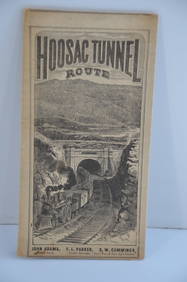
Fitchburg Railroad 1880 Hoosac Tunnel Route Public TimetableJM Hobby Supply and Railroad Artifact Auctions4.4(126)See Sold PriceFeb 24, 2024
1885 CIVIL WAR 1ed Famous Memoirs US Grant Sheridan Sherman 6v RARE LOT MapsSchilb Antiquarian Rare Books4.8(421)See Sold PriceMar 10, 2024
Map UNITED COUNTIES LEEDS & GRENVILLE by Walling 1861 Rare Canada Map 5ft x 5ftLuis Porretta Fine Arts4.3(10)See Sold PriceMar 02, 2024
AMBROISE TARDIEU c1822 Napoleonic War Map GermanyLuis Porretta Fine Arts4.3(10)See Sold PriceMar 02, 2024
1822 Rare Map by Ambroise Tardieu Napoleon Caldiero Battle of Vento 17" x 11Luis Porretta Fine Arts4.3(10)See Sold PriceMar 02, 2024
1818 RARE Geography Made Easy MAPS Jedidiah Morse Boston Indians Atlas AsiaSchilb Antiquarian Rare Books4.8(421)See Sold PriceMar 31, 2024
[MAP]. NICHOLLS, Sutton (1668-1729). An Epitome of Sr. Will...Potter & Potter Auctions4.6(539)See Sold PriceMar 07, 2024
Arrowsmith & Lewis - Map of PolynesiaTrillium Antique Prints & Rare Books4.5(30)See Sold PriceFeb 24, 2024
Arrowsmith & Lewis - Map of North AmericaTrillium Antique Prints & Rare Books4.5(30)See Sold PriceFeb 24, 2024
Arrowsmith & Lewis - Map of the World on Mercator's ProjectionTrillium Antique Prints & Rare Books4.5(30)See Sold PriceFeb 24, 2024
Arrowsmith & Lewis - Map of LouisianaTrillium Antique Prints & Rare Books4.5(30)See Sold PriceFeb 24, 2024
Arrowsmith & Lewis - Map of the United StatesTrillium Antique Prints & Rare Books4.5(30)See Sold PriceFeb 24, 2024
De Jode, Rare, pub. 1593 - Map of Africa (Africae Vera Forma, et Situs)Trillium Antique Prints & Rare Books4.5(30)See Sold PriceFeb 24, 2024


![[MAP]. NICHOLLS, Sutton (1668-1729). An Epitome of Sr. Will... (1 of 1)](https://p1.liveauctioneers.com/928/318880/171361281_1_x.jpg?height=282&quality=70&version=1707501302)