SoldRailways.- - Lengths & Levels to Bradshaw's Maps ofFrom Actual Survey, Dedicated to Thomas Telford, first edition , folding engraved map frontispiece, 1832 bound with at front , Lengths and Levels to Bradshaw's Maps of the Canals, Navigable Rivers, anSee Sold Price
Waterways & Railways.- Bradshaw (George) Lengths &Waterways & Railways.- [Bradshaw (George)] Lengths & Levels to Bradshaw's Maps of Canals, Navigable Rivers, and Railways, folding engraved frontispiece map, offsetting on to title, finger-marks, 1832See Sold Price
SoldBradshaw (George) Bradshaw'sBradshaw (George) Bradshaw's Railway Companion,folding map, 12 other maps (most double-page) and a folding section, some colour in outline, original cloth, label on upper cover, 12mo, ManchestSee Sold Price
SoldBradshaw (George) Bradshaw's Railway Companion, 1843 &Bradshaw (George) Bradshaw's Railway Companion, folding map with route in red, 13 double-page maps/plans, some partly hand-coloured, original brownish cloth, glazed green label to upper cover, 1843; aSee Sold Price
Railways.- Bradshaw (George) Bradshaw's RailwayNO RESERVE Railways.- Bradshaw (George) Bradshaw's Railway Companion, engraved folding maps of London East and West, and The Railways of England and Wales, 12 double-page engraved maps, most with someSee Sold Price
SoldBradshaws Railway Companion for 1843 with MapsBradshaws Railway Companion for 1843 with maps. Pages split from spine to inside and a little wear to edges but generally Good, marked L A Jenkins and dated 1843 to the inside cover. Included with thiSee Sold Price
SoldBradshaw (George) Bradshaw's Railway Time Tables...,Bradshaw (George) Bradshaw's Railway Time Tables..., No.3, folding map with routes supplied in red & yellow (slightly frayed at edges), 8 double-page maps/plans, original purple cloth, 11th Mo. 18th [See Sold Price
SoldA collection of mostly early Victorian letters andA collection of mostly Victorian letters and other documents, general family themes, to/w an 1859 Bradshaw folding Map of the Railways of Central EuropeSee Sold Price
SoldBRADSHAW'S RAILWAY TIME TABLE 1839, complete with maps,BRADSHAW'S RAILWAY TIME TABLE 1839, complete with maps, etc; together with Bradshaw's Continental Railway Guide, special edition. (2)See Sold Price
SoldA large linen backed map of Europe by Octavia & Co,A large linen backed map of Europe by Octavia & Co, Vienna 1856, 98 x 209cm, Bradshaws 'Map of Europe'; showing the railways opened and in progress , linen backed, no date. C Smith's 'Map of France' LSee Sold Price
SoldBradshaws Railway Companion for 1843Bradshaws Railway Companion for 1843 with maps. Pages split from spine to inside and a little wear to edges but generally Good, marked L A Jenkins and dated 1843 to the inside cover. Included with thiSee Sold Price
SoldBradshaw's Map of Great Britain Shewing the RailwaysTitle: Bradshaw's Map of Great Britain Shewing the Railways Publication Date: 1850 Cartographer: BRADSHAW & BLACKLOCK Publisher: BRADSHAW & BLACKLOCK Size: 22.5X16.5 "...completed and in progress withSee Sold Price
SoldBradshaw (George) Map & Sections of the Railways ofBradshaw (George) Map & Sections of the Railways of Great Britain..., folding hand-coloured engraved map, c.1650 x1400mm, dissected and mounted on linen, some light offsetting, folding into contemporaSee Sold Price
Sold1839 BRADSHAW'S MAP & TIME TABLESAN IMPORTANT JACKET-BOUND 1839 BRADSHAW'S "RAILWAYS OF GREAT BRITAIN" FOLDED PRESENTATION MAP WITH TIME TABLES, 65" x 40" unfolded. In very fine condition, highly detailed and color-tinted with ornateSee Sold Price
Bradshaw (G.) Railways of Great Britain mapBradshaw (George) Map & Sections of the Railways of Great Britain,engraved map by I. Dower, with original hand-colouring in outline, with inset plan of London and sections (uncoloured), 1645 xSee Sold Price
SoldRailway map, Great Britain, 1839 map of the railways ofRailway map, Great Britain, 1839 map of the railways of Great Britain, by George Bradshaw, January 1839, map is 54.5" by 33.75", reprint (?)See Sold Price
SoldLot of 3 items from A.H.G trip to Ireland & EnglaLot of three items from A.H.G's travel to Ireland & England. Folded paper map of Bradshaw's map of Great Britian 1872 showing railways completed and in progress. Portfolio of postcards The Lakes of KiSee Sold Price
SoldBradshaw (George) Railways of Great BritainBradshaw (George) Map & Sections of the Railways of Great Britain, folding engraved linen-backed map with original outline hand-colouring, inset plan of London and sections (uncoloured), openiSee Sold Price
Bradshaw (George) Railway Companion containing...Bradshaw (George) Railway Companion containing...18 engraved maps and 1 engraved cross-sectional plan, some folding, a few heightened in colour, plan of Liverpool trimmed, very minor foxing, mSee Sold Price
SoldBradshaw (G.) 3 maps of Canals, Railways etcBradshaw (George) Map of Canals, Navigable Rivers, Rail Roads &c., in the Midland Counties of England; Map of Canals, Situated in the Counties of Lancaster, York, Derby and Chester; Map of Canals, NSee Sold Price
SoldBradshaw (George) - Bradshaw's Railway Time Tables,and Assistant to Railway Travelling , first edition, first issue dated 10th Mo. 19th, 1839, 2 double-page engraved maps with routes supplied by hand in red, blue and yellow, 2 double-page engraved plaSee Sold Price
SoldBradshaw (George) - Bradshaw's Railway Companion,folding glazed map of London with routes supplied by hand in red, 7 double-page maps with partial hand-colouring, 4 double-page plans of Birmingham, Liverpool, Manchester and Leeds, folding engraved pSee Sold Price
SoldBradshaw (George) - Map of Canals, Navigable Rivers,in the Midland Counties of England; Map of Canals, Situated in the Counties of Lancaster, York, Derby and Chester; Map of Canals, Navigable Rivers, Railways , in the Southern Counties of England, 2 laSee Sold Price
SoldBradshaw (George) Map and Sections of the RailwaysBradshaw (George) Map and Sections of the Railways of Great Britain,engraved map, original outline hand-colouring, dissected and linen-backed, 1630 x 1030mm., with accompanying 32pp. letterpreSee Sold Price
Crams Colored Railway Map and Shippers Guide of South Dakota 1908-1909JM Hobby Supply and Railroad Artifact Auctions4.4(127)See Sold PriceFeb 24, 2024
Erie Railway Tourist Book/Magazine-1874JM Hobby Supply and Railroad Artifact Auctions4.4(127)See Sold PriceFeb 24, 2024
Large Railway Express Agency Porcelain SignJM Hobby Supply and Railroad Artifact Auctions4.4(127)See Sold PriceFeb 24, 2024
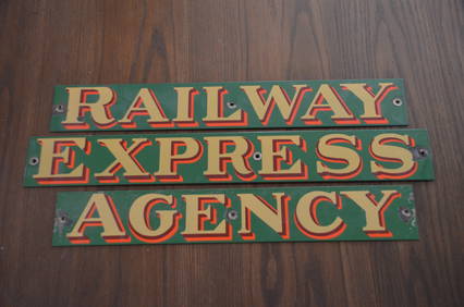
Three Piece Railway Express Agency Colored Porcelain SignJM Hobby Supply and Railroad Artifact Auctions4.4(127)See Sold PriceFeb 24, 2024
LI XIONGCAI'S EXQUISITE PAPER-BASED LANDSCAPE MAP VERTICAL AXISMega International Auction4.3(62)See Sold PriceFeb 24, 2024
Early 1900's Railway Service Map, Illinois, Ohio, Indiana, Kentucky, TennesseeConnoisseur Auctions3.9(336)See Sold PriceFeb 24, 2024
An early Dutch hand colored engraving map by Georg Balthasar Probst (1732-1801)Ostantix Auctions4.4(11)See Sold PriceFeb 27, 2024
Pair of Early Railroad Maps - 1862 Pittsburgh, Ft. Wayne & Chicago Railway and 1873 PennsylvaniaRail & Road Auctions4.6(165)See Sold PriceMar 07, 2024
Group of Ten Railroad Photographs, Maps, and Prints - New Jersey, Long Island, and New YorkRail & Road Auctions4.6(165)See Sold PriceMar 07, 2024
HUANG BINHONG SONGJIANG DEPARTURE MAP VERTICAL AXIS FINE DECORATION MOUNTEDMega International Auction4.3(62)See Sold PriceMar 09, 2024
1887 Appletons' General Guide to the United State and Canada Part IIRail & Road Auctions4.6(165)See Sold PriceMar 08, 2024
Rand McNally & Co's New Ideal State and County Survey and Atlas 1911North American Artifact Auctions4.7(198)See Sold PriceApr 20, 2024
Lot of 2 Vintage L.S. Starrett No 132 - 6" Cast Iron LevelsWestside Traders Emporium4.5(34)See Sold PriceFeb 27, 2024
Railways & Transport.- [Prospectus] The Dorking, Brighton, and Arundel Atmospheric Railway, byForum Auctions4.3(53)See Sold PriceFeb 29, 2024
VERTICAL AXIS OF WU GUANZHONG'S LANDSCAPE MAPMega International Auction4.3(62)See Sold PriceMar 23, 2024


![Railways & Transport.- [Prospectus] The Dorking, Brighton, and Arundel Atmospheric Railway, by (1 of 1)](https://p1.liveauctioneers.com/5458/319736/171654703_1_x.jpg?height=282&quality=70&version=1708010439)


