17TH C. ENGLISH LINEAR MAP BY OGILBY, FRAMEDThomaston Place Auction Galleries4.4(386)See Sold PriceFeb 24, 2024
MAP - PIETER SCHENK / VALK / JANSSEN Hand Colored superb Map Central Italy c1702Luis Porretta Fine Arts4.3(10)See Sold PriceMar 02, 2024
OGILVY & BOWEN c1736 Original Map of Oxfordshire Berkshire Etc.Luis Porretta Fine Arts4.3(10)See Sold PriceMar 02, 2024
CHARLES ROLLIN c1828 Ceasar Hand Colored Africa Military MapLuis Porretta Fine Arts4.3(10)See Sold PriceMar 02, 2024
MAP - Dufour, A. H. ( Malte / Brun ) :MAP - ESPAGNE PARTIE SUD DIVISEE EN PROVINCES ANCIENNES ( MAPLuis Porretta Fine Arts4.3(10)See Sold PriceMar 02, 2024
RIGOBERT BONNE c1787 Original Colored Map Germany & Region 15" x 12"Luis Porretta Fine Arts4.3(10)See Sold PriceMar 02, 2024
AMBROISE TARDIEU c1822 Napoleonic War Map GermanyLuis Porretta Fine Arts4.3(10)See Sold PriceMar 02, 2024
MAP - AMBROISE TARDIEU c1822 Napoleonic Miltary Map GermanyLuis Porretta Fine Arts4.3(10)See Sold PriceMar 02, 2024
1822 Rare Map by Ambroise Tardieu Napoleon Caldiero Battle of Vento 17" x 11Luis Porretta Fine Arts4.3(10)See Sold PriceMar 02, 2024
THOMAS MOULE 1837 Colored Map of Warwickshire Framed vgcLuis Porretta Fine Arts4.3(10)See Sold PriceMar 02, 2024
PIETER SCHENK / VALK / JANSSEN Hand Colored Map of Rhodes Greece ca1702 vgcLuis Porretta Fine Arts4.3(10)See Sold PriceMar 02, 2024
STICH & DRUCK c1888 Map Austrian Alps 20" x 16"Luis Porretta Fine Arts4.3(10)See Sold PriceMar 02, 2024
Rail Road Map of Central Europe, 1870Map: Rail Road Map of Central Europe Publication Date: 1870-08-25 Authors: THE ADVANCE [NEWSPAPER], ANONYMOUS Publisher: THE ADVANCE [NEWSPAPER] Size: Folio – 14.50 H x 20.50 W Inches "as adopted bySee Sold Price
Antique Rail Road Map of Central Europe, 1870Title/Content of Map: Rail Road Map of Central Europe Date Printed: 1870-08-25 Cartographer: ANONYMOUS Publisher/Place: THE ADVANCE [NEWSPAPER] 1870-08-25 CHICAGO Size: Folio – 14.50 H x 20.50 W IncSee Sold Price
Antique Railroad Map of Central Europe, 1870Map: Rail Road Map of Central Europe Publication Date: 1870-08-25 Authors: THE ADVANCE [NEWSPAPER], ANONYMOUS Publisher: THE ADVANCE [NEWSPAPER] Size: Folio – 14.50 H x 20.50 W Inches as adopted bySee Sold Price
SoldRail Road Map of Central EuropeTitle: Rail Road Map of Central Europe Publication Date: 1870-08-25 Cartographer: ANONYMOUS Publisher: THE ADVANCE [NEWSPAPER] Dimension: 14.5Height - 20.5Width as adopted by the Prussian Military AutSee Sold Price
Rail Road Map of Central EuropeTitle/Content of Map: Rail Road Map of Central Europe Date Printed: 1870-08-25 Cartographer: ANONYMOUS Size: 14.5x20.5 "as adopted by the Prussian Military Authorities showing the seat of war, 1870" VSee Sold Price
SoldSTANFORD, EDWARD. Central Europe containing alRAILROAD MAP. STANFORD, EDWARD. Central Europe containing all the Railways in use. Hand-colored engraved case map in 45 sections, 900x1220 mm overall; scattered minor foxing; linen-backed; folds intoSee Sold Price
SoldRare map of central Missouri railroadHeading: (Missouri) Author: Title: Saint Louis, Fort Scott and Santa Fe Air Line Railroad Place Published: St. Louis, MO Publisher:A. McLean Date Published: c.1870 Description:See Sold Price
SoldAntique Diagrammatic Road Map of Central EuropeAntique Framed Diagrammatic Road Map of Central Europe by Wood McMurtry. Measures 22 inches high by 28 inches wide.See Sold Price
Antique Diagrammatic Road Map of Central EuropeAntique Framed Diagrammatic Road Map of Central Europe by Wood McMurtry. Measures 22 inches high by 28 inches wide.See Sold Price
Antique Diagrammatic Road Map of Central EuropeAntique Framed Diagrammatic Road Map of Central Europe by Wood McMurtry. Measures 22 inches high by 28 inches wide.See Sold Price
SoldDavid Railroad Maps of Central AmericaDavis, R. H (Rear Admiral, U.S. Navy) Report On the Interoceanic Canals and Railroads Between the Atlantic and Pacific Oceans. 14 lithographed maps, vary sizes. Government Printing Office, 1867. 14 laSee Sold Price
SoldRailroad maps and postersNice group of railroad maps and posters. Include three Whistler Northwind posters, Conrail system map, Nebraska railroad map, Illinois Central system map, two Santa Fe system maps, Norfolk Southern sySee Sold Price
SoldVarious Vintage RR Photos Postcards PublicationsA selection of vintage railroad and trolley photos and a selection of railroad and trolley postcards, some jumbo and some regular. Also included are Railroad maps, Penn Central Post magazines, The PenSee Sold Price
SoldRare Railroad brochure with maps 1870Heading: Author: Hart, Alfred A. Title: San Francisco to Chicago via the Burlington Route... Place Published: New York Publisher:Fisk & Russell, Engravers Date Published: 1870 DescriptSee Sold Price
1940s Illinois Cental Rail Road Wall Map -- IllinoisTitle/Content of Map: 1940s Illinois Cental Rail Road Wall Map -- Illinois Central Rail Road Date: 1940s ca. Cartographer: Rand McNally Size: 42 x 56 in. A very attractive Railroad wall map of the IllSee Sold Price
1940s Illinois Cental Rail Road Wall Map -- IllinoisTitle/Content of Map: 1940s Illinois Cental Rail Road Wall Map -- Illinois Central Rail Road Date: 1940s ca. Cartographer: Rand McNally Size: 42 x 56 in. A very attractive Railroad wall map of the IllSee Sold Price
1940s Illinois Central Rail Road Wall Map -- IllinoisTitle: 1940s Illinois Central Rail Road Wall Map -- Illinois Central Rail Road Date: 1940s ca. Cartographer: Rand McNally Size: 42 x 56 in. Additional Information: A very attractive Railroad wall mapSee Sold Price
Rand McNally: Illinois Cental Rail Road Wall Map, 1940sMap: 1940s Illinois Cental Rail Road Wall Map -- Illinois Central Rail Road Cartographer: Rand McNally Year / Place: 1940s ca. Map Dimensions: 42 x 56 in. Condition: Good overall. Some sepations. ProfSee Sold Price
1940s Illinois Central Rail Road Wall Map -- IllinoisTitle/Content of Map: 1940s Illinois Central Rail Road Wall Map -- Illinois Central Rail Road Cartographer: Rand McNally Year/Place: 1940s ca. Size: 42 x 56 in. A very attractive Railroad wall map ofSee Sold Price
McNally: Illinois Cental Rail Road Wall Map, 1940sMap: 1940s Illinois Cental Rail Road Wall Map -- Illinois Central Rail Road Cartographer: Rand McNally Year / Place: 1940s ca. Map Dimensions: 42 x 56 in. A very attractive Railroad wall map of the IlSee Sold Price
1940s Illinois Cental Rail Road Wall Map -- IllinoisTitle: 1940s Illinois Cental Rail Road Wall Map -- Illinois Central Rail Road Date: 1940s ca. Cartographer: Rand McNally Size: 42 x 56 in. Additional Information: A very attractive Railroad wall map oSee Sold Price
1940s Illinois Cental Rail Road Wall Map -- IllinoisTitle/Content of Map: 1940s Illinois Cental Rail Road Wall Map -- Illinois Central Rail Road Date: 1940s ca. Cartographer: Rand McNally Size: 42 x 56 in. A very attractive Railroad wall map of the IllSee Sold Price
1940s Illinois Cental Rail Road Vintage Wall MapTitle/Content of Map: 1940s Illinois Cental Rail Road Wall Map -- Illinois Central Rail Road Date Printed: 1940s ca. Cartographer: Rand McNally Size: 42 x 56 in. A very attractive Railroad wall map ofSee Sold Price
1940s Illinois Cental Rail Road Wall Map -- IllinoisTitle: 1940s Illinois Cental Rail Road Wall Map -- Illinois Central Rail Road Cartographer: Rand McNally Date: 1940s ca. Size: 42 x 56 in. Additional Information: A very attractive Railroad wall map oSee Sold Price
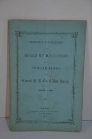
Central Railroad of New Jersey 13th Annual Report-January 1, 1860JM Hobby Supply and Railroad Artifact Auctions4.4(126)See Sold PriceFeb 24, 2024
Two Michigan Central RR Annual Reports-June 1860 and December 31, 1897JM Hobby Supply and Railroad Artifact Auctions4.4(126)See Sold PriceFeb 24, 2024
Michigan Southern and Northern Indiana RR 14th Annual Report-February 28, 1869JM Hobby Supply and Railroad Artifact Auctions4.4(126)See Sold PriceFeb 24, 2024
American Express/New York Central Railroad Map of the United States-1934JM Hobby Supply and Railroad Artifact Auctions4.4(126)See Sold PriceFeb 24, 2024
Central Railroad of New Jersey Map of Sandy Hook Route-ca. 1903JM Hobby Supply and Railroad Artifact Auctions4.4(126)See Sold PriceFeb 24, 2024
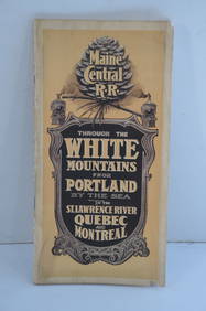
Maine Central RR Through the White Mtns-Portland to the St Lawrence River Book-1901JM Hobby Supply and Railroad Artifact Auctions4.4(126)See Sold PriceFeb 24, 2024
New York Central RR The Adirondacks Brochure 1916-1917JM Hobby Supply and Railroad Artifact Auctions4.4(126)See Sold PriceFeb 24, 2024
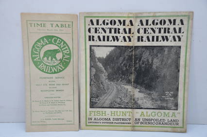
Algoma Central RY March 12, 1944 Public Timetable and BrochureJM Hobby Supply and Railroad Artifact Auctions4.4(126)See Sold PriceFeb 24, 2024
Illinois Central RR October 2, 1901 Public TimetableJM Hobby Supply and Railroad Artifact Auctions4.4(126)See Sold PriceFeb 24, 2024
Illinois Central RR July 24, 1906 Western Lines Public TimetableJM Hobby Supply and Railroad Artifact Auctions4.4(126)See Sold PriceFeb 24, 2024
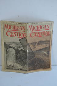
Michigan Central RR May 18, 1884 Public TimetableJM Hobby Supply and Railroad Artifact Auctions4.4(126)See Sold PriceFeb 24, 2024
New York Central and Hudson River RR Public Timetable-November 3, 1901JM Hobby Supply and Railroad Artifact Auctions4.4(126)See Sold PriceFeb 24, 2024
Pennsylvania Central/Pittsburgh Ft Wayne and Chicago 1870 Public TimetableJM Hobby Supply and Railroad Artifact Auctions4.4(126)See Sold PriceFeb 24, 2024
Group of New York Central Railroad Paper - Rule Books, Employee Timetables, Stationary, Log Books,Rail & Road Auctions4.6(165)See Sold PriceMar 07, 2024
Pair of The Gateway to a Continent Books - Grand Central Zone and 1939 World's FairRail & Road Auctions4.6(165)See Sold PriceMar 07, 2024
Pair of Early Railroad Maps - 1874 Delaware, Lackawanna & Western and 1876 Pennsylvania RailroadRail & Road Auctions4.6(165)See Sold PriceMar 07, 2024
Group of Ten Railroad Photographs, Maps, and Prints - New Jersey, Long Island, and New YorkRail & Road Auctions4.6(165)See Sold PriceMar 07, 2024
Rand McNally Railroad Map Cabinet w/ 21 Railroad MapsRail & Road Auctions4.6(165)See Sold PriceMar 08, 2024
TRAIN GEORGE FRANCIS: (1829-1904)International Autograph Auctions Europe S.L.4.5(52)See Sold PriceMar 13, 2024