ATLAS of ANTIENT GEOGRAPHY by SAMUEL BUTLER 1843John McInnis Auctioneers,LLC4.6(502)See Sold PriceFeb 24, 2024
18TH C. ANTIQUE MAP: FRENCH & INDIAN WAR, FRAMEDThomaston Place Auction Galleries4.4(386)See Sold PriceFeb 24, 2024
Rand McNally Railroad Map Cabinet w/ 21 Railroad MapsRail & Road Auctions4.6(165)See Sold PriceMar 08, 2024
Keith Haring - Ink on New York Map, Best Buddies, Inscribed, Signed, and DatedSapphire Auction Gallery4(67)See Sold PriceMar 02, 2024
LATE 17TH C. FRENCH MAP OF THE NEW WORLD BY ALEXIS-HUBERT JAILLOT (1632-1712)Thomaston Place Auction Galleries4.4(386)See Sold PriceFeb 24, 2024
Central Railroad of New Jersey Map of Sandy Hook Route-ca. 1903JM Hobby Supply and Railroad Artifact Auctions4.4(126)See Sold PriceFeb 24, 2024
Lot of Six Mixed Atlas Box Cars-HO Scale-New in BoxJM Hobby Supply and Railroad Artifact Auctions4.4(126)See Sold PriceFeb 25, 2024
Rand McNally/Santa Fe Railroad Map of Iowa-1912JM Hobby Supply and Railroad Artifact Auctions4.4(126)See Sold PriceFeb 24, 2024
NICOLAES VISSCHER (NETHERLANDS, 1618-1709) MAP OF THE NEW WORLDThomaston Place Auction Galleries4.4(386)See Sold PriceFeb 24, 2024
17TH C. WORLD MAP BY NICOLAES VISSCHER (NETHERLANDS, 1618-1709)Thomaston Place Auction Galleries4.4(386)See Sold PriceFeb 24, 2024
Lot of Six Mixed Atlas Cabooses-HO Scale-New in BoxJM Hobby Supply and Railroad Artifact Auctions4.4(126)See Sold PriceFeb 25, 2024
SoldNieuhof. Reys-Kaerte Map of China. 1665Johan Nieuhof. Reys-Kaerte Vande Ambassade Der Nederlantse Oost Indise Compagnie door China. Amsterdam, c. 1665. Hand coloring. Important early map of China, which accompanied Johan Nieuhof's importanSee Sold Price
[MAP OF CHINA] JOHAN NIEUHOFF:Reys-Kaerte Vande Ambassade Der Nederlantse Oost Indise Compagnie Door China..., hand colored engraved map, Amsterdam, c. 1665, framed with French matting h. 17-1/2 w. 20-1/2 in. (sight) overall dimenSee Sold Price
SoldNieuhoff's important map of China 1669Heading: Author: Nieuhoff, Johann Title: Reys-Kaerte vande Ambassade der Nederlantsche Oost Indise Compagnie, door China en den Grooten Tartersen Cham (title also in French and Latin) Place PublishedSee Sold Price
1665 1ed Nieuhof History of CHINA Dutch E. India Trade1665 1ed Nieuhof History of CHINA Dutch East India Trade Illustrated FOLIO MapUTTERLY EXQUISITE & FINEST EXAMPLE KNOWN While there were very few 17th-century works written on China, most of those thatSee Sold Price
SoldJohan Nieuhof & Franz Habermann: China, Nanking, 1770Title/Content of Map: Johan Nieuhof and Franz Xaver Habermann Print Date: aprox. 1770 Cartographer: Johan Nieuhof and Franz Xaver Habermann Material/Medium: Print (optical view) Size: 36.5 cm x 49 cmSee Sold Price
MAPS IN BOOK - China. NieuhoffChina. Johann Nieuhoff, L'Ambassade de la Compagnie Orientale des Provinces Unies vers l'Empereur de la Chine, ou Grand Cam de Tartarie..., 1665 (published). Black & White. This is a French edition ofSee Sold Price
SoldTwo Engravings of Peking and HukeuDutch, 1665, from [Legatio Batavica ad Magnum Tartariae Chamum Sungteium, Modernum Sinae Imperatorem..], by Nieuhof: one of Peking, China, depicting a walled city view, 8-1/8 x 12-3/4 in. (plate); oneSee Sold Price
SoldChina.- Nieuhof (Jan) - Legatio Batavica ad Magnumfirst Latin edition , engraved additional pictorial title, portrait, 35 double-page plates and vignettes, lacking folding map, additional title trimmed to border at head and outer margin, narrow areaSee Sold Price
SoldBasire: Antique View of City of Nanking, China, 1746Title: 'The City of Nan-Kin from Nieuhof' China Date Printed: 1746 Image Size: Approx 19.5 x 31.0cm, 7.5 x 12.25 inches (Medium); Please note that this is a folding print. Type: Antique copperplate prSee Sold Price
2 Hand Colored Prints of Asian Animals, c.1665.2 Hand colored Prints of Asian Animals, c.1665. Johan Nieuhof (Dutch, 1618-1672). From "Het Gezantschap der Neerlandtsche..." (An early publication on travels in China). Published by Pierre de GOYER &See Sold Price
Sold1781 Jesuit Voyage Missions MAP China Peking Philippine1781 Jesuit Voyage Missions MAP China Peking Philippines ASIA Lettres Edifiantes The ‘Lettres Edifiantes et Curieuses’ is a collection of reports and letters from Jesuit missions from around the wSee Sold Price
Sold1859 INDIA 1ed History Indian Revolt Sepoy Mutiny Voyages MAP China Illustrated1859 INDIA 1ed History Indian Revolt Sepoy Mutiny Voyages MAP China Illustrated George Dodds “History of the Indian Revolt” is a rare account of the Indian Rebellion of 1857, or more commoSee Sold Price
SoldColton: Map of China, 1857Title: Map of China By Colton Date: 1857 Dimensions: 17.5 x 14 Medium: Hand Colored Lithograph Joseph Hutchins Colton (1800 - 1893), known professionally as J.H. Colton, founded an American mapmakingSee Sold Price
SoldOrtelius: Antique Map of China, 1597Map: China Regio Asie. Publication Date: 1597 Cartographer: KEERE, PIETER VAN DEN (1571-1646) Publisher: ORTELIUS Size: Miniature – 3.30 H x 4.80 W Inches From the French language edition of the minSee Sold Price
Sold1780 HUGE CHINA MAP & Voyages Mandarin Chinese Theatre1780 HUGE CHINA MAP & Voyages Mandarin Chinese Theatre Military Funeral Procession The best book of its kind! A rare book La Harpe’s ‘General History of Voyages’! This extensive work was begun bSee Sold Price
SoldFrank Dorn folding picture map of ChinaFrank Dorn- folding picture map of Peiping Peking Beijing China, 1936, trimmed. 31 1/2 x 27 1/2''See Sold Price
Sold18th century map of China, Sinarum Regio18th century map of China, Sinarum Regio 20 inches x 23 inchesSee Sold Price
Sold1938 Map of China Government RailwaysNan king Shanghai Ningpo Lines and others Condition some fraying to mapSee Sold Price
Sold(18th/19th c.) Map of China"China Tart A R I AE Paris" hand colored engraving. 13 1/2 x 18 inches (plate). framed. unsigned. Condition: GoodSee Sold Price
Sold3pc Tourist Maps of China 1920-30's3pc Tourist Maps of China. Includes map of Bejing c.1920 (31x21.5''), map of Bejing c.1930 (31x21.5''), and small map of Shanghai from 1927 (6.75x12.5''). (173,175,229)See Sold Price
Sold1755 1st ed Vaissete ATLAS MAPS Asia China Turks Saudi1755 1st ed Vaissete ATLAS MAPS Asia China Turks Saudi Arabia Ottoman Persia Iran Joseph Vaissete was an 18th-century Benedictine historian known for his large work entitled ‘Historical Geography: ESee Sold Price
Sold1747 Voyages INDIA MAPS Japan China Asia Africa Ghana1747 Voyages INDIA MAPS Japan China Asia Africa Ghana Geography Prevost 7v RARE The ‘General History of Voyages’ by abbe Prevost is one of the largest and most impressive collections of stories ofSee Sold Price
Sold1885 Burnaby Ride to KHIVA Uzbekistan Russia China MAPS1885 Burnaby Ride to KHIVA Uzbekistan Russia China MAPS Central Asia Voyages Frederick Burnaby was an intelligence offer in the British Army in the 19th-century. He spent much of his career travelingSee Sold Price
Sold1781 CHINA MAPS Jesuit Voyages Missions Penghu Island Formosa ASIA Lettres Edifiantes1781 CHINA MAPS Jesuit Voyages Missions Penghu Island Formosa ASIA Lettres Edifiantes The Lettres Edifiantes et Curieuses is a collection of reports and letters from Jesuit missions from around the woSee Sold Price
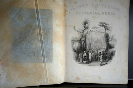
PAYNES UNIVERSUM ca1850 Calf 1st ed Travel 65 X Engravings China etc.Luis Porretta Fine Arts4.3(10)See Sold PriceMar 02, 2024
[ARCTIC]. BOWEN, Emanuel. A New & Accurate Map of the North...Potter & Potter Auctions4.6(539)See Sold PriceMar 07, 2024
Churchill & Nieuhof 1744 Folio Map. Cape of Good Hope, South AfricaAlbion Auctions4.6(336)See Sold PriceMar 01, 2024
Churchill & Nieuhof 1744 Folio Map. Batavia Indonesia East IndiesAlbion Auctions4.6(336)See Sold PriceMar 01, 2024
Churchill & Nieuhof 1744 Map. Batavia Jakarta IndonesiaAlbion Auctions4.6(336)See Sold PriceMar 01, 2024
Perry, Matthew C. 1856 Large Map. Shah Bay, Lew Chew I. JapanAlbion Auctions4.6(336)See Sold PriceMar 01, 2024


![[MAP OF CHINA] JOHAN NIEUHOFF: (1 of 5)](https://p1.liveauctioneers.com/522/100472/51254602_1_x.jpg?height=282&quality=70&version=1487709981)


![[ARCTIC]. BOWEN, Emanuel. A New & Accurate Map of the North... (1 of 1)](https://p1.liveauctioneers.com/928/318880/171360917_1_x.jpg?height=282&quality=70&version=1707501302)


