ATLAS of ANTIENT GEOGRAPHY by SAMUEL BUTLER 1843John McInnis Auctioneers,LLC4.6(502)See Sold PriceFeb 24, 2024
18TH C. ANTIQUE MAP: FRENCH & INDIAN WAR, FRAMEDThomaston Place Auction Galleries4.4(386)See Sold PriceFeb 24, 2024
Rand McNally Railroad Map Cabinet w/ 21 Railroad MapsRail & Road Auctions4.6(165)See Sold PriceMar 08, 2024
Keith Haring - Ink on New York Map, Best Buddies, Inscribed, Signed, and DatedSapphire Auction Gallery4(67)See Sold PriceMar 02, 2024
LATE 17TH C. FRENCH MAP OF THE NEW WORLD BY ALEXIS-HUBERT JAILLOT (1632-1712)Thomaston Place Auction Galleries4.4(386)See Sold PriceFeb 24, 2024
Central Railroad of New Jersey Map of Sandy Hook Route-ca. 1903JM Hobby Supply and Railroad Artifact Auctions4.4(126)See Sold PriceFeb 24, 2024
Lot of Six Mixed Atlas Box Cars-HO Scale-New in BoxJM Hobby Supply and Railroad Artifact Auctions4.4(126)See Sold PriceFeb 25, 2024
Rand McNally/Santa Fe Railroad Map of Iowa-1912JM Hobby Supply and Railroad Artifact Auctions4.4(126)See Sold PriceFeb 24, 2024
NICOLAES VISSCHER (NETHERLANDS, 1618-1709) MAP OF THE NEW WORLDThomaston Place Auction Galleries4.4(386)See Sold PriceFeb 24, 2024
17TH C. WORLD MAP BY NICOLAES VISSCHER (NETHERLANDS, 1618-1709)Thomaston Place Auction Galleries4.4(386)See Sold PriceFeb 24, 2024
Lot of Six Mixed Atlas Cabooses-HO Scale-New in BoxJM Hobby Supply and Railroad Artifact Auctions4.4(126)See Sold PriceFeb 25, 2024
Sold465) MAP OF NEW YORK CA 1790 , D.T.VALENTINES MANUAL, SIGHT: 15 1/2" X 20 1/2"; COND.: LAID DOWN, MISSING BORDER LOWER LFT, TWO SM. BREAKS INTO SUBJECT, ANTIQUE GILT FRAMESee Sold Price
SoldA Map of the Genesee Lands in the County of OntariA Map of the Genesee Lands in the County of Ontario & State of New York, R. H. Pease, 1790 - 13 1/2" x 9"See Sold Price
Samuel Augustus Mitchell (1790-1868), "County Map ofSamuel Augustus Mitchell (1790-1868), "County Map of New York, New Hampshire, Vermont, Massachusettes, Rhode Island and Connecticut," 1860, H. - 15 1/4 in., W. - 22 1/2 in.See Sold Price
SoldNew York Maps (2) (64214)2 maps of New York, 1864 & 1863. New York by Rand, McNally, engraved with color by lithography 20.5" x 23"; New York, 1864, hand colored by Johnson & Ward, double truck, 26.5" x 18.5". Mounted on matSee Sold Price
SoldNew York Antique Maps (2)Plan of City of New York by Lyne, c. 1900. Map of Provinces of New York and New Jersey by Sauthier, 1878 edition. 26" x 19 1/2".See Sold Price
Sold2 New York maps, Founding era, reprinted ca. 1870:2 New York maps, Founding era, reprinted ca. 1870: Chart and Plan of the Harbour of New York & the County Adjacent, From Sandy Hook to Kingsbridge, Comprehending The Whole of New York and Staten IslanSee Sold Price
Sold1790 Receipt For 20 Chests of TeaColonial AmericaNew York Receipt for 20 Chests of Tea, 1790 1790 Receipt For 20 Chests Of Bohea Tea, Choice Fine. March 13, 1790, New York, 2.75” x 8.75”, document written and signed by NeSee Sold Price
Sold1790 Receipt For 20 Chests of TeaColonial AmericaReceipt for 20 Chests Of Bohea Tea 1790 Receipt For 20 Chests Of Bohea Tea. March 13, 1790, New York, 2.75” x 8.75”, document written and signed by Neal McIntire, acknowledSee Sold Price
Sold1790 Receipt For 20 Chests of TeaColonial AmericaNew York Receipt for 20 Chests of Tea, 1790 1790 Receipt For 20 Chests Of Bohea Tea, Choice Fine. March 13, 1790, New York, 2.75” x 8.75”, document written and signed by NeSee Sold Price
Sold1790 Receipt For 20 Chests of TeaColonial AmericaNew York Receipt for 20 Chests of Tea, 1790 1790 Receipt For 20 Chests Of Bohea Tea, Choice Fine. March 13, 1790, New York, 2.75” x 8.75”, document written and signed by NeSee Sold Price
Sold1790 Receipt For 20 Chests of Tea"Colonial AmericaNew York Receipt for 20 Chests of Tea, 1790 1790 Receipt For 20 Chests Of Bohea Tea, Choice Fine. March 13, 1790, New York, 2.75” x 8.75”, document written and signed by NSee Sold Price
Sold1790 Receipt For 20 Chests of TeaReceipt for 20 Chests Of Bohea Tea 1790 Receipt For 20 Chests Of Bohea Tea. March 13, 1790, New York, 2.75” x 8.75”, document written and signed by Neal McIntire, acknowledging receipt ofSee Sold Price
Sold2 MAPS - 1 NEW YORK, 1 PALESTINE2 MAPS - 1 MAP OF NIAGARA AND ORLEANS COUNTY, NEW YORK PUBLISHED 1860 APPROX. 5FT X 5FT 4IN AND RELIEF MAP OF PALESTINE MODEL BY EDWIN E. HOWELL 1905, APPROX. 43" X 65"See Sold Price
SoldNew York City & State Maps & View Publications (2)1) Rand McNally Pocket Maps for Tourists, Travelers & Shippers, General and Commercial Business Reference. 1931. Contains counties, cities, towns, auto roads, railroads & steamship lines, hotels and 1See Sold Price
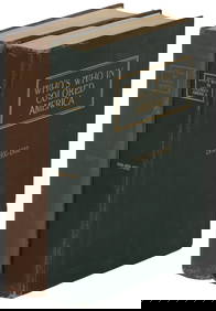
History of the State of new York. 2 vols. Map.. John Romeyn BRODHEAD. History of the State of new York. 2 vols. Second edition of vol. 1; First edition vols. 2. NY: Harper & Bros. 1859 & 1871. 3/4 leather, buttersSee Sold Price
SoldVINTAGE RESTAURANT TABLE LOT OF 2 LAMENTED NEW YVINTAGE RESTAURANT TABLE LOT OF 2 LAMENTED NEW YORK MAPS ON WOOD RESTAURANT TABLESSee Sold Price
SoldLot of 10 New York State Maps and Printslot of 10 New York State maps and prints including 2 prints; Starin's Glen Island, NY and Steinway & Sons Pianoforte Factory, Astoria NY, and 8 maps; county maps, rail maps, business district maps, anSee Sold Price
SoldColonial Currency, NY, Feb. 20, 1790, 2dNew York CurrencyRare 1790 “City of New York” 2 Pence Note February 20, 1790, “City of New York,” 2d, Choice Crisp About Uncirculated. A magnificent specimen in outstanding quaSee Sold Price
SoldManuscript Land Grant of the Chemung River,LAND GRANT for Chemung River and Northumberland County, New York State. Map of Township No. 2: 1st Range of Phelps & Gorain... Manuscript survey on paper. c. 1798. 21" x 17 1/2" sheet. Provenance: OweSee Sold Price
Land Grant for Chemung River and Northumberland CountyLAND GRANT for Chemung River and Northumberland County, New York State. Map of Township No. 2: 1st Range of Phelps & Gorain... Manuscript survey on paper. c. 1798. 21" x 17 1/2" sheet. Provenance: OweSee Sold Price
SoldColonial Currency, NY, Feb. 20, 1790, 2dNew York CurrencyRare 1790 “City of New York” 2 Pence Note February 20, 1790, “City of New York,” 2d, Choice Crisp About Uncirculated. A magnificent specimen in outstanding quaSee Sold Price
SoldColonial Currency, NY, Feb. 20, 1790, 2dNew York CurrencyRare 1790 “City of New York” 2 Pence Note February 20, 1790, “City of New York,” 2d, Choice Crisp About Uncirculated. A magnificent specimen in outstanding quaSee Sold Price
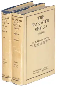
1885 CIVIL WAR 1ed Famous Memoirs US Grant Sheridan Sherman 6v RARE LOT MapsSchilb Antiquarian Rare Books4.8(421)See Sold PriceMar 10, 2024
NICOLAES VISSCHER (NETHERLANDS, 1618-1709) MAP OF THE NEW WORLDThomaston Place Auction Galleries4.4(386)See Sold PriceFeb 24, 2024
Keith Haring - Ink on New York Map, Best Buddies, Inscribed, Signed, and DatedSapphire Auction Gallery4(67)See Sold PriceMar 02, 2024
1867 Map of the Railroads of The State of New YorkRail & Road Auctions4.6(165)See Sold PriceMar 08, 2024
Willem Blaeu, Etc. 17th C. Antiquarian Maps, 2Auctions at Showplace4.5(726)See Sold PriceMar 17, 2024
[LINCOLN, Abraham (1809-1865)]. A group of 2 images honoring Lincoln, incl. commemorative albumenFreeman's | Hindman4.4(1.6k)See Sold PriceFeb 27, 2024
Group of Vintage travel maps and bookletsBaker's Antiques and Auctions3.3(462)See Sold PriceFeb 25, 2024


![[LINCOLN, Abraham (1809-1865)]. A group of 2 images honoring Lincoln, incl. commemorative albumen (1 of 2)](https://p1.liveauctioneers.com/197/319238/171468088_1_x.jpg?height=282&quality=70&version=1707520367)