ATLAS of ANTIENT GEOGRAPHY by SAMUEL BUTLER 1843John McInnis Auctioneers,LLC4.6(502)See Sold PriceFeb 24, 2024
18TH C. ANTIQUE MAP: FRENCH & INDIAN WAR, FRAMEDThomaston Place Auction Galleries4.4(386)See Sold PriceFeb 24, 2024
Rand McNally Railroad Map Cabinet w/ 21 Railroad MapsRail & Road Auctions4.6(165)See Sold PriceMar 08, 2024
Keith Haring - Ink on New York Map, Best Buddies, Inscribed, Signed, and DatedSapphire Auction Gallery4(67)See Sold PriceMar 02, 2024
LATE 17TH C. FRENCH MAP OF THE NEW WORLD BY ALEXIS-HUBERT JAILLOT (1632-1712)Thomaston Place Auction Galleries4.4(386)See Sold PriceFeb 24, 2024
Central Railroad of New Jersey Map of Sandy Hook Route-ca. 1903JM Hobby Supply and Railroad Artifact Auctions4.4(126)See Sold PriceFeb 24, 2024
Lot of Six Mixed Atlas Box Cars-HO Scale-New in BoxJM Hobby Supply and Railroad Artifact Auctions4.4(126)See Sold PriceFeb 25, 2024
Rand McNally/Santa Fe Railroad Map of Iowa-1912JM Hobby Supply and Railroad Artifact Auctions4.4(126)See Sold PriceFeb 24, 2024
NICOLAES VISSCHER (NETHERLANDS, 1618-1709) MAP OF THE NEW WORLDThomaston Place Auction Galleries4.4(386)See Sold PriceFeb 24, 2024
17TH C. WORLD MAP BY NICOLAES VISSCHER (NETHERLANDS, 1618-1709)Thomaston Place Auction Galleries4.4(386)See Sold PriceFeb 24, 2024
Lot of Six Mixed Atlas Cabooses-HO Scale-New in BoxJM Hobby Supply and Railroad Artifact Auctions4.4(126)See Sold PriceFeb 25, 2024
Sold(NEW YORK CITY.) Magnus & Co. Map of the City of New(NEW YORK CITY.) Magnus & Co. Map of the City of New York With Part of Brooklyn and Williamsburgh. Hand-colored lithographed map with an inset view of lower Manhattan and the harbor seen from the eastSee Sold Price
SoldCharles Magnus, New-York City & County Map withMAGNUS, Charles (1826-1900). New-York City & County Map with Vicinity entire Brooklyn Williamsburgh Jersey City &c. New-York: Chs. Magnus, 1855. Lithographed, uncolored. Float mounted and framed. FramSee Sold Price
RAND MCNALLY & CO. NEW YORK CITY BROOKLYN MAP. TEARAND MCNALLY & CO. NEW YORK CITY BROOKLYN MAP. TEARS/STAINS.See Sold Price
SPECTACULAR EARLY 1900s NEW YORK CITY WALL MAPMetropolitan Map of New York City. Lithographed map. Rand McNally and Co., c 1910. 66" x 46" sheet. LARGE WALL MAP WITH ORIGINAL RODS SHOWING ALL MANHATTAN, BROOKLYN, JAMAICA BAY, ADJOINING NEW JERSEYSee Sold Price
SoldRAND, MCNALLY & CO'S NEW HANDY MAP OF NEW YORK CITY, INRAND, MCNALLY & CO'S NEW HANDY MAP OF NEW YORK CITY, IN VERY NICE CONDITION, CIRCA 1890, AS YOU SEE IT, IT MEASURES5.5" X 2.5".See Sold Price
Sold[America, Maps] 3 city maps, about 1910SCARCE EDITIONS OF EARLY 1900 OF THREE HANDY MAPS OF USA CITIES (NEW YORK, PHILADELPHIA AND NEW ORLEANS) [1.]: Rand, McNally Co.. New handy map of New York City with a large scale map of the borough oSee Sold Price
SoldMagnus (Charles) New-York City and County MapMagnus (Charles) New-York City and County Map with Vicinity, Entire Brooklyn, Williamsburgh, Jersey City &c., in the 79th Year of the Independence of the United States,decorative title above tSee Sold Price
Part of Sections Three, Four & Five New York City MapDepicts Midtown, New York City. Plate 20. 1902. G.W. Bromley & Co. Philadelphia. Hand-colored lithograph. ; 22 1/2" x 32"See Sold Price
Part of Section Five, New York City MapDepicts Murray Hill, New York City. Plate 22. 1902. G.W. Bromley & Co. Philadelphia. Hand-colored lithograph. ; 22 1/2" x 32"See Sold Price
1890 Excelsior Dime Vest Pocket Map of New York CityCirca 1890 Antique Map of New York City; "EXCELSIOR DIME VEST POCKET CITY MAPS - NEW YORK". Published by M. J. Ivers & Co. of Fulton St., New York. Approximate map size is 12" x 8-3/4"...a nice frameaSee Sold Price
SoldAntebellum Colton Map of New York CityAntebellum Colton Map of New York CityMap of New York and the Adjacent Cities (New York: J. R. Colton & co., 1855), steel engraving with color from Colton's General Atlas; presented in two-sided woodeSee Sold Price
SoldMap of New York City[ANTIQUARIAN MAP; NEW YORK CITY] MAP OF NEW YORK CITY Showing Portions of Brooklyn, Jersey City, and Westchester Co., Rand-McNally & Co., 1899, original large map 27” high x 22” across including aSee Sold Price
SoldPocket map of New York City 1846Heading: Author: Burr, David H. Title: Map of the City of New York, Drawn by D.H. Burr, for New York as it is in 1846. Population 371,233 Place Published: New York Publisher:C.S. Francis & Co. DSee Sold Price
SoldNEW YORK CITY GUIDE MAPS 1871 AND 1879Edsall's 1879 New York City Guide Map for Pocket Use' published by Van Kleeck, Clark & Co., double sided, measures 28 x 21 unfolded, very good with light toning. And 'Map of New York and Vicinity', 18See Sold Price
SoldLarge framed map, "New York City North of 93rd Street",Large framed map, "New York City North of 93rd Street", Colton's New Map of the City and County of New York Including Extensions North of the Harlem River, published by G.W. and C.B. Colton & Co.'s sSee Sold Price
Sold(1870 New York City roll map). 40 Miles Around New(1870 New York City roll map). 40 Miles Around New York pubbed by HH Lloyd & Co, NY, 1870. 28 ½" x 31 ½". With original black wooden rollers, string ties, and cloth edging intact. Varnished surface,See Sold Price
SoldS. H. Elliot "The Attractions of New Haven Connecticut"Samuel Hayes Elliot (1809-1869), "The Attractions of New Haven, Connecticut; A Guide to the City with Map and Illustrations," New York: N. Tibbals & Co., 1869. With map of the city of New HaSee Sold Price
SoldAntique 1851 Map of New York CityThis is an antique map of New York City from 1851. This is a fantastic early piece that shows much of what is Lower Manhattan today. In addition to the map, there are several depictions of landmarks tSee Sold Price
SoldColton's New York Map [NY City Map]Colton's New York City and County Map. J. H. Colton Cartographer. Published by J. H. Colton, New York. Stamped 'Entered according to Act of Congress in the Year 1855 by J. H. Colton and Co. in in theSee Sold Price
Map of New York City Showing Portions of Brooklyn,Title: Map of New York City Showing Portions of Brooklyn, Jersey City, and Westchester Co. Publication Date: c1901 Cartographer: RAND, MCNALLY & CO. Publisher: RAND, MCNALLY & CO. Size: 26Height - 19WSee Sold Price
SoldNew York City (Southern Part). | Map of New York CityTitle: New York City (Southern Part). | Map of New York City (Northern Part). Publication Date: 1892 ca. Cartographer: FISK & CO. Publisher: HUNT & EATON Size: 11x8.6 The People's Cyclopedia map. PleaSee Sold Price
Colton's map of New York City and CountyHeading: Author: Colton, G.W. and C.B. Title: Map of New York City and County Place Published: New York Publisher:Colton & Co. Date Published: ca. 1870 Description: FoldingSee Sold Price
SoldMagnus's 1850 Litho of the 1728 Bradford Map NYCColonial AmericaMagnus’s 1850s Litho of the 1728 “Bradford Map” of New York City c. 1850, “A Plan of the City of New York from an Actual Survey,” By Charles Magnus, afterSee Sold Price
Rare Sanitary Map of New York 1865Heading: (New York City) Author: Viele, Egbert L. Title: Sanitary & Topographical Map of the City and Island of New York Place Published: New York Publisher:Ferd. Mayer & Co. lith. Date PublishedSee Sold Price
Antique Silver Enamel Watch Pendant 14K NecklaceAuctions at Showplace4.5(726)See Sold PriceMar 03, 2024
George Hayward - Map of the City of New York 1854Dane Fine Art Auctions4.4(494)See Sold PriceMar 07, 2024
Tiffany & Co. HardWear Small Wrap Necklace in 18K Yellow Gold 36"Auction Wallstreet4.5(47)See Sold PriceMar 02, 2024
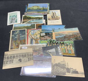
Large Group Vintage Travel Ephemera PostcardsThe Benefit Shop Foundation Inc.4.3(2.9k)See Sold PriceFeb 28, 2024
Thirty-Three Assorted Railroad and Transit Buttons - Kansas City Southern, United Transit ofRail & Road Auctions4.6(165)See Sold PriceMar 07, 2024
Our Trees: How to Know Them by Clarence Weed 1946North American Artifact Auctions4.6(182)See Sold PriceApr 20, 2024
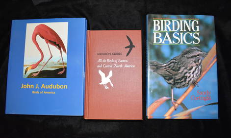
3 Vintage Hardback Bird Books AudubonNorth American Artifact Auctions4.6(182)See Sold PriceApr 20, 2024
American Waltham Co. 14K Gold Ladies Pocket WatchAuctions at Showplace4.5(726)See Sold PriceMar 17, 2024
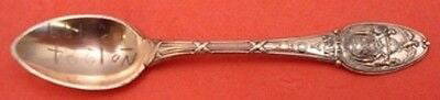
New York City by Tiffany & Co. Copper Sample Demitasse Spoon Oval w/Eagle 4 3/8"Mynt Auctions4.6(680)See Sold PriceFeb 26, 2024
Georg Bockler Map of Ancient Jerulsaem EtchingAuctions at Showplace4.5(726)See Sold PriceApr 07, 2024
Black and white map of part of New York City (mostly Manhattan)Proverde Auctions4.3(3)See Sold PriceFeb 28, 2024
Laminated Unique Media New York City MapRapid Estate Liquidators and Auction Gallery4.5(1.1k)See Sold PriceFeb 29, 2024
8PC New York Police Department Guide BooksBruneau & Co. Auctioneers4.5(491)See Sold PriceMar 18, 2024
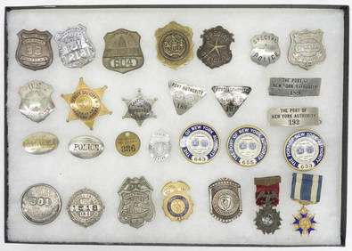
28PC Collection of New York City Police BadgesBruneau & Co. Auctioneers4.5(491)See Sold PriceMar 18, 2024


![[America, Maps] 3 city maps, about 1910 (1 of 10)](https://p1.liveauctioneers.com/2198/56199/31005028_1_x.jpg?height=282&quality=70&version=1415833748)


![Colton's New York Map [NY City Map] (1 of 3)](https://p1.liveauctioneers.com/5755/154409/77936950_1_x.jpg?height=282&quality=70&version=1573094011)