SoldMoxon Map of Jerusalem 1688 VersionArtist: Moxon, Joseph, 1627-1699, corrected and sold by P. Lea Atlas and Hercules in Cheap Side London Title: A Map of Jerusalem Date: 1688 Medium: engraving Dimensions: 12 x 17.5 inches Edition:See Sold Price
Sold[Bible, King James Version, 1715 Folio]THE HOLY BIBLE. [Amsterdam?], 1715. 16" x 10". [28], 712, [2], 160, 248 pp. (text complete), + 2 (of 6) double-page maps/plans by Moxon including plan of Jerusalem and map of Canaan, and 34 small platSee Sold Price
Sold1715, King James Bible, Folio, Large Pulpit Size1715, FOLIO KING JAMES BIBLE VERSION WITH GENEVA NOTES 16" x 10". [28], 712, [2], 160, 248 pp. (text complete), + 2 (of 6) double-page maps/plans by Moxon Including plan of Jerusalem and map of CanaSee Sold Price
Bible, English. 1715Bible, English. The Holy Bible,2 parts in 1, 6 double-page maps by Thomas Moxon, margins creased or frayed, map of Jerusalem with loss at right-hand side, 22ff. with a total of 154 small engrSee Sold Price
SoldIerusalem - Panoramic Map View of Jerusalem, ProbablyIerusalem - Panoramic Map View of Jerusalem, Probably 18th Century. Following the map of Jacques Chereau (1688-1776) from the 18th century. Copperplate. Colored. 21x34cm.See Sold Price
English . The Holy Bible , with Book of Common PrayerEnglish . The Holy Bible , with Book of Common Prayer and Book of Psalms, 22 engraved plates of multiple images, 6 folding engraved maps, including plan of Jerusalem, by Joseph Moxon, woodcut decoratiSee Sold Price
SoldHoly Land.- Jerusalem.- Moxon (Joseph) Jerusalem,Holy Land.- Jerusalem.- Moxon (Joseph) Jerusalem, plan of ancient Jerusalem based on Stern's plan from 1630, showng the City with the Second Temple, Herod's Castle, and streets and markets surroundedSee Sold Price
SoldUnited Nations Resolution regarding the EstablishmentUnited Nations Resolution regarding the Establishment of the State - with Maps - [Tel Aviv, 1948] Full version with three maps. Published by "Ha'Aretz". 31 pp. 15 cm. Condition: Excellent.See Sold Price
SoldWright, Paul 1782 Holy Land Map. Jerusalem"A Correct Plan of the Antient City of Jerusalem" by Thomas Conder. Folio Copper Plate Published 1782, London for "The Complete British Family Bible…" by Paul Wright. Paper Size: 14.5 x 9.5 inch (37See Sold Price
SoldMAP - Jerusalem, Holy Land. DanckertsJerusalem, Holy Land. Cornelius Danckerts, De Stadt Ierusalem, 1718 (published). Hand Color. Great bird's-eye plan of the ancient holy city flanked by engravings of religious icons. At the bottom areSee Sold Price
SoldEARLY HANDCOLORED MAP (JERUSALEM ) MEASURES 16" X 20EARLY HANDCOLORED MAP (JERUSALEM ) MEASURES 16" X 20 1/2", FROM LOCAL ESTATE….See Sold Price
SoldMap, Jerusalem, Gaspar Bouttats,FlemishFramed antique map engraving, ''Den Bergh uan oliueten''[Jerusalem] ca. 1685, by Gaspar Bouttats (Flemish 1640-1695), after Jacques Peeters, signed in the plate lower right. Condition: Some paper lossSee Sold Price
SoldOgilby & Moxon Map of CarolinaOGILBY, John (1600-1676) and MOXON, James (1627-1691).A New Discription of Carolina by Order of the Lord Proprietors.Engraved map with original hand color in part.London, 1673.17" x 22 3/8" sheet.RareSee Sold Price
SoldMap, Jerusalem, Wilkinson, 1807Map, ''The Kingdom of Jerusalem, with it's Environs at the time of the Crusades'', published June 11th, 1807, London, R. Wilkinson, E. Baker, E. Bourne, copper plate engraving, with applied color, sigSee Sold Price
SoldMAP, Jerusalem, Holy Land, I. PutteJerusalem, Holy Land. I. Putte, Ierusalem, 1718 (published). Hand Color. This detailed bird's-eye plan was one of the most popular plans of Jerusalem during the seventeenth century. While it is imaginSee Sold Price
MAP, Jerusalem, Holy Land, SavryJerusalem, Holy Land. Jacob Savry, De Heylige en Wytvermaerde Stadt Ierusalem, Eerst Genaemt Salem, 1648 (dated). Hand Color. This detailed bird's-eye view is based on Claes Janszoon Visscher's depictSee Sold Price
SoldMAP, Jerusalem, Holy Land, VisscherJerusalem, Holy Land. Nicolas Visscher, De Heylige en Wytvermaerde Stadt Ierusalem eerst Genaemt Salem Genesis 14. Vers 18, 1664 (published). Hand Color. This detailed bird's-eye view was one of the mSee Sold Price
SoldMAP, Jerusalem, Holy Land, DetleffsenJerusalem, Holy Land. Johann Detleffsen, Die Heylige und Weitberuhmte Stadt Jerusalem Erstlich Genant Salem..., 1716 (circa). Hand Color. This rare map was published in a German bible by Johann DetlefSee Sold Price
SoldWall map version of Dart's Mining Map of Tuolumne Co.Heading: (California - Tuolumne County) Author: Dart, J.P. Title: Map of the Principal Quartz and Gravel Mines in Tuolumne County, California. Taken from Government Surveys and Mining Records. By J.P.See Sold Price
Rare Late Pocket Map VersionColton, George Woolworth (1827–1901). Colton's New Topographical Map of the States of Virginia, West Virginia, Maryland... Lithographed map with original hand color. G.W. & C.B. Colton, 1892. 3See Sold Price
SoldMAP, Jerusalem, Holy Land, VisscherJerusalem, Holy Land. Nicolas Visscher, De Heylige en Wytvermaerde Stadt Ierusalem Eerst Genaemt Salem Genesis 14. Vers 18, 1665 (published). Hand Color. This detailed bird's-eye view was one of the mSee Sold Price
MAP, Jerusalem, Holy Land, AdrichomFirst Edition of Adrichom's Influential Bird's-Eye Plan of Jerusalem. Jerusalem, Holy Land. Christian van Adrichom, Ierusalem I., et Suburbia eius, Sicut Tempore Christi Floruit, cum Locis, in QuibusSee Sold Price
SoldMap. Jerusalem. Coccejus Johannes Heinrich. Amsterdam,Ierusalemniewlicksuyt de SchriftenIosephusafgebeeld door. Imaginary map, historic, of Jerusalem by Coccejus Johannes Heinrich. According to the book of Josephus Flavius: Alle de werken, p. 655 (in theSee Sold Price
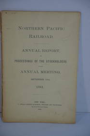
Northern Pacific RR 17th Annual Report-Version 1-September 15, 1881JM Hobby Supply and Railroad Artifact Auctions4.4(127)See Sold PriceFeb 24, 2024
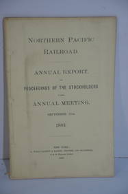
Northern Pacific RR 17th Annual Report-Version 2-September 15, 1881JM Hobby Supply and Railroad Artifact Auctions4.4(127)See Sold PriceFeb 24, 2024
Jerusalem Map for British Soldiers in Palestine - WW2Levy Auction House4.3(11)See Sold PriceFeb 27, 2024
[MAP]. [ALBRIZZI, Giambatista, 1698-1777]. Carta Geografica...Potter & Potter Auctions4.6(550)See Sold PriceMar 07, 2024
1738 BIBLE in DUTCH ILLUSTRATED w/ MAPS MASSIVE FOLIO in DUTCH antique BIBLIAJasper524.5(9.9k)See Sold PriceFeb 27, 2024
1738 BIBLE in DUTCH ILLUSTRATED w/ MAPS antique MASSIVE FOLIO BIBLIAJasper524.5(9.9k)See Sold PriceFeb 27, 2024
1730 BIBLE in DUTCH ILLUSTRATED w/ MAPS antique MASSIVE FOLIO BIBLIAJasper524.5(9.9k)See Sold PriceFeb 27, 2024
Georg Bockler Map of Ancient Jerulsaem EtchingAuctions at Showplace4.6(744)See Sold PriceApr 07, 2024


![[Bible, King James Version, 1715 Folio] (1 of 9)](https://p1.liveauctioneers.com/3532/137883/69938982_1_x.jpg?height=282&quality=70&version=1552160299)


![[MAP]. [ALBRIZZI, Giambatista, 1698-1777]. Carta Geografica... (1 of 1)](https://p1.liveauctioneers.com/928/318880/171361280_1_x.jpg?height=282&quality=70&version=1707501302)


