ATLAS of ANTIENT GEOGRAPHY by SAMUEL BUTLER 1843John McInnis Auctioneers,LLC4.5(505)See Sold PriceFeb 24, 2024
18TH C. ANTIQUE MAP: FRENCH & INDIAN WAR, FRAMEDThomaston Place Auction Galleries4.4(393)See Sold PriceFeb 24, 2024
Rand McNally Railroad Map Cabinet w/ 21 Railroad MapsRail & Road Auctions4.6(165)See Sold PriceMar 08, 2024
Keith Haring - Ink on New York Map, Best Buddies, Inscribed, Signed, and DatedSapphire Auction Gallery4.1(67)See Sold PriceMar 02, 2024
LATE 17TH C. FRENCH MAP OF THE NEW WORLD BY ALEXIS-HUBERT JAILLOT (1632-1712)Thomaston Place Auction Galleries4.4(393)See Sold PriceFeb 24, 2024
Central Railroad of New Jersey Map of Sandy Hook Route-ca. 1903JM Hobby Supply and Railroad Artifact Auctions4.4(127)See Sold PriceFeb 24, 2024
Lot of Six Mixed Atlas Box Cars-HO Scale-New in BoxJM Hobby Supply and Railroad Artifact Auctions4.4(127)See Sold PriceFeb 25, 2024
Rand McNally/Santa Fe Railroad Map of Iowa-1912JM Hobby Supply and Railroad Artifact Auctions4.4(127)See Sold PriceFeb 24, 2024
NICOLAES VISSCHER (NETHERLANDS, 1618-1709) MAP OF THE NEW WORLDThomaston Place Auction Galleries4.4(393)See Sold PriceFeb 24, 2024
17TH C. WORLD MAP BY NICOLAES VISSCHER (NETHERLANDS, 1618-1709)Thomaston Place Auction Galleries4.4(393)See Sold PriceFeb 24, 2024
Lot of Six Mixed Atlas Cabooses-HO Scale-New in BoxJM Hobby Supply and Railroad Artifact Auctions4.4(127)See Sold PriceFeb 25, 2024
SoldMitchell's New Reference Atlas 1868 with 56 CopperMitchell's New Reference Atlas 1868 with 56 Copperplate Maps. Complete inside, binding is intact, wear to outer covers.See Sold Price
SoldMitchell’s New Reference Atlas.[Maps] Mitchell’s New Reference Atlas. Philadelphia: E.H. Butler & Co., 1865. Three-quarter leather over maroon cloth, gilt-stamped cover, gilt title on banded spine, marbled endpapers. Fifty-siSee Sold Price
Sold1865 MITCHELLS NEW REFERENCE ATLAS FOR THE USE OF1865 MITCHELLS NEW REFERENCE ATLAS FOR THE USE OF COLLEGE LIBRARIES, FAMILIES AND COUNTING HOUSES IN A SERIES OF FIFTY SIX COPPERPLATE MAPS, EXHIBITING THE SEVERAL COUNTRIES, EMPIRES, KINGDOMS, AND STSee Sold Price
SoldMitchell's New Reference Atlas 1865Heading: Author: Mitchell, Samuel Augustus Title: Mitchell's New Reference Atlas for the use of Colleges, Libraries, Families, and Counting Houses, in a Series of Fifty-Six Copperplate Maps, ExhibitiSee Sold Price
SoldMitchell's New General Atlas. 1863. 84 maps/insets[Atlas]. MITCHELL’S NEW GENERAL ATLAS, Containing Maps ot the the Various Countries of the World, Plans of Cities, Etc… Phila: S. Augustus Mitchell, 1863. 4to. Orig quarter leather and cloth. WornSee Sold Price
SoldMITCHELL'S NEW GENERAL ATLAS, PUBLISHED BYAUGUSTUS MITCHELL, JR., PHILADELPHIA, 1869, CLOTH BOUND WITH GILT LETTERING. THE ATLAS CONTAINS 96 MAPS OF VARIOUS COUNTRIES INCLUDING U.S. CITY MAPS. OVERALL CONDITION IS VERY GOOD WITH MINOR FOXINGSee Sold Price
SoldMitchell's New General Atlas 1873Mitchell's New General Atlas (of the World), 1873, S. Augustus Mitchell. Has wear around the cover edges and to the spine and the front cover is loose, as well as the first few pages, but the Atlas paSee Sold Price
SoldMitchells New General Atlas 1862Mitchell's new general atlas, containing maps of the various countries of the world, plans of citiew, etc. Published by S. Augustus Mitchell, Jr. 1862; 16x13 inches.See Sold Price
SoldMITCHELLS NEW GENERAL ATLASDATED 1863. BINDING IS ROUGH, STRUNG TOGETHER. INK SMEARS AND SPOTS. ALSO WITH BRITISH MAP AND SOUTH AFRICASee Sold Price
SoldMitchells New Universal Atlas, 1857Mitchells New Universal Atlas, 1857MITCHELL, S. AUGUSTUS. A New Universal Atlas--Containing Maps of the Various Empires, Kingdoms, States, and Republics of the World. Philadelphia: Charles Desilver, 1See Sold Price
SoldMitchell's New General Atlas. 1883.[Atlas] Mitchell, S. Augustus. "Mitchell's New General Atlas containing Maps of the Various Countries of the World, Plans of Cities, Etc.” Philadelphia, Bradley & Company, 1883. 15 1/2” x 13”. CSee Sold Price
SoldMITCHELL’S NEW GENERAL ATLAS. 1863. 84 maps/insets[Atlas]. MITCHELL’S NEW GENERAL ATLAS, Containing Maps of the Various Coutnries of the World, Plans of Cities, Etc… Phila: S. Augustus Mitchell, 1863. Folio. 84 maps & insets (As numbered. MitchelSee Sold Price
SoldMitchell’s New General Atlas.[Maps] Mitchell’s New General Atlas. Philadelphia: S. Augustus Mitchell, Jr., 1861. Publisher’s three-quarter leather over gilt-stamped cloth boards. Seventy-four hand-colored maps and plaSee Sold Price
SoldMitchell’s New General Atlas, 1868.[Atlas]. Mitchell’s New General Atlas, Containing Maps of the Various Countries of the World, Plans of Cities, Etc… Phila: S. Augustus Mitchell, 1868. Complete with 96 maps/insets on 65 pages. (InSee Sold Price
SoldMitchell’s New General Atlas. 1884.[Atlas] Mitchell, S. Augustus. “Mitchell’s New General Atlas containing Maps of the Various Countries of the World, Plans of Cities, Etc.” Philadelphia, Bradley & Company, 1883. FolSee Sold Price
SoldMitchell's New General Atlas.Mitchell, S. Augustus. Mitchell’s New General Atlas. Philadelphia: S. Augustus Mitchell, Jr., 1870. Publisher’s half calf over pebbled cloth, ruled in gilt and decoratively stamped in blinSee Sold Price
SoldMAPS: 1867 Mitchell's New General AtlasMAPS: 1867 Mitchell's New General Atlas, Mitchell's New General Atlas, Containing Maps of the Various Countries of the World, Plans of Cities, Etc., Embraced by Fifty-Eight Quarto Maps, forming a seriSee Sold Price
Sold19th C. "Mitchell's New General Atlas""Mitchell's New General Atlas," circa 1870, 16" h x 12" w. Provenance: From a Massachusetts estate.See Sold Price
SoldMitchell's New Universal Atlas 1852Heading: Author: Thomas, Cowperthwait & Co. Title: A New Universal Atlas Containing Maps of the various Empires, Kingdoms, States and Republics of the World with a special Map of each of the United SSee Sold Price
SoldMitchell's New General Atlas 1860 U.S. mapsHeading: Author: Mitchell, Samuel Augustus Title: Mitchell's New General Atlas, Containing Maps of the Various Countries of the World, Plans of Cities, Etc.... Place Published: Philadelphia PublisherSee Sold Price
SoldMitchell's New General Atlas,Containing Maps of the Various Countries of the World, Plans of Cities, Etc. Philadelphia: S. Augustus Mitchell, 1862, 50 quarto maps, forming a series of 80 maps and plans (complete), all hand-coloreSee Sold Price
EARLY 18TH C. DUTCH CHART OF PACIFIC OCEAN BY FREDERIK DE WIT (1629-1706) WITH CALIFORNIA AS ANThomaston Place Auction Galleries4.4(393)See Sold PriceFeb 24, 2024
HAMMOND'S READY REFERENCE HISTORICAL ATLAS 1920North American Artifact Auctions4.7(198)See Sold PriceApr 20, 2024
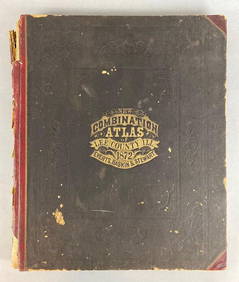
1872 New Combination Atlas of Lee County Illinois BookMatthew Bullock Auctioneers4.7(1.8k)See Sold PriceFeb 24, 2024
Mitchell - Map of the City of Washington (Washington, DC)Trillium Antique Prints & Rare Books4.5(32)See Sold PriceFeb 24, 2024
Distressed New York & Great Northern O Scale BoxcarsRapid Estate Liquidators and Auction Gallery4.5(1.1k)See Sold PriceFeb 24, 2024
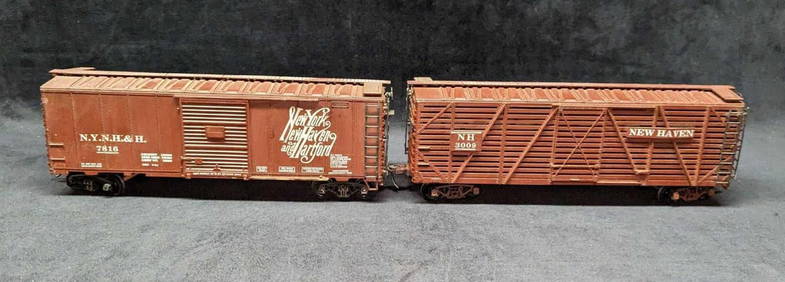
2 Vintage O Scale Atlas New Haven New York BoxcarsRapid Estate Liquidators and Auction Gallery4.5(1.1k)See Sold PriceFeb 24, 2024
Robert H Labberton - Map of The Territory of the Present United States - The territory of theProverde Auctions4.3(3)See Sold PriceFeb 28, 2024