MATTHEWS c1856 Map Of Upper Canada Ontario Indian Land Agency Divisions Scarce!Luis Porretta Fine Arts4.3(10)See Sold PriceMar 02, 2024
DEVINE c1856 Dr Salters Map Of Lake Huron Ontario Indian Lands etc. No. 7 ScarceLuis Porretta Fine Arts4.3(10)See Sold PriceMar 02, 2024
DUNLEVIE c1856 Map Counties Of Gaspe & Bonaventure Quebec Canada SCARCE! #1Luis Porretta Fine Arts4.3(10)See Sold PriceMar 02, 2024
DUNLEVIE c1856 Map Counties Of Gaspe & Bonaventure Quebec Canada SCARCE! #2Luis Porretta Fine Arts4.3(10)See Sold PriceMar 02, 2024
Map UNITED COUNTIES LEEDS & GRENVILLE by Walling 1861 Rare Canada Map 5ft x 5ftLuis Porretta Fine Arts4.3(10)See Sold PriceMar 02, 2024
Ambroise TARDIEU c1822 Map Venice Napoleon Italian Campaign 17" x 11"Luis Porretta Fine Arts4.3(10)See Sold PriceMar 02, 2024
SoldMitchell: Map of Philadelphia (and Camden), 1887Map: Philadelphia (and Camden) Maker: S. Augustus Mitchell Date: 1877 Size: 23 x 15.25 in Please note that this lot has a confidential reserve. When you leave a bid in advance of the auction, submit ySee Sold Price
1887 Mitchell Map of North and South Carolina -- NorthTitle: 1887 Mitchell Map of North and South Carolina -- North and South Carolina Date: 1887, Philadelphia Cartographer: S Mitchell Size: 11.3 X 14 in. Additional Information: A very nice map of the CaSee Sold Price
Plan of the City of Philadelphia and CamdenReserve Reduced! Title: Plan of the City of Philadelphia and Camden Publication Date: 1884 Cartographer: GAMBLE, W.H. Publisher: S. Augustus Mitchell, Jr. Size (inches): H14.1 - W21.6 Map detailing ciSee Sold Price
SoldPlan of the City of Philadelphia and CamdenTitle: Plan of the City of Philadelphia and Camden Publication Date: 1879 ca. Cartographer: GAMBLE, W. H. Publisher: S. Augustus Mitchell, Jr. Size: 13.75x20.6 The city shown north to Allegheny AvenueSee Sold Price
Sold[United States/Northeast]. 5 Maps.[United States/Northeast]. 5 Maps. Each hand-colored. ++ Plan Of The City Of Philadelphia And Camden. From Mitchell's Atlas Of The United States, 1880. 13 3/8 x 20 1/2. Small tear along the bottom folSee Sold Price
SoldPlan of the City of Philadelphia and CamdenTitle: Plan of the City of Philadelphia and Camden Publication Date: c1880 Cartographer: GAMBLE, WM. H. Publisher: S. Augustus Mitchell, Jr. Size: 15Height - 23Width 42. 43. Shows the streets as far nSee Sold Price
1876 Mitchell Map of Philadelphia -- Plan of the CityTitle/Content of Map: 1876 Mitchell Map of Philadelphia -- Plan of the City of Philadelphia and Camden Date: 1876 PhiladelphiaCartographer: S Mitchell Size: 14.6 X 22 in. This is an excellent double pSee Sold Price
Sold1870 Mitchell Map of Philadelphia -- Plan ofTitle: 1870 Mitchell Map of Philadelphia -- Plan of Philadelphia Cartographer: S Mitchell Year / Place: 1870, Philadelphia Map Dimension (in.): 11 X 13 in. This is an excellent map of Philadelphia. GrSee Sold Price
1876 Mitchell Map of Philadelphia -- Plan of the CityTitle/Content of Map: 1876 Mitchell Map of Philadelphia -- Plan of the City of Philadelphia and Camden Date: 1876 Philadelphia Cartographer: S Mitchell Size: 14.6 X 22 in. This is an excellent doubleSee Sold Price
SoldMitchell: Antique Map of Philadelphia, 1870Title/Content of Map: 1870 Mitchell Map of Philadelphia -- Plan of Philadelphia Date Printed: 1870, Philadelphia Cartographer: S Mitchell Size: 11 X 12.8 in. A very nice map of the City of Brotherly LSee Sold Price
Mitchell: Antique Map of Philadelphia, 1870Title/Content of Map: 1870 Mitchell Map of Philadelphia -- Plan of Philadelphia Date Printed: 1870, Philadelphia Cartographer: S Mitchell Size: 11 X 12.8 in. A very nice map of the City of Brotherly LSee Sold Price
SoldWilliam M. Bradley (1758-1833), "Plan of the City ofWilliam M. Bradley (1758-1833), "Plan of the City of Philadelphia and Camden, 1887, hand colored, H. - 15 1/4 in., W. - 24 1/4 in.See Sold Price
SoldPRR Property Atlas, Overbrook to Malvern (c. 1887)J.L. Smith. Atlas of Properties Along the Pennsylvania Railroad from Overbrook to Malvern, with index map & 34 area maps. Philadelphia, c. 1887.CONDITION: Covers lacking; partially disbound, most mapsSee Sold Price
Sold1887 Mitchell Map of Florida -- County Map of FloridaTitle/Content of Map: 1887 Mitchell Map of Florida -- County Map of Florida Date: 1887, Philadelphia Cartographer: S Mitchell Size: 10.7 X 14.3 in. Handsome county map of Florida. In this derivative mSee Sold Price
Sold1887 Mitchell Map od Indian Territory -- IndianTitle/Content of Map: 1887 Mitchell Map od Indian Territory -- Indian Territory Date: 1887, Philadelphia Cartographer: S Mitchell Size: 11.6 x 14.5 in. A very nice map of the Indian Territories, but oSee Sold Price
Sold1887 Mitchell Map of New York City -- New York andTitle/Content of Map: 1887 Mitchell Map of New York City -- New York and Brooklyn Date: 1887, Philadelphia Cartographer: SS Mitchell Size: 13.5 x 21.1 in. This fascinating map of New York City area coSee Sold Price
Sold1887 Mitchell Map of North and South Carolina -- NorthTitle/Content of Map: 1887 Mitchell Map of North and South Carolina -- North and South Carolina Date: 1887, Philadelphia Cartographer: S Mitchell Size: 11.3 X 14 in. A very nice map of the Carolinas,See Sold Price
Sold1887 Mitchell Map of the United States -- Map of theTitle/Content of Map: 1887 Mitchell Map of the United States -- Map of the United States, and Territories. Together with Canada &c Date: 1887, Philadelphia Cartographer: S Mitchell Size: 13.2 x 21.5 iSee Sold Price
SoldAntique Map of Philadelphia and Camden, Walling, 18721872 Map of the Compact Portions of Philadelphia and Camden, Walling. Very nice example with good margins and very clean. Hand-colored map was originally published in the 1872 "New Topographical AtlasSee Sold Price
1887 Mitchell Map of North and South Carolina -- NorthTitle/Content of Map: 1887 Mitchell Map of North and South Carolina -- North and South Carolina Date: 1887, Philadelphia Cartographer: S Mitchell Size: 11.3 X 14 in. A very nice map of the Carolinas,See Sold Price
SoldMitchell: Antique Map of Philadelphia, 1869Title/Content of Map: Philadelphia by Mitchell Date Printed: 1869 Cartographer: Augustus S. Mitchell Material/Medium: Paper Size: 15 1/3" x 12 1/3" Condition: Excellent Hand colored engraved Map. PublSee Sold Price
1887 Mitchell Map of North and South Carolina -- NorthTitle/Content of Map: 1887 Mitchell Map of North and South Carolina -- North and South Carolina Date: 1887, Philadelphia Cartographer: S Mitchell Size: 11.3 X 14 in. A very nice map of the Carolinas,See Sold Price
1887 Mitchell Map of New Orleans -- Plan of New OrleansReserve Reduced! Title/Content of Map: 1887 Mitchell Map of New Orleans -- Plan of New Orleans Date: 1887, Philadelphia Cartographer: S Mitchell Size: 9.2 x 10.9 in. An excellent map of the Crescent CSee Sold Price
Sold1887 Mitchell Map of New Orleans -- Plan of New OrleansTitle/Content of Map: 1887 Mitchell Map of New Orleans -- Plan of New Orleans Date: 1887, Philadelphia Cartographer: S Mitchell Size: 9.2 x 10.9 in. An excellent map of the Crescent City, showing itsSee Sold Price
1849 Mitchell School ATLAS 24 MAPS America Holy Land France Africa Egypt AsiaSchilb Antiquarian Rare Books4.8(428)See Sold PriceMar 31, 2024
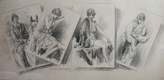
Charles Davis Mitchell (American 1887-1940) Graphite drawing Fashionable LadiesGlobal Auctions Company4.3(36)See Sold PriceMar 03, 2024
Mitchell - Map of the City of Washington (Washington, DC)Trillium Antique Prints & Rare Books4.5(32)See Sold PriceFeb 24, 2024
1887 VAM-1A DONKEY TAIL TOP 100 MORGAN DOLLAR PCGS AU53Mynt Auctions4.6(697)See Sold PriceMar 01, 2024
julius erving signed autographed philadelphia 76ers mitchell & ness jersey inscr3 Kings Auction4.3(201)See Sold PriceFeb 28, 2024
1829 GERMAN-LANGUAGE ANTIQUE AMERICAN BIBLE ILLUSTRATED WITH MAPS OF PHILADELPHIANY Elizabeth 4.2(86)See Sold PriceMar 03, 2024


![[United States/Northeast]. 5 Maps. (1 of 1)](https://p1.liveauctioneers.com/179/1435/617536_1_x.jpg?height=282&quality=70)