ATLAS of ANTIENT GEOGRAPHY by SAMUEL BUTLER 1843John McInnis Auctioneers,LLC4.5(505)See Sold PriceFeb 24, 2024
18TH C. ANTIQUE MAP: FRENCH & INDIAN WAR, FRAMEDThomaston Place Auction Galleries4.4(393)See Sold PriceFeb 24, 2024
Rand McNally Railroad Map Cabinet w/ 21 Railroad MapsRail & Road Auctions4.6(165)See Sold PriceMar 08, 2024
Keith Haring - Ink on New York Map, Best Buddies, Inscribed, Signed, and DatedSapphire Auction Gallery4(67)See Sold PriceMar 02, 2024
LATE 17TH C. FRENCH MAP OF THE NEW WORLD BY ALEXIS-HUBERT JAILLOT (1632-1712)Thomaston Place Auction Galleries4.4(393)See Sold PriceFeb 24, 2024
Central Railroad of New Jersey Map of Sandy Hook Route-ca. 1903JM Hobby Supply and Railroad Artifact Auctions4.4(127)See Sold PriceFeb 24, 2024
Lot of Six Mixed Atlas Box Cars-HO Scale-New in BoxJM Hobby Supply and Railroad Artifact Auctions4.4(127)See Sold PriceFeb 25, 2024
Rand McNally/Santa Fe Railroad Map of Iowa-1912JM Hobby Supply and Railroad Artifact Auctions4.4(127)See Sold PriceFeb 24, 2024
NICOLAES VISSCHER (NETHERLANDS, 1618-1709) MAP OF THE NEW WORLDThomaston Place Auction Galleries4.4(393)See Sold PriceFeb 24, 2024
17TH C. WORLD MAP BY NICOLAES VISSCHER (NETHERLANDS, 1618-1709)Thomaston Place Auction Galleries4.4(393)See Sold PriceFeb 24, 2024
Lot of Six Mixed Atlas Cabooses-HO Scale-New in BoxJM Hobby Supply and Railroad Artifact Auctions4.4(127)See Sold PriceFeb 25, 2024
Sold
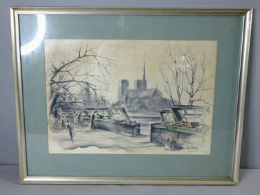
Michaux State of Franklinia Map and Book, 2 itemsMichaux Map and Book related to State of Franklinia, 2 items total. 1st item: Map of the United States, Canada, & C, engraved by Smith and Jones, printed for Richard Phillips, London, 1805. From "TravSee Sold Price
SoldState of Franklin, TN 1827 Map, book, 2 itemsTwo (2) State of Franklin, Tennessee related items, including 1827 Benjamin Smith map and Samuel Cole Williams book. 1st item: Map titled "The United States of America Confirmed by Treaty 1783", engraSee Sold Price
Sold3 19th c. American Map BooksThree 19th century American books. 1ST ITEM: 2 Volume set of The History and Topography of the United States, edited by John Howard Hinton, published London by Simpkin & Marshall &Thomas Waddle, PhilaSee Sold Price
Sold3 items: 1888 atlas, map, 1807 MD & DE geography.[Maryland/Philadelphia/Delaware]. 2 books + 1 map (total of 3). ++ Joseph Scott. A Geographical Description Of The States Of Maryland And Delaware; Also the Counties, Towns, Rivers, Bays and Islands.See Sold Price
SoldBooks on Southern Railroads[9 items] Books on railways in the southern United States, consisting of: Church, Robert, The 4300 4-8-2's Southern Pacific's Mt-Class Locomotives, Signature Press, Wilton, 1980. Collias, Frisco PowerSee Sold Price
Sold2 18th/19th C United States Maps1.) 1831 Map of the Eclipse of Feb 12th in its Passage Across the United States. Published by Gray and Bowen. 9" high x 8-3/4" wide. Cut from book. 2.) 1797 United States map. Published by J. Wilkes.See Sold Price
SoldUS and World Coin AssortmentUS and World Coin Assortment Including a complete H.E. Harris State quarters collectors map, (2) blue books of Jefferson nickle incomplete book 1938-1961 having 1939, 1939-S, 1941, 1943, 1943-D ,1946,See Sold Price
Sold2 items2 items; Geological map of the United State of American (folding mark tears, 19"x12") and Griffith Observatory Astrorama (minor tear, 11.25"x10.75")See Sold Price
SoldLot 2 books 2 maps Geology Colorado Rio GrandeLot of 2 books and 2 loose maps related to Geology: Ninth Annual Report of the United States Geological and Geographical Survey of the Territories embracing Colorado and Parts of Adjacent Territories�See Sold Price
Sold2 Books incl: ASHER & ADAMS' NEW... ATLAS, (1873).[Atlas] 2 Titles. Sold with all faults. ++ ASHER & ADAMS’ NEW STATISTICAL AND TOPOGRAPHICAL ATLAS OF THE UNITED STATES. With Maps Showing The Dominion of Canada, Europe and the World. Exhibiting a CSee Sold Price
Sold2 United States Maps, including 1817.2 United States Maps, including 1817. 1st item: Northern Provinces of the United States map by John Thomson from "Thomson's New General Atlas", engraved by Nathaniel Rodgers Hewitt, 1817. Colored mapSee Sold Price
Sold4 Items: 2 Vols Sanborn + Mitchell's + DC map.[Washington, D.C./School Atlas]. 4 Items (3 Books + 1 Map). ++ Cherrydale, Arlington County, Virginia. Sanborn Map Company, 1929. Orig wraps; good, labels removed from top edge of front wrap, cornersSee Sold Price
SoldMap of Southwestern States of United States, 1864Original engraving published by Virtue, Yorston & Co, 1864. Dimensions: 17" x 14 1/2" This item ships from Ocean View, DE.See Sold Price
Sold(2) Books 'Southern Rebellion', W.A. Crafts 1867 ((2) Books, Volumes I & II, Southern Rebellion, W.A. Crafts 1867-1868; each are 648 pages and are leather bound.. Vol I includes a color map of the United States by S. Walker, Boston and an Index. VoluSee Sold Price
SoldWest Shore Railroad Timetable and 1888 Booklet2 paper items from the New York West Shore & Buffalo Railroad: (1) undated folding timetable - tape repairs - just fair condition (2) great condition 1888 book with fold out map. - fine condition.See Sold Price
SoldLOT (3) EARLY POCKET BOOK MAPS C.1830'sLOT (3) EARLY POCKET BOOK MAPS INCL. H/C STATE OF NEW YORK BY HUMPHREY PHELPS,1833, 16" X 21", STATE OF NEW JERSEY BY J. LOW, C. 1830, 10 1/2" X 7 1/2", STATE OF PENNSYLVANIA BY A. FINLEY, C. 1830, 9"See Sold Price
Sold2 Southeast US Maps, incl. KY and TNTwo (2) Southern Maps. 1st item: Abraham Bradley, Jr. (American, 1767-1838), MAP OF THE SOUTHERN PARTS OF THE UNITED STATES OF AMERICA, engraved for The American Gazetteer by Jedidiah Morse, publishedSee Sold Price
SoldLOT (3) GERMAN THIRD REICH PERIOD ITEMS INCLUDING (2)LOT (3) GERMAN THIRD REICH PERIOD ITEMS INCLUDING (2) ISSUES PROPAGANDA VOLUMES- "GERMAN VICTORY IN WEST", 1940 (1/BOOK MISSING COVER) AND MAP OF ENGLAND WITH ANTI-BRITISH COVER, 1939See Sold Price
SoldCOLLECTION OF 47 MAPSCOLLECTION OF 47 MAPS: Comprising; 11- 2-piece seamed maps from a book, having articles about numerous countries, at the verso. 18- pages from a book, having 36- maps of various states. Largest ApproxSee Sold Price
SoldMitchell's Map of Pennsylvania 1836 Map BookMitchell's Map of Pennsylvania. Red, leather bound with gilt. 4-7/8" x 3". Published by S. Augustus Mitchell of the State of Pennsylvania, April 15, 1831. 13" x 15-1/2". J.H. Young, Philadelphia, 1836See Sold Price
SoldC.1896 RI Hand Drawn Phone Line Diagram Map BookUnited States,Circa 1896 Accompanied by original chapter no.40 museum label stating "RECORD BOOK, DIAGRAMS OF PROVIDENCE TELEPHONE COMPANY, MAIN LINES AND BRANCHES, 1894-1896". 7 1/2" x 5",Paper, leatSee Sold Price
SoldLarge Lot of Vintage New York State Books & PamphletsLarge Lot of Vintage New York State Books & Pamphlets. Includes: 2 Rip Van Winkles Books, Washington Irving Maps New York Folklore Quarterly History of Erie Canal New York Historical Society JournSee Sold Price
Sold4 History books, 2 American & 2 EnglishITEM 1: "The History of the Discovery and Conquest of America" by William Robertson (Halifax, William Milner, 1844) contains a pull-out map as well as illustrations. full leather, embossed. ITEM 2: "GSee Sold Price
SoldBOOKS: (2) Vols Schultz 1810 Inland Voyage w/MapsBOOKS: (2) Vols Schultz 1810 Inland Voyage w/Maps, Christian Schultz. Travels on an Inland Voyage through the States of New-York, Pennsylvania, Virginia, Ohio, Kentucky and Tennessee. Isaac Riley, NewSee Sold Price
Crams Colored Railway Map and Shippers Guide of South Dakota 1908-1909JM Hobby Supply and Railroad Artifact Auctions4.4(127)See Sold PriceFeb 24, 2024
1885 CIVIL WAR 1ed Famous Memoirs US Grant Sheridan Sherman 6v RARE LOT MapsSchilb Antiquarian Rare Books4.8(428)See Sold PriceMar 10, 2024
1867 Map of the Railroads of The State of New YorkRail & Road Auctions4.6(165)See Sold PriceMar 08, 2024
1887 Appletons' General Guide to the United State and Canada Part IIRail & Road Auctions4.6(165)See Sold PriceMar 08, 2024
1905 20th Century Atlas of Boone County IllinoisMatthew Bullock Auctioneers4.7(1.8k)See Sold PriceFeb 24, 2024
Putnam - First Map of the State of Ohio by Rufus PutnamTrillium Antique Prints & Rare Books4.5(32)See Sold PriceFeb 24, 2024
Wilson - Wood Thrush, Red-breasted Thrush or Robin, & Nuthatches. 2Trillium Antique Prints & Rare Books4.5(32)See Sold PriceFeb 24, 2024
1822 MAP of LEEWARD ISLANDS GEOGRAPHICAL STATISTICAL HISTORICAL antique 17.5x22"Jasper524.5(9.9k)See Sold PriceFeb 27, 2024
1822 MAP of NORTH & SOUTH AMERICA GEOGRAPHICAL STATISTICAL HISTORICAL antiqueJasper524.5(9.9k)See Sold PriceFeb 27, 2024
1822 MAP of CHILI GEOGRAPHICAL STATISTICAL HISTORICAL antique 17.5x 22" CHILEJasper524.5(9.9k)See Sold PriceFeb 27, 2024
Vintage Signed William Joseph Eastman Watercolor Book Stalls in ParisMannys Jewelry4.6(335)See Sold PriceMar 14, 2024
The Illustrated Woman Hardcover Book by William Demichele 1993Bidhaus4.3(762)See Sold PriceMar 02, 2024
(Scarce) Technical Book Review Index, Sept. 1936 - June, 1937Jasper524.5(9.9k)See Sold PriceFeb 27, 2024
Beautiful WW2 WWII NY State Guard Dental Officers 4 Pocket JacketEagles Corps International LLC4.5(107)See Sold PriceMar 10, 2024
1827 "The American Chesterfield, or Way to Wealth, Honour and.." by a Member of the Philadelphia BarRapid Estate Liquidators and Auction Gallery4.5(1.1k)See Sold PriceFeb 27, 2024
Map of United States of North America, 1785Antiques Online Auctions4.6(415)See Sold PriceMar 14, 2024
Lot of 3 Guide Books on StampsRapid Estate Liquidators and Auction Gallery4.5(1.1k)See Sold PriceMar 02, 2024