STICH & DRUCK c1888 Map Austrian Alps 20" x 16"Luis Porretta Fine Arts4.3(10)See Sold PriceMar 02, 2024
SoldMeyer's Map of the NetherlandsDie Russischen Ost-See-Provinzen Livland Ehstland und Kurland. Hermann Julius Meyer (1826-1909) from Meyer's Hand Atlas. Leipzig, c. 1893. 19 x 14 1/2 inches sheet.See Sold Price
1849 Joseph Meyer map of IrelandThis antique map of Ireland shows each county in the country. Really nice topographical rendering. Original outline hand coloring. From an 1850 edition of Meyer’s Zeitungs Atlas. Some soiling anSee Sold Price
SoldBarclay, James C1835 Pair of Hand Col Maps. NetherlandsHand Colored Copper Engraved Map Published C1835, London for "A Complete and Universal English Dictionary" by the Rev. James Barclay et al. Folds as issued. Paper Size: 11 x 8.5 inch (28 x 22cm) GoodSee Sold Price
SoldGuthrie, William 1790 Antique Map. NetherlandsCopper Engraved Map Published 1790, London for "A New Geographical, Historical and Commercial Grammar..." by William Guthrie. The maps are by John Senex, Thomas Kitchin and others. Folds as issued. EaSee Sold Price
Sold1845 Meyer Map of Tennessee -- Neueste Karte vonReserve Reduced! Title/Content of Map: 1845 Meyer Map of Tennessee -- Neueste Karte von Tennessee nach den Bessten Quellen Verbessert 1849 Date: 1845, Hildburghausen Cartographer: J Meyer Size: 11.6 XSee Sold Price
SoldMillar: Antique Map Netherlands Belgium Luxenburg, 1768Title/Content of Map: 1768 Millar Map of Netherlands, Belgium, Luxenburg -- A New and Accurate Map of the Seven United Provinces Imcluding the Dutch Netherlands & e. Date Printed: 1768 Cartographer: GSee Sold Price
SoldLochhead (Pub) 1811 Rare Map. Netherlands Holland"The Severn United Provinces with the Dutch and Austrian Netherlands" Copper Engraved Map Published 1811 by William Lochhead, Berwick for "Modern Geography: And a Compendious General Gazetteer" Rare.See Sold Price
1849 Meyer Map of Tennessee -- Neueste Karte vonTitle/Content of Map: 1849 Meyer Map of Tennessee -- Neueste Karte von Tennessee nach den Bessten Quellen Verbessert 1849 Date: 1849, Leipzig Cartographer: J Meyer Size: 12 X 15 in. Elegant and detailSee Sold Price
Anthony Andreas de Meyer (Netherlands 1806 - 1867) LarAnthony Andreas de Meyer (Netherlands 1806 - 1867) Large Landscape with figures, oil on canvas, appox. 38" x 48"See Sold Price
1849 Meyer Map of Tennessee -- Neueste Karte vonTitle: 1849 Meyer Map of Tennessee -- Neueste Karte von Tennessee nach den Bessten Quellen Verbessert 1849 Date: 1849, Leipzig Cartographer: J Meyer Size: 12 X 15 in. Additional Information: Elegant aSee Sold Price
SoldMAP, Netherlands, Van der AaNetherlands. Pieter van der Aa, Le Comte de Hollande, from L'Atlas Soulage, 1714 (circa). Hand Color. Charming map with surprisingly good detail for a small map. Shows roads, cities, and the kavels ofSee Sold Price
SoldMeyer: Map of Connecticut/Hartford, New Haven insetsConnecticut The beautifully detailed and colored map of Connecticut from Meyer's Auswanderungs-Atlas (Emigrant's Atlas). Includes a key to canals, railroads, roads and paths and lists of county and coSee Sold Price
SoldEMANUEL BOWEN MAP NETHERLANDSEMANUEL BOWEN British Title: Map of the Netherlands - The Seven United Province Medium: Engraving Size:13 1/2 x 16 3/4 Matted and under glass Frame: 21 x 23 1/2 Estimate 100.00-200.00See Sold Price
SoldBarclay, James 1809 Antique Map. Netherlands & Belgium"The Seven United Provinces, with The Dutch Possessions in Flanders, Brabant and Limburg" Outline Hand Coloured Copper Engraved Map Published 1809, Leeds for "Barclay's Complete and Universal DictionaSee Sold Price
1849 Meyer Map of Tennessee -- Neueste Karte vonTitle/Content of Map: 1849 Meyer Map of Tennessee -- Neueste Karte von Tennessee nach den Bessten Quellen Verbessert 1849 Cartographer: J Meyer Year/Place: 1849, Leipzig Size: 12 X 15 in. Elegant andSee Sold Price
MAP, Netherlands, Braun & HogenbergBrielle, Netherlands. Braun & Hogenberg, Brilium, Holandiae Opp. ob Intestinum Batavicum Bellum, quod Anno Partae Salutis, M.D.LXXII, Calend Aprlis, hic Initium Sumpsit, Famosum, 1575 (circa). Hand CoSee Sold Price
1850 Meyer map of mid-Atlantic statesInteresting Joseph Meyer map of the mid-Atlantic states. “Die Staaten von New York, pennsylvania, Maryland, New Jersey, Delaware & Virginia.” Map was issued in Meyer's Zeitung Atlas. Hand coloredSee Sold Price
1849 Meyer Map of Tennessee -- Neueste Karte vonTitle: 1849 Meyer Map of Tennessee -- Neueste Karte von Tennessee nach den Bessten Quellen Verbessert 1849 Cartographer: J Meyer Year / Place: 1849, Leipzig Map Dimension (in.): 12 X 15 in. Elegant anSee Sold Price
1849 Meyer Map of Tennessee -- Neueste Karte vonTitle: 1849 Meyer Map of Tennessee -- Neueste Karte von Tennessee nach den Bessten Quellen Verbessert 1849 Date: 1849, Leipzig Cartographer: J Meyer Size: 12 X 15 in. Additional Information: Elegant aSee Sold Price
1850 Meyer map of mid-Atlantic statesInteresting Joseph Meyer map of the mid-Atlantic states. “Die Staaten von New York, pennsylvania, Maryland, New Jersey, Delaware & Virginia.” Map was issued in Meyer's Zeitung Atlas. Hand coloredSee Sold Price
1849 Meyer Map of Tennessee -- Neueste Karte vonTitle/Content of Map: 1849 Meyer Map of Tennessee -- Neueste Karte von Tennessee nach den Bessten Quellen Verbessert 1849 Date: 1849, Leipzig Cartographer: J Meyer Size: 12 X 15 in. Elegant and detailSee Sold Price
Meyer: Map of NY, PA, VA, MD, NJ and DE, 18501850 Meyer map of NY, PA, VA, MD, NJ and DE. Joseph Meyer. 7.75 x 10.5 inches. Map was issued in Meyer's Zeitung Atlas. Hand colored in outline. Map shows Virginia before it was split into two states.See Sold Price
1849 Joseph Meyer map of ScotlandHighly detailed map of Scotland from Joseph Meyer’s Zeitungs Atlas. Dated 1849, this map shows forts, rivers, mountain passes, rapids, fords, cities, towns, rivers, coastal features and highly rSee Sold Price
17TH C. WORLD MAP BY NICOLAES VISSCHER (NETHERLANDS, 1618-1709)Thomaston Place Auction Galleries4.4(389)See Sold PriceFeb 24, 2024
NICOLAES VISSCHER (NETHERLANDS, 1618-1709) MAP OF THE NEW WORLDThomaston Place Auction Galleries4.4(389)See Sold PriceFeb 24, 2024
WILLEM JANSZOON BLAEU (NETHERLANDS, 1571-1638) MAP OF UMBRIAThomaston Place Auction Galleries4.4(389)See Sold PriceFeb 24, 2024
1722 POMPONII MELA De Situ Orbis ARMORIAL VELLUM BINDING antiqueJasper524.5(9.8k)See Sold PriceFeb 27, 2024
1749-59 21 volumes NETHERLANDS HISTORY ILLUSTRATED antique VELLUM BOUNDJasper524.5(9.8k)See Sold PriceFeb 27, 2024
Hubert Kornelisz (1689 - 1733) - Set of 2 Allegorical Copperplate Engravings, NetherlandsProverde Auctions4.3(3)See Sold PriceFeb 28, 2024
Hubert Kornelisz (1689 - 1733) - Set of 2 Allegorical Copperplate Engravings, NetherlandsProverde Auctions4.3(3)See Sold PriceFeb 28, 2024
Jan Goeree (1670-1731) - Set of 2 Italian Engravings of Roman ScenesProverde Auctions4.3(3)See Sold PriceFeb 28, 2024
Joseph Meyer - Set of 12 Prints - Prag - Czech Republic - Germany - Buchberg - Nachod - JohannisbergProverde Auctions4.3(3)See Sold PriceFeb 28, 2024
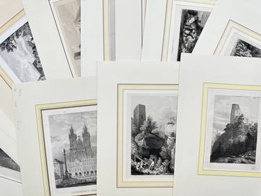
Joseph Meyer - Set of 50 Prints - Views of Austria - Germany - Italy - Sweden - France - CzechProverde Auctions4.3(3)See Sold PriceFeb 28, 2024
Joseph Meyer - Set of 50 Prints - Views of Austria - Germany - Italy - Sweden - France - UnitedProverde Auctions4.3(3)See Sold PriceFeb 28, 2024
Joseph Meyer - Set of 20 Prints - Views of Austria - Germany - Italy - Torino - PisaProverde Auctions4.3(3)See Sold PriceFeb 28, 2024
Joseph Meyer - Set of 20 Prints - Views of Austria - Germany - Italy - Switzerland - France - SpainProverde Auctions4.3(3)See Sold PriceFeb 28, 2024
Set of 4 Maps - Netherlands - Seven United Provinces - Germany - Sweden, Denmark, Norway, FinlandProverde Auctions4.3(3)See Sold PriceFeb 28, 2024
Set of 3 Maps - Netherlands - Belgien - Switzerland - J. BarlowProverde Auctions4.3(3)See Sold PriceFeb 28, 2024
Map of the United Provinces of the Netherlands, 1798 PrintAntiques Online Auctions4.6(410)See Sold PriceMar 14, 2024