ATLAS of ANTIENT GEOGRAPHY by SAMUEL BUTLER 1843John McInnis Auctioneers,LLC4.5(505)See Sold PriceFeb 24, 2024
18TH C. ANTIQUE MAP: FRENCH & INDIAN WAR, FRAMEDThomaston Place Auction Galleries4.4(393)See Sold PriceFeb 24, 2024
Rand McNally Railroad Map Cabinet w/ 21 Railroad MapsRail & Road Auctions4.6(165)See Sold PriceMar 08, 2024
Keith Haring - Ink on New York Map, Best Buddies, Inscribed, Signed, and DatedSapphire Auction Gallery4.1(67)See Sold PriceMar 02, 2024
LATE 17TH C. FRENCH MAP OF THE NEW WORLD BY ALEXIS-HUBERT JAILLOT (1632-1712)Thomaston Place Auction Galleries4.4(393)See Sold PriceFeb 24, 2024
Central Railroad of New Jersey Map of Sandy Hook Route-ca. 1903JM Hobby Supply and Railroad Artifact Auctions4.4(127)See Sold PriceFeb 24, 2024
Lot of Six Mixed Atlas Box Cars-HO Scale-New in BoxJM Hobby Supply and Railroad Artifact Auctions4.4(127)See Sold PriceFeb 25, 2024
Rand McNally/Santa Fe Railroad Map of Iowa-1912JM Hobby Supply and Railroad Artifact Auctions4.4(127)See Sold PriceFeb 24, 2024
NICOLAES VISSCHER (NETHERLANDS, 1618-1709) MAP OF THE NEW WORLDThomaston Place Auction Galleries4.4(393)See Sold PriceFeb 24, 2024
17TH C. WORLD MAP BY NICOLAES VISSCHER (NETHERLANDS, 1618-1709)Thomaston Place Auction Galleries4.4(393)See Sold PriceFeb 24, 2024
Lot of Six Mixed Atlas Cabooses-HO Scale-New in BoxJM Hobby Supply and Railroad Artifact Auctions4.4(127)See Sold PriceFeb 25, 2024
SoldMcNally: Map of Utah, 1898Detached leaf from the Indexed Atlas of the World. Colored print, each county a different color, with lots of detail regarding mountains, rivers, etc. Written information and lists of Indian reservatiSee Sold Price
SoldRand, McNally & Co: Map of Utah, 1898Map: Utah Maker: Rand, McNally & Co. Date: 1898 New Standard Atlas of the World Size: 15 x 21.5 inches Please note that this lot has a confidential reserve. When you leave a bid in advance of the auctSee Sold Price
Sold1898 Rand McNally Map of Utah [verso] Wyoming -- UtahTitle: 1898 Rand McNally Map of Utah [verso] Wyoming -- Utah [verso] Wyoming Date: 1898 Chicago Cartographer: Rand McNally Size: 12.2 X 9.3 in. Additional Information: This is very nice map of Utah anSee Sold Price
1898 Rand McNally Map of Utah [verso] Wyoming -- UtahTitle/Content of Map: 1898 Rand McNally Map of Utah [verso] Wyoming -- Utah [verso] Wyoming Cartographer: Rand McNally Year/Place: 1898 Chicago Size: 12.2 X 9.3 in. This is very nice map of Utah and WSee Sold Price
Sold1898 Rand McNally Map of Utah [verso] Wyoming -- UtahTitle/Content of Map: 1898 Rand McNally Map of Utah [verso] Wyoming -- Utah [verso] Wyoming Cartographer: Rand McNally Year/Place: 1898 Chicago Size: 12.2 X 9.3 in. This is very nice map of Utah and WSee Sold Price
1898 Rand McNally Map of Utah [verso] Wyoming -- UtahTitle/Content of Map: 1898 Rand McNally Map of Utah [verso] Wyoming -- Utah [verso] Wyoming Date: 1898 Chicago Cartographer: Rand McNally Size: 12.2 X 9.3 in. This is very nice map of Utah and WyomingSee Sold Price
1898 Rand McNally Map of Utah [verso] Wyoming -- UtahTitle/Content of Map: 1898 Rand McNally Map of Utah [verso] Wyoming -- Utah [verso] Wyoming Date: 1898 Chicago Cartographer: Rand McNally Size: 12.2 X 9.3 in. This is very nice map of Utah and WyomingSee Sold Price
1898 Rand McNally Map of Utah [verso] Wyoming -- UtahTitle/Content of Map: 1898 Rand McNally Map of Utah [verso] Wyoming -- Utah [verso] Wyoming Date: 1898 Chicago Cartographer: Rand McNally Size: 12.2 X 9.3 in. This is very nice map of Utah and WyomingSee Sold Price
1898 Rand McNally Map of Utah [verso] Wyoming -- UtahTitle/Content of Map: 1898 Rand McNally Map of Utah [verso] Wyoming -- Utah [verso] Wyoming Date: 1898 Chicago Cartographer: Rand McNally Size: 12.2 X 9.3 in. This is very nice map of Utah and WyomingSee Sold Price
SoldGroup of Two Maps of the Southwest(1) Map of Texas. 1898. Rand, McNally & Company's Indexed Atlas of the World. Sheet: 21 1/2 x 27 3/4 inches. (2) Tunison's Montana, Utah. California, Nevada and Oregon. ca. 1902. Sheet: 14 9/16 x 22 1See Sold Price
Rand McNally Map of Utah and Arizona, 1911Cartographer: Rand McNally Year/Place of Publishing: 1911, Chicago 1911 Rand McNally Map of Utah and Arizona -- Rand McNally Indexed Atlas (Utah) verso (Arizona). A nice county map of Arizona and UtahSee Sold Price
1911 Rand McNally Map of Utah and Arizona -- RandTitle/Content of Map: 1911 Rand McNally Map of Utah and Arizona -- Rand McNally Indexed Atlas (Utah) verso (Arizona) Date Printed: 1911, Chicago Cartographer: Rand McNally Size: 19 X 25.8 (18.8 X 12.5See Sold Price
SoldRAND MCNALLY MAPS c1895 UTAH, DAKOTAS,WYOMING, IDAHO XRWe are pleased to offer this large lot of original c.1895 Rand McNally Maps - 6 maps in all. These include Idaho, Wyoming,South Dakota, North Dakota, Utah, Montana. Some maps are on the reverse page oSee Sold Price
SoldRand McNally Map of Italy, 18981898 Rand McNally Map of Italy. 1898, Chicago. 26 X 19 in. A nice, highly detailed map of Italy. Shown are topographical details, political divisions, settlements, transportation routes - railroads, eSee Sold Price
Rand McNally: Map of India, 1898Map: India Cartographer: Rand McNally Date: 1898 Origin: Chicago Size: 26.2 x 19.2 inches A very nice map of South East Asia. Highly detailed as to topography, towns and railroads. Political subdivisiSee Sold Price
Rand McNally: Map of Canada, 1898Map: 1898 Rand McNally Map of Canada -- British America Cartographer: Rand McNally Year / Place: 1898, Chicago Map Dimensions: 12.2 X 19 in. Condition: Very Good. Clear colored map. Very slight toningSee Sold Price
SoldMcNally: Map of Nevada, 1898Detached leaf from the Indexed Atlas of the World. Colored print, each county a different color, with lots of detail regarding mountains, rivers, etc. Written information about Alaska on the verso[NevSee Sold Price
SoldPocket Map of Utah, sold with postcards of Indians1906 Rand McNally Pocket Map of Utah, sold with postcards of Indians, books on the westSee Sold Price
Utah Map (54462)Double truck Rand McNally Utah map. PP 476-477. Multicolor 14.5" x 21". Date: State/Country: Utah City/County:See Sold Price
Utah Map (54462)Double truck Rand McNally Utah map. PP 476-477. Multicolor 14.5" x 21".Date: Country if not USA: State: UtahCity: Provenance: Ken Prag CollectionSee Sold Price
SoldRand, McNally & Co: Map of Asia, 1898Map of Asia. Rand, McNally & Co. 1898 New Standard Atlas of the World, 28 x 21.5 inches Please note that this lot has a confidential reserve. When you leave a bid in advance of the auction, submit youSee Sold Price
Rand McNally: Map of British America, 1898Map: British America Cartographer: Rand McNally Date: 1898 Origin: Chicago Size: 12.2 x 19 inches An attractive map of Canada, color coding the provinces. It offers a great deal of topographic detail,See Sold Price
Sold1898 Rand McNally Map of Louisiana -- [Louisiana]Title/Content of Map: 1898 Rand McNally Map of Louisiana -- [Louisiana] Date: 1898 Chicago Cartographer: Rand Mcnally Size: 13 X 19.4 in. This is a highly detailed, larger map of Lousiana. It color coSee Sold Price
Sold1898 Rand McNally Map of Asia from China, Japan toTitle/Content of Map: 1898 Rand McNally Map of Asia from China, Japan to Indonesia -- China, French Indo-China, Siam, Malaysia & Korea Cartographer: Rand McNally Year/Place: 1898, Chicago Size: 18.6 xSee Sold Price
Rand McNally County/Township/Railroad Map of Kansas-1911JM Hobby Supply and Railroad Artifact Auctions4.4(127)See Sold PriceFeb 24, 2024
Rand McNally Railroad Map of Arizona-1909JM Hobby Supply and Railroad Artifact Auctions4.4(127)See Sold PriceFeb 24, 2024
Rand McNally Railroad Map of Colorado-1929JM Hobby Supply and Railroad Artifact Auctions4.4(127)See Sold PriceFeb 24, 2024
Rand McNally Railroad Map of Washington-1906JM Hobby Supply and Railroad Artifact Auctions4.4(127)See Sold PriceFeb 24, 2024
Rand McNally Railroad Map Cabinet w/ 21 Railroad MapsRail & Road Auctions4.6(165)See Sold PriceMar 08, 2024
Framed Space Age Rand McNally Map of Planets Poster, 1958PUBLIC SALE4.7(226)See Sold PriceMar 02, 2024
NORTH & COLONIAL WEST AFRICA. Nigeria marked as "Royal Niger Company" 1898 mapJasper524.5(9.9k)See Sold PriceFeb 28, 2024
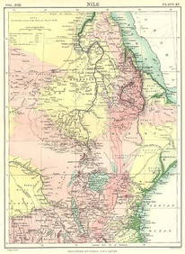
NILE VALLEY. Sudan Tanzania Ethiopia Uganda Lake Victoria. Britannica. 1898 mapJasper524.5(9.9k)See Sold PriceFeb 28, 2024
Algeria Morocco & Tunis. North Africa. Tunisia. Maghreb. BARTHOLOMEW 1898 mapJasper524.5(9.9k)See Sold PriceFeb 28, 2024
COLONIAL CENTRAL AFRICA. Congo German East Africa Rhodesia. BARTHOLOMEW 1898 mapJasper524.5(9.9k)See Sold PriceFeb 28, 2024
AFRICA French Congo State Soudan Nile Delta Suez canal by GW BACON 1898 mapJasper524.5(9.9k)See Sold PriceFeb 28, 2024
Two Hand-Colored 19th Century Maps of New Orleans and Louisiana, Larger- H.- 12 1/2 in., W.- 15 1/2Crescent City Auction Gallery4.3(231)See Sold PriceMar 08, 2024
Francis McNally - Antique Map of Nebraska, Kansas, Dakota, Colorado & MontanaProverde Auctions4.3(3)See Sold PriceFeb 28, 2024
Francis McNally - Antique Map of California & MinnesotaProverde Auctions4.3(3)See Sold PriceFeb 28, 2024
Francis McNally - Antique Map of Ohio, Indiana & KentuckyProverde Auctions4.3(3)See Sold PriceFeb 28, 2024
Francis McNally - Antique Map of Washington, Oregon, Idaho, Nevada, Utah & ArizonaProverde Auctions4.3(3)See Sold PriceFeb 28, 2024
Francis McNally - Antique Map of Illinois, Missouri & IowaProverde Auctions4.3(3)See Sold PriceFeb 28, 2024
Vintage 1920s Rand McNally Auto Trails MapThe Benefit Shop Foundation Inc.4.3(2.9k)See Sold PriceMar 20, 2024


![1898 Rand McNally Map of Utah [verso] Wyoming -- Utah (1 of 2)](https://p1.liveauctioneers.com/5584/164887/83261194_1_x.jpg?height=282&quality=70&version=1585745963)
![1898 Rand McNally Map of Utah [verso] Wyoming -- Utah (1 of 2)](https://p1.liveauctioneers.com/5584/175439/88301336_1_x.jpg?height=282&quality=70&version=1596577988)
![1898 Rand McNally Map of Utah [verso] Wyoming -- Utah (1 of 2)](https://p1.liveauctioneers.com/5584/182355/91727155_1_x.jpg?height=282&quality=70&version=1603285541)
![1898 Rand McNally Map of Utah [verso] Wyoming -- Utah (1 of 2)](https://p1.liveauctioneers.com/5584/147080/74330363_1_x.jpg?height=282&quality=70&version=1565136997)
![1898 Rand McNally Map of Utah [verso] Wyoming -- Utah (1 of 2)](https://p1.liveauctioneers.com/5584/161241/81396417_1_x.jpg?height=282&quality=70&version=1581460166)
![1898 Rand McNally Map of Utah [verso] Wyoming -- Utah (1 of 2)](https://p1.liveauctioneers.com/5584/155577/78518650_1_x.jpg?height=282&quality=70&version=1574821323)
![1898 Rand McNally Map of Utah [verso] Wyoming -- Utah (1 of 2)](https://p1.liveauctioneers.com/5584/152686/77105549_1_x.jpg?height=282&quality=70&version=1571789576)


![1898 Rand McNally Map of Louisiana -- [Louisiana] (1 of 1)](https://p1.liveauctioneers.com/5584/133765/67934968_1_x.jpg?height=282&quality=70&version=1546475054)