ATLAS of ANTIENT GEOGRAPHY by SAMUEL BUTLER 1843John McInnis Auctioneers,LLC4.5(505)See Sold PriceFeb 24, 2024
18TH C. ANTIQUE MAP: FRENCH & INDIAN WAR, FRAMEDThomaston Place Auction Galleries4.4(393)See Sold PriceFeb 24, 2024
Rand McNally Railroad Map Cabinet w/ 21 Railroad MapsRail & Road Auctions4.6(165)See Sold PriceMar 08, 2024
Keith Haring - Ink on New York Map, Best Buddies, Inscribed, Signed, and DatedSapphire Auction Gallery4.1(67)See Sold PriceMar 02, 2024
LATE 17TH C. FRENCH MAP OF THE NEW WORLD BY ALEXIS-HUBERT JAILLOT (1632-1712)Thomaston Place Auction Galleries4.4(393)See Sold PriceFeb 24, 2024
Central Railroad of New Jersey Map of Sandy Hook Route-ca. 1903JM Hobby Supply and Railroad Artifact Auctions4.4(127)See Sold PriceFeb 24, 2024
Lot of Six Mixed Atlas Box Cars-HO Scale-New in BoxJM Hobby Supply and Railroad Artifact Auctions4.4(127)See Sold PriceFeb 25, 2024
Rand McNally/Santa Fe Railroad Map of Iowa-1912JM Hobby Supply and Railroad Artifact Auctions4.4(127)See Sold PriceFeb 24, 2024
NICOLAES VISSCHER (NETHERLANDS, 1618-1709) MAP OF THE NEW WORLDThomaston Place Auction Galleries4.4(393)See Sold PriceFeb 24, 2024
17TH C. WORLD MAP BY NICOLAES VISSCHER (NETHERLANDS, 1618-1709)Thomaston Place Auction Galleries4.4(393)See Sold PriceFeb 24, 2024
Lot of Six Mixed Atlas Cabooses-HO Scale-New in BoxJM Hobby Supply and Railroad Artifact Auctions4.4(127)See Sold PriceFeb 25, 2024
SoldMatthaus Merian, China Map, c.1649Matthaus Merian, Swiss, 1593-1650, c.1649, China Veteribus Sinarum Regio nunc Incolis Tame dicta , map of China and Japan is closely modeled on Jansson's map of 1633. The detail includes the eastern pSee Sold Price
Sold23 Maps/Views incl: Tartaria Sive Magni Chami...[Asia/India] 23 Maps/Views. ++ Tartaria Sive Magnichami Imperiorum. Folding map showing the area from the Caspian Sea to China [Matthaus Merian, c. 1646]. Numerous place names, many in areas that hadSee Sold Price
Merian, M. China Veteribus Sinarum regioMerian, Matthaus China Veteribus Sinarum regio nunc incolis Tame dicta 1660 Copperplate engraving; coloured Printed area: 27.5 x 35 cm; 10.8 x 13.7 in Modern day Taiwan and the most northern part of tSee Sold Price
SoldMerian map of Tartary 1646Title: Tartaria sive Magni Chami Imperiorum Author: Merian, Matthaus Description: Copper-engraved map. 27x35 cm. (10½x14").Based on Blaeu's map of Tartaria and northern China with information compileSee Sold Price
Merian map of Tartary 1646Title: Tartaria sive Magni Chami Imperiorum Author: Merian, Matthaus Description: Copper-engraved map. 27x35 cm. (10½x14").Based on Blaeu's map of Tartaria and northern China with information compileSee Sold Price
SoldMatthaus Merian,c.1638, India Orientalis MapMatthaus Merian, Swiss, 1593-1650, c.1638 Hand Colored Map of India Orientalis et Insulae Adiecentes (with early discoveries in Western Australia) includes Southeast Asia, China, India, the PhilippineSee Sold Price
SoldMatthaus Merian, 'China Veteribus' 1640Matthaus Merian, 'China Veteribus Sinarum Regio numc Incolis Tame dicta'. Frankfurt, c. 1640. Image measures 10.75 x 13.5'' on 12.5 x 14'' sheet. B&W. Purchased from Richard Arkway in 2001. (158)See Sold Price
Matthaus Merian Map, Listed Artist,(1593-1650)Matthaus Merian Map, Listed Artist,(1593-1650) Copper Plate Engraving of Heidelberg Germany On Laid Paper, Inscribed 1620. No Information Is Available On The Exact Date This Image Was Pulled. Framed 3See Sold Price
SoldMATTHAUS MERIAN (SWISS/GERMAN, 1593-1650) MAP OF THEMATTHAUS MERIAN (SWISS/GERMAN, 1593-1650) MAP OF THE AMERICAS hand-colored engraving on laid paper, "America noviter delineata", published in Frankfurt after Jodocus Hondius's map of the same year. ReSee Sold Price
SoldMAP MAKER MATTHAUS MERIAN"Tabula Russiae ex autographo, quod delineandum curavit Foedor filius Tzaris Boris . . . Map Maker: Matthaus Merian.", Frankfurt, 1640" Printed and hand colored on paper Dimensions: H12" x W 15" CondiSee Sold Price
SoldMatthaus Merian (Swiss, 1593-1650), engraving, Map ofMatthaus Merian (Swiss, 1593-1650), engraving, Map of Hala, Hall in Schwaben, 801/2" x 14-3/4" sight, 14-1/4" x 20-3/4" overall, center crease, light foxingSee Sold Price
SoldMatthaus Merian (Swiss, 1593-1650), engraving, Map ofMatthaus Merian (Swiss, 1593-1650), engraving, Map of Hala, Hall in Schwaben, 801/2" x 14-3/4" sight, 14-1/4" x 20-3/4" overall, center crease, light foxingSee Sold Price
SoldNova Totios Germaniae Descriptio TeutchlandCirca 1650 map by Merian Matthaus (1593-1650). Hand tinted and engraved map of German city states. Condition: Overall condition is good.See Sold Price
SoldNova Totios Germaniae Descriptio TeutchlandCirca 1650 map by Merian Matthaus (1593-1650). Hand tinted and engraved map of German city states.See Sold Price
SoldMerian World MapNova Totius Terrarum Orbis Geographica ac Hydrographica Tabula. Matthaus Merian. C. 1646. Engraved Map with with hand color in full. 10 1/2 x 14 1/4 inches visible, 19 x 22 1/2 inches framed. This beaSee Sold Price
SoldEngraved Map of America by MerianAmerica noviter delineata. Matthäus Merian (1539-1650). Engraved map with hand color in part. Frankfurt, c. 1631. 14 1/4 x 18 inches visible, 24 1/2 x 28 inches framed. An uncommon map of America bySee Sold Price
Merian Map of the WorldNova Totius Terrarum Orbis Geographica ac Hydrographica Tabula. Matthaus Merian (1593-1650). Engraved map. Frankfurt, after 1638. 10 3/4 x 14 1/4 inches sheet, 20 x 23 1/2 inches framed. Matthaus MeriSee Sold Price
Sold17th century map of Italy,[Stato Della Chiesa, Con la Toscana. Herschaffen der Kom: Kirchen and Groshertzogthumb Florentz", by Matthaus Merian, Frankfurt, 1695, after Blaeu's map of the same region, detailed map with ornate tiSee Sold Price
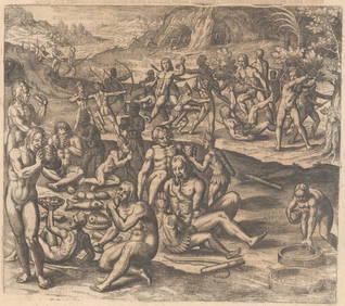
Sold2 maps: Brazilian village, battle plan [1638-1738[South America]. Matthaus Merian. 2 double-page engraved maps, uncolored, very good condition. Each 10 3/4 x 14 in. ++ Abbildung Der Statt Und Vestung Parayba In Der Lanschaft Brasilia. Portugese coasSee Sold Price
Sold13 c.17th cent. battle views[Europe: Battle Views]. Matthaus Merian. 13 double-page engraved maps, uncolored. Very good condition unless noted. Each about 11 x 14 in. ++ Nova Totius Germaniae Descriptio Teutchland. Place names uSee Sold Price
Sold1640 map of Moscow by Matthaus MerianHeading: (Russia) Author: Merian, Matthaus Title: Moscua Place Published: Frankfurt Publisher: Date Published: [1640] Description: Engraved map of Moscow. 26.7x34.6 cm (10&fSee Sold Price
SoldEngraving Matthaus Merian After Kupferstich "Rotenburg"8 1/2" X 12 1/2" matted in a 17" X21" frame, wood engraving by Matthaus Merian (1593-1650) after Kupferstich, Rotenburg, map has a stain and was folded with a crease tear, matte has stains and frame hSee Sold Price
SoldMerian map of the Americas 1638Title: America Noviter Delineata Author: Merian, Matthaus Description: Copper-engraved map. 27.6x35.7 cm. (10¾x14").Well-engraved map of the Americas, a reduced version of Hondius' map of 1631, withSee Sold Price
SoldGrp: Maps of AsiaGroup of maps of Asia. Includes Matthaus Merian (1593-1650), "Xuntien alias Quinzay," from the "Archontologia Cosmica," Frankfurt, ca. 1690. "Carte de la Baye de Chin-Chew ou Chang-Chew Avec les IslesSee Sold Price
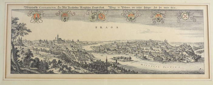
Matthaus Merian (Swiss 1593-1650) Engraving Panoramic View of PragueGlobal Auctions Company4.3(36)See Sold PriceMar 03, 2024
[ARCTIC]. BOWEN, Emanuel. A New & Accurate Map of the North...Potter & Potter Auctions4.6(545)See Sold PriceMar 07, 2024
After Matthaus Merian (1593-1650), Engraving with hand colouring, Ander Prost: der Kirche de R. P.Claydon Auctioneers Ltd4.3(125)See Sold PriceFeb 26, 2024
Perry, Matthew C. 1856 Large Map. Shah Bay, Lew Chew I. JapanAlbion Auctions4.7(341)See Sold PriceMar 01, 2024


![[ARCTIC]. BOWEN, Emanuel. A New & Accurate Map of the North... (1 of 1)](https://p1.liveauctioneers.com/928/318880/171360917_1_x.jpg?height=282&quality=70&version=1707501302)